2046 results for: triangle
- Page
-
- of
- 21
Please sign in for more results

BRK26C62_411
Annalena Bärbock (Alliance 90/The Greens), Federal...
BRK26C97_152
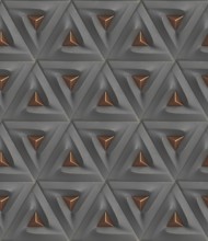
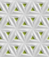
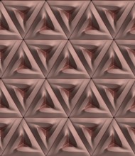
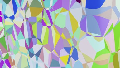
3D geometric pattern featuring triangular shapes w...

BRK26C70_277
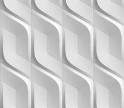
This image features a 3D rendered abstract backgro...
BRK26C61_361
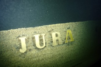
The lettering 'Jura' can be seen on a weathered sh...
BRK26C71_134
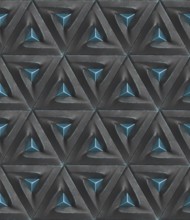
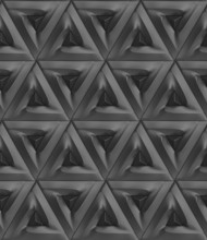
Futuristic 3D Wallpaper of black and green angular...
BRK26C85_153
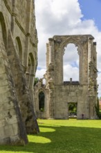
Walkenried Abbey is a former Cistercian abbey in W...
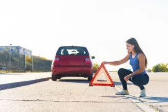
BRK26C11_001
A young woman places a reflective warning triangle...
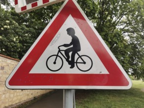
BRK26C37_190
Road sign for bicycles, red and white triangle in ...
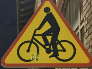
BRK26C37_191
Traffic warning sign with a black bicycle symbol o...
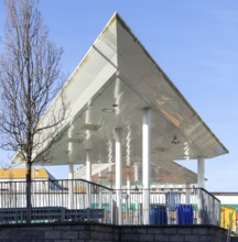
BRK26C06_098
Triangular white canopy and slender columns, Plymo...
BRK26C06_340
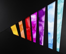
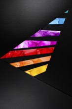
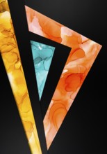
A bold triangular design featuring vibrant colors ...
BRK26C11_171
This vibrant minimalistic illustration features ge...
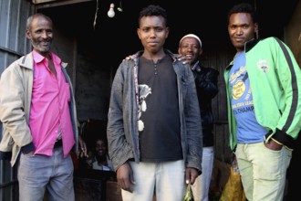
BRK26C42_427
Group of men posing in front of a small shop and s...
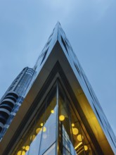
BRK26C13_105
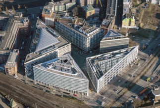
A striking view of a modern glass building in Lond...
BRK26C06_354
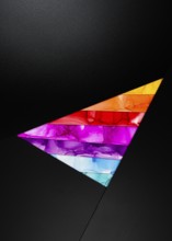
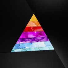
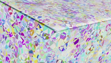
A vibrant geometric triangle featuring layers of v...
BRK26C06_360
A vibrant geometric pattern with colorful segments...
BRK26C47_019
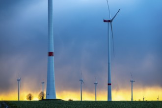
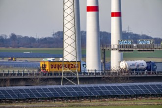
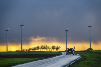
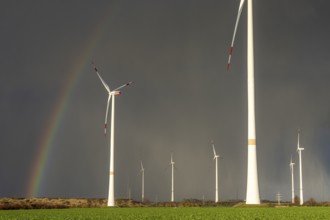
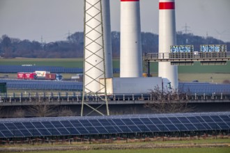
Königshovener Höhe onshore wind farm, on the A44 m...
BRK26C42_425
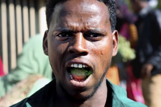
Man with khat leaves in his mouth smiles during li...
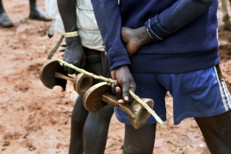
BRK26C26_175
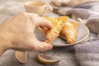
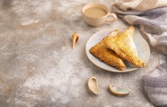
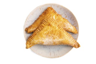
Triangles Pie, Puff Pastry, Samsa with cherry jam ...
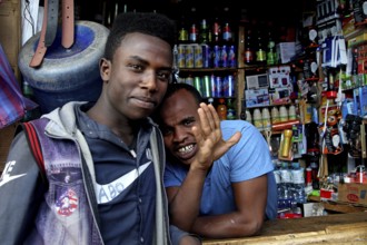
BRK26C42_428
Two men stand in front of a well-equipped shop at ...
BRK26C06_343
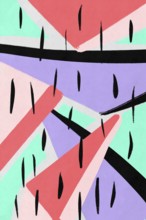
Colorful abstract design with geometric shapes in ...
BRK26C40_354
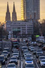
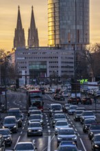
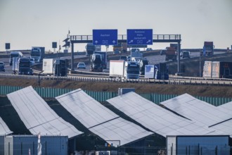
City traffic in Cologne-Deutz, rush hour in the af...

BRK26C42_343
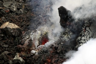
Detailed view of volcanic rocks with complex struc...
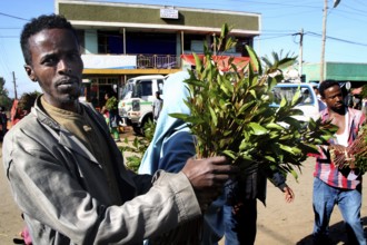
BRK26C42_429
Man proudly displays his khat bundles on a busy st...
BRK26C23_386
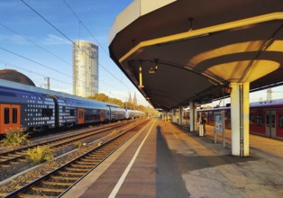
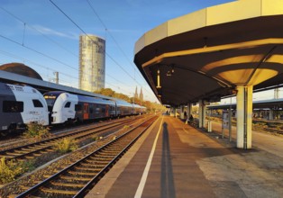
On the train track with a view of the Cologne Tria...
BRK26C13_081
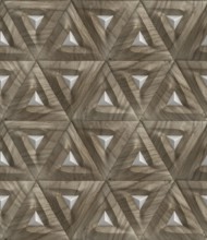
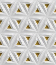
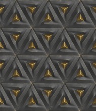
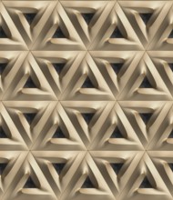
This 3D illustration showcases a geometric pattern...
BRK26C13_084
Abstract 3D geometric pattern featuring repetitive...
BRK26C13_080
This 3D geometric wallpaper design features a repe...
BRK26C13_082
This 3D geometric pattern features an abstract des...
BRK26C13_077
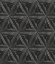
A striking 3D geometric pattern featuring metallic...
BRK26C13_089
An intricate 3D geometric pattern creates a visual...
BRK26C11_005
This striking 3D render features a complex interpl...
BRK26C26_182
Triangles Pie, Puff Pastry, Samsa with cherry jam ...
BRK26C06_355
A vibrant abstract design featuring triangular sha...
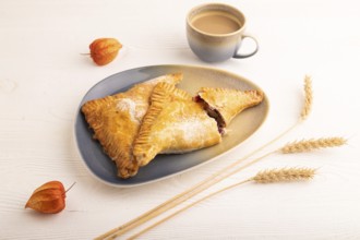
BRK26C26_176
Triangles Pie, Puff Pastry, Samsa with cherry jam ...
BRK26C13_083
An intricate 3D geometric pattern featuring triang...
BRK26C35_289
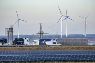
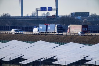
86.5 MW peak open space photovoltaic systems, from...
BRK26C20_499
This image features a visually striking 3D rendere...
BRK26C26_178
Triangles Pie, Puff Pastry, Samsa with cherry jam ...
BRK26C15_400
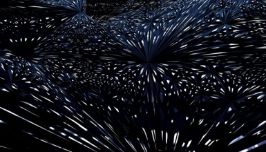
This digital artwork features a mesmerizing array ...
BRK26C13_086
This 3D geometric pattern features a repetitive tr...

BRK26C47_444
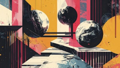
Vector art illustration, spheres, rectangles, tria...
BRK26C13_085
This 3D geometric pattern features intricate trian...
BRK26C13_079
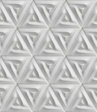
A detailed 3D geometric pattern featuring triangul...
BRK26C11_174
Vibrant and colorful 3D-rendered geometric shapes ...
BRK26C00_073
Königshovener Höhe onshore wind farm, on the A44 m...
BRK26C00_074
Königshovener Höhe onshore wind farm, on the A44 m...
BRK26B76_203
86.5 MW peak open space photovoltaic systems, from...
BRK26B88_092
City traffic in Cologne-Deutz, rush hour in the af...
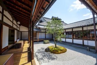
BRK26B63_425
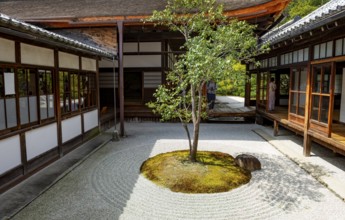
Courtyard with Zen Garden, Circle Triangle Square ...
BRK26B55_308
On the train track with a view of the Cologne Tria...
BRK26B65_281
Excelsior Hotel Ernst, commercial building, genera...
BRK26B63_433
Courtyard with Zen Garden, Circle Triangle Square ...
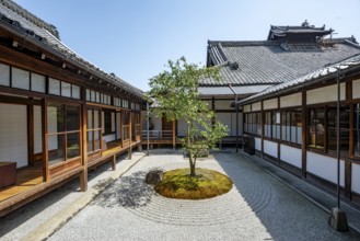
BRK26B63_428
Courtyard with Zen Garden, Circle Triangle Square ...
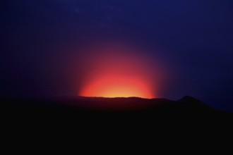
BRK26B93_059
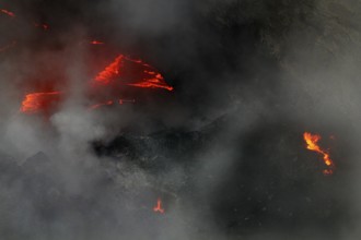
Bright red-orange crater rim of Erta Ale at night,...
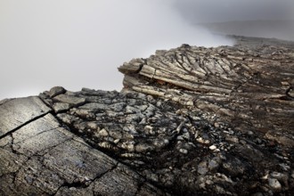
BRK26B93_061
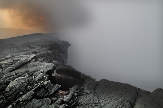
Detailed view of volcanic rocks with complex struc...
BRK26B93_055
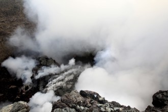
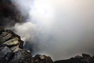
Smoke and steam rise from the crater of a volcano,...
BRK26B93_046
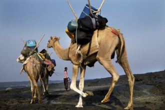
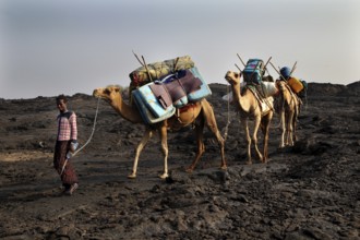
Camel caravan carrying luggage on the descent in t...
BRK26B93_058
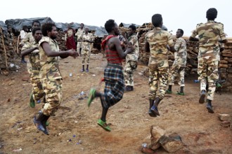
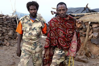
Soldiers dance in their military uniforms on rocky...
BRK26B93_060
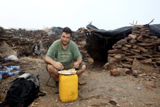
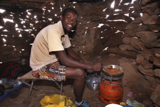
Man sitting in a warehouse of stone huts with mini...
BRK26B93_062
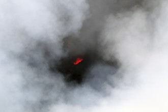
Smoke rises from a crater in a volcanic landscape,...
BRK26B93_064
Smouldering volcano with a crater partly covered b...
BRK26B93_066
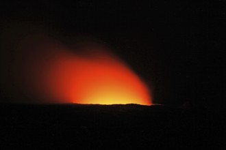
Fiery glow over the crater of a volcano at night, ...
BRK26B93_078
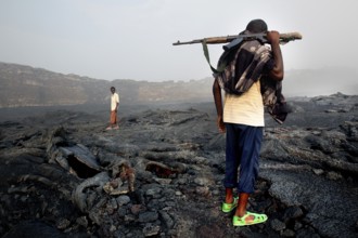
Members of the escort crew cross the volcanic terr...
BRK26B93_079
Two soldiers in traditional and military clothing ...
BRK26C01_446
Vector art illustration, spheres, rectangles, tria...
BRK26B93_067
Smoke rises from a volcanic crater and obscures th...
BRK26B93_054
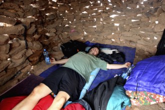
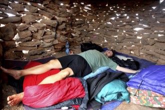
Simple place to sleep in a hut in Erta Ale Camp, E...
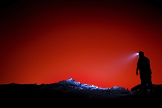
BRK26B93_068
Silhouette of a human with head light against a br...
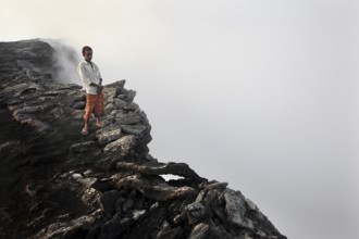
BRK26B93_081
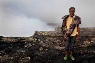
Mountain guide stands at the edge of a smoking cra...
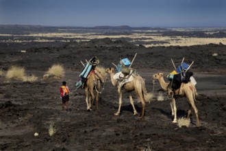
BRK26B93_045
Caravan with camels and people in the vast desert ...
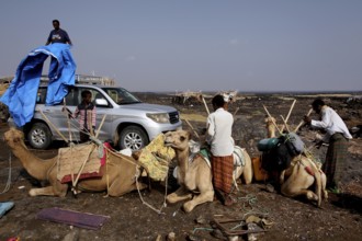
BRK26B93_047
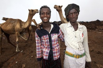
Unloading a camel caravan next to a land cruiser i...
BRK26B93_063
Glowing lava breaks through thick steam in the vol...
BRK26B93_075
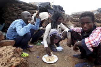
People sitting around the campfire and sharing a m...
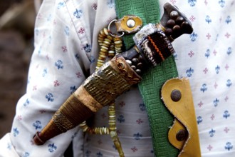
BRK26B93_080
Close-up of a camel driver's decorative knife, zer...
BRK26B76_208
20 MWp open-air photovoltaic system, from RWE, wit...
BRK26B93_050
A camel caravan descends Erta Ale volcano loaded w...
BRK26B93_057
Person lying in a sleeping bag in a simple stone h...
BRK26B93_076
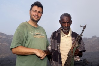
Police officer Muhammed at the edge of the smoking...
BRK26B93_009
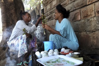
Two woman enjoy a traditional coffee ceremony and ...
BRK26B93_077
Police officer Muhammed stands next to a man in th...
BRK26B54_483
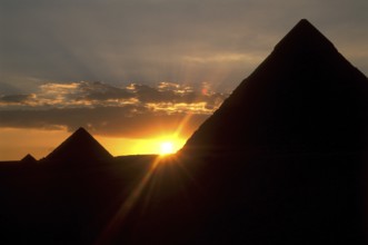
The pyramids of Giza, Egypt
BRK26B93_019
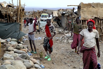
Busy street in a village with traditionally dresse...
BRK26B93_048
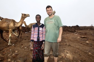
A camel driver with Roland's company and camels at...
BRK26B93_049
Camel driver with two camels in camp on Erta Ale, ...
BRK26B93_065
Lava and steam in a rugged volcanic environment, E...
BRK26B93_073
Kusay cooks using traditional methods in the Erta ...
BRK26B93_056
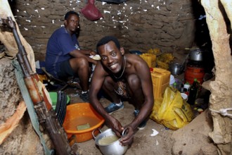
In the hut at Erta Ale Camp, two men are immersed ...
BRK26B24_211
People interacting socially at the cattle market, ...
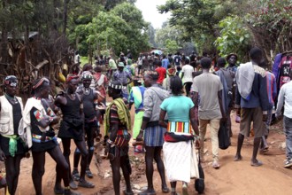
BRK26B24_219
Busy market with people dressed in groups, Key Afa...
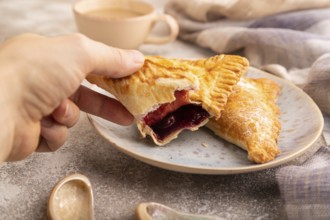
BRK26B28_038
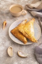
Triangles Pie, Puff Pastry, Samsa with cherry jam ...
BRK26B18_405
Münzviertel, Hamburg, city center, new building, h...
BRK26B24_208
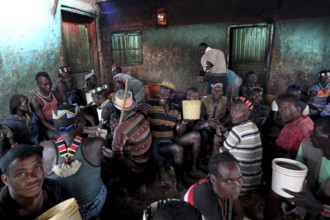
Beer bar in Key Afar with lively atmosphere and lo...
BRK26B24_212
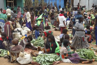
Lively market with people wearing traditional clot...
BRK26B23_342
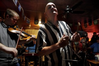
A triangle player performs with a violinist in the...

BRK26B28_030
Triangles Pie, Puff Pastry, Samsa with cherry jam ...
BRK26B28_035
Triangles Pie, Puff Pastry, Samsa with cherry jam ...
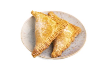
BRK26B28_032
Triangles Pie, Puff Pastry, Samsa with cherry jam ...
BRK26B03_377
86.5 MW peak open space photovoltaic systems, from...
BRK26B03_378
20 MWp open-air photovoltaic system, from RWE, wit...
- Page
-
- of
- 21