11759 results for: drone landscape
- Page
-
- of
- 118
Please sign in for more results
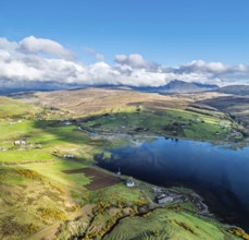
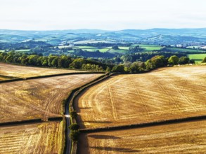
BRK26C58_095
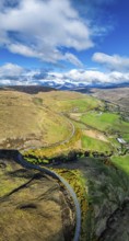
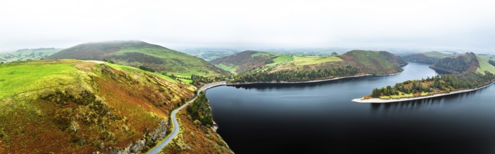
Panorama of Farms and Moors over Loch Harport from...
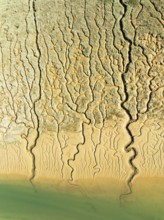
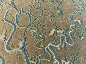
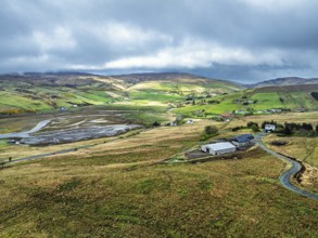
BRK26C62_006
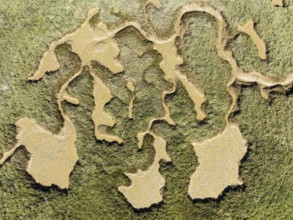
Network of channels and streams at low tide. In th...
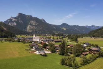
BRK26C56_408
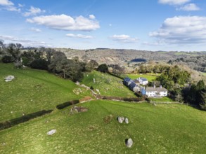
Farms and Woods over East Dartmoor National Nature...
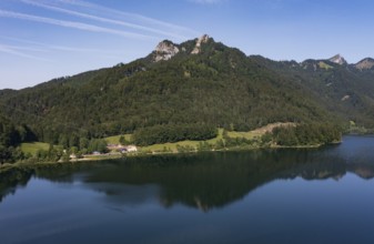
BRK26C57_117
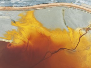
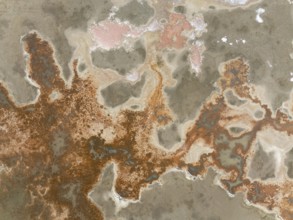
Waste pond in the mineral-rich area of the Rio Tin...
BRK26C62_454
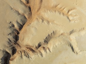
Canyon in the Tsondab Valley in the Namib Desert. ...
BRK26C64_283
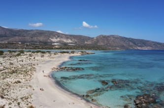
Drone shot, Elafonissi beach, south-west Crete, Cr...
BRK26C64_343
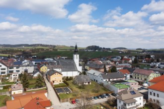
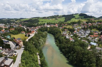
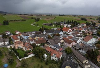
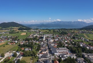
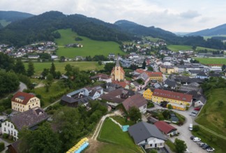
Drone image, view of the town, Lembach im Mühlkrei...
BRK26C68_346
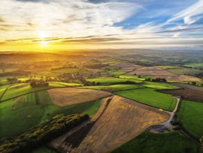
Colours of Devon Farms and Fields over Berry Pomer...
BRK26C70_143
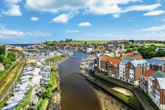
Whitby and River Esk from a drone, North Yorkshire...
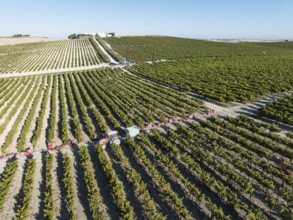
BRK26C73_136
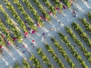
Vintage at the vineyard of the Bodega González Bya...
BRK26C55_461
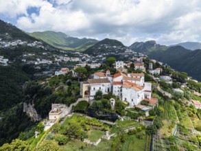
View of Ravello from a drone, Amalfi Coast, Tyrrhe...
BRK26C59_289
Drone image, Weißenbach am Attersee with Höllengeb...
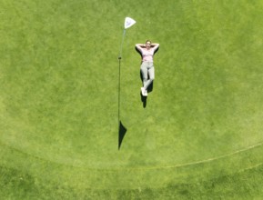
BRK26C63_210
Woman lying on the green at the La Noria Golf Reso...
BRK26C70_476
Vintage at the La Canariera vineyard of the Bodega...
BRK26C74_142
Colours of autumn Fields and Farms over Sheldon fr...
BRK26C75_087
Larpool Viaduct over River Esk and Esk Valley Viad...
BRK26C91_177
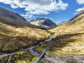
Mountains and Moors over Glen Etive Valley from a ...
BRK26C61_499
Drone image, Steinbach an der Steyr, Traunviertel,...
BRK26C62_434
Drone image, summit cross on the Ochsenberg, Oster...
BRK26C64_276
Top Down over Callop River and Marshes from a dron...
BRK26C64_462
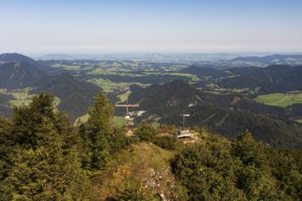
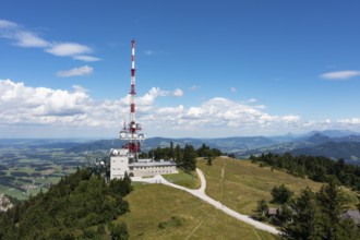
Drone image, Gaisberg transmitter on the Gaisbersp...
BRK26C58_265
Network of channels and streams at low tide. In th...
BRK26C60_495
Cultivated orange trees (Citrus sinensis) and netw...
BRK26C62_139
Drone image, view of the village, Mettmach, Innvie...
BRK26C69_434
Fields and Farms at evening sun from a drone, Shal...
BRK26C71_320
Roseberry Topping from a drone, Great Ayton, Newto...
BRK26C74_217
Colours of autumn Fields and Farms over Sheldon fr...
BRK26C94_454
Vertical panorama of Farms and Fields over Cononle...
BRK26C62_040
Panorama of Farms and Moors over Loch Harport from...
BRK26C63_156
Network of channels and streams at low tide. In th...
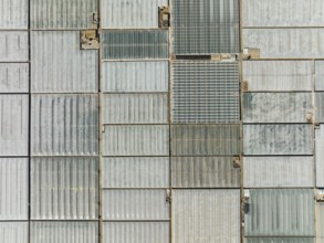
BRK26C63_196
Masses of shimmering plastic greenhouses near El E...
BRK26C64_047
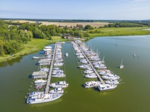
Aerial view, drone photo: Yachts in Krummin natura...
BRK26C64_073
Drone image, view of the village, Sankt Johann am ...
BRK26C72_209
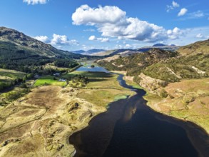
Autumn colours over Llyn Clywedog and Clywedog Res...
BRK26C59_496
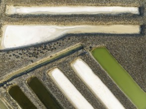
Saline ponds at the salt works near Chiclana de la...
BRK26C67_183
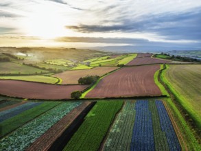
Drone shot, panorama shot, agricultural landscape,...
BRK26C71_490
The vineyard of the Bodega González Byass near the...
BRK26D02_180
Panorama of Fairy Pools and Waterfalls from a dron...
BRK26C60_146
Haytor Rocks from a drone, Dartmoor Park, Devon, E...
BRK26C61_349
Drone image, summit cross on the Ochsenberg with U...
BRK26C64_105
Drone photography, location photography, Waldzell,...
BRK26C88_221
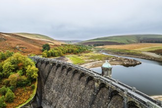
Autumn over Craig Goch Dam from a drone, Elan Vall...
BRK26C68_471
Colours of autumn Fields and Farms over Sheldon fr...
BRK26C84_403
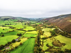
Autumn colours of Farms over River Wye and Road A4...
BRK26C95_132
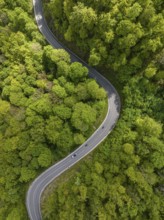
Winding country road through a forest, Swabian Alb...
BRK26C56_086
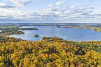
Aerial view, drone photo: Parsteiner See, also Par...
BRK26C58_346
Mountains over Loch Iubhair from a drone, Crianlar...
BRK26C59_268
Salt marsh at the Skeleton Coast. Aerial view. Dro...
BRK26C60_388
Drone image, view of the village, Waldhausen im St...
BRK26C64_322
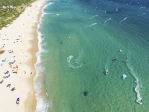
Kite surfers at the Valdevaqueros beach near Tarif...
BRK26C65_319
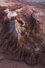
Conical rocks, so-called Prince Albert formations....
BRK26C68_396
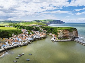
Staithes Village from a drone, North Yorkshire, No...
BRK26C68_498
Forest in Teesdale over River Tees from a drone, N...
BRK26C59_380
Aerial view, hydro-electric power station at Inver...
BRK26C63_391
Drone image, view of the village, Grän, Tannheimer...
BRK26C66_414
Aerial view, drone photo: A man and a woman walkin...
BRK26C75_057
The La Canariera vineyard of the Bodega González B...
BRK26C58_112
Panorama of Moors and Road A82 over Glencoe Valley...
BRK26C62_173
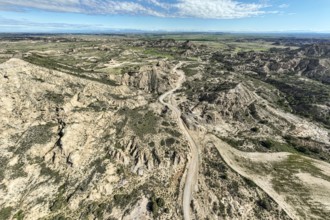
Badlands. Aerial view. Drone shot. Granada provinc...
BRK26C85_044
Farms and Fields over East Harlsey from a drone, N...
BRK26C92_042
Colours of Devon Farms and Fields over Berry Pomer...
BRK26C59_273
Farms and Moors over Loch Harport from a drone, Dr...
BRK26C61_103
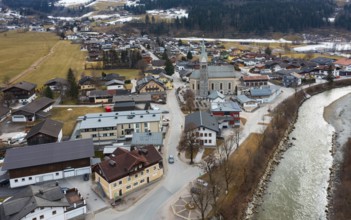
Drone image, Sankt Martin bei Lofer, Saalachtal, P...
BRK26C61_180
Drone image, Schwarzensee in the Schafberg massif ...
BRK26C69_487
Sunset of Devon Farms and Fields over Berry Pomero...
BRK26C70_070
Colours of autumn Fields and Farms over Sheldon fr...
BRK26C60_062
Cape Trafalgar at the Atlantic Ocean at low tide. ...
BRK26C75_118
Colours of Devon Farms and Fields over Berry Pomer...
BRK26C60_081
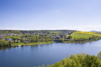
Lake Bergsee ('mountain lake') near Bad Säckingen,...
BRK26C66_082
Aerial view with Dresdner Straße and railway stati...
BRK26C68_047
Aerial view of the town from the south with Osterb...
BRK26C60_363
Aerial view of a row of trees with autumn leaves c...
BRK26C66_186
Aerial view of river and path in a birch forest, p...
BRK26C65_411
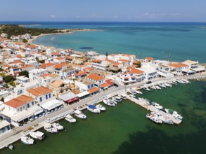
Drone shot, harbour, town of Elafonisos, Elafoniso...
BRK26C83_096
Salt mining plant, Salinas de Janubio, top-down, n...
BRK26C65_437
Malter, town view with dam and Weißeritz valley ra...
BRK26C66_122
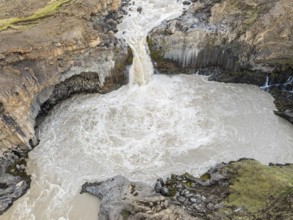
Aerial view of waterfall Aldeyarfoss, canyon of vo...
BRK26C65_407
Aerial view, glacial stream flows around a large r...
BRK26C64_471
Aerial view, drone photo: Europabrücke Bienenwerde...
BRK26C56_475
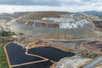
Aerial view of Corta Atalaya open pit mine, copper...
BRK26C63_348
Gravel road Ruta Jubierre, desert, rock formations...
BRK26C65_259
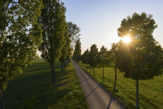
Aerial view of an avenue with evening sun, Kesseld...
BRK26C59_498
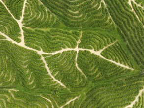
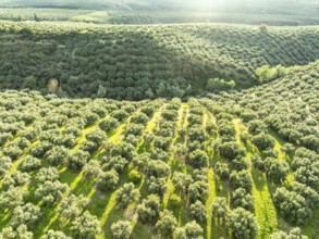
Fields of olive trees, trees planted in rows, aeri...
BRK26C65_177
Aerial view of Grubnitz, in the background the vil...
BRK26C67_172
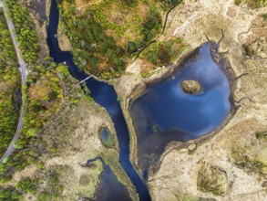
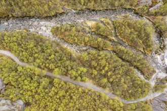
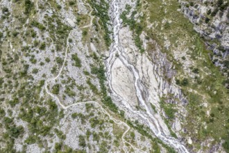
Branched wild river with blue water in forest land...
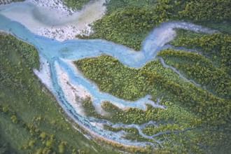
BRK26C61_438
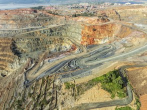
Aerial view of open pit mining, copper mine, Rio T...
BRK26C59_486
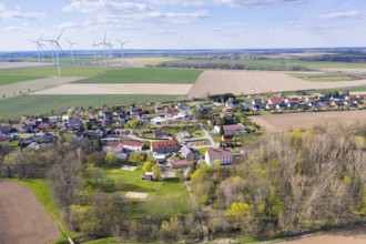
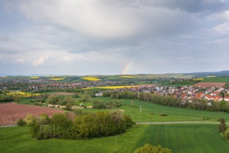
Aerial view with rainbow, city view of Duderstadt,...
BRK26C62_397
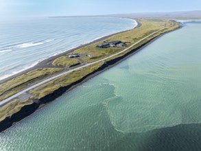
Coast east of Eyrarbakki, aerial view, southern co...
BRK26C67_022
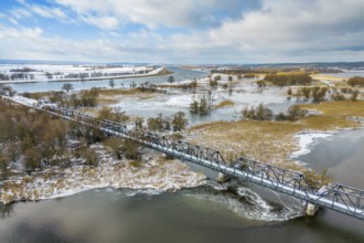
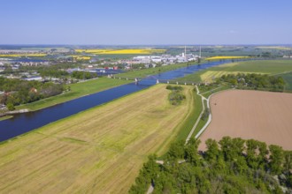
Aerial view of the Elbe with railway bridge and in...
BRK26C60_432
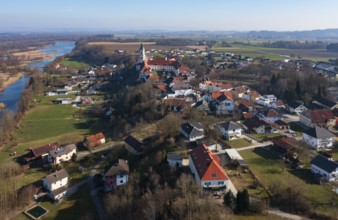
Drone shot, view of the village with Augustinian m...
BRK26C61_348
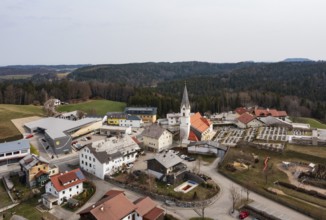
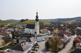
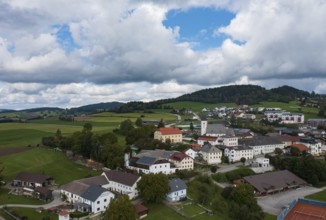
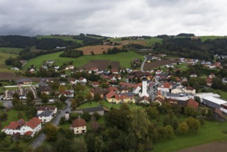
Drone image, view of the village with parish churc...
BRK26C62_371
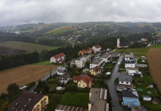
Drone image, residential buildings, view of villag...
BRK26C62_460
Drone shot, view of the village with Augustinian m...
BRK26C56_376
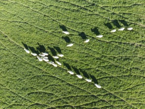
Sheep (Ovis aries). Aerial view. Drone shot. Cádiz...
BRK26C60_027
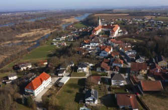
Drone image, view of the village with parish churc...
BRK26C64_064
Drone image, residential buildings, view of villag...
BRK26C65_128
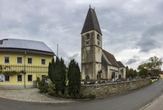
Drone shot, view of village with church, Enzenkirc...
BRK26C72_322
From above aerial drone photograph of an unrecogni...
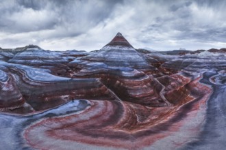
BRK26C77_023
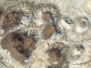
Stunning aerial capture of the unique geological f...
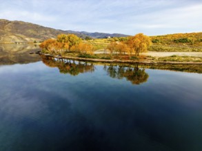
BRK26C86_076
Aerial view of a tranquil lake in Queenstown durin...
- Page
-
- of
- 118