495 résultats pour : right-angled
- Page
-
- sur
- 5
Connectez-vous pour plus de résultats
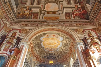
BRK24B86_479
Ceiling fresco by Giovanni Francesco Marchini 1729...
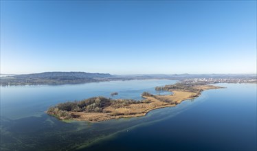
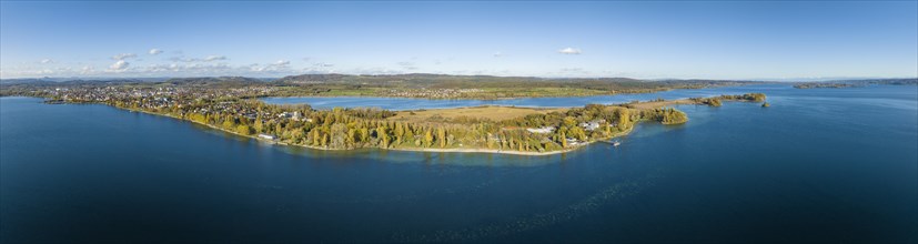
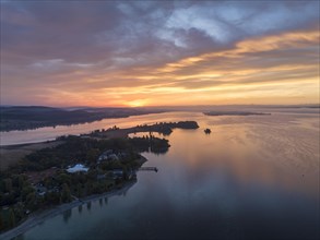
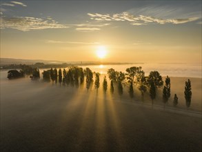
BRK24A72_151
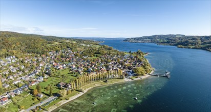
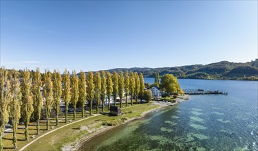
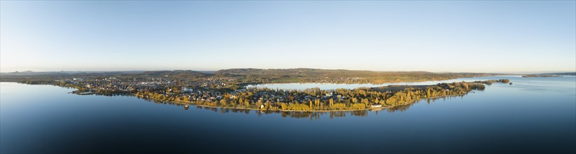
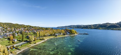
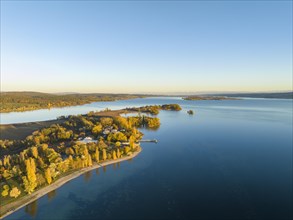
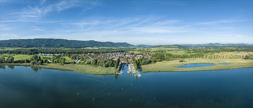
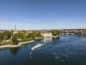
Aerial panorama of the Mettnau peninsula on a clea...
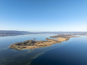
BRK24A76_350
Aerial view of the Mettnau peninsula on a clear wi...
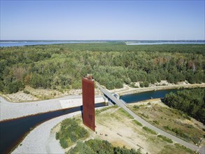
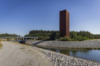
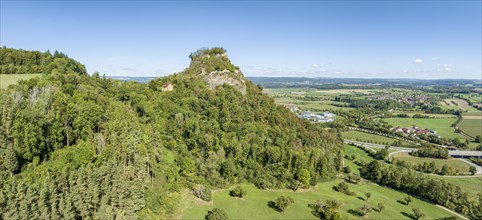
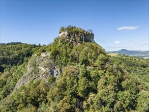
BRK24B18_303
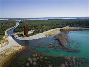
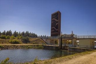
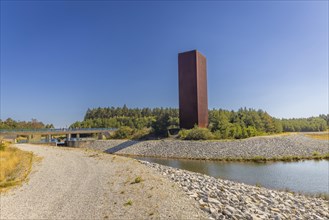
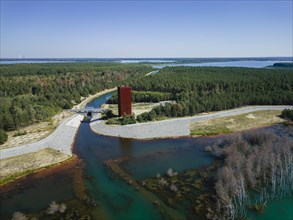
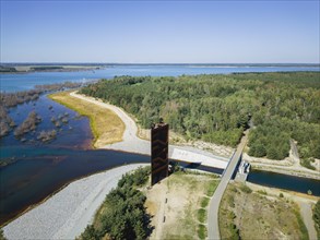
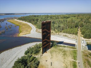
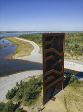
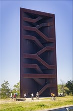
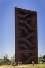
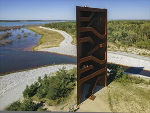
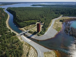
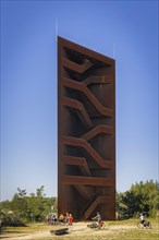
The 30 metre high landmark of the Lusatian Lakelan...
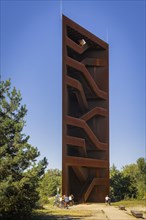
BRK24B24_494
The 30 metre high landmark of the Lusatian Lakelan...
BRK24B29_198
The 30 metre high landmark of the Lusatian Lakelan...
BRK24B13_197
The 30 metre high landmark of the Lusatian Lakelan...
BRK24B17_403
The 30 metre high landmark of the Lusatian Lakelan...
BRK24B18_097
The 30 metre high landmark of the Lusatian Lakelan...
BRK24B26_300
The 30 metre high landmark of the Lusatian Lakelan...
BRK24B15_201
The 30 metre high landmark of the Lusatian Lakelan...
BRK24B15_202
The 30 metre high landmark of the Lusatian Lakelan...
BRK24B19_202
The 30 metre high landmark of the Lusatian Lakelan...
BRK24B24_307
The 30 metre high landmark of the Lusatian Lakelan...
BRK24B20_103
The 30 metre high landmark of the Lusatian Lakelan...
BRK24B20_299
The 30 metre high landmark of the Lusatian Lakelan...
BRK24B28_499
The 30 metre high landmark of the Lusatian Lakelan...
BRK24B29_393
The 30 metre high landmark of the Lusatian Lakelan...
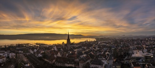
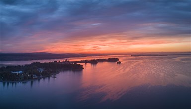
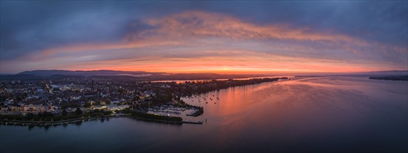
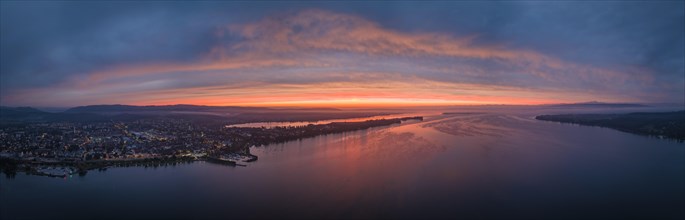
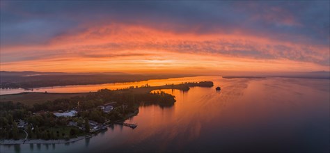
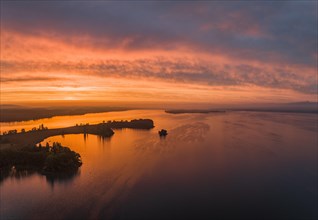
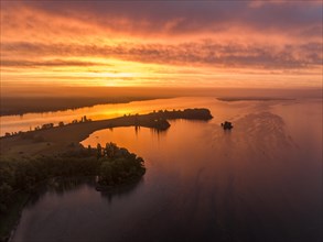
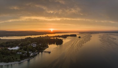
BRK24A01_296
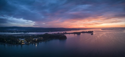
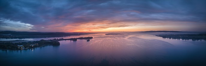
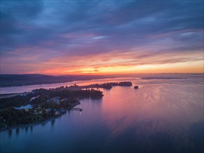
Aerial panorama of an atmospheric sunset over the ...
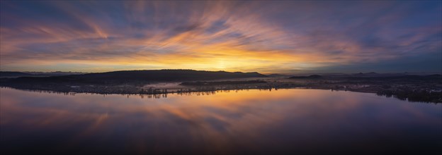
BRK24A01_094
Aerial panorama of an atmospheric sunset over the ...
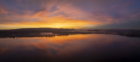
BRK24A11_494
Aerial panorama of an atmospheric sunset over the ...
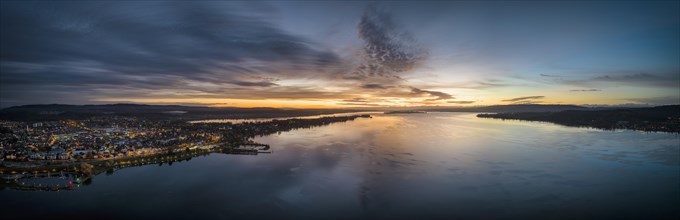
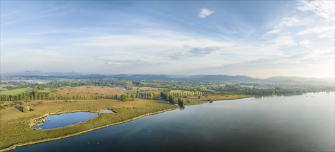
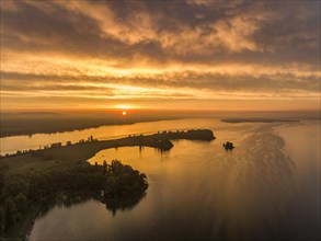
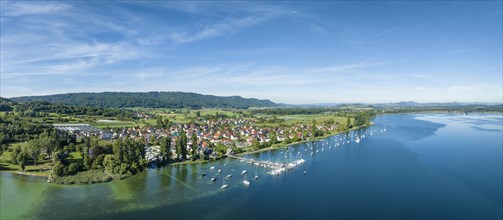
BRK23H07_386
Aerial panorama of western Lake Constance in front...
BRK23H17_185
Aerial panorama of western Lake Constance in front...
BRK23H10_085
Aerial panorama of the Mettnau peninsula in wester...
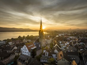
BRK23H01_127
Aerial panorama of the village of Wangen on the Ho...
BRK23H10_222
Aerial panorama of the village of Wangen on the Ho...
BRK23H10_290
Aerial panorama of the Mettnau peninsula in wester...
BRK23H00_408
Aerial panorama of western Lake Constance in front...
BRK23H06_438
Aerial panorama of the village of Wangen on the Ho...
BRK23H09_314
Aerial panorama of western Lake Constance in front...
BRK23H16_294
Aerial view of the Mettnau peninsula in western La...
BRK23H05_110
Aerial view of western Lake Constance in front of ...
BRK23H02_412
Aerial panorama of western Lake Constance in front...
BRK23H12_010
Aerial view of western Lake Constance in front of ...

BRK23G98_111
Top view arrangement meal plan

BRK23G91_215
Top view traveling items arrangement
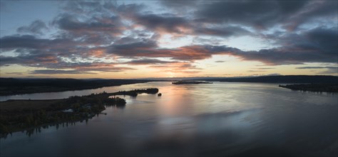
BRK23G77_380
Aerial panorama of the western part of Lake Consta...
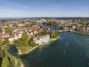
BRK23G77_433
Aerial view of the historic town centre of Radolfz...
BRK23G77_407
Aerial panorama of western Lake Constance in front...
BRK23G77_376
Aerial view of the Radolfzell Aachried with the po...
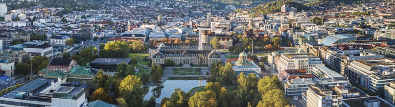
BRK23G67_234
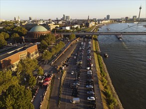
City view Stuttgart
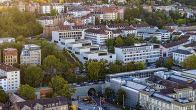
BRK23G67_235
John Cranko School
BRK23G77_406
Aerial panorama of western Lake Constance in front...
BRK23G77_411
Aerial view of western Lake Constance at sunrise w...
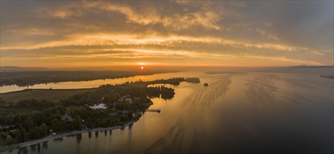
BRK23G77_412
Aerial panorama of western Lake Constance at sunri...
BRK23G77_387
Aerial panorama of the Hegau volcano and Hohenkrae...
BRK23G77_408
Aerial panorama of western Lake Constance in front...
BRK23G77_409
Aerial panorama of western Lake Constance in front...
BRK23G77_385
Aerial view of the Hegau volcano and Hohenkraehen ...
BRK23G77_410
Aerial view of western Lake Constance in front of ...
BRK23G77_413
Aerial panorama of western Lake Constance at sunri...
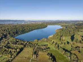
BRK23G18_205
Aerial view of Mindelsee
BRK23G18_202
Aerial view of Lake Constance with the Seerhein
BRK23G18_198
Aerial panorama of western Lake Constance with the...
BRK23G18_197
Aerial panorama of western Lake Constance with the...
BRK23G18_207
Aerial panorama of Mindelsee
BRK23G18_206
Aerial panorama of Mindelsee
BRK23G05_084
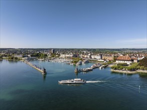
Aerial view of Lake Constance with the harbour of ...
BRK23G01_086
Aerial view of Lake Constance with the Seerhein
BRK23G07_350
Aerial view
BRK23F71_159
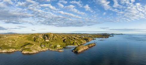
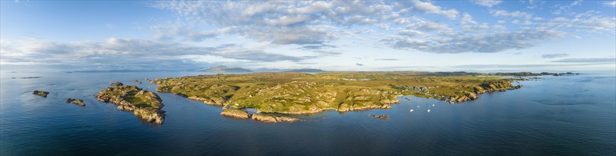
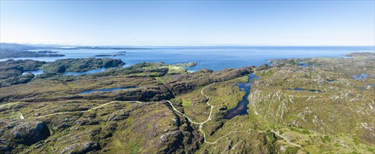
Aerial view of the Ross of Mull peninsula and the ...
BRK23F78_457
Aerial panorama of the coastline of the Ross of Mu...
BRK23F69_158
Aerial panorama of the western part of the Ross of...

BRK23F71_458
Lifestyle
BRK23F74_225
Aerial view
BRK23F78_294
Aerial view
BRK23F84_293
Aerial view
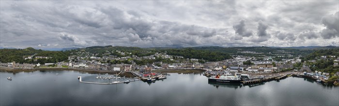
BRK23F96_136
Aerial panorama of the harbour town of Oban
BRK23F58_380
Aerial view
BRK23F50_236
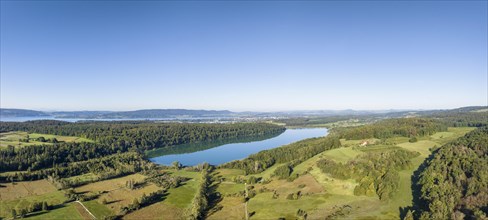
Aerial view of the eastern part of the freshwater ...
BRK23F46_419
Aerial panorama of the prominent mountain range an...
BRK23F46_033
Aerial view of the eastern part of the freshwater ...
BRK23F54_358
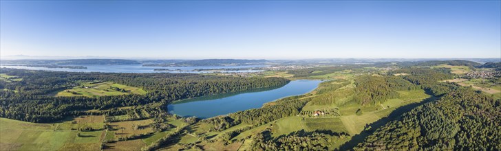
Aerial panorama of the eastern part of the freshwa...
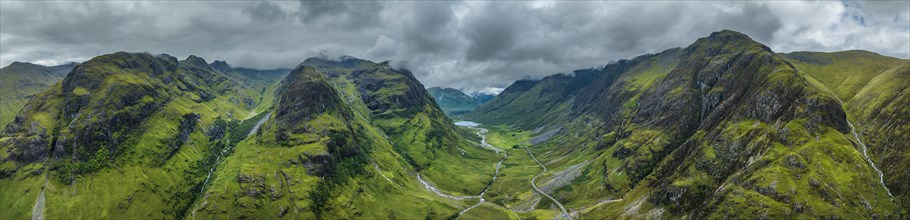
BRK23F48_022
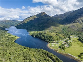
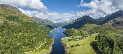
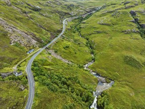
Aerial view of the A82 scenic road through Glen Co...
BRK23F28_048
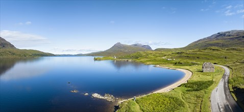
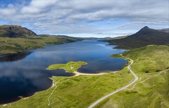
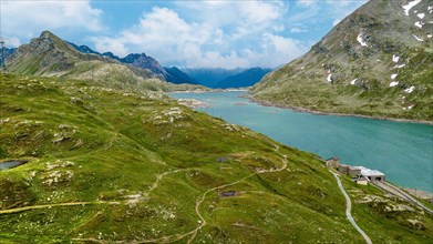
Aerial panorama of the freshwater loch Loch Assynt...
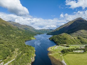
BRK23F37_171
Aerial view of the freshwater loch Loch a' Chairn ...
BRK23F31_429
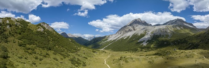
Pass da Costainas
BRK23F25_157
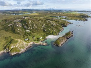
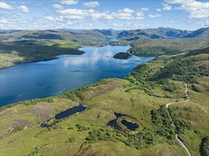
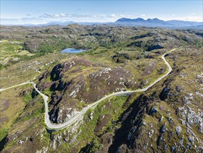
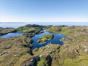
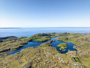
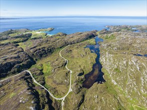
Aerial view of the sparsely populated Northwest Hi...
BRK23F32_406
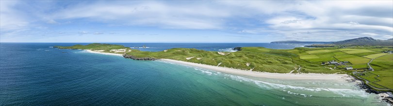
Aerial panorama of Balnakeil Bay with sandy beach ...
BRK23F24_266
Aerial view of the sparsely populated North West H...
BRK23F36_265
Aerial view of the sparsely populated North West H...
BRK23F24_452
Aerial panorama of the freshwater loch Loch Assynt...
BRK23F28_460
Aerial view of the sparsely populated Northwest Hi...
BRK23F30_315
View of the Chaschauna Pass with Piz Chaschauna
BRK23F32_461
Aerial panorama of the sparsely populated Northwes...

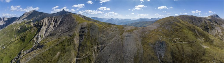
BRK23F10_003
Close-up of head of grey reef shark

BRK23E98_186
Top view credit cards with lock

BRK23E97_147
Top view paper airplane with copy space

BRK23F02_431
Top view tourism items arrangement
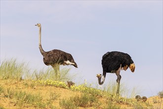
BRK23E88_330
Ostrich
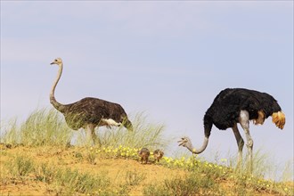
BRK23F00_130
Ostrich
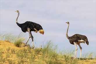
BRK23F06_329
Ostrich

BRK23E51_076
Top view hat passport arrangement
BRK23E55_186
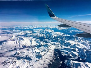
View from aeroplane window bird's eye view aeropla...

BRK23E60_363
Woman drawing with triangular ruler blackboard
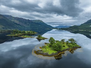
BRK23E26_029
Aerial view Bird's eye view of mountain lake at mo...
BRK23E73_400
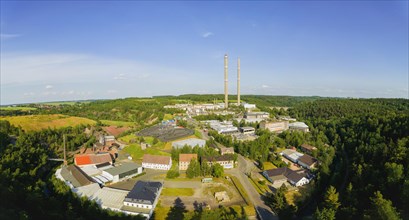
Muldenhuetten is an industrial area that has been ...
BRK23E27_019
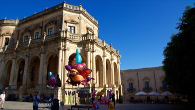
Palazzo Ducezio
BRK23E00_064
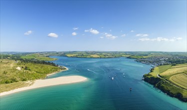
Aerial panorama of the River Camel on the left the...
BRK23E15_226
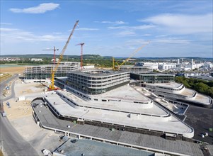
JSWD Architects. On the right
- Page
-
- sur
- 5