33 résultats pour : mercantour national park
- Page
-
- sur
- 1
Connectez-vous pour plus de résultats
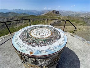
BRK22D56_345
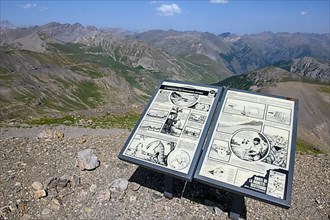
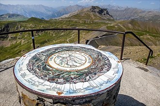
Orientation board at 2862 metre high viewpoint on ...
BRK22D56_428
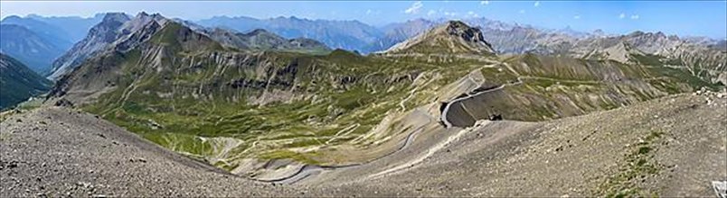
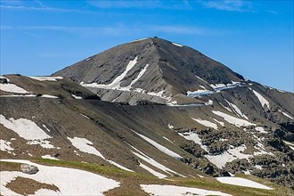
View from Cime de la Bonette on high alpine mounta...
BRK22D56_437
View from Cime de la Bonette on high alpine mounta...
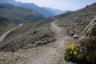
BRK22D56_344
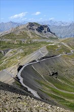
Footpath from left highest paved road in the Alps ...
BRK22D56_417
Tourist board on 2862-metre-high Cime de la Bonett...
BRK22D56_423
View from Cime de la Bonette on high alpine mounta...
BRK22D56_391
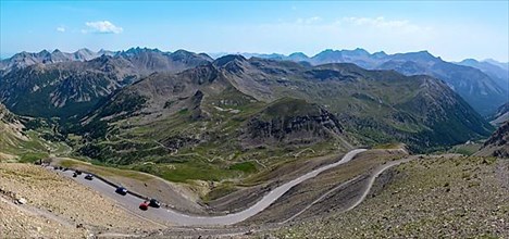
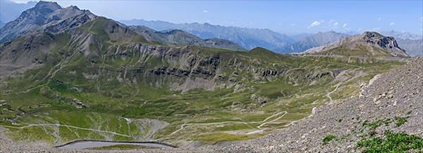
Panoramic view from Cime de la Bonette to the sout...
BRK22D56_294
Panoramic view from Cime de la Bonette to the nort...
BRK22D56_325
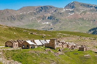
Historic barracks of Fortin de Restefond
BRK22D56_442
View from Cime de la Bonette on high alpine mounta...
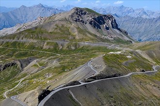
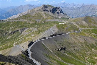
BRK22D57_027
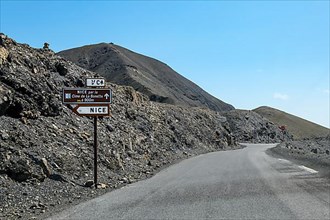
Pass road to Col de la Bonette
BRK22D56_351
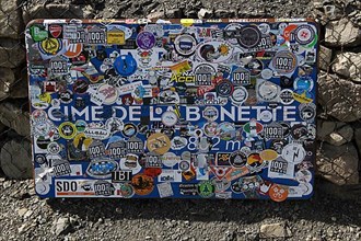
Sticker-covered official sign indicating altitude ...
BRK22D56_353
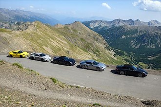
View of five Porsche sports cars on 2802 metre hig...
BRK22D56_354
Five Porsche sports cars on 2802 metre highest pav...
BRK22D50_486
View of historic early 20th century accommodation ...
BRK22D50_491
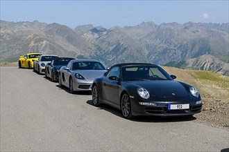
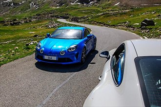
Sports car Renault Alpine coming towards Porsche G...
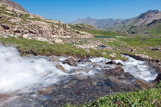
BRK22D51_201
View of torrential mountain stream tributary of La...
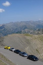
BRK22D56_453
View of five Porsche sports cars on 2802 metre hig...
BRK22D50_492
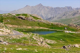
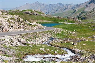
View of Lac des Eissaupres above tree line on Rout...
BRK22D50_487
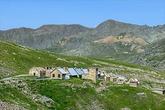
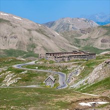
Historic Fortin Fort Garrison Caserne de Restefond
BRK22D50_488
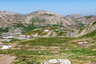
View of alpine high plateau with historic Fortin F...
BRK22D50_489
View of the mountain top Cime de la Bonette with a...
BRK22D51_202
View of alpine plateau with Lac des Eissaupres nex...
BRK22D50_490
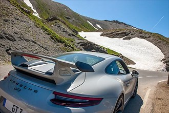
View on rear spoiler of supercar sports car Porsch...
BRK22D56_359
Orientation board at 2862 metre high viewpoint on ...
BRK21B67_085
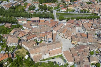
Aerial view of the mountain village Sospel at an a...
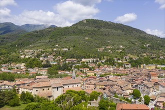
BRK21B65_268
Aerial view of the mountain village Sospel at an a...
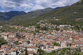
BRK21B67_486
Aerial view of the mountain village of Sospel on t...

BRK21B66_369
Aerial view of the mountain village of Sospel on t...
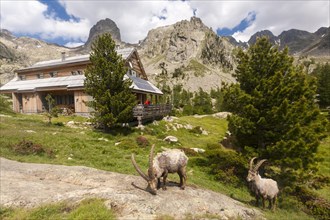
BRK19G79_402
Alpine Ibexes (Capra ibex) grazing in front of the...
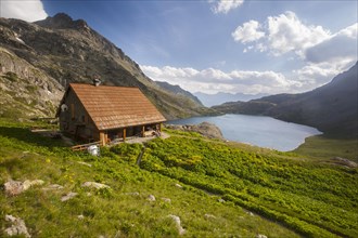
BRK19H25_499
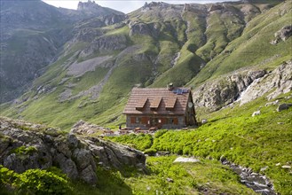
Refuge de Vens mountain hut
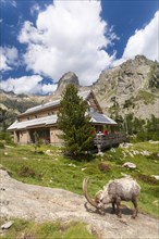
BRK19G79_403
Alpine Ibex (Capra ibex) grazing in front of the R...
BRK19G79_435