12 résultats pour : longitude
- Page
-
- sur
- 1
Connectez-vous pour plus de résultats
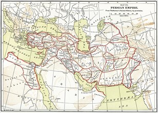
GLS22A06_490
Persian Empire Map
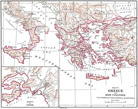
GLS22A07_028
Map V
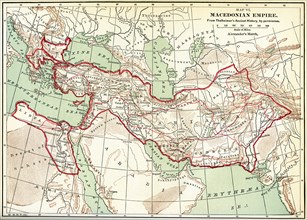
GLS22A07_038
Map VI. Macedonian Empire
GLS21A00_089
Map XIX
GLS20A04_113
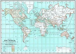
Map XV
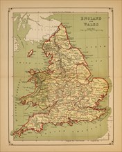
GLS18A31_490
Historical Map of England and Wales
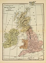
GLS18A31_489
Historical Map of British Isles Since A.D. 1066
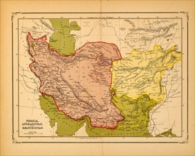
GLS18A31_413
Persia, Afghanistan, Beluchistan, Map, early 1900'...
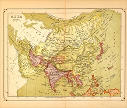
GLS18A31_398
Map of Asia, early 1900's
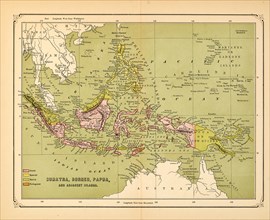
GLS18A31_407
Map of Sumatra, Borneo, Papua and Adjacent Islands...
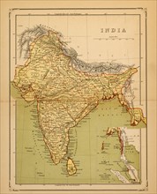
GLS18A31_399
Map of India, early 1900's

GLS18A04_277