180 résultats pour : geography
- Page
-
- sur
- 2
Connectez-vous pour plus de résultats
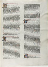
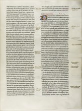
LZT20A02_176
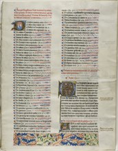
Folio Nineteen from Burchard of Sion’s De locis ac...
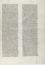
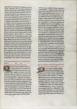
LZT20A02_175
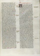
Folio Eighteen from Burchard of Sion’s De locis ac...
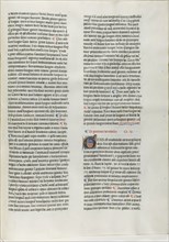
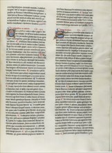
LZT20A02_174
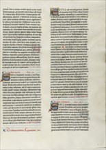
Folio Sixteen from Burchard of Sion’s De locis ac ...
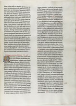
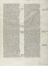
LZT20A02_173
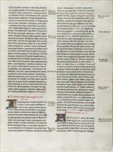
Folio Fifteen from Burchard of Sion’s De locis ac ...

LZT20A10_188
Geogaphic Scarves. Look Dodolphe, this is really t...
LZT20A02_167
Folio One from Burchard of Sion’s De locis ac mira...
LZT20A02_180
Folio Six from Burchard of Sion’s De locis ac mira...
LZT20A02_168
Folio Ten from Burchard of Sion’s De locis ac mira...
LZT20A02_179
Folio Five from Burchard of Sion’s De locis ac mir...
LZT20A02_169
Folio Eleven from Burchard of Sion’s De locis ac m...
LZT20A02_178
Folio Four from Burchard of Sion’s De locis ac mir...
LZT20A02_170
Folio Twelve from Burchard of Sion’s De locis ac m...
LZT20A02_177
Folio Twenty from Burchard of Sion’s De locis ac m...
LZT20A02_171
Folio Thirteen from Burchard of Sion’s De locis ac...
LZT20A02_172
Folio Fourteen from Burchard of Sion’s De locis ac...
LZT20A02_182
Folio Eight from Burchard of Sion’s De locis ac mi...
LZT20A02_181
Folio Seven from Burchard of Sion’s De locis ac mi...

LZT19B45_197
Luchtmans, Sam. & Joh. (printer), MELAE, POMPONII....
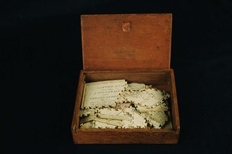
LZT19B49_166
Geography puzzle in coffin: map with the Netherlan...
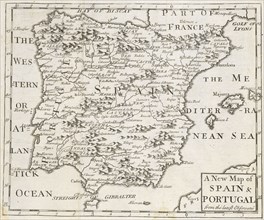
LZT19B36_249
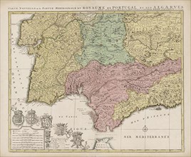
A new map of Spain and Portugal, from the latest o...
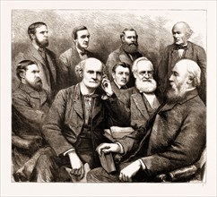
LZT16A09_321
THE FORTHCOMING MEETING OF THE BRITISH ASSOCIATION...

LZT16A24_167
Allegory of the Brabant Revolution, 1791, Anonymou...
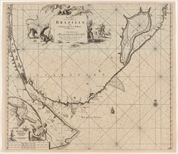
LZT16A27_338
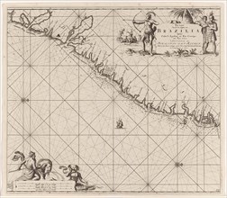
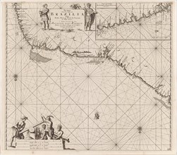
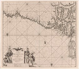
Sea chart of part of the coast of Brazil, Jan Luyk...
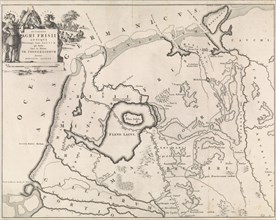
LZT16A28_346
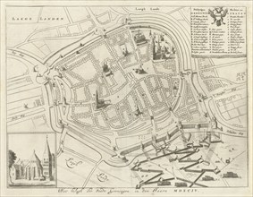
Map of Groningen during the siege, 1594, The Nethe...
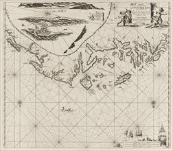
LZT16A27_412
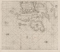
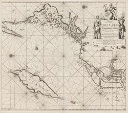
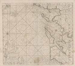
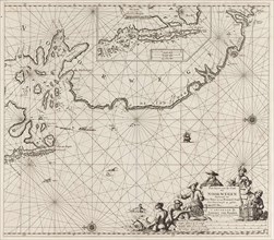
Sea chart of part of the coast of the Kola peninsu...
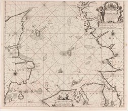
LZT16A27_430
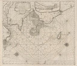
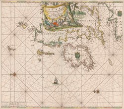
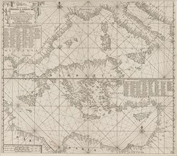
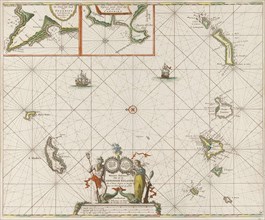
Sea chart of the Danish Islands, part of the coast...
LZT16A27_439
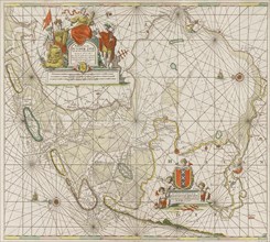
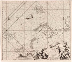
Sea chart of the Baltic and North Sea, Jan Luyken,...
LZT16A25_273
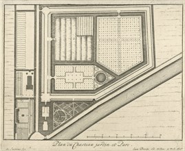
Map of estate Gunterstein, Breukelen, Joseph Mulde...
LZT16A27_349
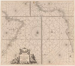
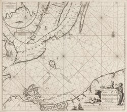
Sea chart of the southern part of the Atlantic coa...
LZT16A27_385
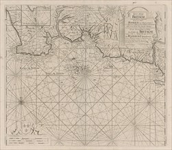
Sea chart of part of the coast of Brittany, Anonym...
LZT16A27_394
Sea chart of part of the south coast of Brittany, ...
LZT16A27_403
Sea chart of the coast of Ireland, Scotland, Engla...
LZT16A27_421
Sea chart of the southern part of the Baltic Sea, ...
LZT16A27_448
Sea chart of the coasts of England, Scotland and I...

LZT16A29_387
Coat of arms of Michiel ten Hove, Romeyn de Hooghe...
LZT16A27_339
Sea chart of part of the east coast of Brazil, pri...
LZT16A32_105
Coat of arms of Antoni Coning (mayor of Haarlem?) ...
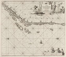
LZT16A27_413
Sea chart of part of the coast of Finnmark, Jan Lu...
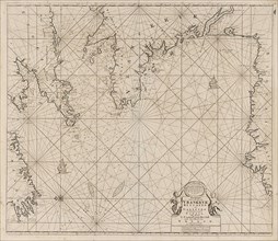
LZT16A27_431
Sea chart of Denmark in the Skagerrak and Kattegat...
LZT16A31_437
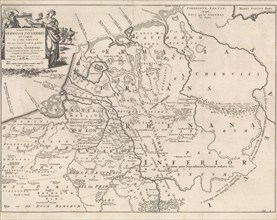
Historical map of Netherlands with the areas of th...
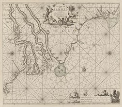
LZT16A27_348
Sea chart of the coast of Gambia and part of the c...
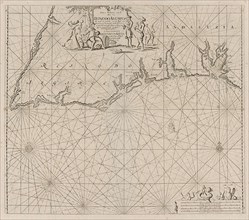
LZT16A27_384
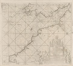
Sea map of part of the south coast of Portugal and...
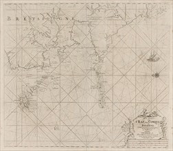
LZT16A27_395
Map of the west coast of Brittany, Anonymous, Clae...
LZT16A27_402
Sea chart of the Channel between England and Franc...
LZT16A27_420
Sea chart of the northwestern part of the Baltic S...
LZT16A27_449
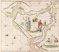
Sea chart of the Northern Dvina River, Jan Luyken,...
LZT16A27_340
Sea chart of the east coast of Brazil, Jan Luyken,...
LZT16A32_101
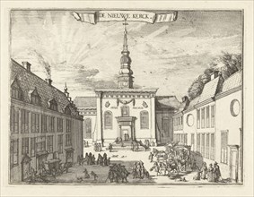
View of the New Church in Haarlem, The Netherlands...
LZT16A27_414
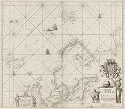
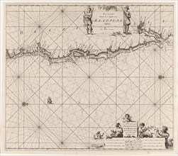
Sea chart of part of the Norwegian coast, Norway, ...
LZT16A27_441
Sea chart of part of the coast of Ireland, England...

LZT16A31_376
H. Titus, Jan Luyken, Zacharias Chatelain (II), Fr...
LZT16A31_438
Historical map of the Netherlands at the time of t...
LZT16A27_351
Sea chart of part of the east coast of the United ...
LZT16A27_383
the Mediterranean Sea Map with over the western an...
LZT16A27_392
Sea chart of Saintonge and Aunis, Anonymous, Claes...
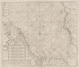
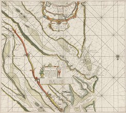
LZT16A27_405
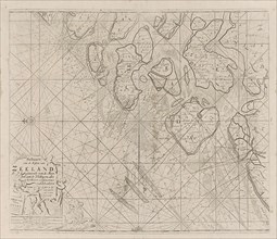
Sea chart of the Zeeland Islands and part of the N...
LZT16A27_419
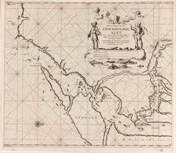
Map of the waters around Stockholm, Jan Luyken, Jo...
LZT16A27_428
Sea chart of part of the coast of Norway, print ma...
LZT16A27_450
Sea chart of the Canary Islands, print maker: Jan ...

LZT16A29_389
Mercury, Romeyn de Hooghe, 1688 - 1689
LZT16A27_341
Sea chart of a portion of the northeast coast of B...
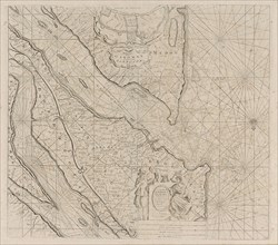
LZT16A27_451
Sea chart of the Zuiderzee and the Wadden Sea, Jan...
LZT16A32_102
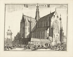
View of the Grote Kerk, Haarlem, Netherlands, Rome...
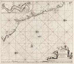
LZT16A27_415
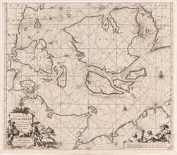
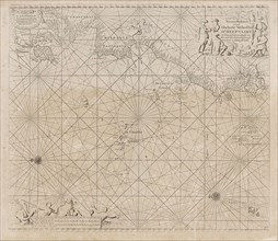
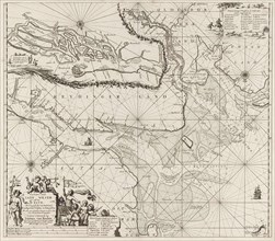
Sea chart of Northern part of Atlantic and Arctic ...
LZT16A27_440
Sea chart of the Strait of Gibraltar, Anonymous, J...
LZT16A31_439
Historical map of the Netherlands at the time of t...
LZT16A27_350
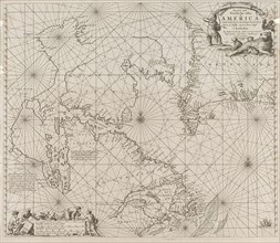
Sea chart a part of the coast of northern Canada a...
LZT16A27_393
Sea chart of the coast of France between the islan...
LZT16A27_404
Sea chart of part of the east coast of England at ...
LZT16A27_418
Sea chart of a portion of the Baltic coast of Pola...

LZT16A29_388
Diana, Romeyn de Hooghe, 1688-1689

LZT16A31_414
Address Map of Jacob & George Roeters and Company ...
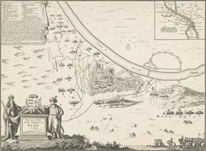
LZT16A33_236
Map of Buda, 1686, Harmanus van Loon, Lodewijk XIV...
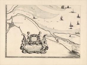
LZT16A39_340
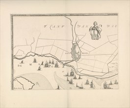
Map of Maassluis and the banks of the Meuse, The N...
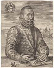
LZT16A25_354
Portrait of a naval officer William Bloys van Tres...
LZT16A27_335
Sea chart of part of the coast of Brazil, Uruguay ...
LZT16A27_342
Sea chart of part of the coast of Brazil with the ...
LZT16A27_353
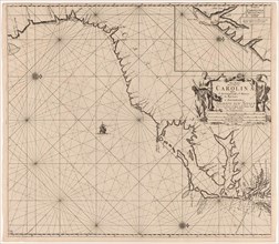
Sea chart of part of the east coast of the United ...
LZT16A27_443
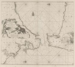
Map of the south of Spain and Portugal, Johannes C...
LZT16A32_108
Part of the plan of Haarlem, The Netherlands, Rome...
LZT16A27_408
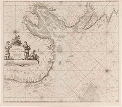
Sea chart of the Atlantic Ocean to the west coast ...
LZT16A27_381
Sea chart of the Strait of Gibraltar, Jan Luyken, ...
LZT16A27_399
Sea chart of the Bristol Channel, Jan Luyken, Anon...
LZT16A27_425
Sea chart of the east coast of England, with the m...
LZT16A27_434
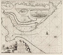
Sea chart of part of the Elbe, the Weser and Jadeb...
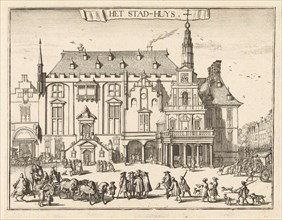
LZT16A29_385
View of the city hall in Haarlem, The Netherlands,...
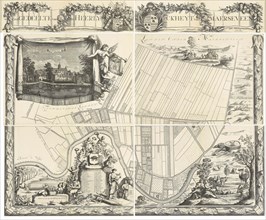
LZT16A37_337
Map of the heerlijkheid Maarsseveen, The Netherlan...
LZT16A39_341
Map of Brielle and the banks of the Meuse, The Net...
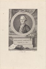
LZT16A24_278
Portrait of Gerardus Oorthuys, Robbert Muys, Jan K...
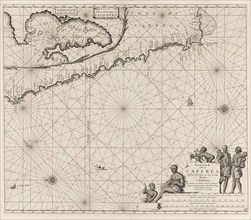
LZT16A27_343
Sea chart of the coast of Namibia and South Africa...
LZT16A27_442
Sea chart of the Garonne, France, Johannes van Keu...
LZT16A31_305
Map of the North Sea and the coast of Holland, Jac...
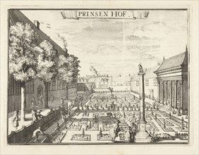
LZT16A32_103
View of the Prinsenhof in Haarlem, The Netherlands...
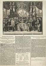
LZT16A38_253
Presentation and description of the appointment of...
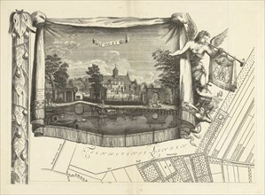
LZT16A25_302
Map of the heerlijkheid Maarsseveen, The Netherlan...
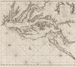
LZT16A27_352
Sea chart of part of the coast of Virginia, Jan Lu...
LZT16A27_391
Sea chart of the River Gironde to Bordeaux, Anonym...
LZT16A27_398
Sea chart of part of the Irish Sea between Ireland...
LZT16A27_424
Sea chart of part of the northeast coast of Englan...
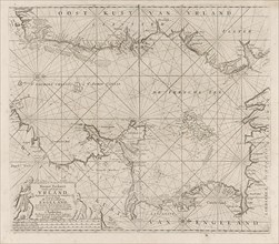
LZT16A27_435
Sea chart of a large part of the Wadden, Jan Luyke...
- Page
-
- sur
- 2