137 résultats pour : genealogy
- Page
-
- sur
- 2
Connectez-vous pour plus de résultats

UMG23A62_074
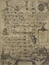
Genealogy of the Medici family of Florence.
UMG23A44_285
Genealogy of the House of Habsburg.

UMG22A73_366
Quartered shield of the Bermudez

UMG22A65_309
Views of Hempstead.
UMG22A65_478
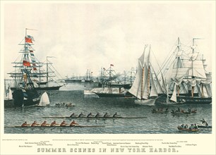
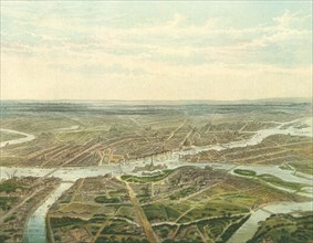
Harbor. New York City.
UMG22A65_468
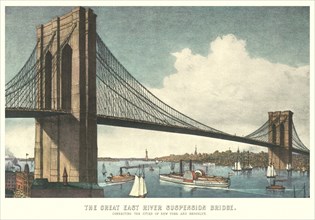
The Great East River Suspension Bridge
UMG22A65_274
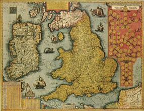
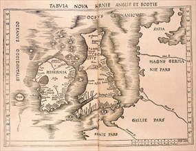
Old World Irish Map 1600
UMG22A65_276
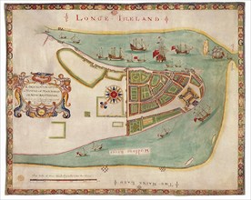
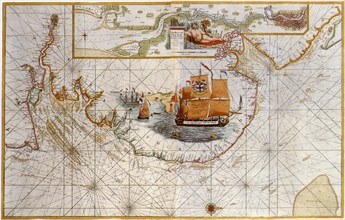
New York Harbor 1664
UMG22A65_278
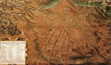
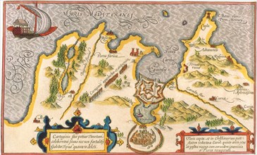
Map of Potosi, Peru 1758
UMG22A66_209
King's Dressing Room. Munich.
UMG22A66_185
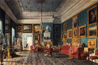
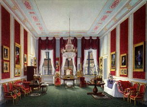
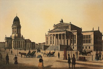
Berlin Palace Salon. Berlin.
UMG22A66_208
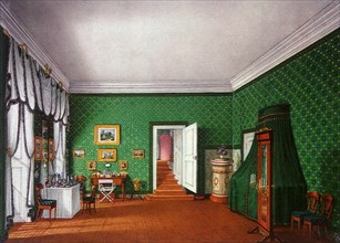
Queen's Dressing Room. Munich.
UMG22A65_408
View of Saint Petersburg
UMG21A17_053
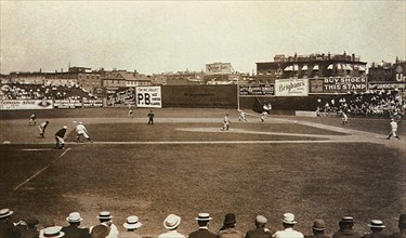
South End Grounds
UMG21A17_214
North Western Italy
UMG21A17_269
How the Battle Lines Were Drawn
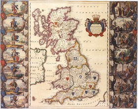
UMG21A17_328
Great Britain 1606
UMG21A17_031
Koningliches Theatre, Berlin
UMG21A17_188
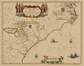
Greater Florida
UMG21A17_193
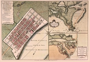
A Very New New Orleans
UMG21A18_098
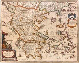
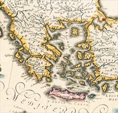
Map of Greece 1640
UMG21A17_085
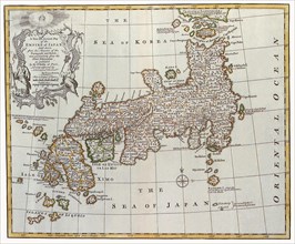
Japan, 1747
UMG21A17_113
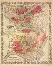
The Cities of Pittsburgh and Allegheny; The City o...
UMG21A17_182
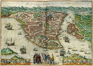
Constantinople, Byzantium
UMG21A17_190
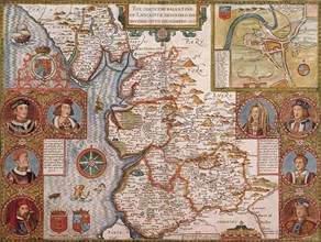
Lancashire, 1611
UMG21A17_332
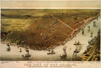
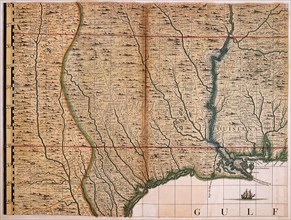
New Orleans and Mississippi River.
UMG21A17_352
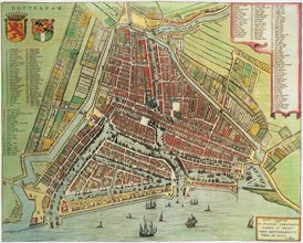
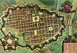
Map of Rotterdam. 1649
UMG21A18_097
Map of Greece 1650
UMG21A18_161
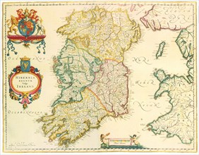
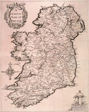
Map of Ireland 1635
UMG21A17_035
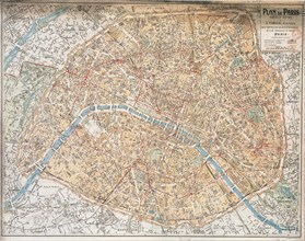
Map of Paris
UMG21A17_103
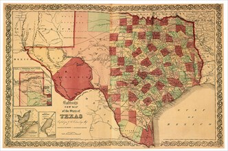
The Largest State—1863
UMG21A17_268
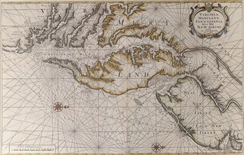
Chesapeake, Delaware & Jersey Coastlines, 1689
UMG21A17_320
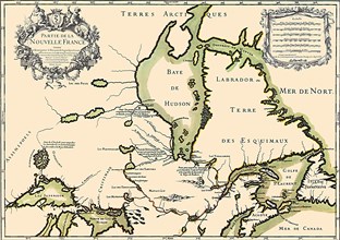
Canada Map 1762
UMG21A17_351
Italian Town with Citadel 1663
UMG21A18_099
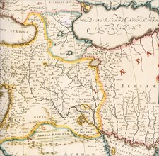
Map of Mesopotamia 1650
UMG21A18_160
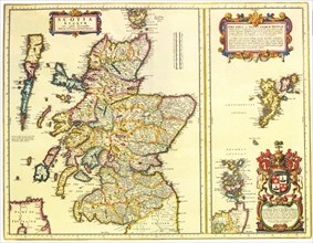
Map of Scotland 1654
UMG21A17_255
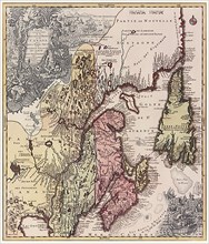
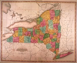
New York State
UMG21A17_341
Provinces of NY and NJ 1776
UMG21A17_102
East Coast and Thames Estuary
UMG21A17_224
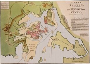
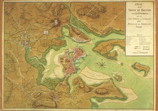
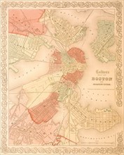
Map of Boston and Environs. 1776
UMG21A17_461
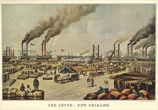
The Levee - New Orleans
UMG21A17_212
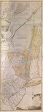
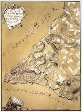
A Plan of the City of New York and Its Environs
UMG21A17_229
Great Britain and Scotland
UMG21A17_249
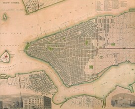
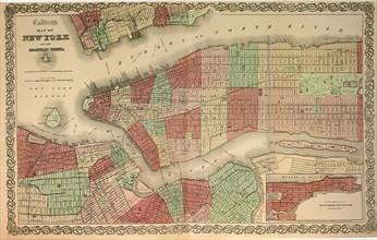
New York
UMG21A17_250
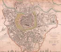
Vienna
UMG21A17_105
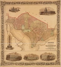
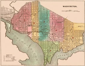
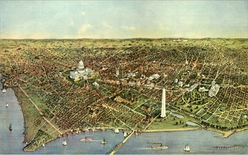
Washington D.C. 1865
UMG21A17_166
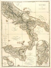
Kingdoms of Naples, Sicily, Sardigna & Malta
UMG21A17_201
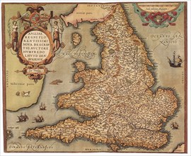
England and Wales, 1573
UMG21A17_206
Barbary coast
UMG21A17_226
General Mapp of Ireland
UMG21A17_253
The First Territorial Expansion —1823
UMG21A17_313
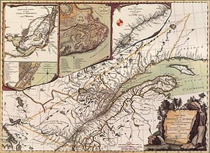
Antique Canadian Map 1685
UMG21A17_322
Quebec Map 1776
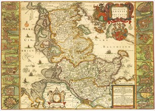
UMG21A17_329
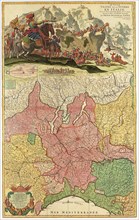
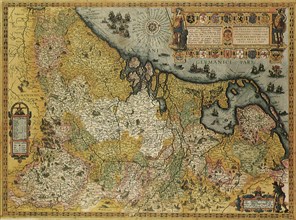
Belgium and Holland Map 1606
UMG21A17_336
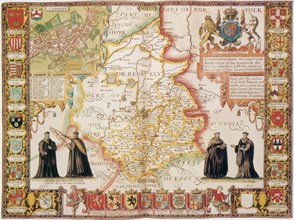
Cambridgeshire 1611
UMG21A17_355
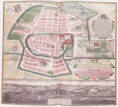
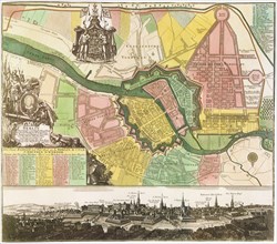
Map of Stuttgart 1742
UMG21A17_381
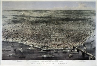
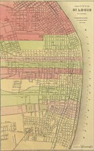
Aerial View of Saint Louis. 1874
UMG21A17_385
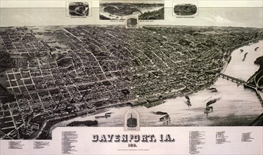
Aerial Map of Davenport. 1881
UMG21A17_081
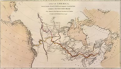
Smith a la Blaeu
UMG21A17_090
Planned Communities
UMG21A17_118
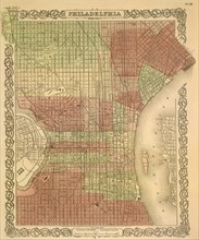
The Philadelphia Grid—1865
UMG21A17_183
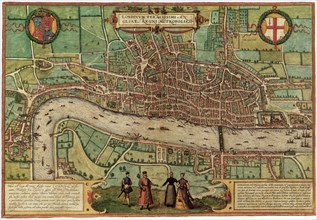
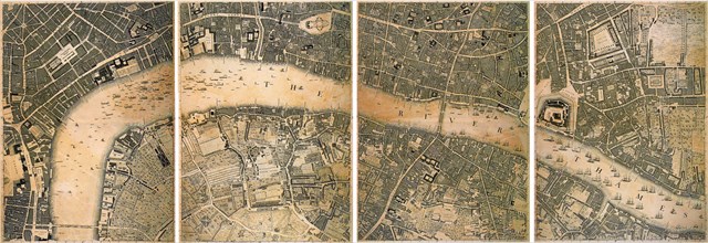
London, 1572
UMG21A17_187
Enter Lake Ontario
UMG21A17_207
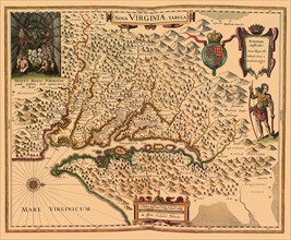
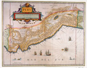
Peru
UMG21A17_216
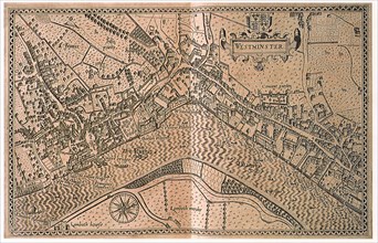
Westminster
UMG21A17_321
Prince Edward Island 1775
UMG21A17_356
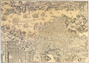
Map of Nagasaki.
UMG21A17_382
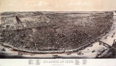
1896 View of Saint Louis.
UMG21A17_386
Map of Davenport. 1888
UMG21A18_164
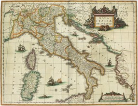
Map of Italy 1631
UMG21A17_059
The City of Washington
UMG21A17_082
The Massacre of Matanzas Inlet
UMG21A17_111
New York a Century Ago
UMG21A17_234
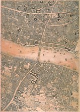
London
UMG21A17_324
Canada Map 1801
UMG21A17_353
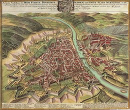
View of Wuzburg City 1735
UMG21A18_148
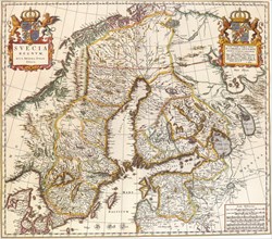
Map of Sweden 1662
UMG21A18_154
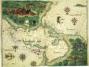
Map of Mexico et al 1547
UMG21A18_165
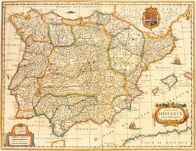
Iberian Peninsula Map 1631
UMG21A17_117
The Original District of Columbia—1865
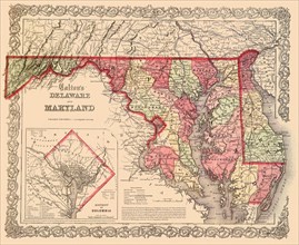
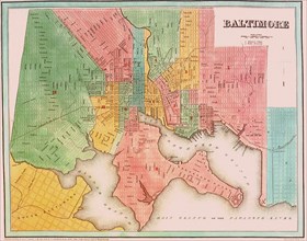
UMG21A17_164
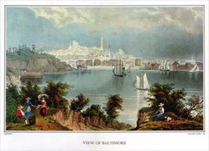
View of Baltimore
UMG21A17_235
London
UMG21A17_244
New York in the Late 1600s
UMG21A17_354
Map of Berlin City. 1740
UMG21A17_380
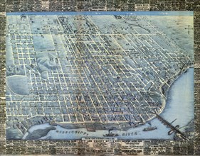
1848 Map of St. Louis 1848
UMG21A17_007
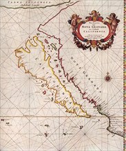
California, 1666
UMG21A17_092
Planned Communities
UMG21A17_114
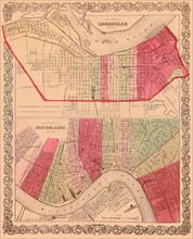
The City of Louisville; The City of New Orleans
UMG21A17_116
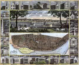
The City of St. Louis
UMG21A17_227
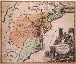
Louisiana and Gulf, 1733
UMG21A17_232
London
UMG21A17_338
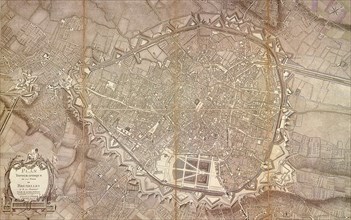
Brussels Topography 1777
UMG21A17_350
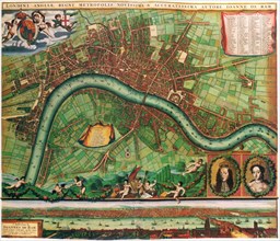
Plan of London 1700
UMG21A17_359
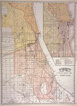
Chicago Railway Map 1887
UMG21A17_379
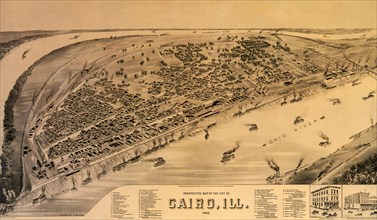
Perspective Map of Cairo. 1888
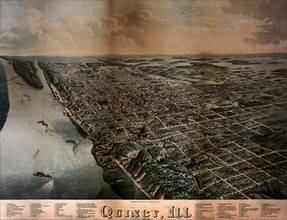
UMG21A17_384
View of Quincy. 1878
UMG21A18_159
Border Map 1652
UMG21A18_162
British Isles Map1645
UMG21A17_088
Explosive Growth—1837
UMG21A17_106
Boston’s famous buildings
- Page
-
- sur
- 2