140 résultats pour : compass
- Page
-
- sur
- 2
Connectez-vous pour plus de résultats

LZT20A36_123
Panel, c. 1720, England or France, England, silk, ...

LZT20A43_042
The Nest Robber, 1780s, Hubert Robert, French, 173...
LZT19B43_180
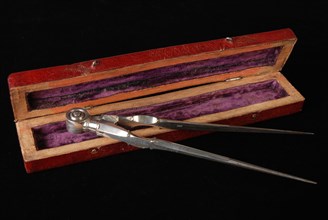
Silversmith: Adrianus van Bemme, Silver compass in...

LZT19B51_373
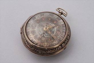
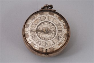
William Gib Junior, Pocket watch with golden ajour...
LZT19B47_400
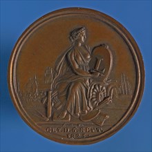
Van Bemme, Medal on the 50th anniversary of the Ro...
LZT19B49_355
Carolus van Aller, Silver pocket watch with silver...

LZT19B57_025
J.G. Seytz, Pocket watch with enamel dial with dat...

LZT19B52_195
Antonio Christoffel Reballio (Milaan circa 1720/25...
LZT19B58_038
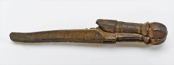
Hinged metal compass with round knob, passer measu...

LZT19B43_435
Roof bonnet, shield-shaped cover plate with guide ...
LZT19B50_132
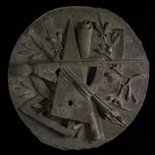
Round plaque with carved masonic symbols: compass,...

LZT19B56_321
Elias van Nijmegen (Nijmegen 1667 - Rotterdam 1755...

LZT19B56_495
atelier Van Nijmegen; Gerard Sanders? Dionys van N...
LZT19B49_344
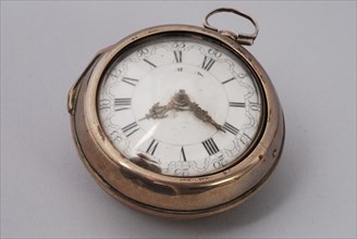
William Gib, Pocket watch with silver dial and gol...
LZT19B49_342
Samuel Ruel, Pocket watch with enamel dial and und...

LZT19B34_492
Surtouts et plan géométral de table, Le cannamelis...
LZT19A33_416
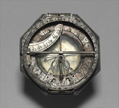
Compass and Sun Dial, 1700-1750. Germany, Augsbur...

LZT16A48_284
Giovanni Battista Tiepolo (Italian, 1696 - 1770), ...
LZT16A27_338
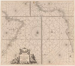
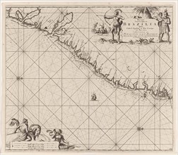
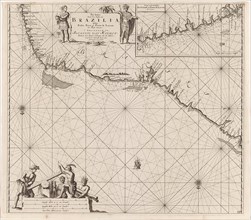
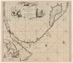
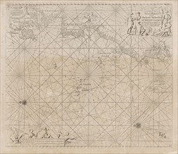
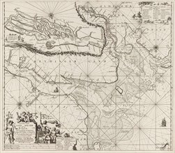
Sea chart of part of the coast of Brazil, Jan Luyk...
LZT16A27_412
Sea chart of part of the coast of the Kola peninsu...
LZT16A27_430
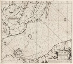
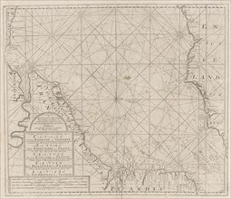
Sea chart of the Danish Islands, part of the coast...
LZT16A27_439
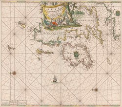
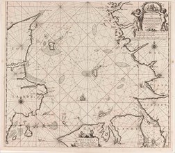
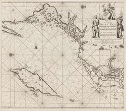
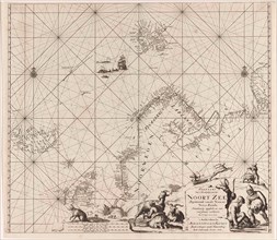
Sea chart of the Baltic and North Sea, Jan Luyken,...
LZT16A27_349
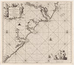
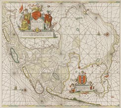
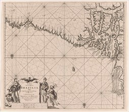
Sea chart of the southern part of the Atlantic coa...
LZT16A27_385
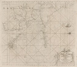
Sea chart of part of the coast of Brittany, Anonym...
LZT16A27_394
Sea chart of part of the south coast of Brittany, ...
LZT16A27_403
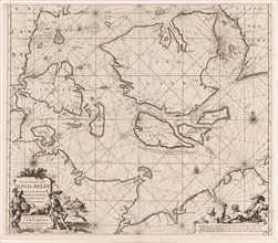
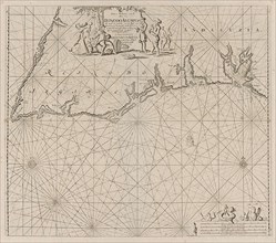
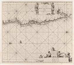
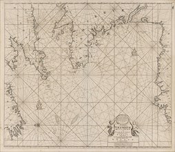
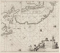
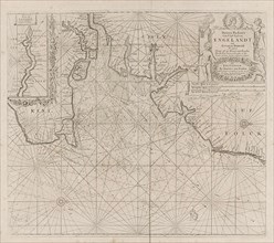
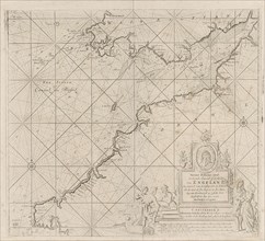
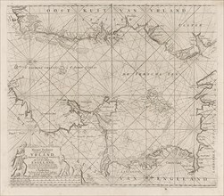
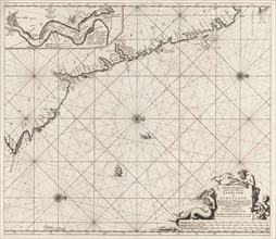
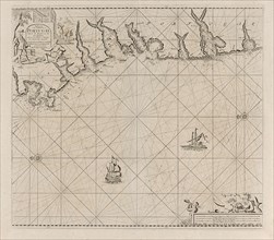
Sea chart of the coast of Ireland, Scotland, Engla...
LZT16A27_421
Sea chart of the southern part of the Baltic Sea, ...
LZT16A27_448
Sea chart of the coasts of England, Scotland and I...
LZT16A27_339
Sea chart of part of the east coast of Brazil, pri...
LZT16A27_413
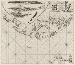
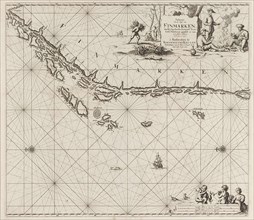
Sea chart of part of the coast of Finnmark, Jan Lu...
LZT16A27_431
Sea chart of Denmark in the Skagerrak and Kattegat...
LZT16A27_348
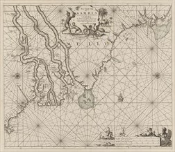
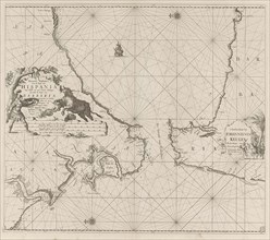
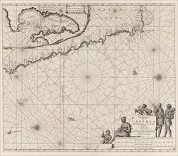
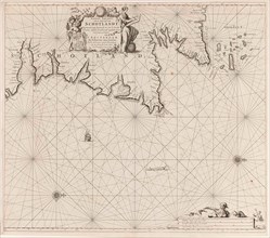
Sea chart of the coast of Gambia and part of the c...
LZT16A27_384
Sea map of part of the south coast of Portugal and...
LZT16A27_395
Map of the west coast of Brittany, Anonymous, Clae...
LZT16A27_402
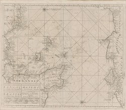
Sea chart of the Channel between England and Franc...
LZT16A27_420
Sea chart of the northwestern part of the Baltic S...
LZT16A27_340
Sea chart of the east coast of Brazil, Jan Luyken,...
LZT16A27_414
Sea chart of part of the Norwegian coast, Norway, ...
LZT16A27_441
Sea chart of part of the coast of Ireland, England...
LZT16A27_351
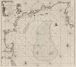
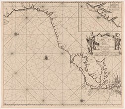
Sea chart of part of the east coast of the United ...
LZT16A27_383
the Mediterranean Sea Map with over the western an...
LZT16A27_392
Sea chart of Saintonge and Aunis, Anonymous, Claes...
LZT16A27_405
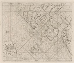
Sea chart of the Zeeland Islands and part of the N...
LZT16A27_419
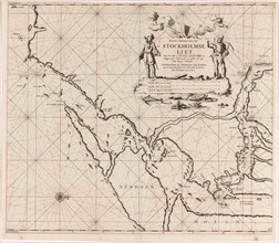
Map of the waters around Stockholm, Jan Luyken, Jo...
LZT16A27_428
Sea chart of part of the coast of Norway, print ma...
LZT16A27_450
Sea chart of the Canary Islands, print maker: Jan ...
LZT16A27_341
Sea chart of a portion of the northeast coast of B...
LZT16A27_451
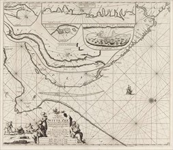
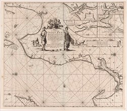
Sea chart of the Zuiderzee and the Wadden Sea, Jan...
LZT16A27_415
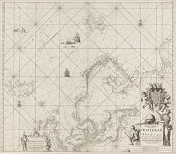
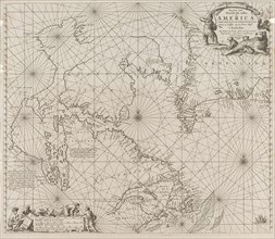
Sea chart of Northern part of Atlantic and Arctic ...
LZT16A27_440
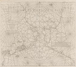
Sea chart of the Strait of Gibraltar, Anonymous, J...
LZT16A27_350
Sea chart a part of the coast of northern Canada a...
LZT16A27_393
Sea chart of the coast of France between the islan...
LZT16A27_404
Sea chart of part of the east coast of England at ...
LZT16A27_418
Sea chart of a portion of the Baltic coast of Pola...
LZT16A25_354
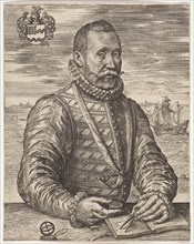
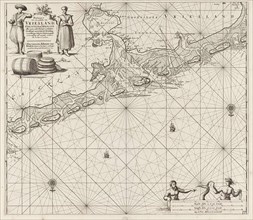
Portrait of a naval officer William Bloys van Tres...
LZT16A27_335
Sea chart of part of the coast of Brazil, Uruguay ...
LZT16A27_342
Sea chart of part of the coast of Brazil with the ...
LZT16A27_353
Sea chart of part of the east coast of the United ...

LZT16A39_048
Painter with a model in his studio, Wouter Dam, Co...
LZT16A27_408
Sea chart of the Atlantic Ocean to the west coast ...
LZT16A27_381
Sea chart of the Strait of Gibraltar, Jan Luyken, ...
LZT16A27_399
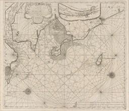
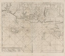
Sea chart of the Bristol Channel, Jan Luyken, Anon...
LZT16A27_425
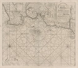
Sea chart of the east coast of England, with the m...
LZT16A27_434
Sea chart of part of the Elbe, the Weser and Jadeb...

LZT16A39_356
Portrait of François Villain, Pieter van Schuppen...
LZT16A27_343
Sea chart of the coast of Namibia and South Africa...
LZT16A27_442
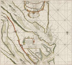
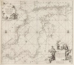
Sea chart of the Garonne, France, Johannes van Keu...
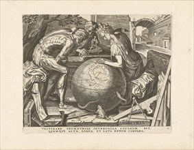
LZT16A36_188
Geometry (Geometry), Cornelis Cort, Hieronymus Coc...
LZT16A27_409
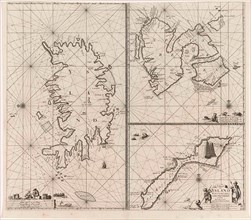
Three-piece waiver of Iceland, Jan Mayen Island an...

LZT16A38_269
Personification of beauty, Arnold Houbraken, 1710 ...
LZT16A27_352
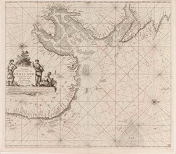
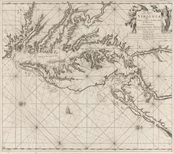
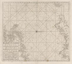
Sea chart of part of the coast of Virginia, Jan Lu...
LZT16A27_391
Sea chart of the River Gironde to Bordeaux, Anonym...
LZT16A27_398
Sea chart of part of the Irish Sea between Ireland...
LZT16A27_424
Sea chart of part of the northeast coast of Englan...
LZT16A27_435
Sea chart of a large part of the Wadden, Jan Luyke...
LZT16A27_344
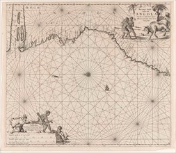
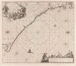
Sea chart of the coast of Congo and Angola, Jan Lu...
LZT16A27_355
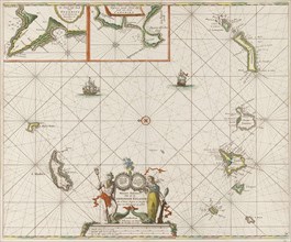
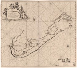
Sea chart of Bermuda, Jan Luyken, Claes Jansz Voog...
LZT16A27_366
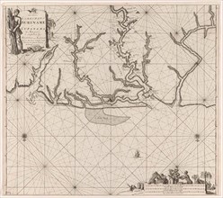
Sea chart of various Surinamese rivers, Jan Luyken...
LZT16A27_377
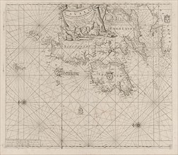
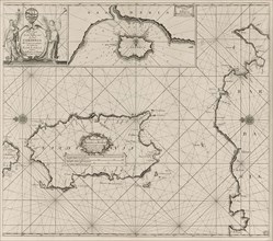
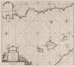
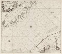
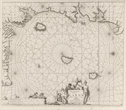
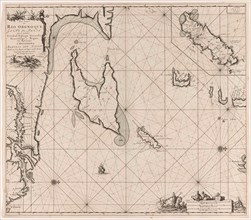
Sea chart of the island of Sardinia and part of th...
LZT16A27_432
Sea chart of the coast of Norway, Jan Luyken, Joha...
LZT16A24_216
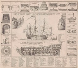
Engraving showing cross sections of a warship. "Nu...
LZT16A27_379
Sea chart of a part of the Mediterranean Sea with ...
LZT16A27_388
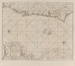
Sea chart of part of the south coast of Portugal, ...
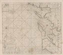
LZT16A27_401
Sea chart of the Channel between England and Franc...
LZT16A27_423
Sea chart of part of north east coast of Scotland ...
LZT16A27_445
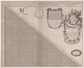
Distance Chart for some places in Europe, Jan Luyk...

LZT16A25_368
Allegory of perception, Jan Saenredam, Johannes Ja...
LZT16A27_345
Sea chart of the coast of Congo, Gabon and Angola,...
LZT16A24_316
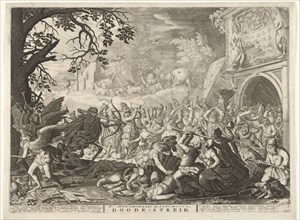
Death fights against humanity, Boëtius Adamsz. Bo...
LZT16A27_367
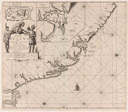
Sea chart of the coast of French Guiana, Jan Luyke...
LZT16A27_376
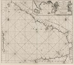
Sea chart of part of the southwest coast of Italy ...
LZT16A27_433
Sea chart of part of the coast of Norway and Jutla...
LZT16A27_378
Map of part of the Mediterranean coast of France a...
LZT16A27_389
Sea chart of a portion of the Bay of Biscay in Bil...
LZT16A27_400
Sea chart of the Channel between England and Franc...
LZT16A27_422
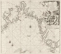
Sea chart of the Baltic Sea from Rostock to Vyborg...
LZT16A27_346
Sea chart of the coast of Equatorial Guinea, Gabon...
LZT16A27_357
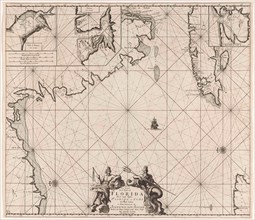
Sea chart of part of the Gulf of Mexico, with the ...
LZT16A27_364
Sea chart of the Gulf of Paria to the mouth of the...
LZT16A27_375
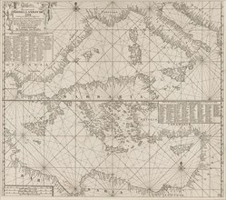
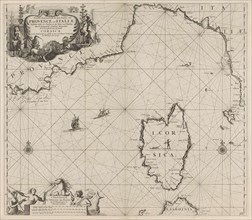
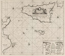
Map of the islands of Sicily and Malta and part of...
- Page
-
- sur
- 2