123 résultats pour : north sea
- Page
-
- sur
- 2
Connectez-vous pour plus de résultats

LZT26A39_115
Costumes of the inhabitants of the north-eastern p...
LZT20A41_164
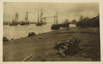
Bound for the North Sea, 1887, Peter Henry Emerson...

LZT20A45_091
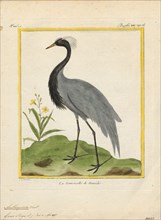
Anthropoides virgo, Print, The demoiselle crane (G...

LZT20A45_092
Anthropoides virgo, Print, The demoiselle crane (G...
LZT20A45_090
Anthropoides virgo, Print, The demoiselle crane (G...

LZT19B52_186
Large pewter jug marked on the ear with hinged lid...

LZT19B48_396
painter: JN, Rear-glass painting 'fire in brewery ...

LZT19B49_166
Geography puzzle in coffin: map with the Netherlan...
LZT19B21_397
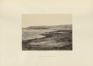
The North Shore of the Dead Sea; Francis Frith, En...
LZT19B08_057
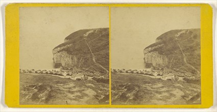
North Sea Landing, Flanders(?, about 1865; Albumen...

LZT19B23_102
Man on bridge; Arthur Brown, British, active 1850s...

LZT19B23_104
Fallen trees in forest; Arthur Brown, British, act...

LZT19B23_103
Couple and child by stream; Arthur Brown, British,...

LZT19B23_105
Forest stream; Arthur Brown, British, active 1850s...

LZT19B23_108
Bend in forest stream; Arthur Brown, British, acti...

LZT19B23_107
Forest stream; Arthur Brown, British, active 1850s...

LZT19B23_110
Stream and small waterfall; Arthur Brown, British,...

LZT19B23_109
Forest scene; Arthur Brown, British, active 1850s,...

LZT19B23_112
Forest stream; Arthur Brown, British, active 1850s...

LZT19A83_289
Sea Lion Pup Vessel, 200-850. Central Andes, North...
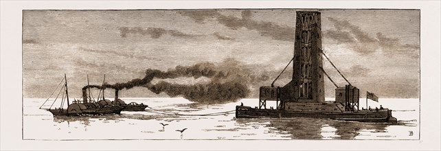
LZT16A09_386
THE NEW GRAIN ELEVATOR, "INTERNATIONAL," BEING TOW...
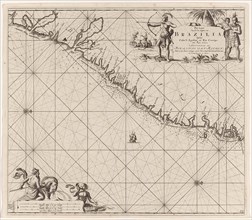
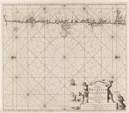
LZT16A27_338
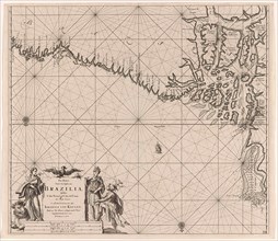
Sea chart of part of the coast of Brazil, Jan Luyk...
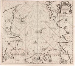
LZT16A27_430
Sea chart of the Danish Islands, part of the coast...
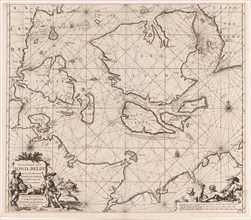
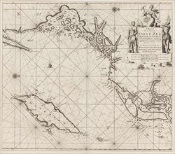
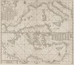
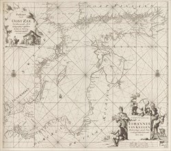
LZT16A27_439
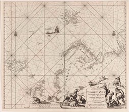
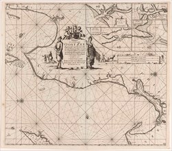
Sea chart of the Baltic and North Sea, Jan Luyken,...
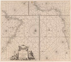
LZT16A27_349
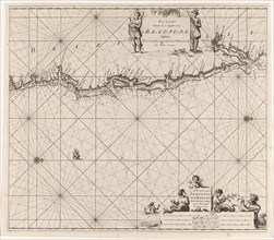
Sea chart of the southern part of the Atlantic coa...
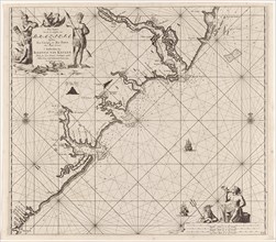
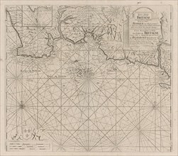
LZT16A27_385
Sea chart of part of the coast of Brittany, Anonym...
LZT16A27_394
Sea chart of part of the south coast of Brittany, ...
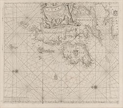
LZT16A27_403
Sea chart of the coast of Ireland, Scotland, Engla...
LZT16A27_421
Sea chart of the southern part of the Baltic Sea, ...
LZT16A27_448
Sea chart of the coasts of England, Scotland and I...
LZT16A27_339
Sea chart of part of the east coast of Brazil, pri...
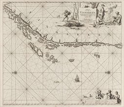
LZT16A27_413
Sea chart of part of the coast of Finnmark, Jan Lu...
LZT16A27_431
Sea chart of Denmark in the Skagerrak and Kattegat...
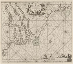
LZT16A27_348
Sea chart of the coast of Gambia and part of the c...
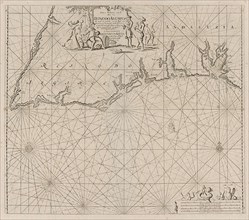
LZT16A27_384
Sea map of part of the south coast of Portugal and...
LZT16A27_420
Sea chart of the northwestern part of the Baltic S...
LZT16A27_340
Sea chart of the east coast of Brazil, Jan Luyken,...
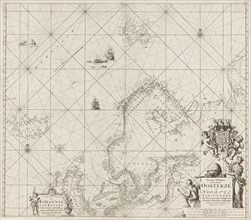
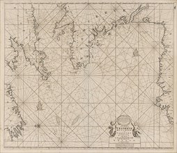
LZT16A27_414
Sea chart of part of the Norwegian coast, Norway, ...
LZT16A27_441
Sea chart of part of the coast of Ireland, England...
LZT16A27_351
Sea chart of part of the east coast of the United ...
LZT16A27_383
the Mediterranean Sea Map with over the western an...
LZT16A27_392
Sea chart of Saintonge and Aunis, Anonymous, Claes...
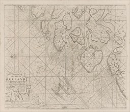
LZT16A27_405
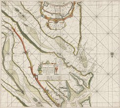
Sea chart of the Zeeland Islands and part of the N...
LZT16A27_428
Sea chart of part of the coast of Norway, print ma...
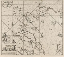
LZT16A27_450
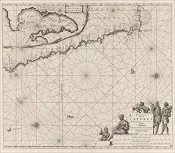
Sea chart of the Canary Islands, print maker: Jan ...
LZT16A27_451
Sea chart of the Zuiderzee and the Wadden Sea, Jan...
LZT16A27_415
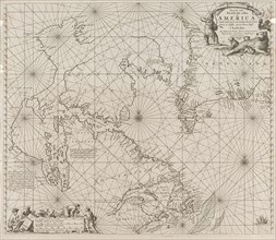
Sea chart of Northern part of Atlantic and Arctic ...
LZT16A27_440
Sea chart of the Strait of Gibraltar, Anonymous, J...
LZT16A27_350
Sea chart a part of the coast of northern Canada a...
LZT16A27_418
Sea chart of a portion of the Baltic coast of Pola...
LZT16A27_342
Sea chart of part of the coast of Brazil with the ...
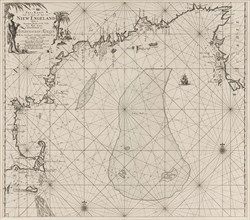
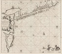
LZT16A27_353
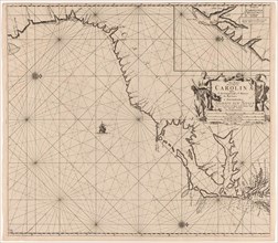
Sea chart of part of the east coast of the United ...
LZT16A27_408
Sea chart of the Atlantic Ocean to the west coast ...
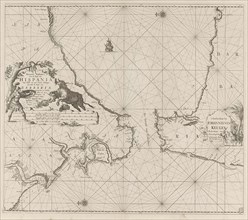
LZT16A27_381
Sea chart of the Strait of Gibraltar, Jan Luyken, ...
LZT16A27_425
Sea chart of the east coast of England, with the m...
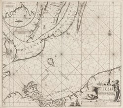
LZT16A27_434
Sea chart of part of the Elbe, the Weser and Jadeb...
LZT16A27_343
Sea chart of the coast of Namibia and South Africa...
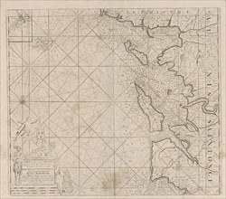
LZT16A27_442
Sea chart of the Garonne, France, Johannes van Keu...
LZT16A31_305
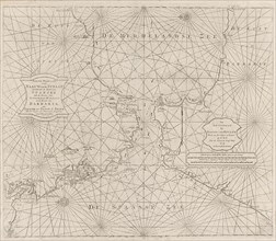
Map of the North Sea and the coast of Holland, Jac...

LZT16A30_334
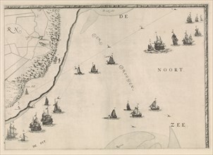
Girl from fishing village on the North Sea coast, ...
LZT16A27_352
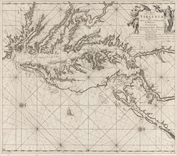
Sea chart of part of the coast of Virginia, Jan Lu...
LZT16A27_391
Sea chart of the River Gironde to Bordeaux, Anonym...
LZT16A27_398
Sea chart of part of the Irish Sea between Ireland...
LZT16A27_424
Sea chart of part of the northeast coast of Englan...
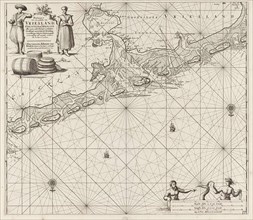
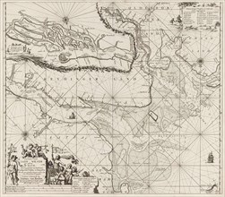
LZT16A27_435
Sea chart of a large part of the Wadden, Jan Luyke...
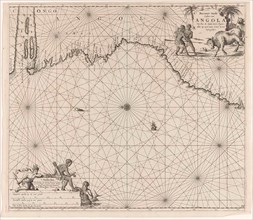
LZT16A27_344
Sea chart of the coast of Congo and Angola, Jan Lu...
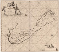
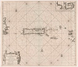
LZT16A27_355
Sea chart of Bermuda, Jan Luyken, Claes Jansz Voog...
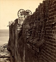
LZT16A08_210
North wall of Fort Sumpter (i.e. Sumter). Fort Sum...
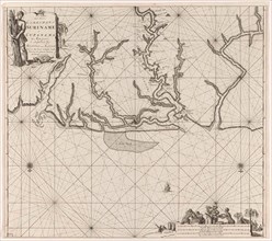
LZT16A27_366
Sea chart of various Surinamese rivers, Jan Luyken...
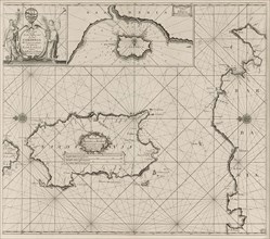
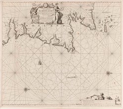
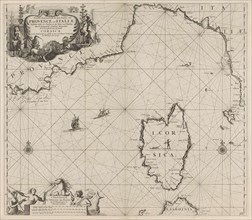
LZT16A27_377
Sea chart of the island of Sardinia and part of th...
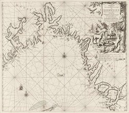
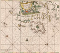
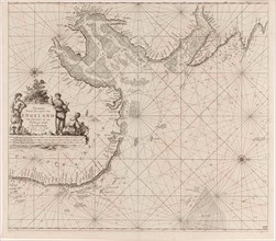
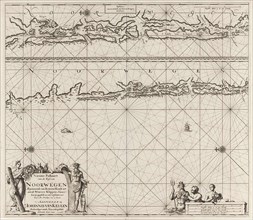
LZT16A27_432
Sea chart of the coast of Norway, Jan Luyken, Joha...
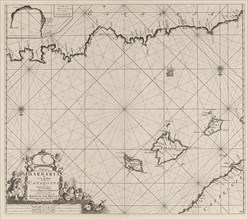
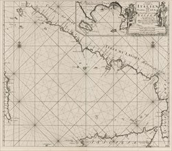
LZT16A27_379
Sea chart of a part of the Mediterranean Sea with ...
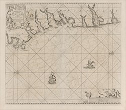
LZT16A27_388
Sea chart of part of the south coast of Portugal, ...
LZT16A27_423
Sea chart of part of north east coast of Scotland ...
LZT16A27_345
Sea chart of the coast of Congo, Gabon and Angola,...
LZT16A31_030
Receipt of the post at sea, Jacob Quack, Jan Houwe...
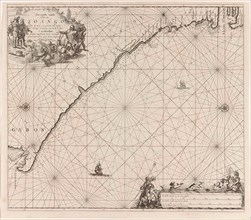
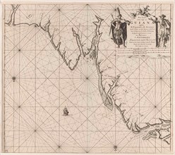
LZT16A27_367
Sea chart of the coast of French Guiana, Jan Luyke...
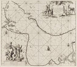
LZT16A27_376
Sea chart of part of the southwest coast of Italy ...
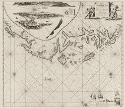
LZT16A27_411
Sea chart of part of the White Sea in Russia, Jan ...
LZT16A27_433
Sea chart of part of the coast of Norway and Jutla...
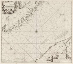
LZT16A27_378
Map of part of the Mediterranean coast of France a...
LZT16A27_422
Sea chart of the Baltic Sea from Rostock to Vyborg...
LZT16A27_357
Sea chart of part of the Gulf of Mexico, with the ...
LZT16A27_364
Sea chart of the Gulf of Paria to the mouth of the...
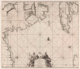
LZT16A27_356
Sea chart of part of southeastern Florida and nort...
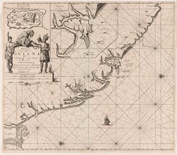
LZT16A27_365
Sea chart of part of the coast of Suriname and Guy...
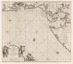
LZT16A27_337
Sea chart of part of the coast of Brazil in the Mo...
LZT16A27_427
Sea chart of part of the coast of Norway near Berg...
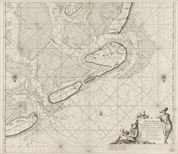
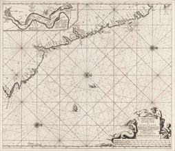
LZT16A27_436
Sea chart of the Wadden Sea from Den Helder to Ter...
LZT16A27_336
Sea map of part of the coast of Brazil, Jan Luyken...
LZT16A27_363
Sea chart of Puerto Rico, Jan Luyken, Claes Jansz ...
LZT16A27_372
Sea chart of the western part of the Aegean part o...
LZT16A27_426
Sea chart of the coast of Norway near Trondheim, J...
LZT16A27_437
Sea chart of the Zuiderzee and the Wadden Sea, Jan...
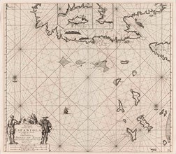
LZT16A27_360
Sea chart of the north coast of Hispaniola, with t...
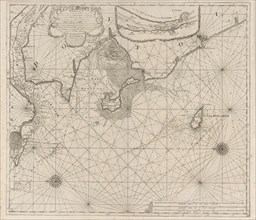
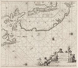
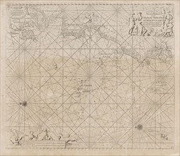
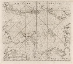
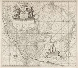
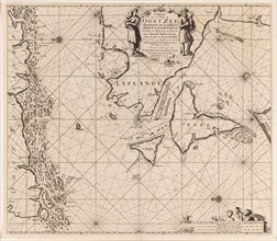
LZT16A27_407
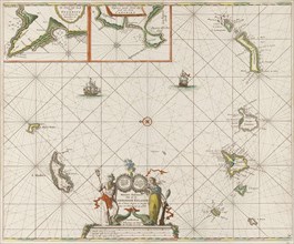
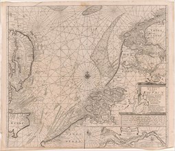
Sea chart of the southern part of the North Sea an...
LZT16A27_361
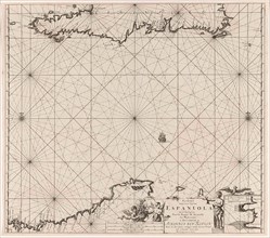
Sea chart of Haiti, the Dominican Republic, Venezu...
LZT16A27_417
Sea chart of the mouth of the Gulf of Finland in t...
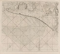
LZT16A27_406
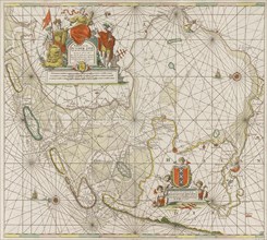
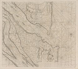
Sea chart of the coast of Holland between Texel an...
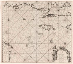
LZT16A27_358
Sea chart of the south coast of Cuba and Jamaica, ...
- Page
-
- sur
- 2