60 résultats pour : coast sailing
- Page
-
- sur
- 1
Connectez-vous pour plus de résultats
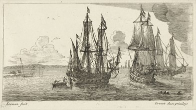
LZT16A43_038
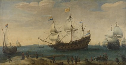
A number of East Indiamen off the Coast (The Mauri...
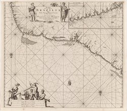
LZT16A27_338
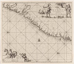
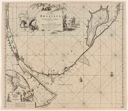
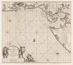
Sea chart of part of the coast of Brazil, Jan Luyk...
LZT16A27_412
Sea chart of part of the coast of the Kola peninsu...
LZT16A27_430
Sea chart of the Danish Islands, part of the coast...
LZT16A27_394
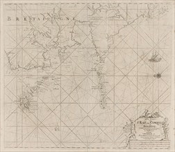
Sea chart of part of the south coast of Brittany, ...
LZT16A27_403
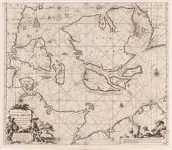
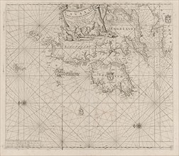
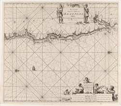
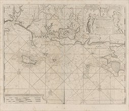
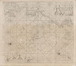
Sea chart of the coast of Ireland, Scotland, Engla...
LZT16A27_339
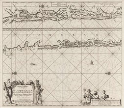
Sea chart of part of the east coast of Brazil, pri...
LZT16A27_348
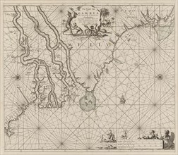
Sea chart of the coast of Gambia and part of the c...
LZT16A27_395
Map of the west coast of Brittany, Anonymous, Clae...
LZT16A30_178
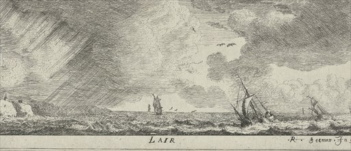
Port on the Mediterranean coast, print maker: Rein...
LZT16A27_340
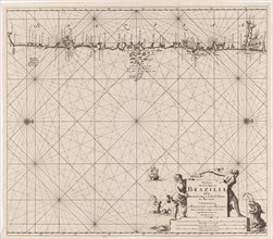
Sea chart of the east coast of Brazil, Jan Luyken,...
LZT16A27_441
Sea chart of part of the coast of Ireland, England...
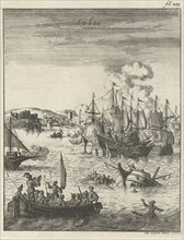
LZT16A27_282
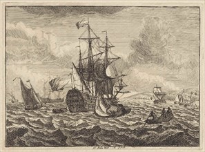
Sea Battle between Dutch and Spanish ships off the...
LZT16A27_351
Sea chart of part of the east coast of the United ...
LZT16A27_392
Sea chart of Saintonge and Aunis, Anonymous, Claes...
LZT16A27_428
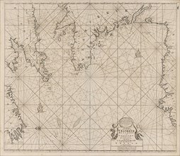
Sea chart of part of the coast of Norway, print ma...
LZT16A27_450
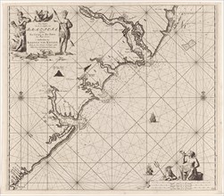
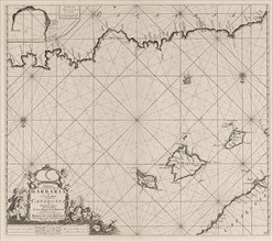
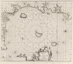
Sea chart of the Canary Islands, print maker: Jan ...
LZT16A27_341
Sea chart of a portion of the northeast coast of B...
LZT16A27_283
Sea battle off the coast of Salee, Morocco, Jan Lu...
LZT16A27_350
Sea chart a part of the coast of northern Canada a...
LZT16A27_393
Sea chart of the coast of France between the islan...
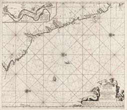
LZT16A27_404
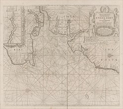
Sea chart of part of the east coast of England at ...
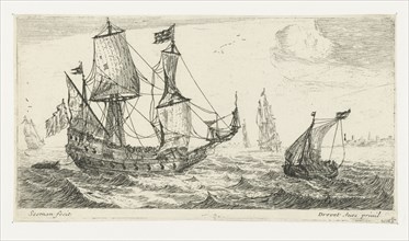
LZT16A38_082
Seascapes with boats and rowing boat, Adam Silo, 1...
LZT16A27_335
Sea chart of part of the coast of Brazil, Uruguay ...
LZT16A27_353
Sea chart of part of the east coast of the United ...
LZT16A31_224
A large sailing ship, a pinnace, and a smaller shi...
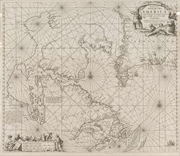
LZT16A27_408
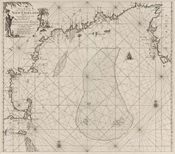
Sea chart of the Atlantic Ocean to the west coast ...
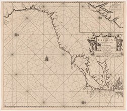
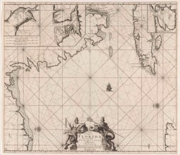
LZT16A27_352
Sea chart of part of the coast of Virginia, Jan Lu...
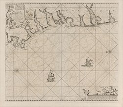
LZT16A27_424
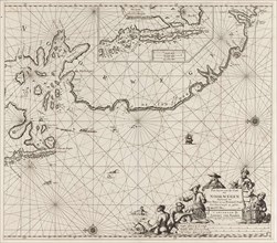
Sea chart of part of the northeast coast of Englan...
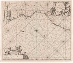
LZT16A27_344
Sea chart of the coast of Congo and Angola, Jan Lu...
LZT16A27_379
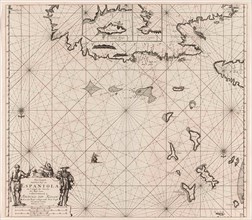
Sea chart of a part of the Mediterranean Sea with ...
LZT16A27_388
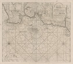
Sea chart of part of the south coast of Portugal, ...
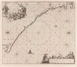
LZT16A27_345
Sea chart of the coast of Congo, Gabon and Angola,...
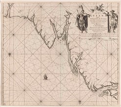
LZT16A27_367
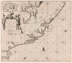
Sea chart of the coast of French Guiana, Jan Luyke...
LZT16A27_422
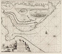
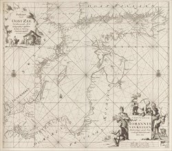
Sea chart of the Baltic Sea from Rostock to Vyborg...
LZT16A27_346
Sea chart of the coast of Equatorial Guinea, Gabon...
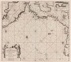
LZT16A27_357
Sea chart of part of the Gulf of Mexico, with the ...
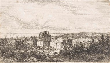
LZT16A30_480
Coastal landscape with ruins, Johannes Pieter van ...
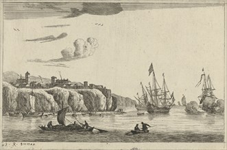
LZT16A36_415
Harbour with a village on a cliff, Reinier Nooms, ...
LZT16A27_365
Sea chart of part of the coast of Suriname and Guy...
LZT16A27_337
Sea chart of part of the coast of Brazil in the Mo...
LZT16A27_427
Sea chart of part of the coast of Norway near Berg...
LZT16A24_387
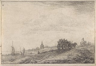
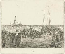
Coastline with horse and carriage, Anthonie Waterl...
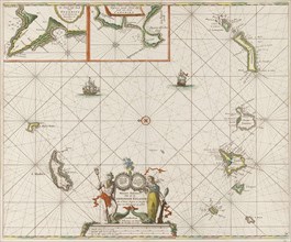
LZT16A27_336
Sea map of part of the coast of Brazil, Jan Luyken...
LZT16A39_289
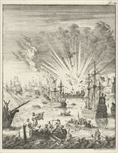
Stranding of the British East Indiaman General Bar...
LZT16A35_228
Air, Reinier Nooms, 1651 - 1652
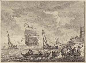
LZT16A30_176
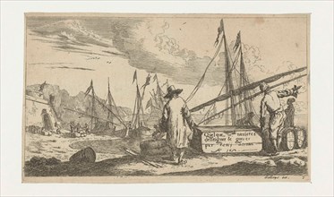
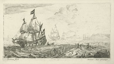
Ships before coast, print maker: Anonymous, Reinie...
LZT16A27_360
Sea chart of the north coast of Hispaniola, with t...
LZT16A35_144
Three merchant ships off the coast, Anonymous, Pie...
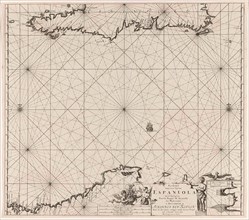
LZT16A27_361
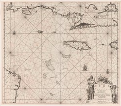
Sea chart of Haiti, the Dominican Republic, Venezu...
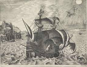
LZT16A33_443
Sailing ship with the Fall of Icarus, Frans Huys, ...
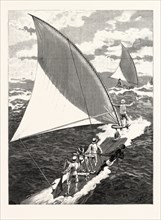
LZT16A36_115
Seascape with boats offshore, Adam Silo, 1689-1760
LZT16A27_406
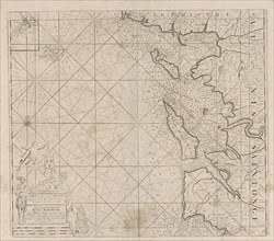
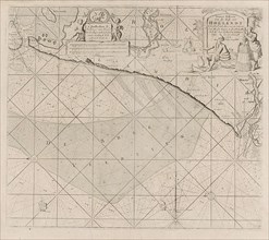
Sea chart of the coast of Holland between Texel an...
LZT16A27_358
Sea chart of the south coast of Cuba and Jamaica, ...
LZT16A27_387
Sea chart of a portion of the south coast of Portu...
LZT16A27_396
Map of part of the south coast of Ireland, Jan Luy...
LZT16A27_359
Sea chart of the coasts of Colombia, Panama, Costa...
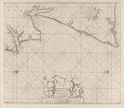
LZT16A27_386
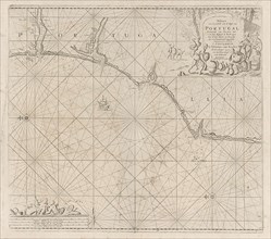
Sea map of part of the coast of Portugal, Jan Luyk...
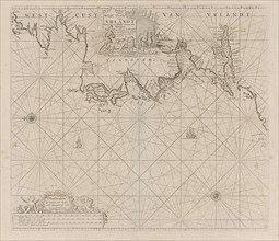
LZT16A27_397
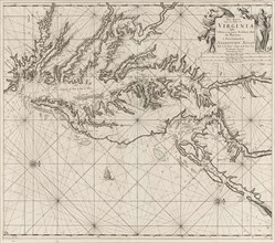
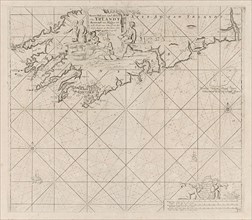
Sea chart of a portion of the west coast of Irelan...
LZT13A24_228