Période

31 résultats pour : 1681 - 1799

  • Page
  • sur
  • 1
Connectez-vous pour plus de résultats
William Baillie, English, 1723-1810, after Gerard ter Borch, Dutch, 1617-1681, Student Sitting
LZT20A55_426

William Baillie, English, 1723-1810, after Gerard ...

Sea chart of part of the coast of the Kola peninsula in Russia, Jan Luyken, Johannes van Keulen
LZT16A27_412

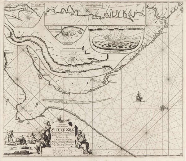
Sea chart of part of the coast of the Kola peninsu...

Sea chart of the Danish Islands, part of the coast of Sweden and Germany, Jan Luyken, Johannes van
LZT16A27_430

Sea chart of the Danish Islands, part of the coast...

Sea chart of the Baltic and North Sea, Jan Luyken, Johannes van Keulen (I), unknown, 1681 - 1799
LZT16A27_439

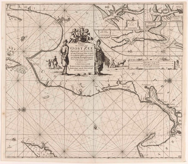
Sea chart of the Baltic and North Sea, Jan Luyken,...

Sea chart of the southern part of the Baltic Sea, print maker: Jan Luyken, Johannes van Keulen I,
LZT16A27_421

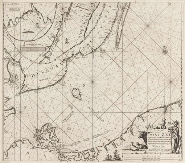
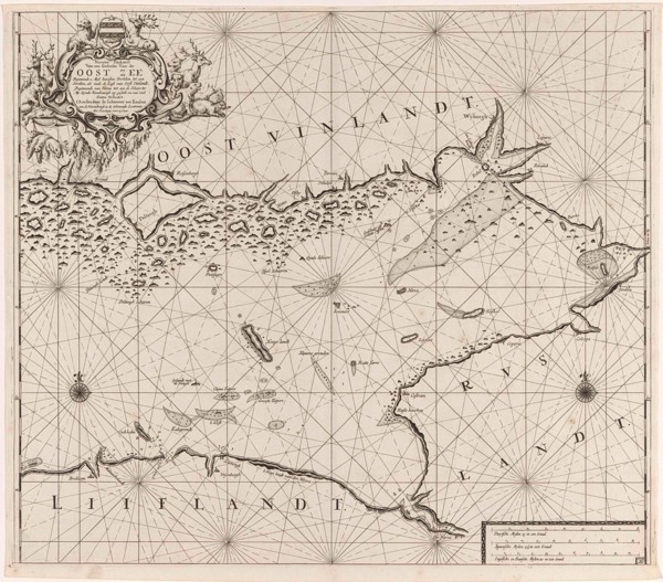
Sea chart of the southern part of the Baltic Sea, ...

Sea chart of part of the coast of Finnmark, Jan Luyken, Johannes van Keulen (I), unknown, 1681 -
LZT16A27_413

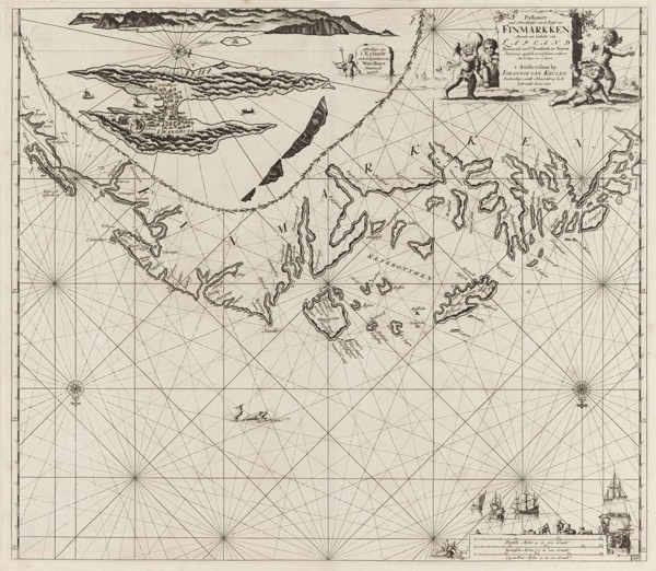
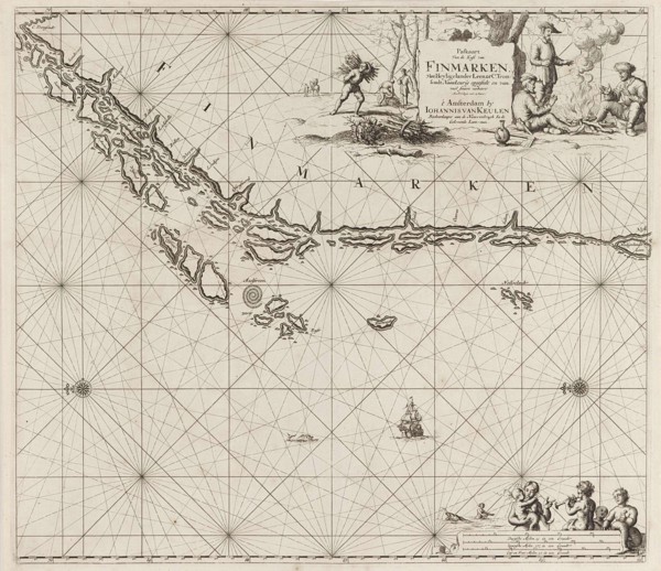
Sea chart of part of the coast of Finnmark, Jan Lu...

Sea chart of Denmark in the Skagerrak and Kattegat, Jan Luyken, Johannes van Keulen I, unknown,
LZT16A27_431

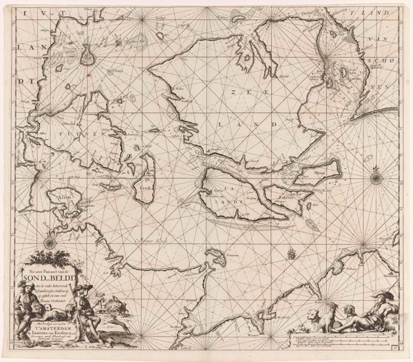
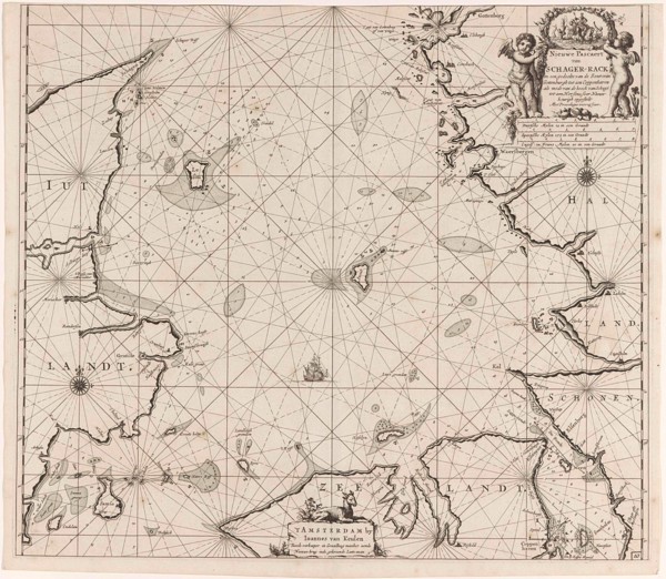
Sea chart of Denmark in the Skagerrak and Kattegat...

Sea chart of the northwestern part of the Baltic Sea by the Swedish coast, Jan Luyken, Johannes van
LZT16A27_420

Sea chart of the northwestern part of the Baltic S...

Sea chart of the Northern Dvina River, Jan Luyken, Johannes van Keulen (I), unknown, 1681 - 1799
LZT16A27_449

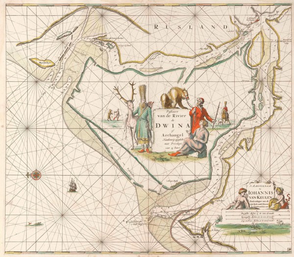
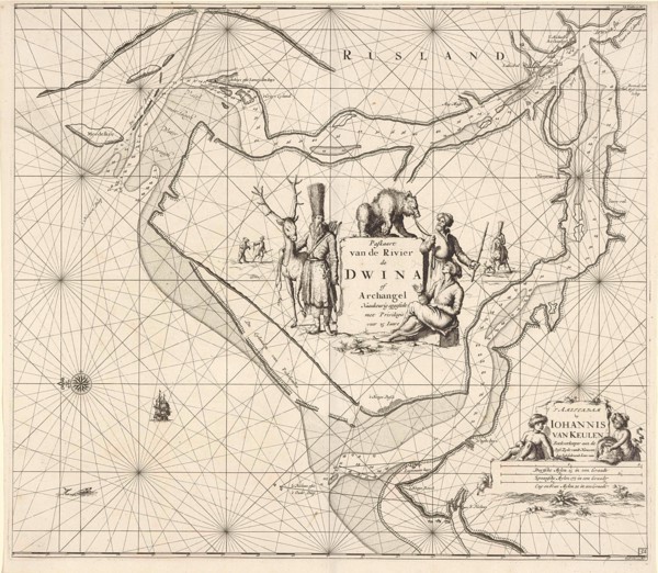
Sea chart of the Northern Dvina River, Jan Luyken,...

Sea chart of part of the Norwegian coast, Norway, print maker: Jan Luyken, Johannes van Keulen I,
LZT16A27_414

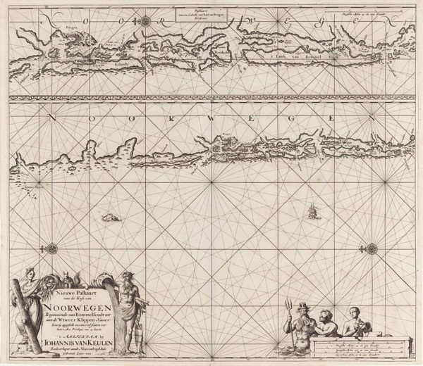
Sea chart of part of the Norwegian coast, Norway, ...

Map of the waters around Stockholm, Jan Luyken, Johannes van Keulen (I), unknown, 1681 - 1799
LZT16A27_419

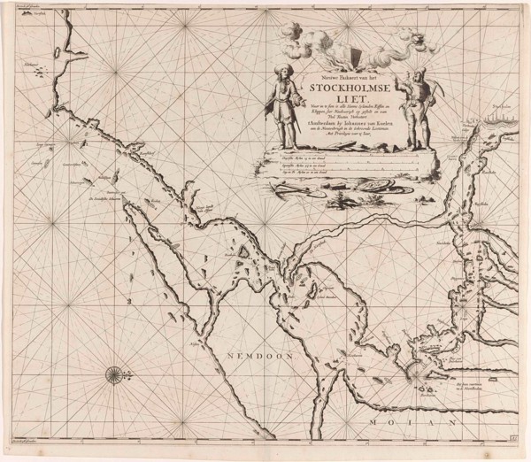
Map of the waters around Stockholm, Jan Luyken, Jo...

Sea chart of part of the coast of Norway, print maker: Jan Luyken, Johannes van Keulen I, unknown,
LZT16A27_428

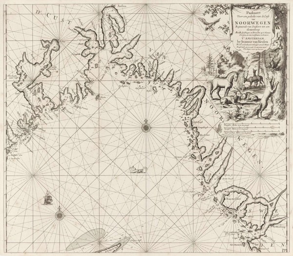
Sea chart of part of the coast of Norway, print ma...

Sea chart of Northern part of Atlantic and Arctic Ocean, North Sea and Baltic Sea, Jan Luyken,
LZT16A27_415

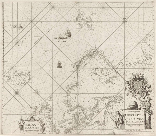
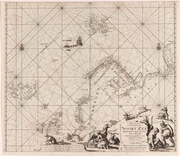
Sea chart of Northern part of Atlantic and Arctic ...

Sea chart of a portion of the Baltic coast of Poland and Latvia, Jan Luyken, Johannes van Keulen
LZT16A27_418

Sea chart of a portion of the Baltic coast of Pola...

Sea chart of the east coast of England, with the mouth of the Humber, Jan Luyken, Johannes van
LZT16A27_425

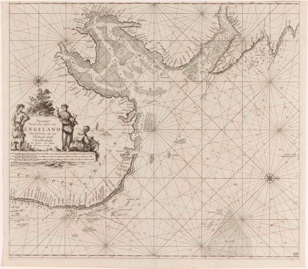
Sea chart of the east coast of England, with the m...

Sea chart of part of the Elbe, the Weser and Jadebusen, Jan Luyken, Johannes van Keulen I, unknown,
LZT16A27_434

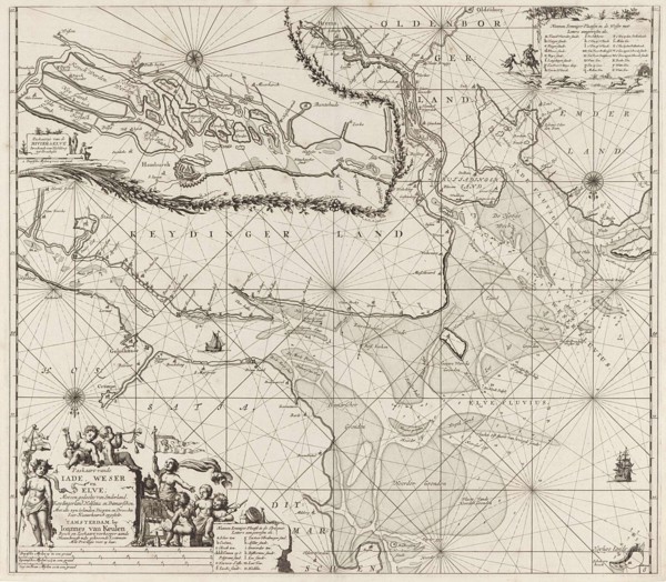
Sea chart of part of the Elbe, the Weser and Jadeb...

Three-piece waiver of Iceland, Jan Mayen Island and Spitsbergen, Jan Luyken, Johannes van Keulen I,
LZT16A27_409

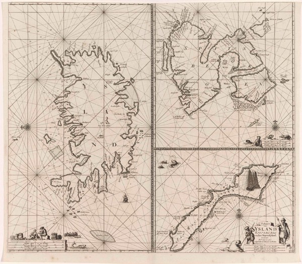
Three-piece waiver of Iceland, Jan Mayen Island an...

Sea chart of part of the northeast coast of England and part of Scotland, Jan Luyken, Johannes van
LZT16A27_424

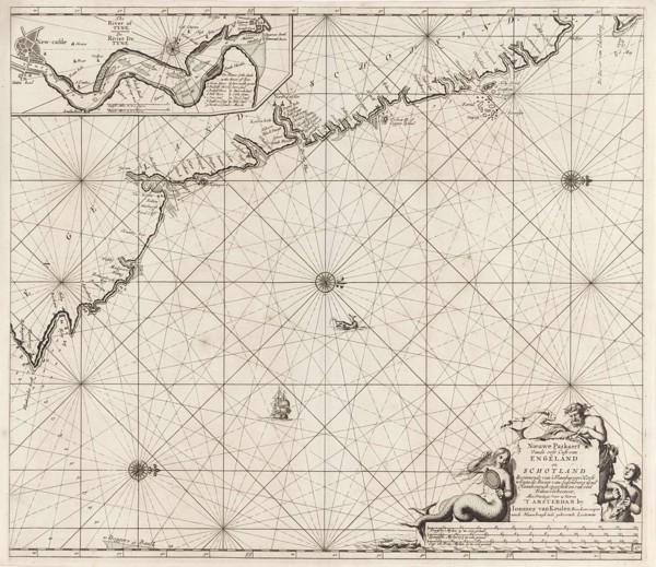
Sea chart of part of the northeast coast of Englan...

Sea chart of a large part of the Wadden, Jan Luyken, Johannes van Keulen (I), unknown, 1681 - 1799
LZT16A27_435

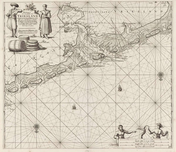
Sea chart of a large part of the Wadden, Jan Luyke...

Sea chart of the coast of Norway, Jan Luyken, Johannes van Keulen (I), unknown, 1681 - 1799
LZT16A27_432

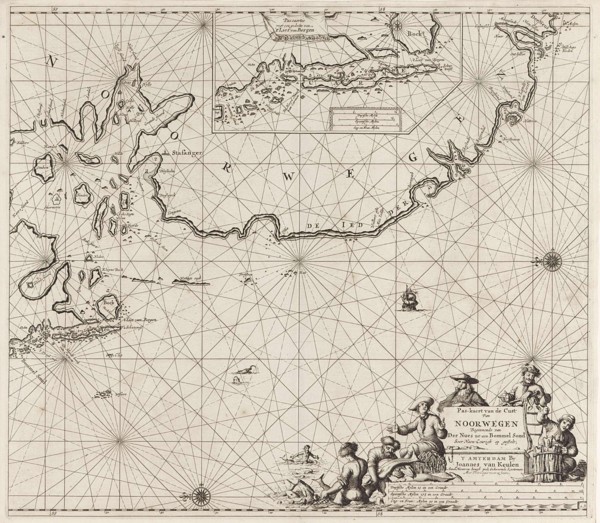
Sea chart of the coast of Norway, Jan Luyken, Joha...

Sea chart of part of north east coast of Scotland and the Orkney Islands, Jan Luyken, Johannes van
LZT16A27_423

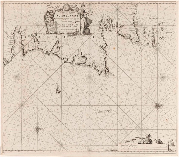
Sea chart of part of north east coast of Scotland ...

Sea chart of the Northern Dvina River, Russia, Jan Luyken, Johannes van Keulen I, unknown,
LZT16A27_466

Sea chart of the Northern Dvina River, Russia, Jan...

Sea chart of part of the White Sea in Russia, Jan Luyken, Johannes van Keulen (I), unknown,
LZT16A27_411

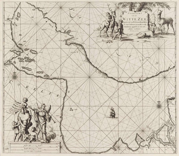
Sea chart of part of the White Sea in Russia, Jan ...

Sea chart of part of the coast of Norway and Jutland, Jan Luyken, Johannes van Keulen (I), unknown,
LZT16A27_433

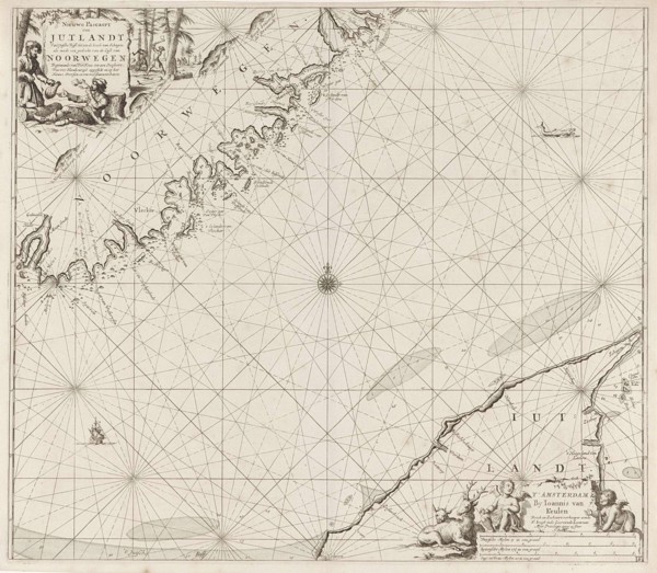
Sea chart of part of the coast of Norway and Jutla...

Sea chart of the Baltic Sea from Rostock to Vyborg, Jan Luyken, Johannes van Keulen (I), unknown,
LZT16A27_422

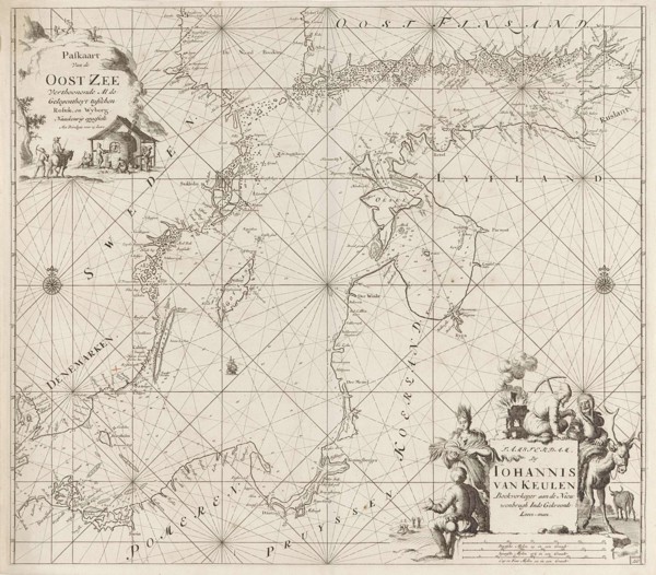
Sea chart of the Baltic Sea from Rostock to Vyborg...

Sea chart of part of the coast of Norway near Bergen, Jan Luyken, Johannes van Keulen I, unknown,
LZT16A27_427

Sea chart of part of the coast of Norway near Berg...

Sea chart of the Wadden Sea from Den Helder to Terschelling, Jan Luyken, Johannes van Keulen (I),
LZT16A27_436

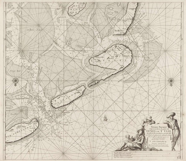
Sea chart of the Wadden Sea from Den Helder to Ter...

Sea chart of the coast of Norway near Trondheim, Jan Luyken, Johannes van Keulen (I), unknown, 1681
LZT16A27_426

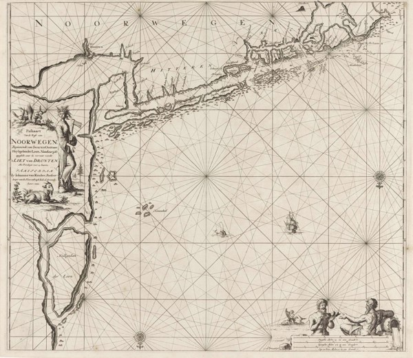
Sea chart of the coast of Norway near Trondheim, J...

Sea chart of the Zuiderzee and the Wadden Sea, Jan Luyken, Johannes van Keulen (I), unknown, 1681 -
LZT16A27_437

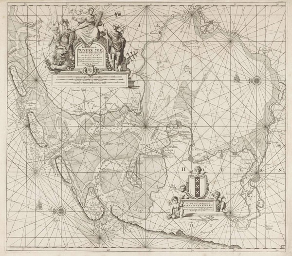
Sea chart of the Zuiderzee and the Wadden Sea, Jan...

Map of the eastern part of the Gulf of Finland, Johannes van Keulen (I), unknown, 1681 - 1799
LZT16A27_416

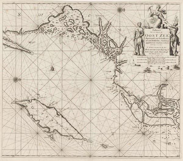
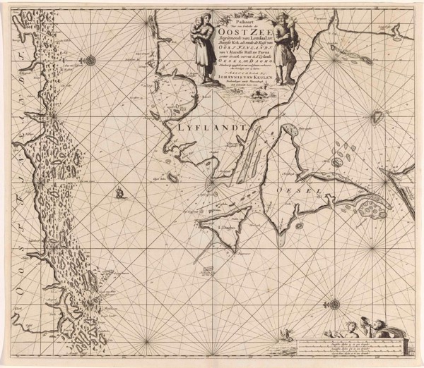
Map of the eastern part of the Gulf of Finland, Jo...

Sea chart of the mouth of the Gulf of Finland in the Baltic Sea, Jan Luyken, Johannes van Keulen
LZT16A27_417

Sea chart of the mouth of the Gulf of Finland in t...