6803 résultats pour : coastal
- Page
-
- sur
- 69
Connectez-vous pour plus de résultats
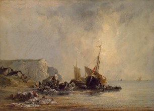
HRM26A29_390
Boats near Shore of Normandy, 1823. Creator: Richa...
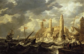
HRM26A30_041
Fortified Harbour, 1646. Creator: Bonaventura Peet...
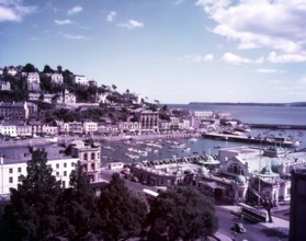
HRM26A35_393
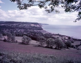
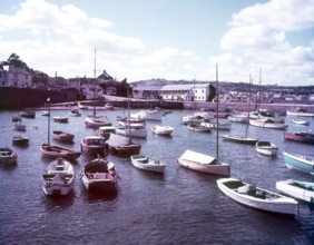
Torquay, Devon, c1955. Creator: Arthur Charles Kir...
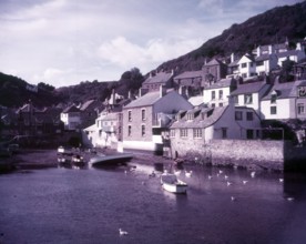
HRM26A35_439
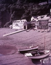
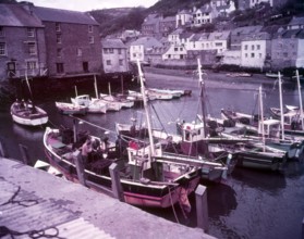
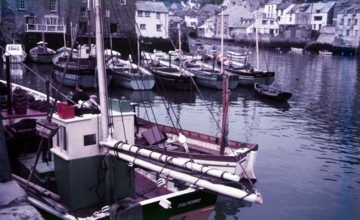
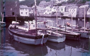
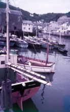
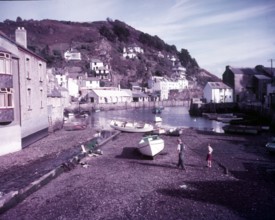
Polperro, Cornwall, c1955. Creator: Arthur Charles...
HRM26A35_483
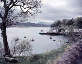
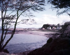
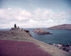
Portree Harbour, Isle of Skye, Scotland, c1955. Cr...
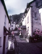
HRM26A36_073
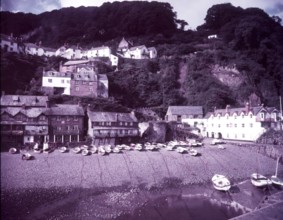
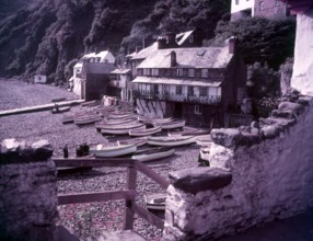
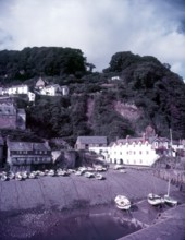
Clovelly Harbour, Devon, c1955. Creator: Arthur Ch...
HRM26A36_100
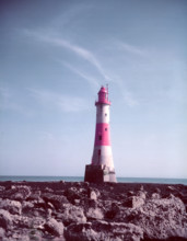
Beachy Head Lighthouse, Sussex, c1955. Creator: Ar...
HRM26A36_192
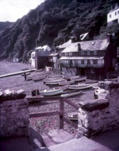
Clovelly, North Devon, c1955. Creator: Arthur Char...
HRM26A36_199
Lydstep Haven, Pembrokeshire, c1955. Creator: Arth...
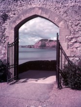
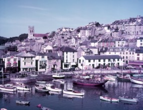
HRM26A36_210
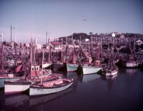
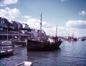
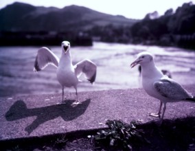
Gulls and boats in Brixham Harbour, Devon, c1955. ...
HRM26A33_342
Fort Samson, Grandcamp, 1885. Creator: Georges-Pie...
HRM26A35_361
The Sound and the Hoe, Plymouth, Devon, c1955. Cr...
HRM26A35_394
Sidmouth, Devon, c1955. Creator: Arthur Charles K...
HRM26A35_449
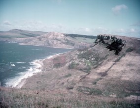
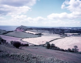
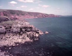
Kimmeridge Ledges and coastline seen from St Alban...
HRM26A35_484
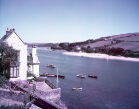
Salcombe, Devon, c1955. Creator: Arthur Charles Ki...
HRM26A36_028
Clovelly Harbour, Devon, c1955. Creator: Arthur Ch...
HRM26A36_074
Clovelly Harbour, Devon, c1955. Creator: Arthur Ch...
HRM26A36_146
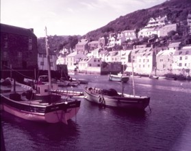
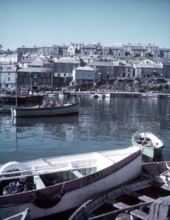
Polperro Harbour, Cornwall, c1955. Creator: Arthur...
HRM26A36_173
New Quay, Cardigan, c1955. Creator: Arthur Charles...
HRM26A29_363
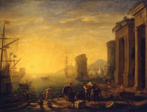
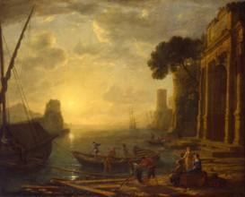
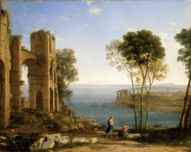
Morning in the Harbour, 1630. Creator: Claude Lorr...
HRM26A35_360
Boats in Brixham Harbour, Devon, c1955. Creator: A...
HRM26A35_452
Sidmouth, Devon, c1955. Creator: Arthur Charles Ki...
HRM26A36_044
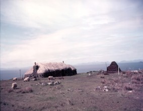
Crofter's hut at Score Bay, Isle of Skye, Scotland...
HRM26A36_102
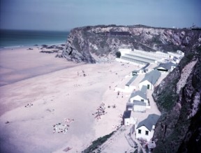
Bedruthan Bay, Newquay, Cornwall, c1955. Creator: ...
HRM26A36_176
Brixham, Devon, c1955. Creator: Arthur Charles Kir...
HRM26A36_201
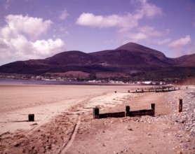
Mountains of Mourne, Newcastle, County Down, North...
HRM26A29_364
Harbour at Sunset, 1634. Creator: Claude Lorrain.
HRM26A29_382
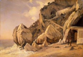
Rocks in Amalfi, 1828. Creator: Jean-Baptiste-Cami...
HRM26A30_049
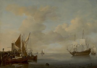
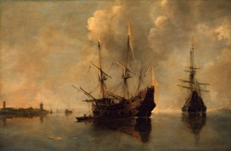
Calm, 1654. Creator: Willem van de Velde the Young...
HRM26A35_370
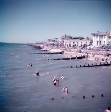
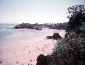
The beach at Bognor, Sussex, c1955. Creator: Arthu...
HRM26A35_403
Ganavan Bay, Oban, Scotland, c1955. Creator: Arth...
HRM26A35_414
Clovelly, Devon, c1955. Creator: Arthur Charles Ki...
HRM26A36_166
Seagulls, Ilfracombe, Devon, c1955. Creator: Arthu...
HRM26A30_028
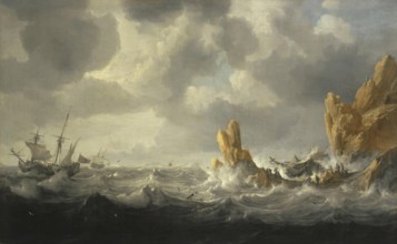
Stormy Sea, 1645. Creator: Jan Peeters.
HRM26A30_045
Two Ships at Anchor, 1640. Creator: Andries van Ee...
HRM26A30_056
Coast View with Apollo and the Cumaean Sibyl, 1645...
HRM26A35_353
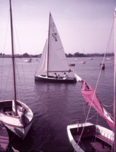
Yachting near Arundel, Sussex, c1955. Creator: Art...
HRM26A35_366
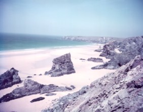
Barafundle Bay, Pembrokeshire, c1955. Creator: Art...
HRM26A35_465
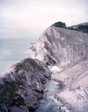
Landslide at Lulworth Cove, Dorset, c1955. Creator...
HRM26A36_086
Tolcarne Sands, Newquay, Cornwall, c1955. Creator:...
HRM26A36_203
The beach at Bognor, Sussex, c1955. Creator: Arthu...
HRM26A29_349
Sea Bay, 1835. Creator: August Matthias Hagen.
HRM26A29_362
Seashore at Villerville, 1875. Creator: Charles Fr...
HRM26A29_393
Low Tide at Yport, 1883. Creator: Pierre-Auguste R...
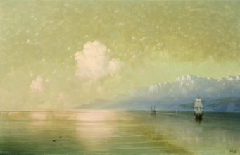
HRM26A30_046
Seascape, 1885. Creator: Ivan Aivazovsky.
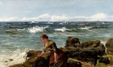
HRM26A34_497
Gathering Limpets, 1886. Creator: James Clarke Hoo...
HRM26A35_343
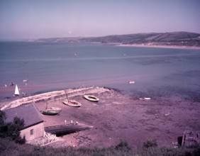
Start Bay, Devon, c1955. Creator: Arthur Charles K...
HRM26A35_480
The River Gannel estuary, Newquay, Cornwall, c1955...
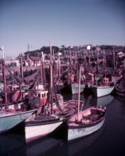
HRM26A36_041
Boats in Polperro Harbour, Cornwall, c1955. Creato...
HRM26A36_103
Mevagissey, Cornwall, c1955. Creator: Arthur Charl...
HRM26A36_213
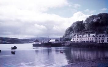
Portree, Isle of Skye, Scotland, c1955. Creator: ...
HRM26A29_150
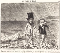
Parisiens recevant un grain sur la plage de Dieppe...
HRM26A29_337
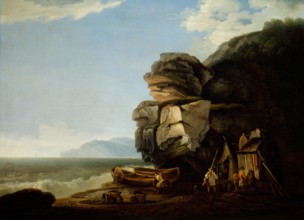
Rocks on a Seashore, 1753. Creator: Claude-Joseph ...
HRM26A29_385
Antheor Bay, 1906. Creator: Louis Valtat.
HRM26A30_043
Seashore, 1630. Creator: Simon de Vlieger.
HRM26A33_466
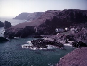
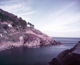
Coastal landscape (Morte Point, North Devon), earl...
HRM26A33_489
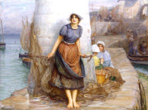
The Lass that a Sailor loves, 1903. Creator: Rober...
HRM26A36_010
Duntulm Castle and Tulm Island, Isle of Skye, Scot...
HRM26A36_115
County Kerry, Ireland, c1955. Creator: Arthur Char...
HRM26A36_128
Polperro Harbour, Cornwall, c1955. Creator: Arthur...
HRM26A36_139
Tresaith Bay, Cardigan, c1955. Creator: Arthur Cha...
HRM26A36_150
Brixham, Devon, c1955. Creator: Arthur Charles Ki...
HRM26A36_172
Tenby Harbour, Pembrokeshire, c1955. Creator: Arth...
HRM26A36_216
Tenby Harbour, Pembrokeshire, c1955. Creator: Arth...
HRM26A36_227
Start Bay, Devon, c1955. Creator: Arthur Charles ...
HRM26A35_356
Mevagissey, Cornwall, c1955. Creator: Arthur Charl...
HRM26A36_116
The Hoe and Smeaton's Tower, Plymouth, Devon, c195...
HRM26A36_138
Tenby, Pembrokeshire, c1955. Creator: Arthur Charl...
HRM26A36_149
Connaught Gardens, Sidmouth, Devon, c1955. Creator...
HRM26A36_162
Kynance Cove, Cornwall, c1955. Creator: Arthur Cha...
HRM26A36_193
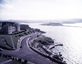
The Sound, Royal Citadel, and Mount Edgecumbe, Ply...
HRM26A30_024
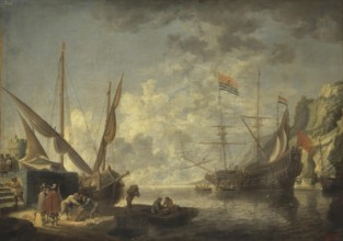
Sea Harbour, 1650. Creator: David Teniers II.
HRM26A35_420
Polperro Harbour, Cornwall, c1955. Creator: Arthur...
HRM26A35_429
Cliffs at Polperro, Cornwall, c1955. Creator: Arth...
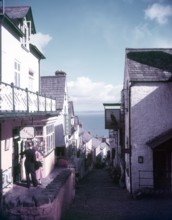
HRM26A36_108
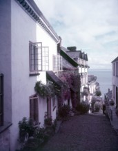
Clovelly High Street, Devon, c1955. Creator: Arthu...
HRM26A35_072
Coastal Scene, 1786. Creator: Joseph Farington.
HRM26A36_107
Clovelly High Street, Devon, c1955. Creator: Arthu...
HRM26A36_226
Brixham, Devon, c1955. Creator: Arthur Charles Kir...
HRM26A35_377
Boats in Brixham Harbour, Devon, c1955. Creator: A...
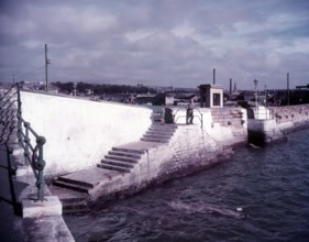
HRM26A36_133
The Mayflower Steps, Plymouth, Devon, c1955. Crea...
HRM26A30_025
Sailing Vessels, 1730. Creator: Adam Silo.
HRM26A30_048
Seashore: Grey and Black, 1900. Creator: James Abb...
HRM26A33_321
Square in a Seaside Town, 1675. Creators: Adriaen ...
HRM26A35_421
Mevagissey harbour, Cornwall, c1955. Creator: Arth...
HRM26A35_468
Paignton Harbour, Devon, c1955. Creator: Arthur Ch...
HRM26A36_188
Polperro Harbour, Cornwall, c1955. Creator: Arthur...
HRM26A36_122
Tenby, Pembrokeshire, c1955. Creator: Arthur Charl...
HRM26A30_029
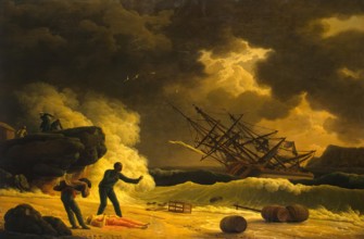
Death of Virginia, 1789. Creator: Claude-Joseph Ve...
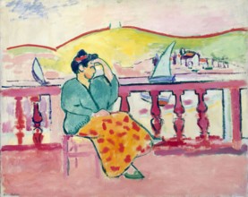
HRM26A30_125
Woman on a Terrace, 1907. Creator: Henri Matisse.
HRM26A35_424
Clovelly, North Devon, c1955. Creator: Arthur Char...
HRM26A36_023
Newquay Harbour, Cornwall, c1955. Creator: Arthur ...
HRM26A36_068
Towan Sands, Newquay, Cornwall, c1955. Creator: Ar...
HRM26A36_167
Paignton, Devon, c1955. Creator: Arthur Charles K...
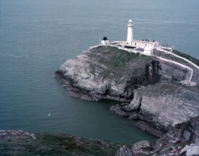
HRM26A35_434
South Stack Lighthouse, Holyhead, Anglesey/Wales, ...
HRM26A35_497
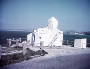
Huer's Hut, Newquay, Cornwall, c1955. Creator: Art...
HRM26A36_078
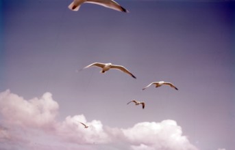
Herring gulls in flight, Isles of Scilly, c1955. ...
HRM26A36_132
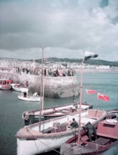
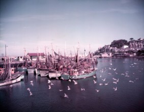
Boats and gulls in the harbour at Brixham, Devon, ...
HRM26A36_231
Polperro, Cornwall, c1955. Creator: Arthur Charles...
HRM26A35_334
Torquay, Devon, c1955. Creator: Arthur Charles Ki...
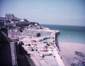
HRM26A36_007
View towards the harbour, Newquay, Cornwall, c1955...
- Page
-
- sur
- 69