435 résultats pour : water lenses
- Page
-
- sur
- 5
Connectez-vous pour plus de résultats

BRK26C65_182
Two young women recording a podcast using laptop, ...
BRK26C14_159
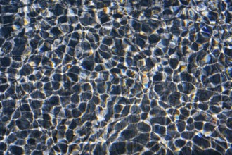
Sunlight dances on the rippling waters of Playa Bl...
BRK26B84_226
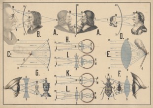
Teaching chart on optics and illustrates various o...
BRK26A47_189
Sunlight streaming through the passenger cabin of ...
BRK25M89_476
Smiling child holding a bucket and enjoying refres...
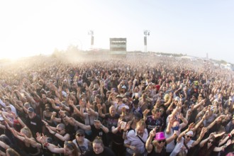
BRK25M14_353
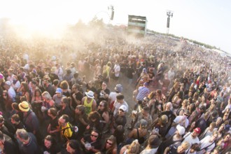
Festival visitors at the Highfield Festival on Sat...
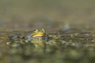
BRK25M20_199
The water frog (Pelophylax kl. esculentus) is well...
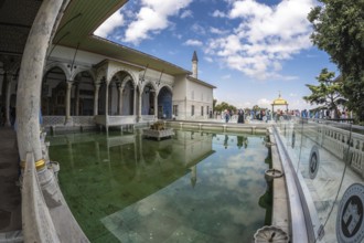
BRK25L46_102
Tourists walking around the courtyard with reflect...

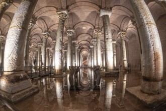
BRK25L46_108
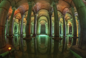
The basilica cistern, an ancient underground water...
BRK25L46_109
Ancient basilica cistern with many columns reflect...
BRK25L46_115
Ancient underground water reservoir with many colu...
BRK25L48_241
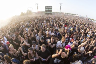
Festival visitors during a mosh pit at the Highfie...

BRK25L46_113
Tourists walking on a walkway in the basilica cist...
BRK25L48_239
Festival visitors at the Highfield Festival on Sat...
BRK25K66_386
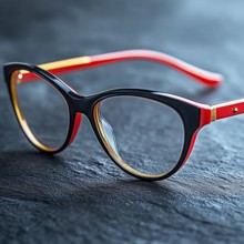
Women's glasses in red frames on a blue texture ba...
BRK25K87_298
Aerial view, villa hill and hill park with autumna...
BRK25K52_480
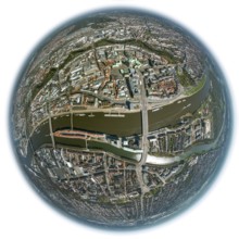
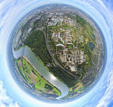
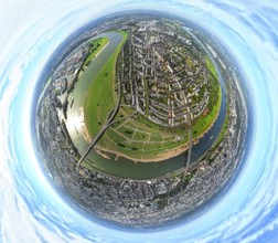
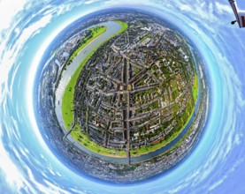
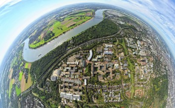
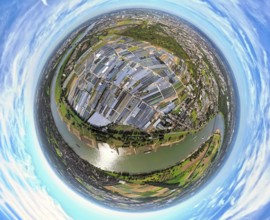
Aerial view, town view of Wesel, Rhine river and W...
BRK25K52_477
Aerial view, town view of Wesel, Rhine river and W...
BRK25K87_307
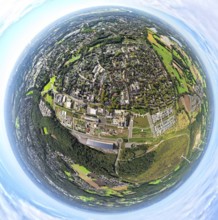
Aerial view, residential area town view Werden dis...
BRK25K87_318
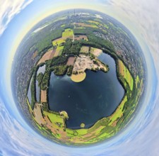
Aerial view, Lake Baldeney with dam RWE hydroelect...
BRK25K87_270
Aerial view, Lake Baldeney with dam RWE hydroelect...
BRK25K87_313
Aerial view, residential area town view Werden dis...
BRK25K26_125
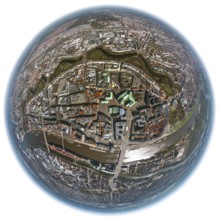
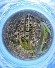
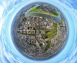
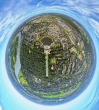
City hall Bremen, overview of the old town island ...
BRK25K28_311
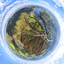
Elbe valley, fields, groynes, river course, fishey...
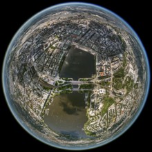
BRK25K27_210
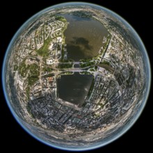
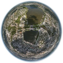
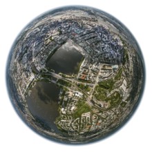
Inner Alster Lake, Außenalster, Kennedybrücke, fis...
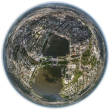
BRK25K27_211
Inner Alster Lake, Außenalster, Kennedybrücke, fis...
BRK25K28_309
Elbe valley, fields, groynes, river course, fishey...
BRK25K27_212
Inner Alster Lake, Außenalster, Kennedybrücke, fis...
BRK25K27_213
Inner Alster Lake, Außenalster, Kennedybrücke, fis...
BRK25K27_214
Inner Alster Lake, Außenalster, Kennedybrücke, fis...
BRK25K26_122
City hall Bremen, overview of the old town island ...
BRK25K26_121
City hall Bremen, overview of the old town island ...
BRK25K26_126
City hall Bremen, overview of the old town island ...
BRK25J73_122
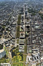
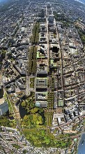
Aerial view, Königsallee with tree avenue, city ce...
BRK25J81_405
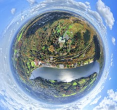
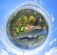
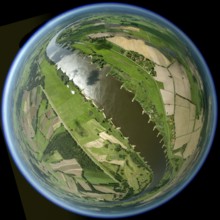
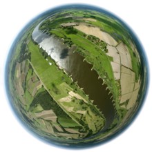
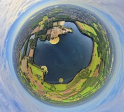
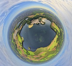
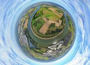
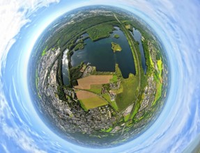
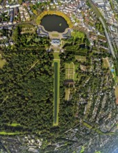
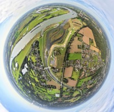
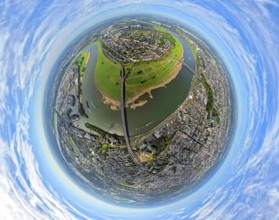
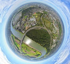
Aerial view, Tenderingssee and lido, globe, fishey...
BRK25J86_249
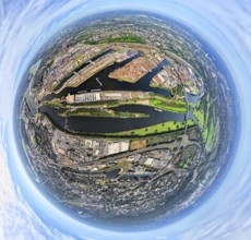
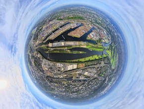
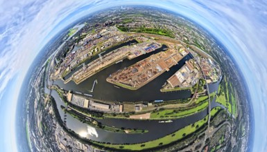
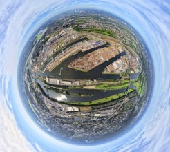
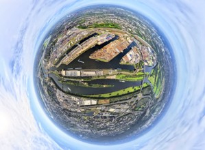
Aerial view, Duisburg-Ruhrort harbour with oil isl...
BRK25J72_007
Aerial photo, Heinrich-Heine-University at the riv...
BRK25J73_119
Aerial view, old town and Königsallee with tree av...
BRK25J81_404
Aerial view, Tenderingssee and lido, globe, fishey...
BRK25J86_250
Aerial view, Duisburg-Ruhrort harbour with oil isl...
BRK25J71_364
Aerial view, Himmelgeister Rheinbogen nature reser...
BRK25J81_299
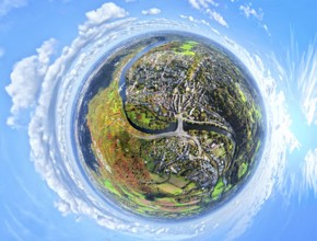
Aerial view, Emscher Hangpark and tailings pile wi...
BRK25J86_257
Aerial view, Duisburg-Ruhrort harbour with oil isl...
BRK25J86_259
Aerial view, Duisburg-Ruhrort harbour with oil isl...
BRK25J71_344
Aerial photo, Elbsee and Unterbacher See with fore...
BRK25J73_112
Aerial view, old town and Königsallee with tree av...
BRK25J81_358
Aerial view, meadows and fields Tenderingsweg at B...
BRK25J81_406
Aerial view, Tenderingssee and lido, globe, fishey...
BRK25J86_277
Aerial view, Duisburg-Ruhrort harbour with oil isl...
BRK25J71_341
Aerial photo, Elbsee and Unterbacher See with fore...
BRK25J71_365
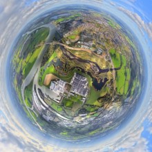
Aerial view, Benrath Castle with castle park and c...
BRK25J73_067
Aerial view, district Oberkassel with Festwiese Ob...
BRK25J81_331
Aerial view, Emscher renaturalisation river Emsche...
BRK25J81_342
Aerial view, residential area Lohberg district, be...
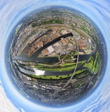
BRK25J86_253
Aerial view, Duisburg-Ruhrort harbour with oil isl...
BRK25J86_275
Aerial view, harbour Duisburg-Ruhrort with oil isl...
BRK25J71_342
Aerial photo, Elbsee and Unterbacher See with fore...
BRK25J71_367
Aerial view, Benrath Castle with castle park and c...
BRK25J73_068
Aerial view, district Oberkassel with Festwiese Ob...
BRK25J73_088
Aerial view, district Oberkassel and river Rhine, ...
BRK25J81_365
Aerial view, Emscher renaturalisation river Emsche...
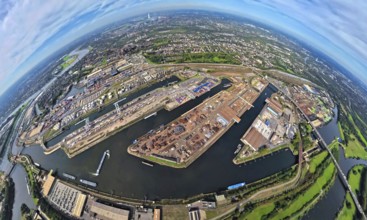
BRK25J86_251
Aerial view, Duisburg-Ruhrort harbour with oil isl...
BRK25J86_258
Aerial view, harbour Duisburg-Ruhrort with oil isl...
BRK25J71_419
Aerial photo, Elbsee and Unterbacher See with fore...
BRK25J73_014
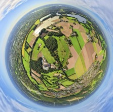
Aerial view, horticulture and agricultural use in ...
BRK25J73_069
Aerial view, district Oberkassel with Festwiese Ob...
BRK25J73_120
Aerial view, Königsallee with tree avenue, city ce...
BRK25J86_276
Aerial view, harbour Duisburg-Ruhrort with oil isl...
BRK25J71_371
Aerial photo, Elbsee and Unterbacher See with fore...
BRK25J72_032
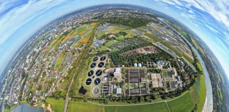
Aerial view, sewage treatment plant Düsseldorf-Süd...
BRK25J86_248
Aerial view, Duisburg-Ruhrort harbour with oil isl...
BRK25J71_418
Aerial photo, Elbsee and Unterbacher See with fore...
BRK25J73_037
Aerial view, horticulture and agricultural use in ...
BRK25J71_380
Aerial photo, Elbsee and Unterbacher See with fore...
BRK25J71_368
Aerial view, Benrath Castle with castle park and c...
BRK25J73_192
Aerial view, river Rhine with Tonhalle at the Rhin...
BRK25J81_334
Aerial view, Emscher renaturalisation river Emsche...
BRK25J86_273
Aerial view, Duisburg-Ruhrort harbour with oil isl...
BRK25J86_282
Aerial view, Ruhrort district with Ruhrort termina...
BRK25J72_006
Aerial photo, Heinrich-Heine-University at the riv...
BRK25J72_010
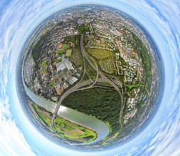
Aerial view, Fleher forest and motorway junction D...
BRK25J86_252
Aerial view, Duisburg-Ruhrort harbour with oil isl...
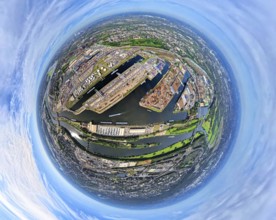
BRK25J86_274
Aerial view, Duisburg-Ruhrort harbour with oil isl...

BRK25J86_283
Aerial view, Ruhrort district with Ruhrort termina...
BRK25J72_042
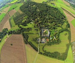
Aerial view, Schloss Heltorf moated castle with ca...
BRK25J71_496
Aerial view, horticulture and agricultural use in ...
BRK25J72_036
Aerial view, Fleher forest and motorway junction D...
BRK25J73_007
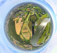
Aerial view, river Rhine Rhine bend, golf course A...
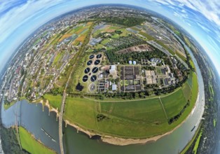
BRK25J71_487
Aerial view, sewage treatment plant Düsseldorf-Süd...
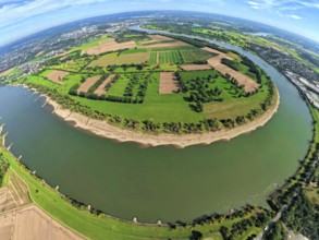
BRK25J71_498
Aerial view, Himmelgeister Rheinbogen nature reser...
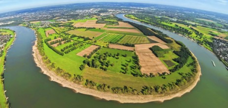
BRK25J71_497
Aerial view, Himmelgeister Rheinbogen nature reser...
BRK25J81_345
Aerial view, Emscher renaturalisation river Emsche...
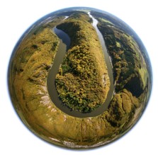
BRK25J04_404
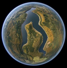
Aerial photo, Saarschleife, Saar, Montclair Castle...
BRK25J04_242
Aerial photo, Merzig, Saar, Saarland, Germany, Eur...
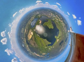
BRK25J30_273
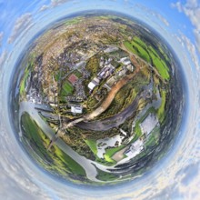
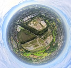
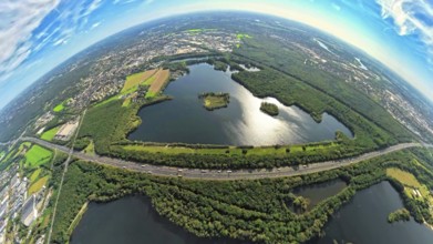
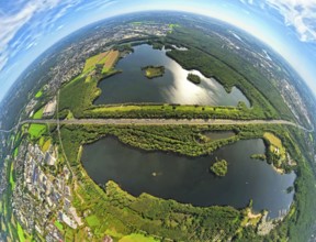
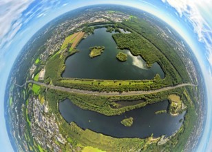
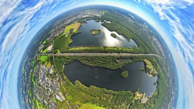
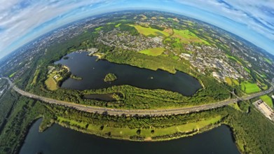
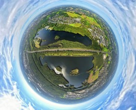
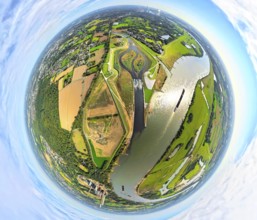
Aerial view, fisheye view of Haltern reservoir wit...
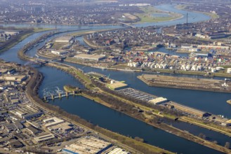
BRK25J43_258
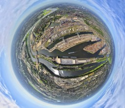
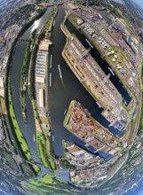
Aerial view, Duisburg harbour, coal island, Duispo...
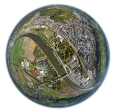
BRK25J47_431
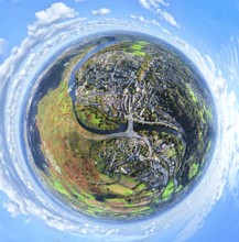
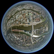
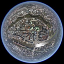
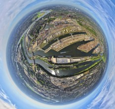
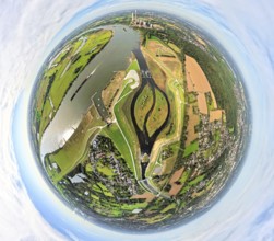
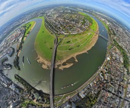
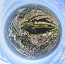
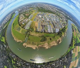
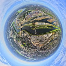
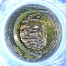
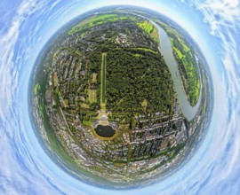
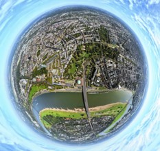
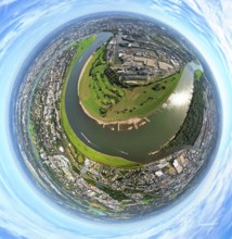
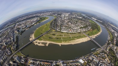
Aerial view, fisheye view river Rhine with Rheinkn...
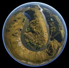
BRK25J04_405
Aerial photo, Saarschleife, Saar, Montclair Castle...
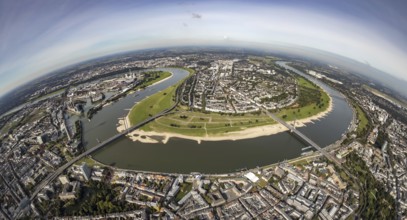
BRK25J47_430
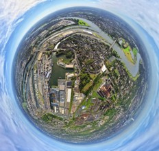
Aerial view, fisheye view river Rhine with Rheinkn...
BRK25J04_344
Nonnweiler reservoir, dam Primstalsperre Nonnweile...
- Page
-
- sur
- 5