184 résultats pour : schwerte
- Page
-
- sur
- 2
Connectez-vous pour plus de résultats
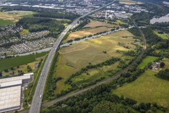
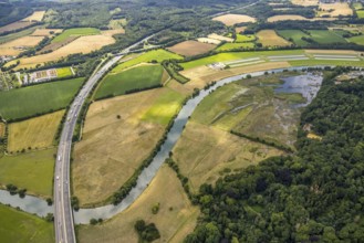
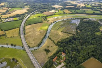
BRK25J15_302
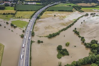
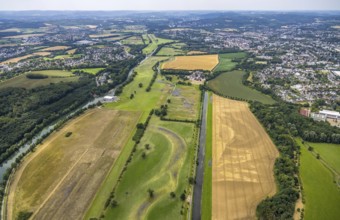
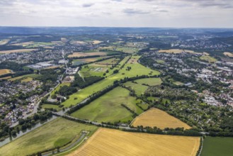
Aerial view, motorway A1 near Hagen and Schwerte, ...
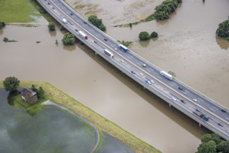
BRK25J15_313
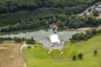
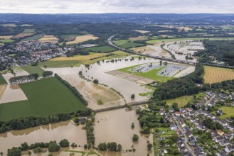
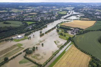
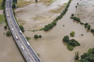
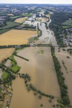
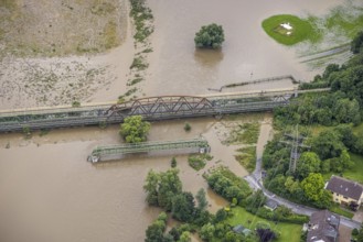
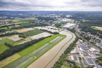
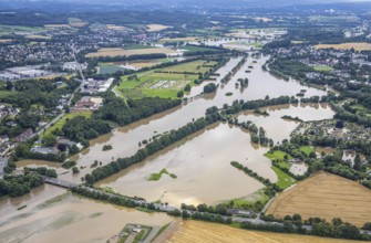
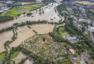
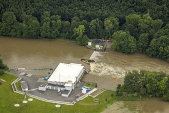
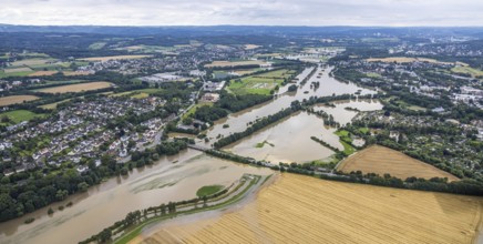
Aerial photo, Ruhr flood, Ruhr bridge of the Sauer...
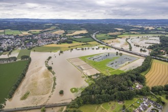
BRK25J29_237
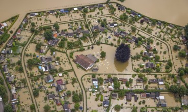
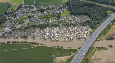
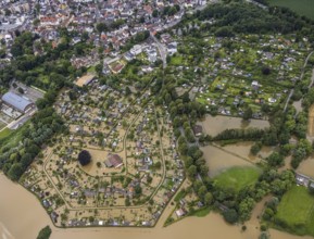
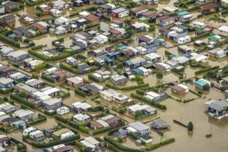
Aerial photo, Ruhr flood, flooded camping site Cam...

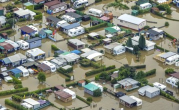
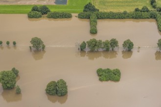
BRK25J09_207
Aerial photo, Ruhr flood, flooded campsite Camping...
BRK25J15_303
Aerial view, motorway A1 near Hagen and Schwerte, ...

BRK25J15_312
Aerial photo, Ruhr flood, Ruhr bridge of the Sauer...
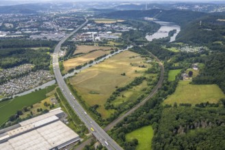
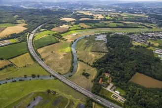
BRK25J15_304
Aerial view, motorway A1 near Hagen and Schwerte, ...

BRK25J15_332
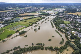
Aerial photo, Ruhr flood, Wandhofen, Schwerte, Ruh...
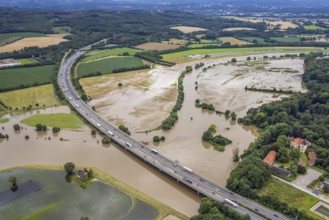
BRK25J15_353
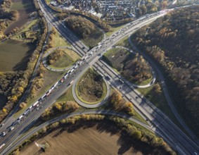
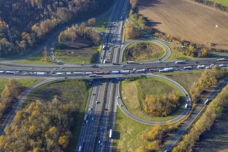
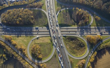
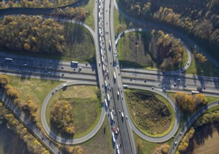
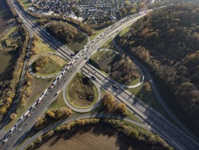
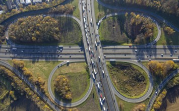
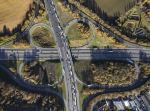
Aerial view, Westhofener Kreuz of the A1 motorway ...
BRK25J15_361
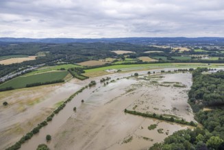
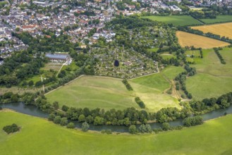
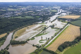
Aerial view, a week ago there was land under water...
BRK25J15_305
Aerial view, motorway A1 near Hagen and Schwerte, ...
BRK25J15_314
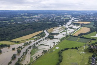
Aerial photo, Ruhr flood, Wandhofen, Schwerte, Ruh...
BRK25J15_364
Aerial view, a week ago there was still land under...

BRK25J15_308
Aerial photo, Ruhr flood, Ruhr bridge of the Sauer...
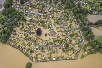
BRK25J15_321
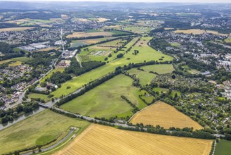
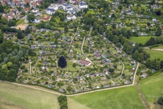
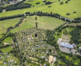
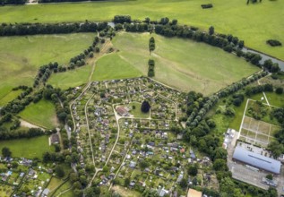
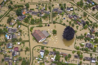
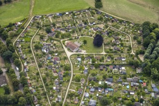
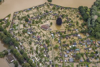
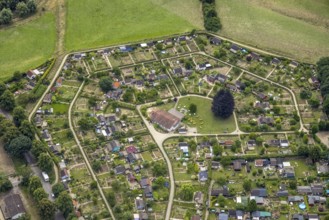
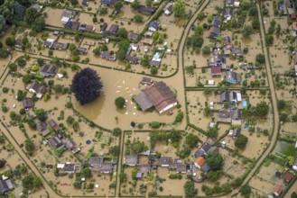
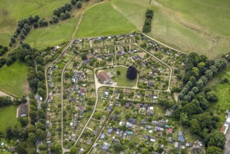
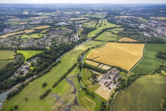
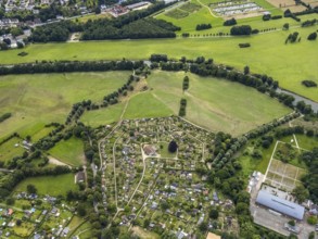
Aerial view, allotment garden site in the south of...

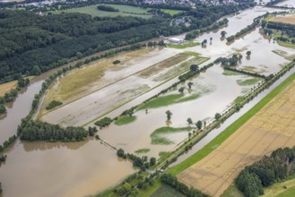
BRK25J15_333
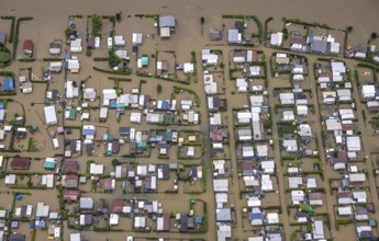
Aerial photo, Ruhr flood, Schwerte, Ruhr area, Nor...

BRK25J15_340
Aerial photo, Ruhr flood, Schwerte, Ruhr area, Nor...
BRK25J11_014
Aerial photo, Ruhr flood, Geisecke, Schwerte, Ruhr...

BRK25J15_309
Aerial photo, Ruhr flood, Ruhr bridge of the Sauer...
BRK25J15_322
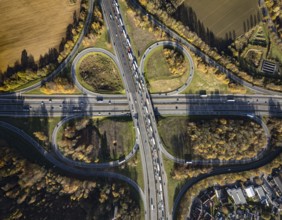
Aerial view, motorway A45 Sauerlandlinie with Ruhr...
BRK25J15_334
Aerial photo, Ruhr flood, Wandhofen, Schwerte, Ruh...

BRK25J15_341
Aerial view, Ruhr flood, flooded campsite, Amsel r...
BRK25J11_030
Aerial photo, Ruhr flood, Geisecke, Schwerte, Ruhr...
BRK25J15_310
Aerial photo, Ruhr flood, Ruhr bridge of the Sauer...
BRK25J15_323
Aerial view, motorway A45 Sauerlandlinie with Ruhr...

BRK25J11_008
Aerial photo, Ruhr flood, Schwerte, Ruhr area, Nor...
BRK25J11_022
Aerial photo, Ruhr flood, Ruhr bridge of the Sauer...

BRK25J15_311
Aerial photo, Ruhr flood, Ruhr bridge of the Sauer...
BRK25J15_324
Aerial view, motorway A45 Sauerlandlinie with Ruhr...
BRK25J11_007
Aerial photo, Ruhr flood, flooded campsite Amsel r...

BRK25J11_020
Aerial photo, Ruhr flood, Ruhr bridge of the Sauer...

BRK25J15_315
Aerial view, Ruhr flood, flooded campsite, Amsel r...
BRK25J15_317
Aerial view, allotment garden site in the south of...

BRK25J15_326
Aerial photo, Ruhr flood, Geisecke, Schwerte, Ruhr...
BRK25J15_363
Aerial view, Westhofener Kreuz of the A1 motorway ...
BRK25J11_021
Aerial photo, Ruhr flood, Ruhr bridge of the Sauer...

BRK25J11_023
Aerial photo, Ruhr flood, Ruhr bridge of the Sauer...
BRK25J11_029
Aerial photo, Ruhr flood, flooded campsite Amsel r...
BRK25J29_263
Aerial view, Ruhr flood, flooded campsite CampingC...
BRK25J15_300
Aerial photo, Ruhr flood, Schwerte, Ruhr area, Nor...
BRK25J15_316
Aerial view, allotment garden site in the south of...

BRK25J15_344
Aerial photo, Ruhr flood, Geisecke, Schwerte, Ruhr...
BRK25J15_362
Aerial view, Westhofener Kreuz of the A1 motorway ...
BRK25J09_256
Aerial photo, Ruhr flood, flooded campsite Camping...
BRK25J11_009
Aerial photo, Ruhr flood, flooded campsite Amsel r...
BRK25J11_019
Aerial photo, Ruhr flood, Ruhr bridge of the Sauer...

BRK25J11_024
Aerial photo, Ruhr flood, Ruhr bridge of the Sauer...

BRK25J29_264
Aerial photo, Ruhr flood, flooded camping site Cam...
BRK25J15_307
Aerial photo, Ruhr flood, Westhofen, Schwerte, Ruh...
BRK25J15_318
Aerial view, allotment garden site in the south of...
BRK25J15_325
Aerial view, allotment garden site in the south of...
BRK25J15_335
Aerial photo, Ruhr flood, flooded campsite Amsel r...

BRK25J15_343
Aerial photo, Ruhr flood, Geisecke, Schwerte, Ruhr...
BRK25J15_365
Aerial view, a week ago there was land under water...
BRK25J11_011
Aerial photo, Ruhr flood, flooded campsite Amsel r...

BRK25J11_015
Aerial photo, Ruhr flood, Geisecke, Schwerte, Ruhr...

BRK25J11_018
Aerial photo, Ruhr flood, Westhofen, Schwerte, Ruh...
BRK25J11_025
Aerial photo, Ruhr flood, Wandhofen, Schwerte, Ruh...

BRK25J29_260
Aerial photo, Ruhr flood, flooded campsite Camping...

BRK25J15_301
Aerial photo, Ruhr flood, Schwerte, Ruhr area, Nor...

BRK25J15_306
Aerial photo, Ruhr flood, Westhofen, Schwerte, Ruh...
BRK25J15_319
Aerial view, allotment garden site in the south of...
BRK25J15_320
Aerial view, allotment garden site in the south of...
BRK25J15_336
Aerial photo, Ruhr flood, flooded campsite Amsel r...
BRK25J15_360
Aerial view, Westhofener Kreuz of the A1 motorway ...

BRK25J09_298
Aerial photo, Ruhr flood, Geisecke, Schwerte, Ruhr...

BRK25J11_010
Aerial photo, Ruhr flood, flooded campsite Amsel r...
BRK25J11_017
Aerial photo, Ruhr flood, Westhofen, Schwerte, Ruh...

BRK25J11_026
Aerial photo, Ruhr flood, Wandhofen, Schwerte, Ruh...

BRK25J15_339
Aerial photo, Ruhr flood, flooded campsite Amsel r...
BRK25J15_355
Aerial view, Westhofener Kreuz of the A1 motorway ...
BRK25J15_367
Aerial view, a week ago there was still land under...
BRK25J11_012
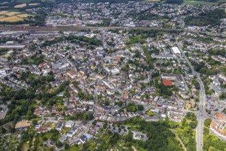
Aerial photo, Ruhr flood, Schwerte, Ruhr area, Nor...

BRK25J11_016
Aerial view, Ruhr flood, flooded camping site Camp...
BRK25J11_027
Aerial photo, Ruhr flood, Schwerte, Ruhr area, Nor...

BRK25J15_342
Aerial photo, Ruhr flood, flooded campsite Amsel r...
BRK25J15_348
Aerial photo, Ruhr flood, Geisecke, Schwerte, Ruhr...
BRK25J15_354
Aerial view, Westhofener Kreuz of the A1 motorway ...
BRK25J15_366
Aerial view, allotment garden site in the south of...
BRK25J11_001
Aerial view, Ruhr flood, flooded camping site Camp...

BRK25J11_006
Aerial photo, Ruhr flood, Wandhofen, Schwerte, Ruh...
BRK25J11_049
Aerial photo, Ruhr flood, flooded campsite Amsel r...

BRK25J15_337
Aerial photo, Ruhr flood, flooded campsite Amsel r...
BRK25J15_357
Aerial view, Westhofener Kreuz of the A1 motorway ...
BRK25J15_358
Aerial view, a week ago there was land under water...

BRK25J09_249
Aerial photo, Ruhr flood, flooded camping site Cam...
BRK25J11_013
Aerial photo, Ruhr flood, Geisecke, Schwerte, Ruhr...

BRK25J11_028
Aerial photo, Ruhr flood, flooded campsite Amsel r...

BRK25J15_338
Aerial photo, Ruhr flood, flooded campsite Amsel r...
BRK25J15_345
Aerial photo, Ruhr flood, Geisecke, Schwerte, Ruhr...
BRK25J15_356
Aerial view, Westhofen interchange of the A1 motor...
BRK25J15_359
Aerial view, allotment garden site in the south of...
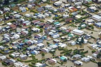
BRK25J09_289
Aerial photo, Ruhr flood, flooded camping site Cam...

BRK25J09_290
Aerial photo, Ruhr flood, flooded campsite Amsel r...
BRK25J09_291
Aerial photo, Ruhr flood, Schwerte, Ruhr area, Nor...
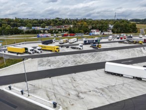
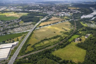
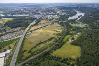
BRK25I74_197
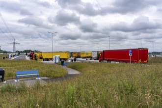
New large service area for trucks on the A1 motorw...
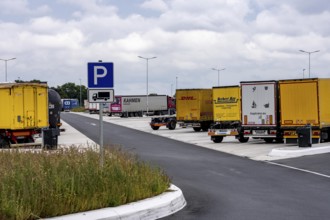
BRK25I74_207
New large service area for trucks on the A1 motorw...
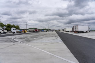
BRK25I74_198
New large service area for trucks on the A1 motorw...
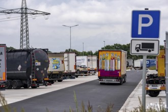
BRK25I74_206
New large service area for trucks on the A1 motorw...
BRK25I74_166
New large service area for trucks on the A1 motorw...
- Page
-
- sur
- 2