5910 résultats pour : railroad lines
- Page
-
- sur
- 60
Connectez-vous pour plus de résultats
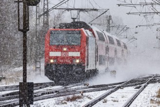
BRK26C72_371
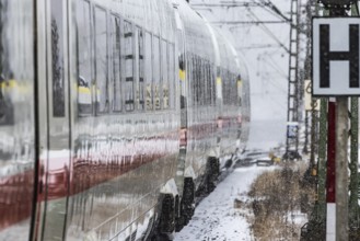
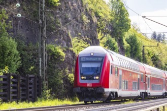
RegionalExpress RE on the road through a winter la...
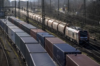
BRK26C80_423
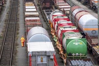
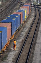
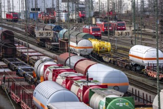
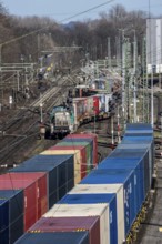
Container trains in the freight yard, so-called in...
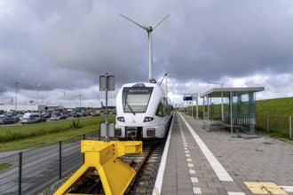
BRK26C82_316
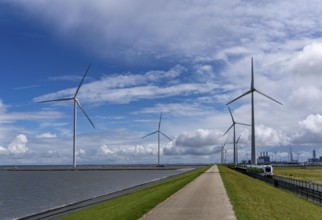
Train connection to the seaport of Eemshaven, in t...
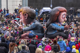
BRK26C75_455
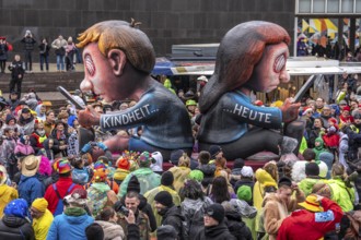
Rose Monday procession in Düsseldorf, theme car by...
BRK26C99_092
Shunters, check the assembled freight cars at the ...
BRK26D00_214
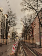
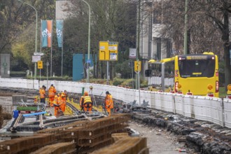
A street with construction site of tram tracks and...
BRK26C56_299
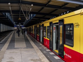
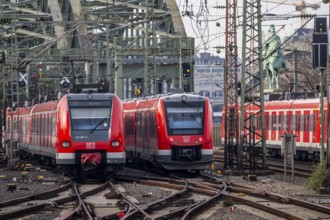
S station Jannowitzbrücke, platform and train traf...
BRK26C66_246
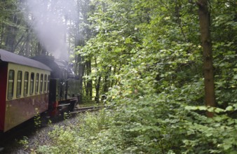
Selketalbahn, Harzer Schmalspurbahn, Brockenbahn r...
BRK26C77_443
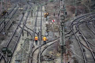
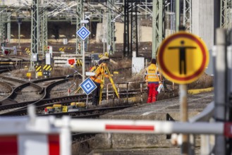
Railway employees check the tracks and switches at...
BRK26C72_365
Container trains in the freight yard, so-called in...
BRK26D01_381
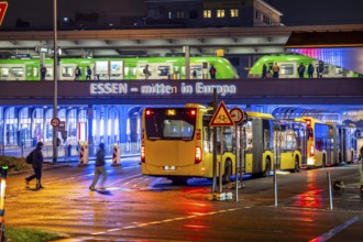
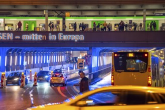
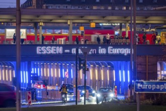
The main train station in Essen, blue illuminated ...
BRK26C69_296
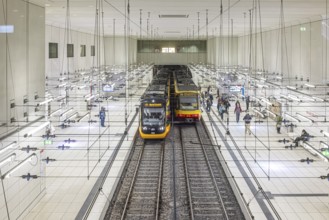
Combined solution, public transport in Karlsruhe. ...
BRK26C69_388
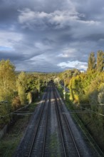
Railway line, tracks, rails, Constance county, Bad...
BRK26C89_236
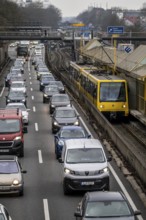
Traffic jam on the A40 motorway, in both direction...
BRK26C60_315
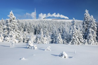
Deep snowy winter landscape with snow-covered spru...
BRK26D05_023
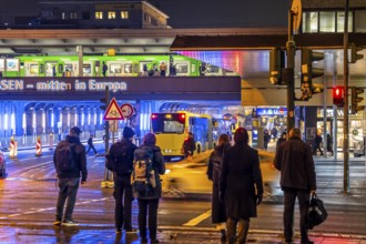
Tram stop Bahnhof Deutz/Lanxess Arena in Cologne-D...
BRK26C75_368
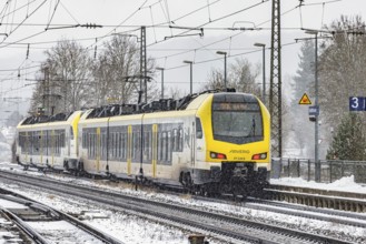
Winter weather, heavy snowfall, railway tracks in ...

BRK26C73_248
S-Bahn train on the route east, in front of Essen ...
BRK26C82_075
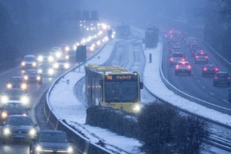
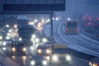
Winter weather, motorway traffic, A40 motorway, Ru...
BRK26C73_043
The Hanover–Würzburg high-speed railway, Nörten-Ha...
BRK26C56_029
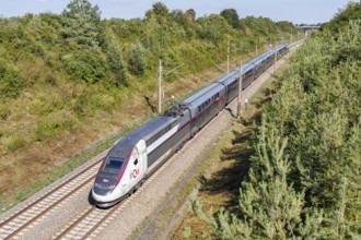
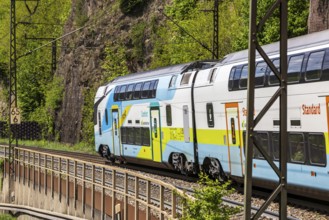
SNCF TGV Duplex train on the new Mannheim-Stuttgar...
BRK26C58_153
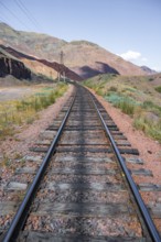
Train line, railway tracks, Chuy Province, Kyrgyzs...
BRK26C63_333
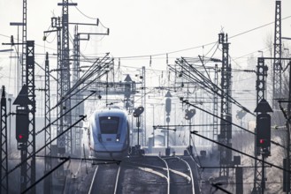
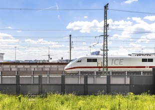
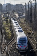
Deutsche Bahn AG tracks with ICE train against the...
BRK26C70_241
The Hanover–Würzburg high-speed railway, Nörten-Ha...
BRK26C68_005
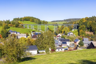
Town view with Markersbach viaduct, historic metal...
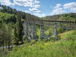
BRK26C62_083
The Ziemestal Bridge, historic railway viaduct ove...
BRK26C76_454
Rail Travel in Serbia, The Balkans
BRK26C58_351
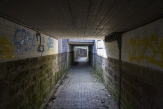
Pedestrian tunnel under the railway line, Hümme, T...
BRK26C64_272
A train stands at a railway keeper's house in the ...
BRK26C58_299
Viaduc de Morlaix, viaduct, circular arch bridge w...
BRK26C71_093
Railway tracks in front of the main railway statio...
BRK26C65_345
First test run on the new railway line between Stu...
BRK26C66_421
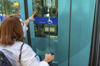
Woman using a wheelchair is pushing accessible but...
BRK26C77_244
The Hagen-Vorhalle marshalling yard is one of the ...
BRK26C57_261
Construction work at Ulm Central Station: Until Ja...
BRK26C91_098
The Hardenberg bridge, A40 motorway in Mülheim an ...
BRK26C61_080
Construction site of a tram line, tracks and railw...
BRK26C75_173
Deutsche Bahn AG tracks with ICE train against the...
BRK26C47_151
Construction site of the stop at the main train st...
BRK26C10_223
Container trains in the freight yard, so-called in...
BRK26C38_018
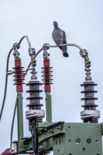
Pigeon sits on a power cable for traction power, m...
BRK26C40_347
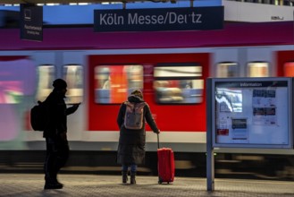
Regional train at Cologne-Messe/Deutz station, 2nd...
BRK26C44_299
Announcement of restrictions, train cancellations ...
BRK26C51_334
InterCityExpress ICE en route on the winding railw...

BRK26C13_435
A cheerful young man stands at a train station, ho...
BRK26C31_324
Rails of the Elevador da Gloria funicular, A dark ...
BRK26C43_425
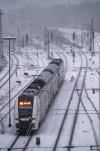
ICE traveling through a winter landscape in snowfa...
BRK26C46_204
The main train station in Essen, blue illuminated ...
BRK26C46_205
The main train station in Essen, blue-lit underpas...
BRK26C46_423
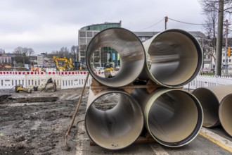
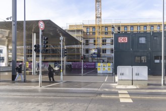
Large-scale construction site in the city center o...
BRK26B98_194
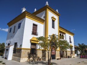
Former train station at village Olvera, now used f...
BRK26C10_225
Regionalbahnhof Duisburg-Rheinhausen, regional tra...
BRK26C39_236
New construction of steel bridges Parts at the Dui...
BRK26C40_452
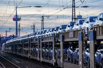
Car train, transport of Toyota small cars with a f...
BRK26C46_424
Large construction site in the city center of Esse...
BRK26C50_149
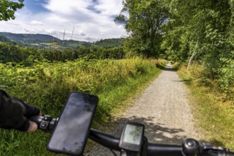
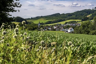
Sauerlandring cycle path, an 84 km long circular c...
BRK26C40_458
Passengers on the platform, S-Bahn train, Cologne-...
BRK26C43_423
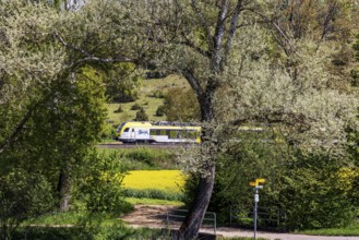
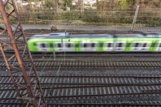
Regional train from Arverio on its way through a w...
BRK26C50_148
Landscape along the Sauerlandring cycle path, an 8...
BRK26C53_479
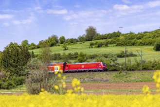
Regional train travelling on the Swabian Alb. Land...
BRK26B99_082
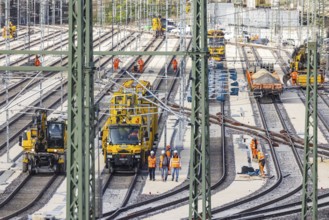
Rail construction crews with a work train. New par...
BRK26C10_224
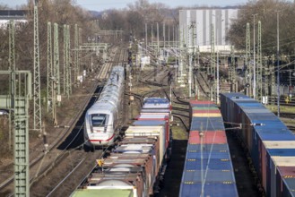
ICE long-distance train, on the line, container tr...
BRK26C40_339
Regional trains at Cologne-Messe/Deutz station, 2n...
BRK26C47_121
ICE trains, in Essen main station, on the platform...
BRK26C50_150
Sauerlandring cycle path, an 84 km long circular c...
BRK26C10_227
Regionalbahnhof Duisburg-Rheinhausen, ICE from Dui...
BRK26C39_239
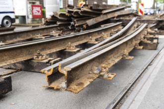
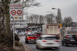
Information on bridge damage to a road bridge over...
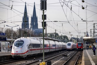
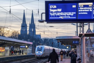
BRK26C40_349
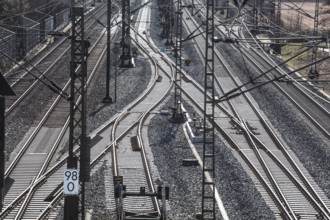
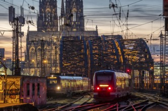
Rail system in front of Cologne Central Station, H...
BRK26C46_110
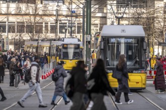
Trams at Alexanderplatz in Berlin, passers-by, Ger...
BRK26C47_150
Freight train on the so-called Schusterbahn, a byp...
BRK26C48_199
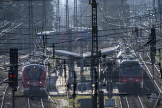
ICE trains on the railway line, S-Bahn train, nort...
BRK26C27_203
Rose Monday procession in Düsseldorf, theme car by...
BRK26C40_345
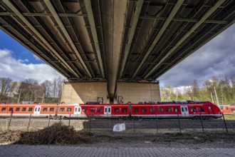
Regional train on the line, railway bridge over De...
BRK26C06_103
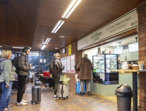
Passengers queuing at The Westcountry Larder Coffe...
BRK26C49_219
Train connection to the seaport of Eemshaven, in t...
BRK26C53_477
Regional express RE5 en route on the winding railw...
BRK26C10_228
Regionalbahnhof Duisburg-Rheinhausen, ICE from Dui...
BRK26C31_162
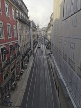
View from above of a long, empty city street with ...
BRK26C31_319
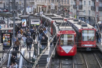
A busy scene with a tram on illuminated cobbleston...
BRK26C40_459
Long-distance train and regional train at Cologne-...
BRK26C41_207
View from a train window of an empty railway line ...
BRK26C45_370
RRX, Rhein-Ruhr-Express, regional traffic, on the ...
BRK26C40_343
Tram stop Bahnhof Deutz/Lanxess Arena in Cologne-D...

BRK26C40_352
ICE and S-Bahn train on the line, railway bridge o...
BRK26C45_371
S-Bahn train on the route east, in front of Essen ...
BRK26C46_203
The main train station in Essen, blue illuminated ...
BRK26C47_022
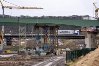
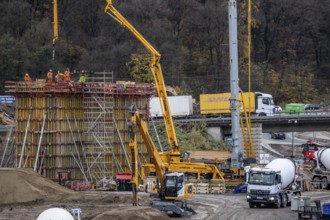
Concreting of a new bridge pillar at the Duisburg-...
BRK26C40_348
ICE long-distance train and regional trains at Col...
BRK26C40_356
ICE long-distance train at Cologne-Messe/Deutz sta...
BRK26C10_226
Regionalbahnhof Duisburg-Rheinhausen, regional tra...
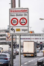
BRK26C39_238
Information on bridge damage to a road bridge over...
BRK26C40_351
Passengers on the platform, Cologne-Messe/Deutz st...
BRK26C53_318
Train of the Austrian Westbahn en route on the win...
BRK26C55_105
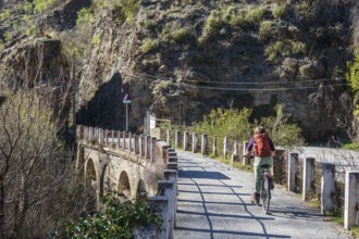
People on the Tranvía de Sierra Nevada, former rai...
BRK26C40_355
Rail track in front of Cologne Central Station, Ho...
BRK26C43_322
Construction work at Ulm Central Station: Until Ja...
BRK26C44_157
Winter weather, motorway traffic, A40 motorway, Ru...
BRK26C53_478
RegionalExpress RE5 en route on the Swabian Alb. L...
BRK26C55_106
Cyclist on the Tranvía de Sierra Nevada, former ra...
BRK26B99_235
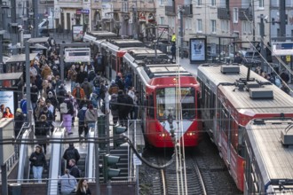
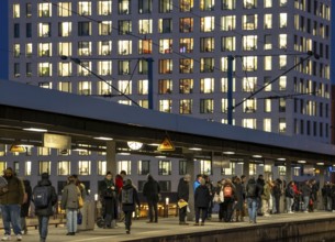
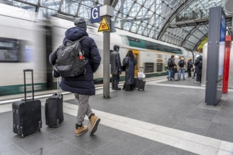
Central Station in Berlin, passengers on the platf...
- Page
-
- sur
- 60