2263 résultats pour : preservation
- Page
-
- sur
- 23
Connectez-vous pour plus de résultats
BRK26C67_173
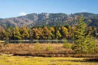
The Hengelesweiher pond in the Hengelesweiher natu...
BRK26C97_276
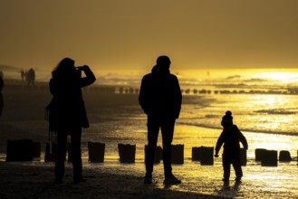
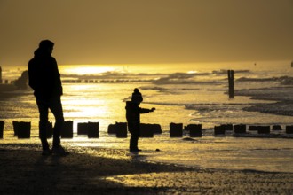
Winter on the North Sea, sunset at sea, beach walk...
BRK26C87_124
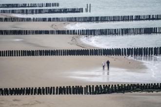
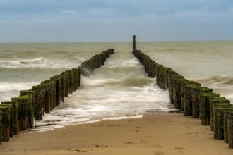
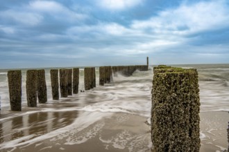
Coastal protection, through wooden posts, paalhoof...
BRK26C56_026
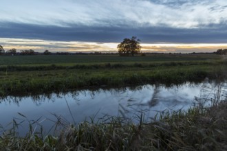
Raklitza water channel at sunset, Niederspreer pon...
BRK26C66_293
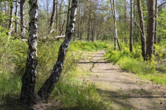
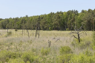
Heath trail through the Gohrischer Heide near Gröd...
BRK26C65_039
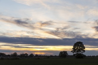
Sunset near Daubitz, Niederspreer pond area, Riets...
BRK26C70_317
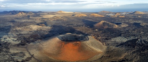
Caldera Colorada volcano, picturesque volcanic lan...

BRK26C80_326
Dried dill, in a ceramic bowl, a bunch of fresh di...
BRK26C82_104
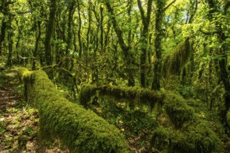
A lush, green forest densely covered with verdant ...
BRK26C63_036
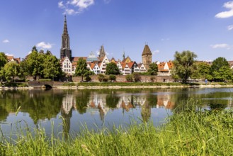
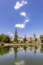
City view of Ulm with the Danube. Ulm Minster, Met...
BRK26C71_307
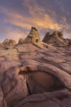
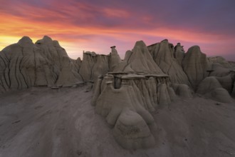
Dramatic sunset illuminates the unique rock format...
BRK26C82_066
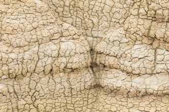
A close-up view of intricate patterns in dried cla...
BRK26C70_155
Coastal protection, through wooden posts, paalhoof...
BRK26C75_444
City view of Ulm with the Danube. Ulm Minster, Met...
BRK26C80_468
Striking landscape showcasing the vibrant, swirlin...
BRK26D00_392
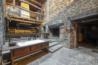
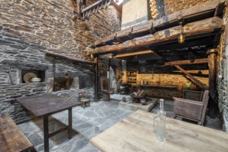
Rustic and traditional interior of a stone country...
BRK26C78_241
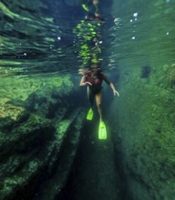
Underwater view of a woman with flippers snorkelin...
BRK26C92_159
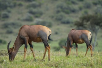
A serene scene in the savannah featuring two Topi ...
BRK26C96_343
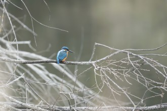
A vibrant kingfisher sits on a bare twig overlooki...
BRK26D04_442
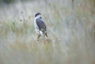
A stunning female Goshawk stands alert amidst the ...
BRK26C74_037
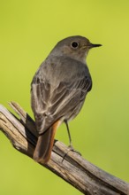
A detailed portrait of a Black Redstart, Phoenicur...
BRK26C83_315
A textured, sunlit archway casts golden hues acros...
BRK26C98_148
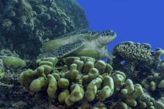
A serene green sea turtle, Chelonia mydas, rests a...
BRK26C59_251
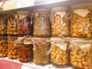
Jars of honey filled, with various nuts and seeds,...
BRK26C66_267
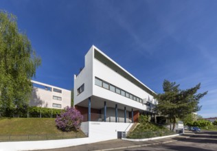
Weissenhof Estate on the Killesberg in Stuttgart. ...
BRK26C68_421
A majestic sunset casts warm colors over the uniqu...
BRK26C75_293
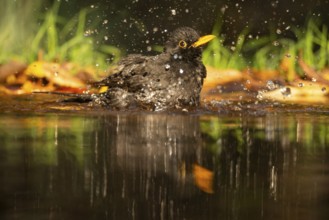
A vibrant image capturing a male blackbird (Turdus...
BRK26C77_416
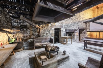
An authentic rustic kitchen featuring stone walls ...
BRK26C68_493
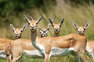
Multiple blackbucks, Antilope cervicapra, stand at...
BRK26C75_068
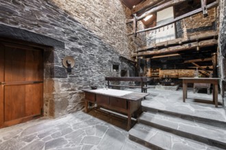
Traditional stone-walled kitchen inside an old cou...
BRK26C77_247
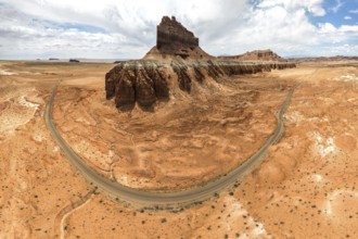
Panoramic aerial view of Goblin Valley State Park ...
BRK26C95_283
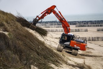
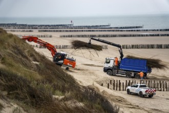
Coastal protection, work on strengthening the dune...
BRK26C69_442
Traditional Lugo, Spain country house featuring ru...
BRK26C81_169
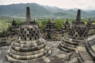
Majestic view of the Borobudur Temple's ancient st...
BRK26C95_245
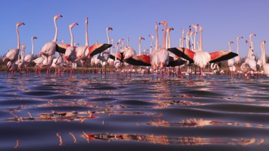
Stunning image depicting pink flamingos participat...
BRK26C96_095
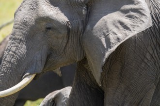
Detailed close-up image of an African elephant's t...
BRK26D03_450
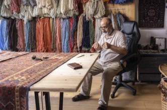
An Iranian master craftsman meticulously restores ...
BRK26C72_412
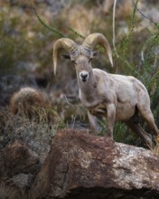
From below, a bighorn sheep stands majestically on...
BRK26D01_091
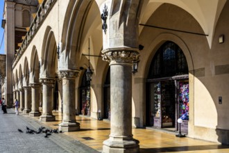
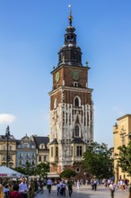
Arcades and Mascaron Heads, Rynek with Cloth Hall,...
BRK26C67_295
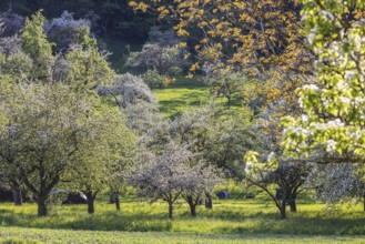
Blossoming fruit trees on the Albtrauf of the Swab...
BRK26C67_122
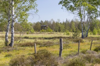
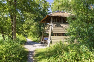
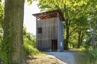
Observation tower on the heath trail through the G...
BRK26C68_059
View from the observation tower in the Dubringer M...
BRK26C77_040
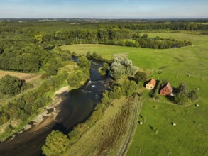
Datteln, North Rhine-Westphalia, Germany - Lippe, ...
BRK26C62_462
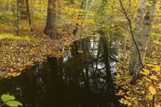
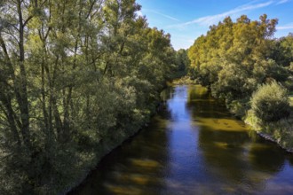
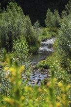
Water ditch in the forest with autumnal foliage co...
BRK26C59_267
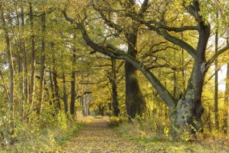
Elephant oak and avenue with old oaks (Quercus) at...
BRK26C63_400
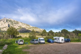
Camper vans enjoying the breathtaking view of the ...
BRK26C77_167
Haltern, North Rhine-Westphalia, Germany, flood pr...
BRK26C83_035
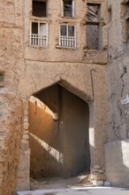
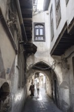
Damascus, Syria. December 10th 2025. The narrow st...
BRK26C11_424
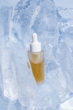
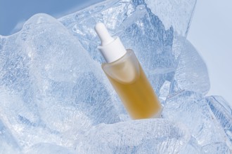
A clear serum bottle with a dropper, encapsulated ...

BRK26C11_412
A frosted glass serum bottle with a dropper, cradl...
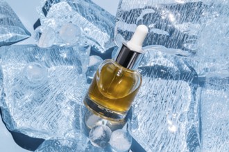
BRK26C11_422
A serum bottle with a dropper is elegantly placed ...
BRK26C37_435
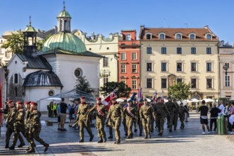
Polish National Military Festival, Rynek with Clot...
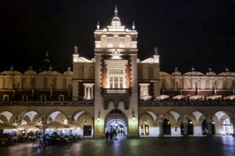
BRK26C37_440
Night view of Rynek with Cloth Hall, from 13th cen...
BRK26C54_430
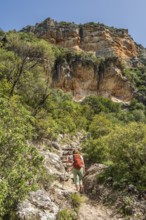
Woman hiking in the corlorful gorge La Garganta Ve...
BRK26C28_126
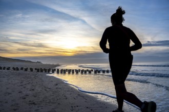
Winter on the North Sea, sunset at the beach, jogg...
BRK26C37_436
Town Hall Tower on Rynek, rest of the town hall bu...
BRK26C16_260
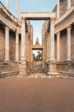
A stunning view of the Roman Theatre in Merida, hi...
BRK26C11_411
A skincare serum bottle nestled in sparkling clear...
BRK26C15_328
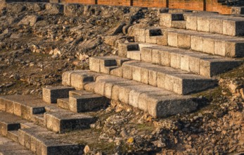
Warm sunlight casts over the stone steps of the an...
BRK26C11_410
A cosmetic serum bottle with a dropper perched ato...
BRK26C28_121
Winter on the North Sea, sunset at sea, beach walk...
BRK26C28_123
Coastal protection, through wooden posts, paalhoof...
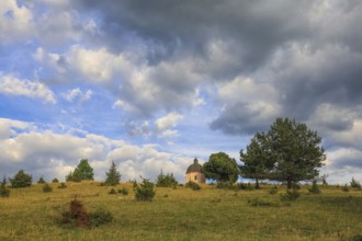
BRK26C30_336
A small chapel stands on a green hill under a clou...

BRK26C11_413
A single serum bottle with a dropper rests on clea...
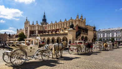
BRK26C37_434
Carriage in front of Rynek with Cloth Hall, from 1...
BRK26C28_127
Coastal protection, work on strengthening the dune...
BRK26B55_064
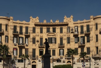
Cairo, Egypt, November 26th 2022 Beautiful 19th to...
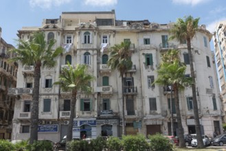
BRK26C25_004
Weather worn traditional architecture of Alexandri...
BRK26C49_299
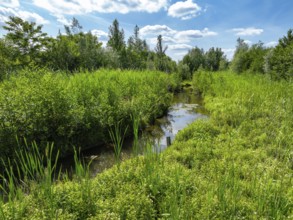
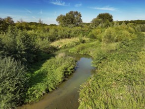
Bottrop, North Rhine-Westphalia, Germany - Renatur...
BRK26C23_372
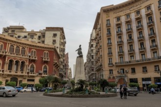
Cairo, Egypt, November 26th 2022 Mustafa Kamel Squ...
BRK26C33_021
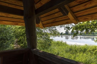
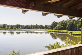
View from the observation tower at Großteich, Gutt...
BRK26C33_027
Observation tower on the large pond, Guttau ponds,...
BRK26C19_067
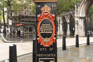
United Kingdom. August 2nd 2023 Decorative cast ir...
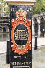
BRK26C19_066
United Kingdom. August 2nd 2023 Decorative cast ir...
BRK26C25_007
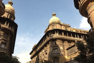
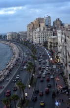
Old high rise buildings overlooking the busy Corni...
BRK26C33_023
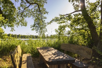
Seating area on the banks of Brösaer Teich, Guttau...
BRK26C33_026
Brösaer Teich, Guttauer Teiche, Oberlausitzer Heid...
BRK26C27_232
Datteln, North Rhine-Westphalia, Germany - Restore...
BRK26C54_476
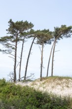
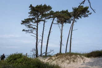
West beach near Prerow on the Darß, Vorpommersche ...
BRK26C33_020
Observation tower at Brösaer Teich, Guttauer Teich...
BRK26C49_298
Bottrop, North Rhine-Westphalia, Germany - Renatur...
BRK26C27_231
Datteln, North Rhine-Westphalia, Germany - Renatur...
BRK26C33_024
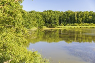
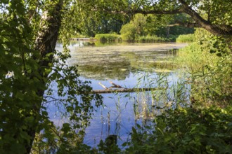
Parish pond with trees and reed belt, Guttau ponds...
BRK26C54_477
West beach near Prerow on the Darß, Vorpommersche ...
BRK26B55_071
Cairo, Egypt, November 26th 2022 Talet Harb Square...
BRK26C32_123
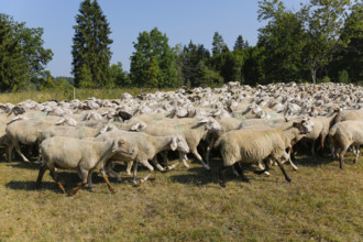
Sheep (Ovis), Fauser sheep farm, landscape conserv...
BRK26C33_028
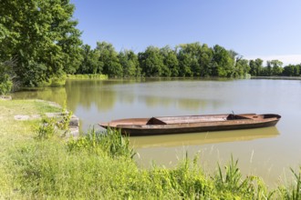
Fishing barge on a fishing pond in the Upper Lusat...
BRK26C27_228
Olfen, North Rhine-Westphalia, Germany - Lippe, in...
BRK26C33_022
Am Brösaer Teich, Guttauer Teiche, Oberlausitzer H...
BRK26C33_025
View from Brösaer Teich observation tower, Guttaue...
BRK26C13_242
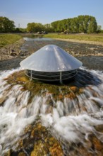
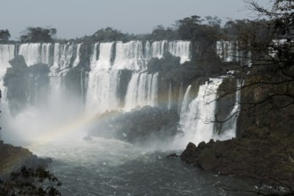
Breathtaking image capturing the powerful cascades...

BRK26C37_438
Caffe am Rynek with Cloth Hall, from 13th century,...
BRK26C12_141
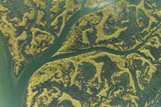
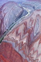
An aerial shot capturing the intricate patterns an...
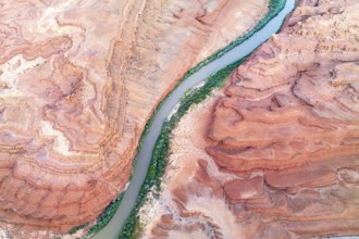
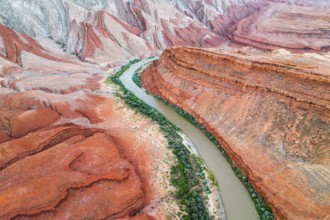
BRK26C14_199
A stunning aerial shot of the Rio San Juan river w...
BRK26C15_489
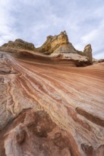
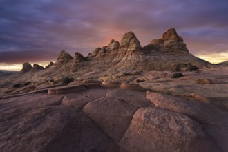
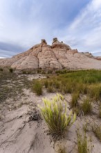
The striking rock formations of Coyote Buttes in P...
BRK26C11_409
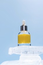
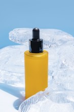
A vibrant yellow serum bottle with a black dropper...
BRK26C15_262
A stunning aerial photograph displaying the Rio Sa...
BRK26C15_491
An aerial photograph captures the stunning Rio San...
BRK26C15_495
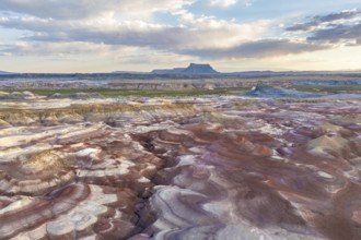
Stunning aerial photograph captures the unique pat...
BRK26C12_109
Stunning sunset over the unique rock formations in...
- Page
-
- sur
- 23