66022 résultats pour : mountain peak
- Page
-
- sur
- 661
Connectez-vous pour plus de résultats
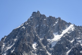
BRK26C57_003
Steep rocky mountain peak, summit of the Aiguille ...
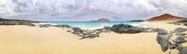
BRK26C57_130
Sandy beach of Playa de las Conchas, volcano Monte...
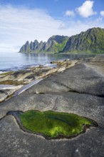
BRK26C58_378
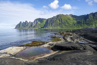
Green algae in a tidal pool, rocky coast of Tungen...
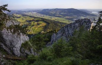
BRK26C60_182
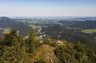
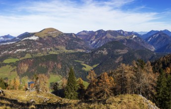
Hiking trail to the Schober with a view to Thalgau...
BRK26C63_180
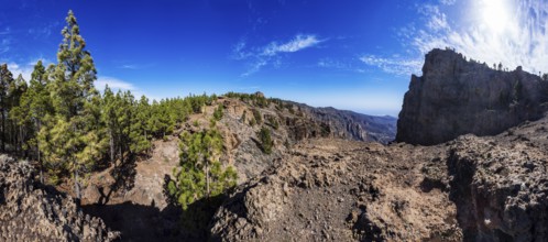
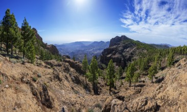
View from El Campanario to the summit of Pico de l...
BRK26C64_158
View from Windkogel to Sparberl, Postalm, Osterhor...
BRK26C70_348
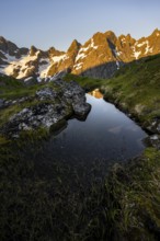
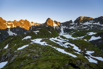
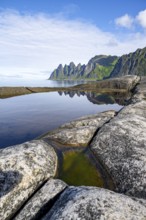
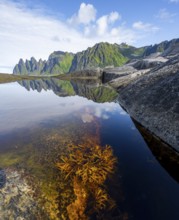
Rocky mountain peaks with reflection, small pond i...
BRK26C61_274
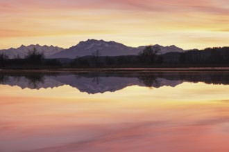
Sunset at Lake Zug, Pilatus in the background, Cha...
BRK26C61_377
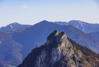
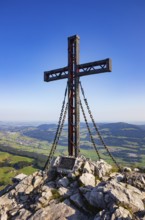
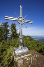
Summit cross on the Schober with view to Thalgau, ...
BRK26C75_258
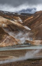
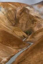
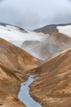
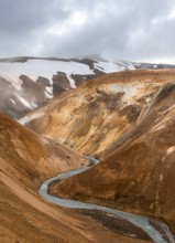
Steaming stream between colourful rhyolite mountai...
BRK26C82_099
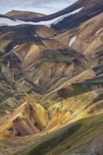
Small river between colourful rhyolite mountains, ...
BRK26C90_290
Snowdon Massif, Snowdon Range, Snowdonia, North Wa...
BRK26C56_484
Rocky mountain peaks with snow, at the Trollfjord ...
BRK26C56_271
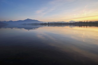
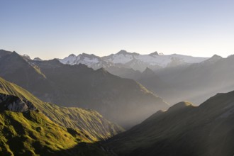
Mountain landscape in morning mood, view of the su...
BRK26C57_089
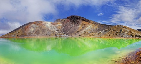
Green sulphurous Emerald Lakes and volcanio Mt Ton...
BRK26C62_337
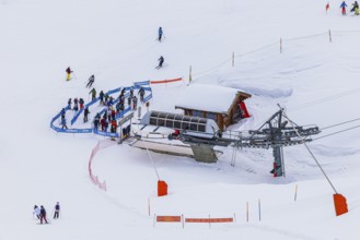
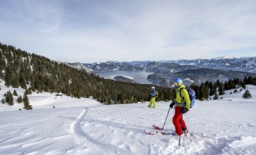
Skiers at the valley station of the chairlift to t...
BRK26C71_122
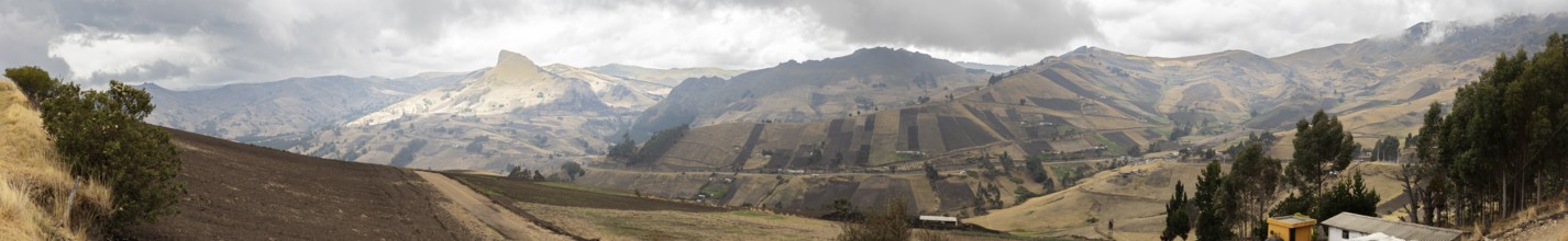
Highlands, Andes, Ecuador
BRK26C73_463
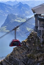
Cable car cabin, Dragon Ride aerial cableway from ...
BRK26C82_496
Snowdon Massif, Snowdon Range, Snowdonia, North Wa...
BRK26C87_475
Fog envelops the snowy summit of the mountain Le B...
BRK26C99_150
Hiking trail in the Umbaltal valley with Isel moun...
BRK26D01_180
Los Cuernos, the horns, in the evening light, Torr...
BRK26D01_324
Maple tree with autumn leaves, autumn landscape in...
BRK26C56_137
View from Glacier Point to Yosemite Valley with Ha...
BRK26C57_331
Alpenglow at Seekopf or Monte Capolago, old war tu...
BRK26C59_354
Mountain peaks, Laguna Victoria, Provinz Tierra de...
BRK26C60_231
Climber on a rock, view of picturesque coastal lan...
BRK26C61_373
Mountaineer looking over mountain landscape with p...
BRK26C62_434
Drone image, summit cross on the Ochsenberg, Oster...
BRK26C67_283
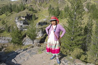
Peruvian woman, 38 years old, in traditional dress...
BRK26C85_406
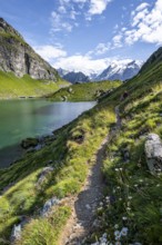
Mountaineer on a hiking trail at a mountain lake w...
BRK26C90_034
Snow-covered summit of the Jenner with viewing pla...
BRK26C98_004
Mountain stream in picturesque mountain landscape,...
BRK26C99_479
Snowdon Massif, Snowdon Range, Snowdonia, North Wa...
BRK26D02_060
Snowdon Massif, Snowdon Range, Snowdonia, North Wa...
BRK26C55_421
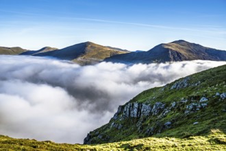
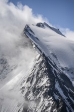
Clouds moving in, summit area of Mt Slættaratindur...
BRK26C59_316
View into the valley of the Caldera de Tirajana, p...
BRK26C61_428
Tidal pools, rocky coast of Tungeneset, Devil's Te...
BRK26C62_156
Two skiers skiing down the Simetsberg, view of Wal...
BRK26C65_185
Tyrolean mountains near Saalbach-Hinterglemm, view...
BRK26C72_234
Mountaineer on a narrow mountain ridge in winter, ...
BRK26C74_288
Steaming stream between colourful rhyolite mountai...
BRK26C56_356
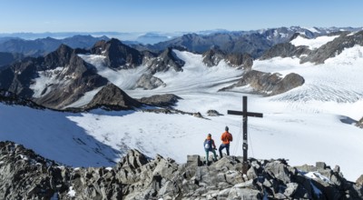
Panorama at the summit of the Wilder Freiger with ...
BRK26C57_096
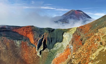
Red Crater and volcanio Mount Ngauruhoe, Tongariro...
BRK26C58_370
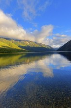
View of Lake Rotoiti, Nelson Lakes National Park, ...
BRK26C62_022
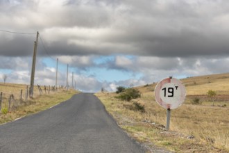
Desolate road in the countryside on a sunny summer...
BRK26C64_458
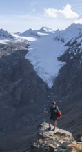
Mountaineer standing on a rock, surrounded by an i...
BRK26C73_291
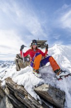
Happy mountaineer with ice axes and crampons on th...
BRK26C84_438
Mountaineer on hiking trail in picturesque mountai...
BRK26C86_031
Snowdon Massif, Snowdon Range, Snowdonia, North Wa...
BRK26C89_084
Sycamore maple with autumnal yellow foliage and su...
BRK26C91_003
View from the Wendelstein into the surroundings, A...

BRK26D05_238
Snowdon Massif, Snowdon Range, Snowdonia, North Wa...
BRK26C59_084
Enchanted dead trees, Cuernos del Paine mountain r...
BRK26C59_179
Tourist on bridge over steaming stream between col...
BRK26C75_028
Mountain panorama, mountain landscape with sun sta...
BRK26C79_430
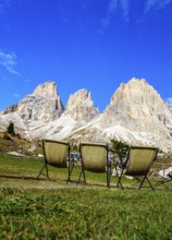
Three camping chairs in a meadow at Passo Sella in...
BRK26C80_170
Summit cross at the summit of the Kramerspitz, at ...
BRK26C83_415
View from the Nebelhorn summit to mountains of the...
BRK26D00_406
Snow-covered mountain landscape, ascent to the Nie...
BRK26D01_153
Mountains and fjord landscape, view from the summi...
BRK26C55_416
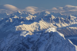
Views of snowy summits of the Ötztal Alps in winte...
BRK26C56_169
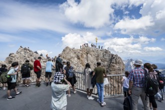
Tourists on the viewing platform at the summit of ...
BRK26C57_450
Hiking trail on the Riffelalp with golden yellow l...
BRK26C60_046
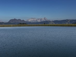
Pilatus reflected in the flooded nature reserve in...
BRK26C61_306
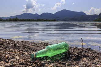
Empty beer bottle lying on the shore of a lake, ru...
BRK26C62_481
View from the Frauenkopf to Lake Fuschlsee, Osterh...
BRK26C67_203
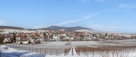
View over snow-covered vineyards to the wine villa...
BRK26C78_239
Steaming stream between colourful rhyolite mountai...
BRK26C99_434
View of coastal landscape, cliffs with peak Måtind...
BRK26C58_214
Mountain peak Ackerlspitze with summit cross, moun...
BRK26C61_349
Drone image, summit cross on the Ochsenberg with U...
BRK26C62_277
Early morning mist in the Egelsee nature reserve w...
BRK26C62_338
View from the summit of the Einberg to the Schwarz...
BRK26C69_406
Folaldafoss Waterfall, Öxi Pass, Berufjarðará Rive...
BRK26C77_134
Picturesque mountain landscape in Val Brenta Alta ...
BRK26C84_491
Geisler peaks rise above the rock layers into the ...
BRK26C56_294
Snow-covered summit of the Jenner in autumn, view ...
BRK26C57_311
Mountain peak Ackerlspitze with summit cross, moun...
BRK26C57_458
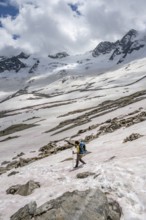
Mountaineer on hiking trail in mountain landscape,...
BRK26C57_488
Bridge and steaming streams between colourful rhyo...
BRK26C57_491
Reflection in a tidal pool, rocky coast of Tungene...
BRK26C60_315
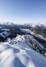
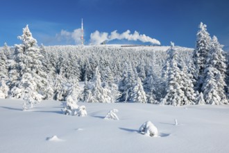
Deep snowy winter landscape with snow-covered spru...
BRK26C61_207
View from Schwarzer Berg to Seewaldsee and Trattbe...
BRK26C63_269
Summit cross on the Eibleck with a view of the Och...
BRK26C85_295
View from the Gamsfeld into the Osterhorn group, R...
BRK26C89_115
Mountain peaks of the Ötztal Alps reflected in Lak...
BRK26C59_077
Mountain landscape with green canyon, waterfall an...
BRK26C64_350
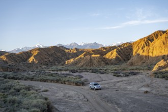
Off-road vehicle driving through a canyon, landsca...
BRK26C69_348
Steaming stream between colourful rhyolite mountai...
BRK26C73_143
Mountaineer on a snowfield, descent from the summi...
BRK26C84_132
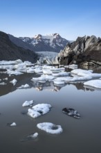
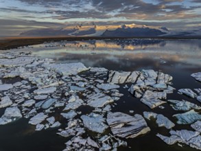
Reflection in the Svínafellslon glacier lagoon wit...
BRK26C86_029
Rocky mountain ridge and glaciated mountain peak G...
BRK26C86_283
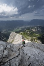
Mountaineer with helmet climbing on the rock in a ...
BRK26C89_348
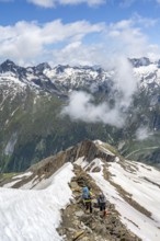
Mountaineer on a rocky ridge with snow, descent fr...
BRK26C92_322
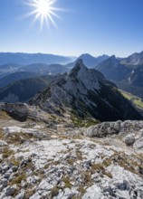
View at the summit of the Große Arnspitze, mountai...
BRK26C96_282
Ice floes, glacier, glacier tongue, fog, clouds, m...
BRK26C57_251
Plants and reflection in the tidal pool, rocky coa...
BRK26C60_188
Mountain peak in the evening light with foehn clou...
BRK26C70_460
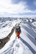
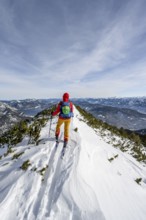
Ski tourer at the summit of Simetsberg, mountain p...
- Page
-
- sur
- 661