187 résultats pour : mühlheim an der ruhr
- Page
-
- sur
- 2
Connectez-vous pour plus de résultats
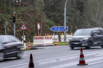
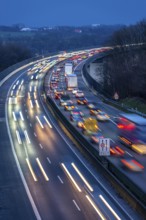
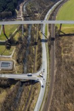
BRK26C80_238
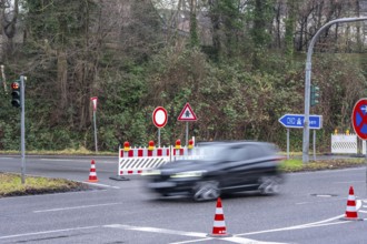
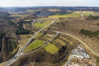
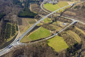
Closure of the A52 motorway, between AK Breitschei...
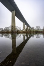
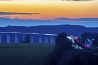
BRK26C75_483
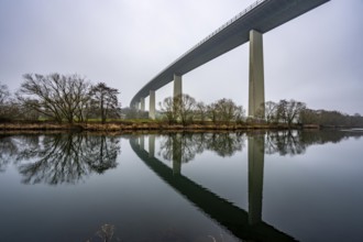
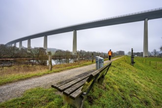
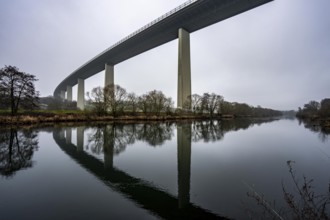
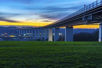
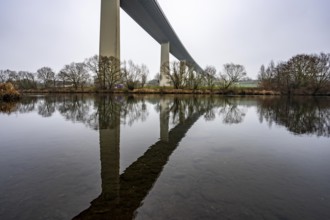
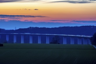
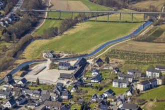
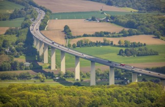
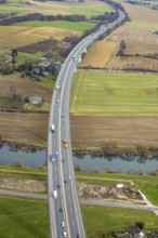
The Mintarder Ruhr Valley Bridge, A52 motorway bri...
BRK26C73_193
The Mintarder Ruhr Valley Bridge, A52 motorway bri...
BRK26C38_135
Closure of the A52 motorway, between AK Breitschei...
BRK26C38_136
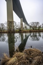
The Mintarder Ruhr Valley Bridge, A52 motorway bri...
BRK26C38_133
The Mintarder Ruhr Valley Bridge, A52 motorway bri...
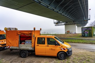
BRK26C38_139
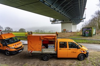
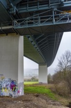
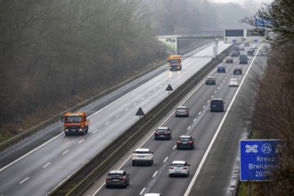
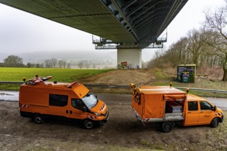
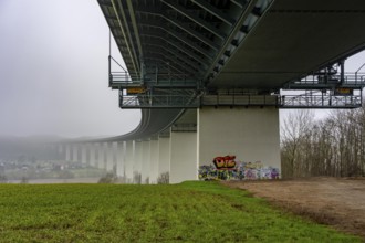
Autobahn GmbH vehicles under the Ruhr Valley Bridg...
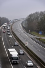
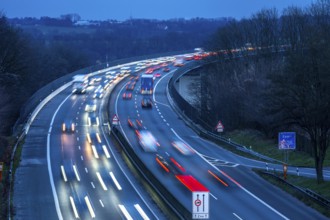
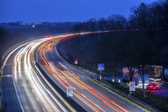
BRK26C45_375
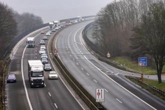
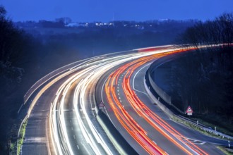
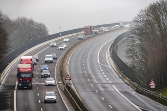
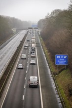
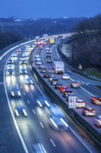
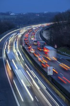
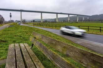
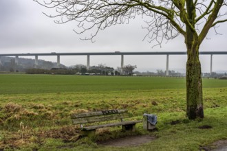
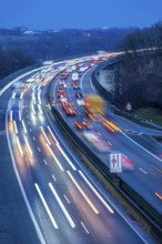
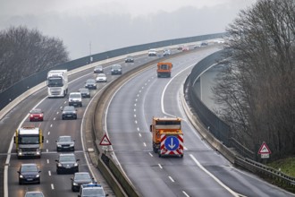
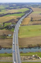
Evening traffic on the A52 motorway, between Düsse...
BRK26C38_134
The Mintarder Ruhr Valley Bridge, A52 motorway bri...
BRK26C38_138
Closure of the A52 motorway, between AK Breitschei...
BRK26C38_137
Closure of the A52 motorway, between AK Breitschei...
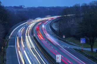
BRK26C45_376
Evening traffic on the A52 motorway, between Düsse...
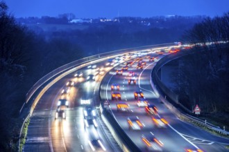
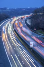
BRK26B98_174
Evening traffic on the A52 motorway, between Düsse...
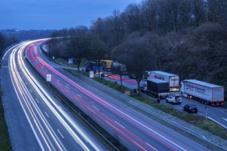
BRK26B82_463
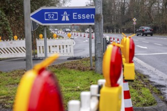
Closure of the A52 motorway, between AK Breitschei...
BRK26B82_466
Closure of the A52 motorway, between AK Breitschei...
BRK26B82_465
Closure of the A52 motorway, between AK Breitschei...
BRK26B82_464
Autobahn GmbH vehicles under the Ruhr Valley Bridg...
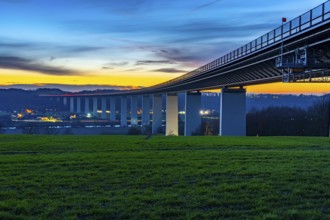
BRK26B97_495
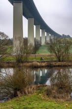
The Ruhr Valley Bridge, motorway bridge of the A52...
BRK26B98_172
Evening traffic on the A52 motorway, between Düsse...
BRK26B82_469
The Mintarder Ruhr Valley Bridge, A52 motorway bri...
BRK26B82_467
The Mintarder Ruhr Valley Bridge, A52 motorway bri...
BRK26B82_468
The Mintarder Ruhr Valley Bridge, A52 motorway bri...
BRK26B14_293
The Mintarder Ruhr Valley Bridge, A52 motorway bri...
BRK26B14_295
The Mintarder Ruhr Valley Bridge, A52 motorway bri...
BRK26B14_298
Closure of the A52 motorway, between AK Breitschei...
BRK26B14_299
Autobahn GmbH vehicles under the Ruhr Valley Bridg...
BRK26B14_294
The Mintarder Ruhr Valley Bridge, A52 motorway bri...
BRK26B34_093
Evening traffic on the A52 motorway, between Düsse...
BRK26B14_296
Closure of the A52 motorway, between AK Breitschei...
BRK26B34_091
Evening traffic on the A52 motorway, between Düsse...
BRK26B33_160
The Ruhr Valley Bridge, motorway bridge of the A52...
BRK26B14_297
Closure of the A52 motorway, between AK Breitschei...
BRK26A83_147
Evening traffic on the A52 motorway, between Düsse...
BRK26A81_431
The Ruhr Valley Bridge, motorway bridge of the A52...
BRK26A83_149
Evening traffic on the A52 motorway, between Düsse...
BRK26A19_402
The Ruhr Valley Bridge, motorway bridge of the A52...
BRK26A20_492
Evening traffic on the A52 motorway, between Düsse...
BRK26A20_491
Evening traffic on the A52 motorway, between Düsse...

BRK25M65_028
Evening traffic on the A52 motorway, between Düsse...
BRK25M65_031
Evening traffic on the A52 motorway, between Düsse...

BRK25M65_029
Evening traffic on the A52 motorway, between Düsse...
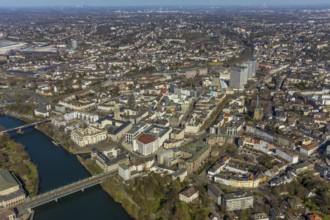
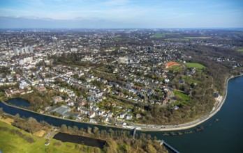
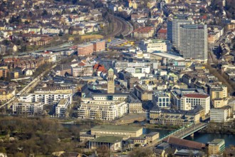
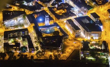
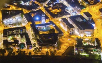
BRK25K30_209
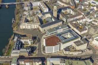
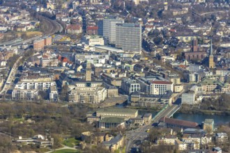
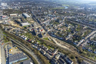
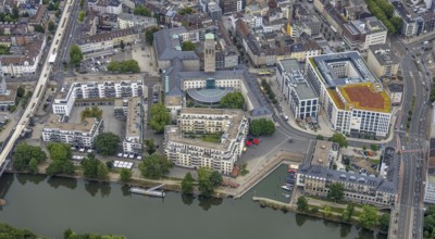
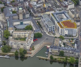
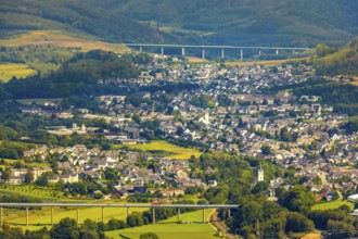
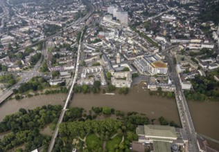
Aerial view, Ruhrbania in the city centre of Mülhe...
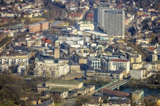
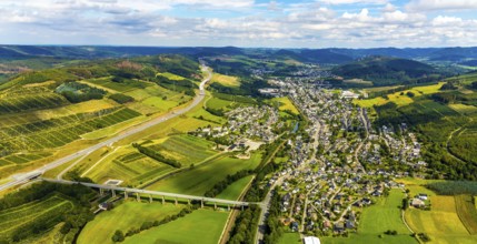
BRK25K36_350
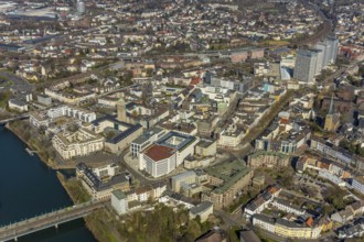
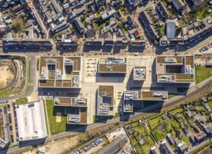
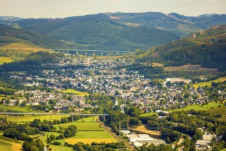
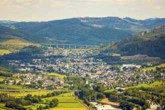
Aerial photo, overview Mühlheim, centre-east, Holt...
BRK25K32_141
Aerial view, industrial area Solinger Straße, Köln...
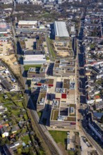
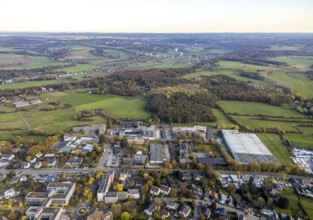
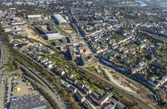
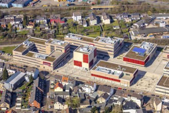
BRK25K30_222
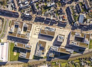
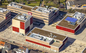
Aerial photo, Campus Mühlheim, MH Hochschule Ruhr ...
BRK25K30_224
Aerial photo, Campus Mühlheim, MH Hochschule Ruhr ...
BRK25K30_232
Aerial view, Ruhrbania in the city centre of Mülhe...
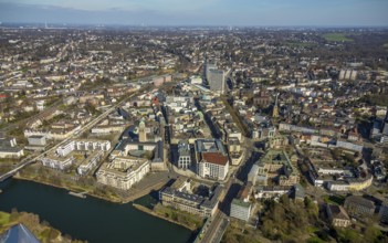
BRK25K30_233
Aerial view, Ruhrbania in the city centre of Mülhe...
BRK25K30_197
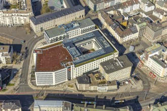
Aerial view, Ruhr, Ruhrbania, StadtQuartier Schlos...
BRK25K30_203
Aerial photo, Campus Mühlheim, MH Hochschule Ruhr ...
BRK25K30_208
Aerial view, Ruhrbania in the city centre of Mülhe...
BRK25K30_207
Aerial view, Ruhrbania in the city centre of Mülhe...
BRK25K30_202
Aerial photo, Campus Mühlheim, MH Hochschule Ruhr ...
BRK25K30_206
Aerial view, Ruhrbania in the city centre of Mülhe...
BRK25K30_201
Aerial photo, Campus Mühlheim, MH Hochschule Ruhr ...
BRK25K30_210
Aerial view, Ruhrbania in the city centre of Mülhe...
BRK25K36_334
Aerial view, Ruhrbania in the city centre of Mülhe...
BRK25K30_200
Aerial photo, Campus Mühlheim, MH Hochschule Ruhr ...
BRK25K30_223
Aerial photo, Campus Mühlheim, MH Hochschule Ruhr ...
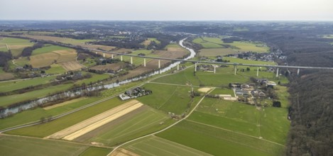
BRK25J21_450
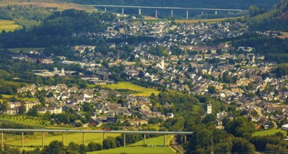
Aerial view, Mintarder Ruhrtalbrücke, motorway A52...
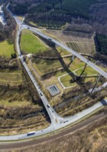
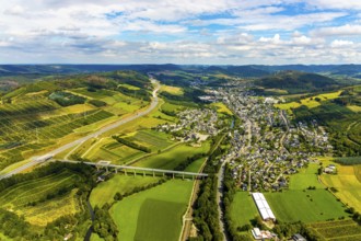
BRK25J06_309
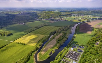
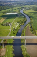
Aerial view, federal road B480n, Ruhrtalbrücke Ber...
BRK25J22_035
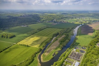
Aerial view, Untere Kettwiger Ruhraue, river Ruhr,...
BRK25J06_308
Aerial view, federal road B480n, Ruhrtalbrücke Ber...

BRK25J20_403
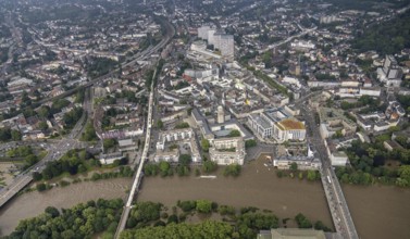
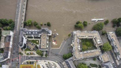
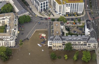
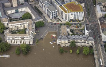
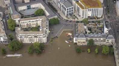
Aerial photo, Ruhr flood, flooding, Ruhrbania with...
BRK25J20_349
Aerial view, Ruhrbania, city centre of Mülheim, a ...
BRK25J20_348
Aerial view, Ruhrbania, city centre of Mülheim, a ...
BRK25J06_310
Aerial view, federal road B480n, Ruhrtalbrücke Ber...
BRK25J21_127
Aerial view, historic town hall, Altstadt I, Ruhrb...
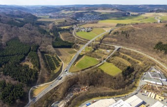
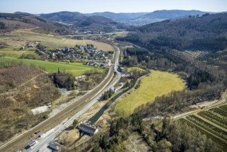
BRK25J06_376
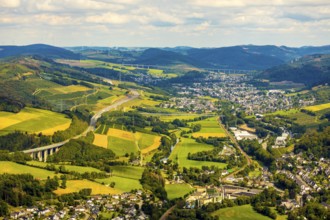
Aerial view, Ruhr valley bridge Velmede, valley br...
BRK25J06_305
Aerial view, federal road B480n, Ruhrtalbrücke Ber...
BRK25J49_289
Aerial view, federal road B7, river Ruhr, hydroele...
BRK25J21_115
Aerial view, historic town hall, Altstadt I, Ruhrb...
BRK25J06_377
Aerial view, Ruhr valley bridge Velmede, valley br...
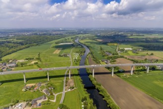
BRK25J21_456
Aerial view, Mintarder Ruhrtalbrücke, motorway A52...
BRK25J21_460
Aerial view, river Ruhr, Mintarder Ruhrtalbrücke, ...
BRK25J06_365
Aerial view, Ruhr valley bridge Velmede, valley br...
BRK25J06_366
Aerial view, Ruhr valley bridge Velmede, valley br...
BRK25J06_306
Aerial view, federal road B480n, Ruhrtalbrücke Ber...
BRK25J48_176
Aerial view, Ruhr river, Ruhr valley bridge Velmed...
BRK25J06_367
Aerial view, Ruhr valley bridge Velmede, valley br...
BRK25J06_378
Aerial view, Ruhr valley bridge Velmede, valley br...
BRK25J21_312
Aerial view, Mintarder Ruhrtalbrücke, Saarn, Mülhe...
BRK25J21_449
Aerial view, river Ruhr, Mintarder Ruhrtalbrücke, ...
BRK25J21_453
Aerial view, Mintarder Ruhrtalbrücke, motorway A52...
BRK25J06_368
Aerial view, Ruhr valley bridge Velmede, valley br...
BRK25J09_174
Aerial photo, Ruhr flood, flooding, Ruhrbania with...

BRK25J09_176
Aerial photo, Ruhr flood, flooding, Ruhrbania with...
BRK25J20_400
Aerial photo, Ruhr flood, flooding, Ruhrbania with...
BRK25J37_500
Aerial view, Untere Kettwiger Ruhraue, Mintarder R...
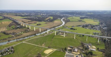
BRK25J21_458
Aerial view, Mintarder Ruhrtalbrücke, motorway A52...

BRK25J09_175
Aerial photo, Ruhr flood, flooding, Ruhrbania with...
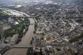
BRK25J09_177
Aerial photo, Ruhr flood, flooding, Ruhrbania with...
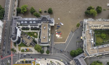
BRK25J20_415
Aerial photo, Ruhr flood, flooding, Ruhrbania with...
BRK25J09_172
Aerial photo, Ruhr flood, flooding, Ruhrbania with...

BRK25J20_398
Aerial photo, Ruhr flood, flooding, Ruhrbania with...

BRK25J09_173
Aerial photo, Ruhr flood, flooding, Ruhrbania with...

BRK25J20_396
Aerial photo, Ruhr flood, flooding, Ruhrbania with...
BRK25J09_171
Aerial photo, Ruhr flood, flooding, Ruhrbania with...
BRK25J20_395
Aerial view, Ruhr flood, flooding, Ruhrbania with ...
BRK25J09_190
Aerial photo, Ruhr flood, flooding, Ruhrbania with...
- Page
-
- sur
- 2