261 résultats pour : hohe straße
- Page
-
- sur
- 3
Connectez-vous pour plus de résultats
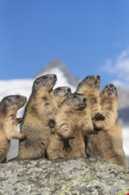
BRK26D00_326
Group of Alpine Marmots, Marmota marmota, sideview...
BRK26C47_019
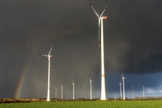
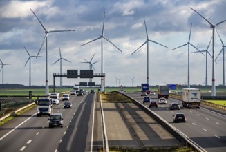
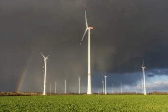
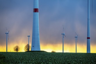
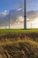
Königshovener Höhe onshore wind farm, on the A44 m...

BRK26C53_258
Fountain avenue in the spa gardens of Bad Homburg ...
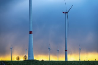
BRK26C00_073
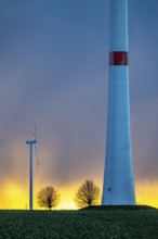
Königshovener Höhe onshore wind farm, on the A44 m...
BRK26C00_074
Königshovener Höhe onshore wind farm, on the A44 m...
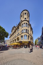
BRK26B65_290
Historic commercial building Palatium, architect W...
BRK26B65_293
Historic commercial building Palatium, architect W...
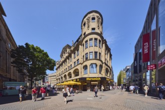
BRK26B65_271
Pedestrian zone, shops, shopping, general architec...

BRK26B47_019
Fountain avenue in the spa gardens of Bad Homburg ...

BRK26B47_018
Fountain avenue in the spa gardens of Bad Homburg ...
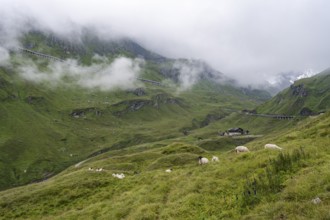
BRK26A91_290
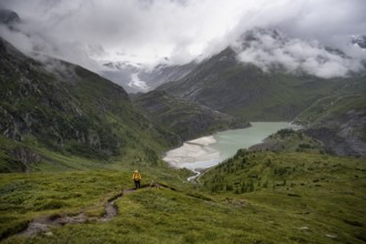
Cloudy mountain landscape, sheep on an alpine mead...
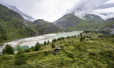
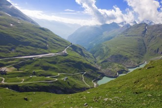
BRK26A91_289
Cloudy mountain landscape, reservoir Speicher Marg...
BRK26A85_464
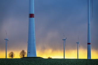
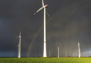
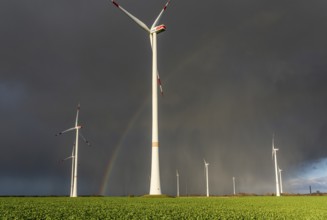
Königshovener Höhe onshore wind farm, on the A44 m...
BRK26A85_465
Königshovener Höhe onshore wind farm, on the A44 m...
BRK26A85_466
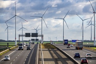
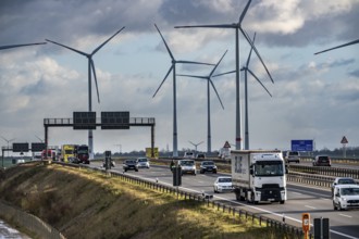
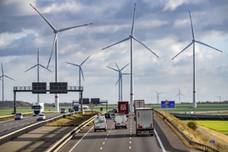
A44 motorway near Bedburg, in front of the Jackera...
BRK26A25_450
A44 motorway near Bedburg, in front of the Jackera...
BRK26A25_449
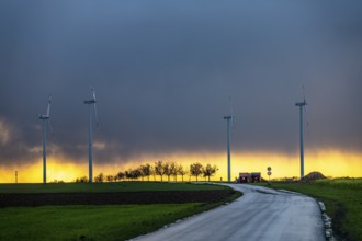
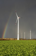
Königshovener Höhe onshore wind farm, on the A44 m...
BRK26A25_448
Königshovener Höhe onshore wind farm, on the A44 m...

BRK25M02_282
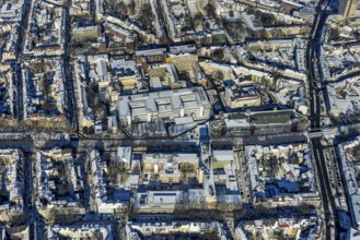
Hohe Lilie City Museum with passage to Mühlgasse, ...
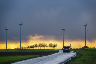
BRK25M72_347
A44 motorway near Bedburg, in front of the Jackera...

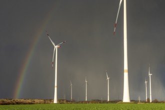
BRK25M72_349
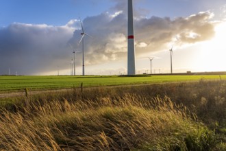
Königshovener Höhe onshore wind farm, on the A44 m...

BRK25M72_354
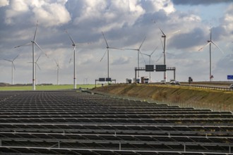
86.5 MW peak open-air photovoltaic systems, from R...
BRK25M72_348
Königshovener Höhe onshore wind farm, on the A44 m...

BRK25M72_351
Bedburg A 44n onshore wind farm, on the A44 motorw...

BRK25M49_378
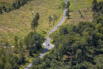
Rural road lined with trees under a clear sky, Fla...
BRK25M47_156
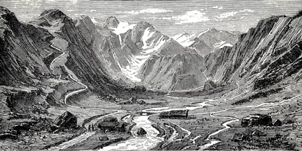
Pinzgau with high mountain valley, river course, a...
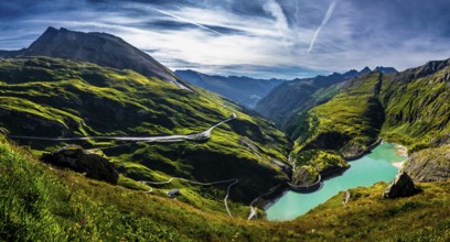
BRK25L60_016
Königshovener Höhe onshore wind farm, on the A44 m...
BRK25L60_028
Bedburg A 44n onshore wind farm, on the A44 motorw...
BRK25L60_025
86.5 MW peak open-air photovoltaic systems, from R...
BRK25L60_015
Königshovener Höhe onshore wind farm, on the A44 m...
BRK25L60_017
A44 motorway near Bedburg, in front of the Jackera...
BRK25L60_031
Bedburg A 44n onshore wind farm, on the A44 motorw...
BRK25L60_021
Königshovener Höhe onshore wind farm, on the A44 m...
BRK25L60_022
Königshovener Höhe onshore wind farm, on the A44 m...
BRK25L44_164
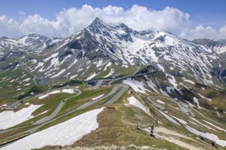
View from Edelweiss ridge to mountain pass Alpine ...
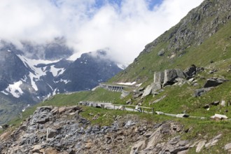
BRK25L44_165
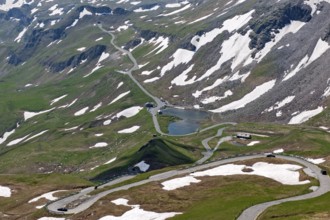
View of the section of the Grossglockner High Alpi...
BRK25L44_166
View to the left Großglockner-Hochalpenstraße acce...
BRK25L44_162
View to the south from Hochtor pass summit of Gros...
BRK25L18_058
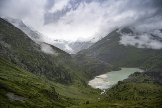
Cloudy mountain landscape, Margaritzen Reservoir, ...
BRK25L18_066
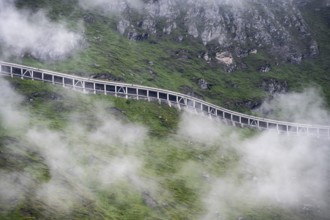
Gallery against falling rocks on the road, Grossgl...
BRK25K67_222
Hikers in a cloudy mountain landscape, Margaritzen...

BRK25K67_218
Hikers in a cloudy mountain landscape, Margaritzen...

BRK25K67_216
Cloudy mountain landscape, Margaritzen Reservoir, ...
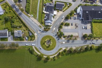
BRK25K37_221
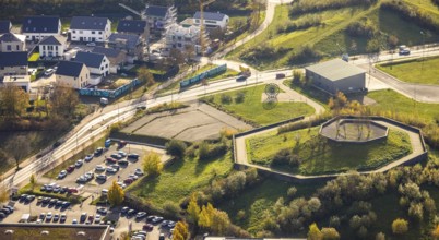
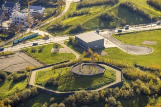
Aerial view, roundabout, Im Schlahbruch, Meschede,...
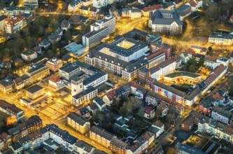
BRK25K49_180
Aerial photo, Volksbank Hamm, Hamm head office, Go...
BRK25K32_197
Aerial view, TV tower Wesel Langer Heinrich, prote...
BRK25K32_416
Aerial view, Loh water tower, Loher Höhe, Von-der-...
BRK25K32_232
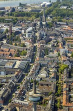
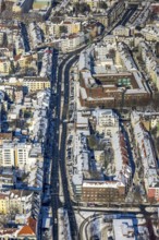
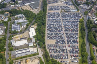
Aerial view, Hohe Straße shopping mile, green tree...
BRK25K34_058
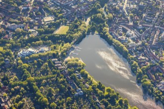
Aerial photo, Aasee, Allwetterzoo, river Münstersc...
BRK25K32_195
Aerial view, TV tower Wesel Langer Heinrich, prote...
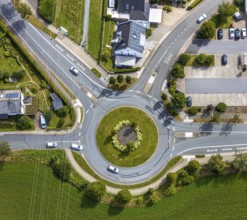
BRK25K37_226
Aerial view, roundabout, Im Schlahbruch, Meschede,...
BRK25K32_233
Aerial view, Hohe Straße shopping mile, green tree...
BRK25K37_219
Aerial view, residential area Hückeler Höhe, comme...
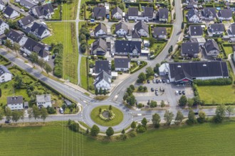
BRK25K37_189
Aerial view, roundabout, Meschede, Sauerland, Hoch...
BRK25J75_224
Pasterze Glacier Lake With Hydropower Dam In Natio...
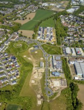
BRK25J06_462
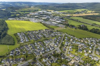
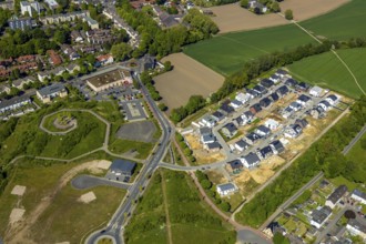
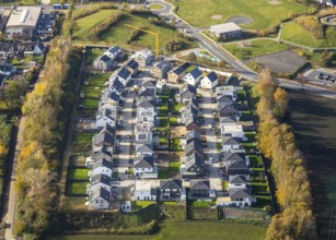
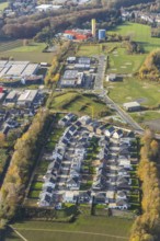
Aerial view, residential area Marie-Luise-Tanski-S...
BRK25J07_153
Aerial view, residential area, Marie-Luise-Tanski-...
BRK25J06_460
Aerial view, residential area Marie-Luise-Tanski-S...
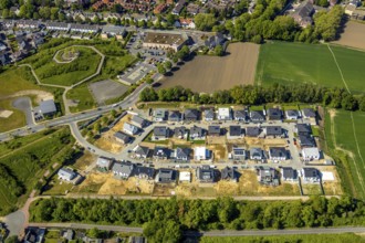
BRK25J06_461
Aerial view, residential area Marie-Luise-Tanski-S...
BRK25J43_181
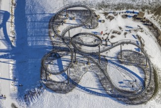
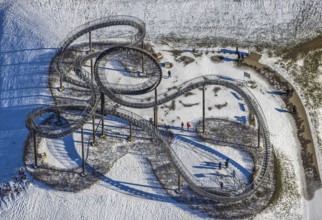
Aerial view, Tiger & Turtle - Magic Mountain, artw...
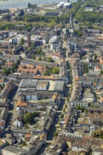
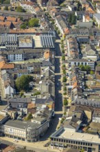
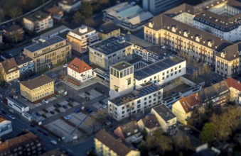
BRK25J45_089
Aerial view, city centre, city clinics, Hohe Straß...
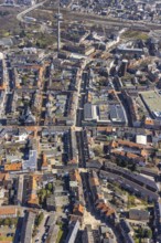
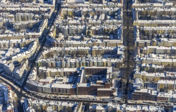
BRK25J08_208
Hiltroper Höhe slagheap, Hiltroper Straße, Bochum,...
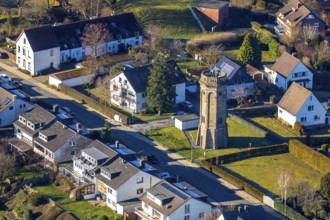
BRK25J10_331
Aerial view, Alter Wasserturm, Hohe Straße pedestr...
BRK25J44_282
Aerial view, Tiger & Turtle - Magic Mountain, artw...
BRK25J45_091
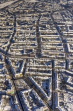
Aerial view, city centre, residential buildings, H...
BRK25J44_279
Aerial view, Tiger & Turtle - Magic Mountain, artw...
BRK25J45_090
Aerial view, city centre, residential buildings Ho...
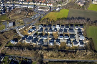
BRK25J08_182
Residential estate Marie-Luise-Tanski-Straße, Berg...
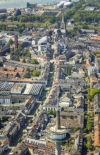
BRK25J45_095
Aerial view, city centre, Hohe Straße, Ruhrallee, ...
BRK25J06_463
Aerial view, residential area Marie-Luise-Tanski-S...
BRK25J08_190
Residential estate Marie-Luise-Tanski-Straße, Berg...
BRK25J45_092
Aerial view, city centre, residential buildings, H...
BRK25J45_130
Aerial view, city centre, residential buildings, H...
BRK25J01_125
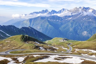
Landscape panorama, high alpine road, Großglockner...
BRK25J33_202
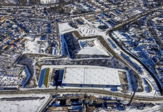
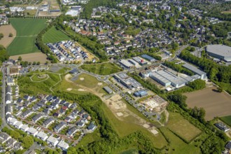
Aerial view, commercial area between Dortmunder St...
BRK25J08_206
Hiltroper Höhe slagheap, Hiltroper Straße, Bochum,...
BRK25I89_305
View from Edelweißgrat Edelweißspitze Edelweißhütt...
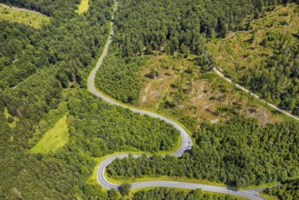
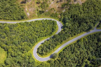
BRK25I56_231
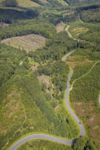
Aerial view, serpentines at the Ochsenkopf between...
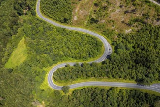
BRK25I56_238
Aerial view, serpentines at the Ochsenkopf between...
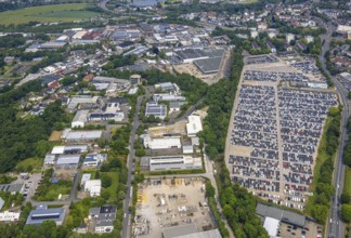
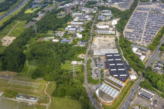
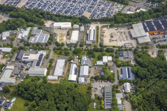
BRK25I79_267
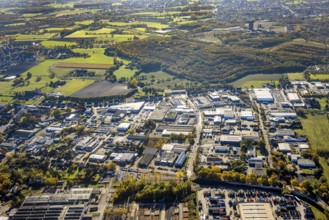
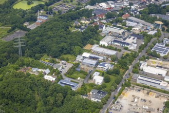
Aerial view, commercial area Beuler Höhe and comme...
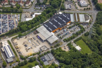
BRK25I79_270
Aerial view, commercial area Beuler Höhe, Obi Baum...
BRK25I81_270
ATTENTION Photos with partial blurring created by ...
BRK25I56_239
Aerial view, serpentines at the Ochsenkopf between...
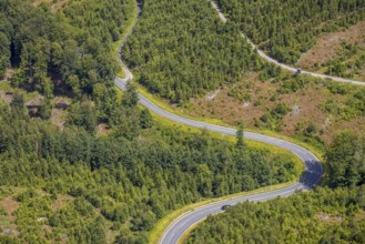
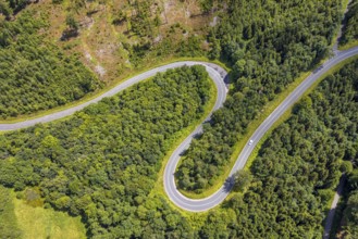
BRK25I56_233
Aerial view, serpentines at the Ochsenkopf between...
BRK25I56_236
Aerial view, serpentines at the Ochsenkopf between...
BRK25I79_252
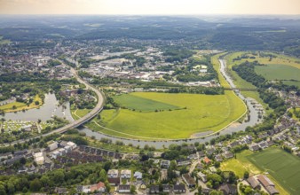
Aerial view, Ruhrbogen mit Leinpfad und Ruhraue Im...
BRK25I79_266
Aerial view, commercial area Beuler Höhe and comme...
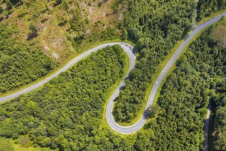
BRK25I56_232
Aerial view, serpentines at the Ochsenkopf between...
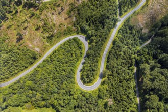
BRK25I56_237
Aerial view, serpentines at the Ochsenkopf between...
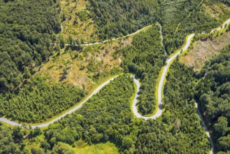
BRK25I56_242
Aerial view, serpentines at the Ochsenkopf between...
BRK25I79_269
Aerial view, commercial area Beuler Höhe, Rosentha...
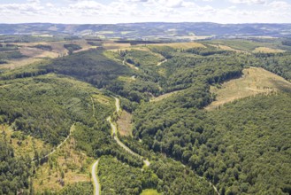
BRK25I56_243
Aerial view, serpentines at the Ochsenkopf between...
BRK25I79_258
Aerial view, Ruhrbogen mit Leinpfad und Ruhraue Im...
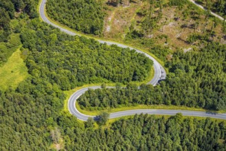
BRK25I56_240
Aerial view, serpentines at the Ochsenkopf between...
BRK25I79_268
Aerial view, commercial area Beuler Höhe and comme...
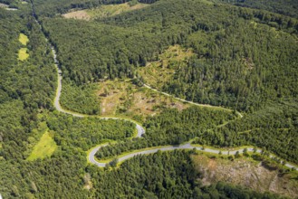
BRK25I56_241
Aerial view, serpentines at the Ochsenkopf between...
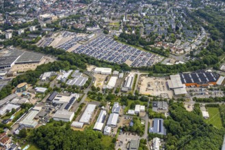
BRK25I79_233
Aerial view, commercial area Beuler Höhe and comme...
BRK25I79_271
Aerial view, commercial area Beuler Höhe and comme...
BRK25I56_234
Aerial view, serpentines at the Ochsenkopf between...
BRK25I56_235
Aerial view, serpentines at the Ochsenkopf between...
- Page
-
- sur
- 3