12985 résultats pour : high valleys
- Page
-
- sur
- 130
Connectez-vous pour plus de résultats
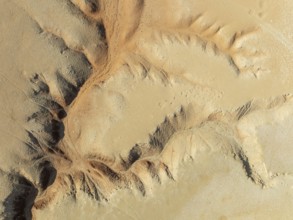
BRK26C62_454
Canyon in the Tsondab Valley in the Namib Desert. ...
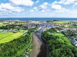
BRK26C75_087
Larpool Viaduct over River Esk and Esk Valley Viad...
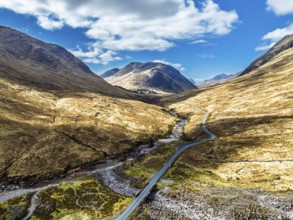
BRK26C91_177
Mountains and Moors over Glen Etive Valley from a ...
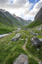
BRK26C99_150
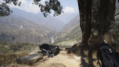
Hiking trail in the Umbaltal valley with Isel moun...
BRK26C56_137
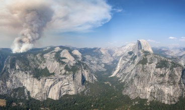
View from Glacier Point to Yosemite Valley with Ha...
BRK26C58_120
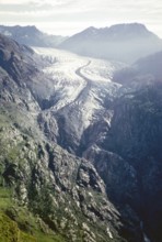
Aletsch Glacier, Great Aletsch Glacier, Bernese Al...
BRK26C56_458
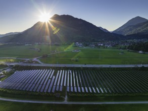
Aerial view, solar system, photovoltaics, morning ...
BRK26C57_450
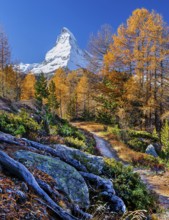
Hiking trail on the Riffelalp with golden yellow l...
BRK26C84_491
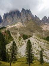
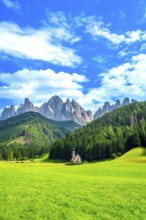
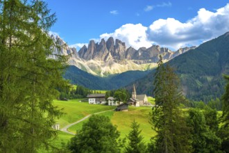
Geisler peaks rise above the rock layers into the ...
BRK26C88_221
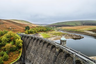
Autumn over Craig Goch Dam from a drone, Elan Vall...
BRK26C78_157
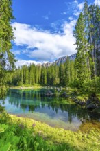
Isel mountain stream in the Umbaltal valley, Vened...
BRK26C89_348
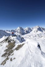
Mountaineer on a rocky ridge with snow, descent fr...
BRK26C60_033
View from Belalp of snow-covered mountains to the ...
BRK26C63_391
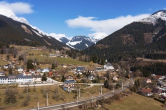
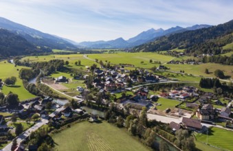
Drone image, view of the village, Grän, Tannheimer...
BRK26C76_040
Ski tourer, ascent to the summit of the Köllkuppe ...
BRK26C58_112
Panorama of Moors and Road A82 over Glencoe Valley...
BRK26D03_417
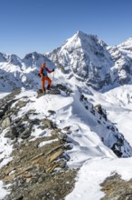
Ski tourer stretches his arms triumphantly into th...
BRK26C75_493
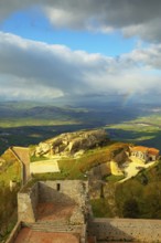
Rocca di Cerere and surrounding valley, elevated v...
BRK26C60_076
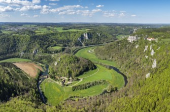
Aerial view, panorama of the upper Danube valley, ...
BRK26C57_285
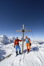
Two ski tourers at the summit cross on the summit ...
BRK26C60_081
Lake Bergsee ('mountain lake') near Bad Säckingen,...
BRK26D01_281
River Isel in the Umbaltal valley, Hohe Tauern Nat...
BRK26C98_469
Hiker looking down into the valley from the Hochkö...
BRK26C62_115
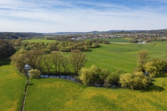
Sunrise, floodplain meadows, floodplain landscape ...
BRK26C73_332
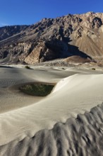
Sand dunes in Nubra valley in Himalayas. Hunder, N...
BRK26D00_269
Ski tourers on foot, mountain panorama with snow-c...
BRK26C63_473
Wet meadows at the confluence or source of the Mai...
BRK26C88_290
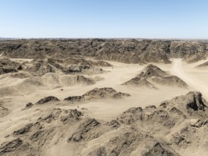
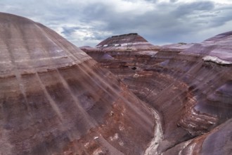
Aerial view, dry barren mountains in Moon Valley, ...
BRK26C75_285
Achik Tash river, Achik Tash valley, behind glacia...
BRK26C59_484
Beautiful landscape of the Mountain silhouettes of...
BRK26C65_437
Malter, town view with dam and Weißeritz valley ra...
BRK26C57_294
Spiti, valley, mountain valley, roads, mountain ro...
BRK26C65_407
Aerial view, glacial stream flows around a large r...
BRK26C61_032
Beautiful landscape of the forest in the Sexten Do...
BRK26C81_296
Dramatic mountain landscape, mountain valley, behi...

BRK26C65_315
Summit cross, Seceda, Val Gardena, Trentino, South...
BRK26C55_404
Symbolic image extreme weather, global warming, cl...
BRK26C76_241
View over Säntis mountains into the valley of Megl...
BRK26C68_265
Road through a mountain valley in autumn, Eki-Nary...
BRK26C67_022
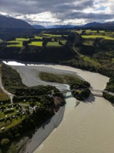
Aerial view of the Elbe with railway bridge and in...
BRK26C78_476
Green valley with snow-covered mountains under clo...
BRK26C57_371
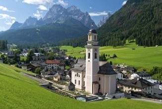
Surrounded by lush meadows and forests, st. Magdal...
BRK26C70_303
A striking aerial shot of the distinctive geologic...
BRK26C87_484
A picturesque scene at Seealpsee in Switzerland fe...
BRK26C58_291
Emerald waters of lake carezza reflecting latemar ...
BRK26C72_374
Hiker walking along a path with open arms, enjoyin...
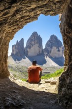
BRK26C73_174
Hiker admiring the tre cime di lavaredo from insid...
BRK26C77_023
Stunning aerial capture of the unique geological f...
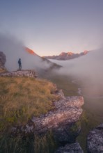
BRK26C77_231
A lone hiker stands on a cliff, gazing at a stunni...
BRK26C85_020
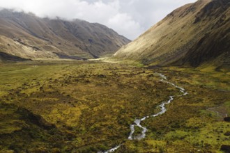
A meandering stream flows through a vast Andean va...
BRK26C60_034
Drone image, residential buildings, view of town, ...
BRK26C60_287
Roman Catholic parish church of St Peter and St Pa...
BRK26C62_080
Drone shot, view of village with parish church, Pr...
BRK26C64_212
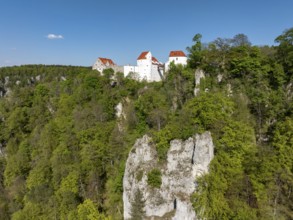
Aerial view of Wildenstein Castle near Leibertinge...
BRK26C77_384
A panoramic aerial photograph capturing the unique...
BRK26C77_430
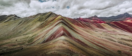
A stunning panoramic capture of Vinicunca, or Rain...
BRK26C82_341
Aerial photograph capturing the breathtaking lands...
BRK26C83_193
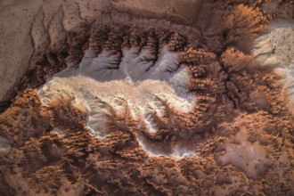
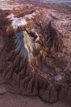
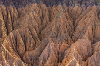
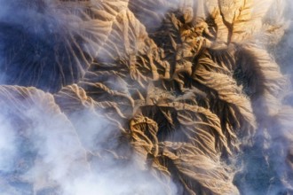
Stunning aerial photograph captures the intricate,...
BRK26C93_028
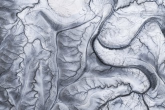
This stunning aerial image captures the intricate,...
BRK26C95_290
A stunning drone photograph capturing the layered ...
BRK26C70_354
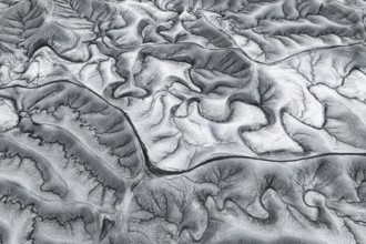
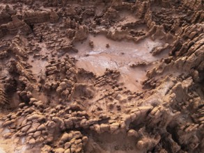
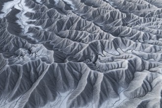
Aerial photograph showcasing the intricate texture...
BRK26C85_235
Aerial view capturing the mystical landscape of Go...
BRK26C90_098
Stunning aerial shot capturing the intricate, text...
BRK26C94_363
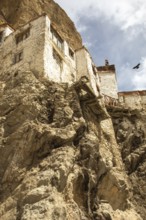
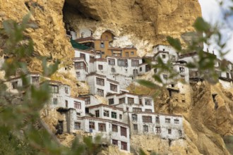
Phugtal Monastery, set against dramatic cliffs in ...
BRK26C84_062
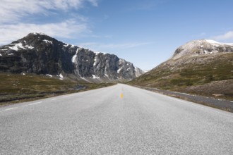
Experience the breathtaking scenery of Norway with...
BRK26C89_229
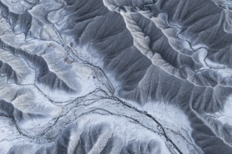
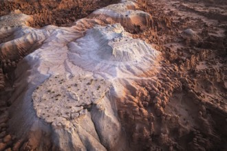
Aerial view showcasing a striking example of gully...
BRK26C99_407
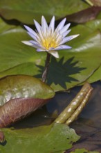
Blue Lotus (Nymphaea caerulea), South Luangwa Nati...
BRK26D00_036
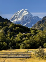
Stunning autumn landscape of Mount Cook, New Zeala...
BRK26C73_218
A captivating aerial shot of the unique and intric...
BRK26C75_420
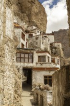
Phugtal Monastery, nestled in Ladakh's rugged clif...
BRK26C77_180
An aerial view showcases rocky mountain formations...
BRK26C81_468
Phugtal Gompa, a stunning Buddhist monastery nestl...
BRK26C95_178
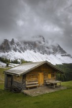
Charming wooden huts scattered across lush green m...
BRK26D01_440
Aerial view captures the diverse landscape of Cant...
BRK26C71_111
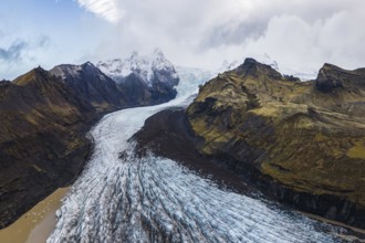
Stunning aerial capture of Vatnajökull Glacier win...
BRK26C72_325
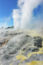
Prince of Wales and Pohutu geysers erupting, Te Pu...
BRK26C74_436
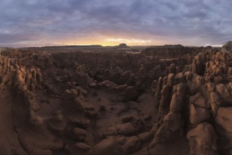
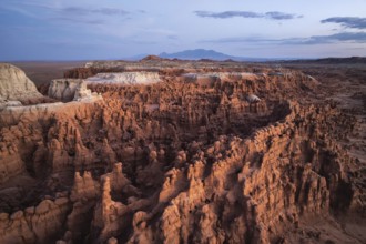
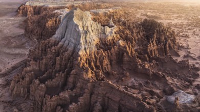
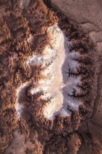
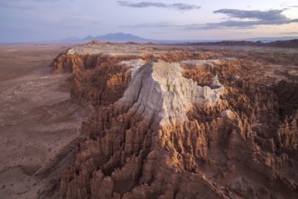
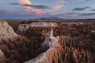
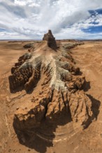
Captivating aerial shot of Goblin Valley State Par...
BRK26C87_201
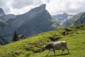
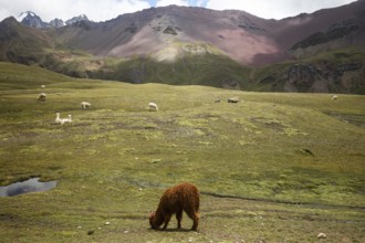
Alpaca and alpacas graze peacefully in the vibrant...
BRK26C93_180
A captivating aerial shot of the textured, rocky f...
BRK26C57_038
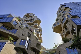
High-rise building The Valley, architects MVRDV, Z...
BRK26C60_007
Drone image, residential buildings, view of the vi...
BRK26C60_218
Scenic landscape showing st. Magdalena church in v...
BRK26C60_387
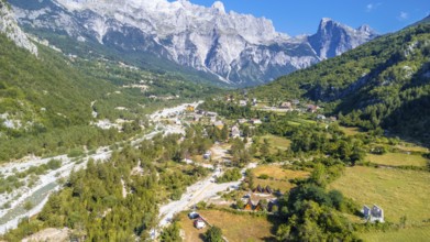
Aerial drone view of the valley of Theth national ...
BRK26C61_368
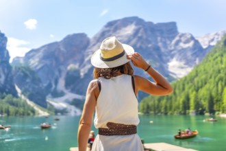
Woman wearing summer hat enjoying stunning landsca...
BRK26C68_337
Stunning aerial photograph capturing Goblin Valley...
BRK26C74_228
Captivating aerial view showcasing the intricate a...
BRK26C70_318
Captivating aerial shot capturing the intricate an...
BRK26C70_349
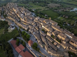
Aerial view of Treia, Italy, highlighting its rema...
BRK26C71_375
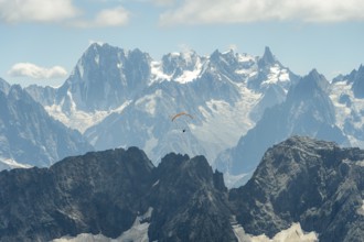
A lone paraglider glides gracefully above the rugg...
BRK26C75_197
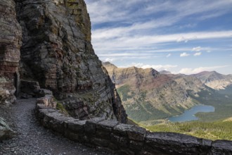
Rugged mountain landscape of Glacier National Park...
BRK26C80_187
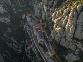
An aerial view of the Montserrat Abbey in Cataloni...
BRK26C84_439
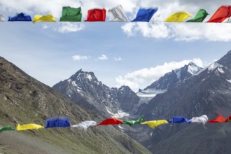
Colorful prayer flags flutter in the foreground, s...
BRK26D04_391
Aerial view of rugged mountain peaks partially cov...
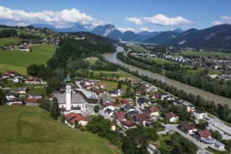
BRK26C60_276
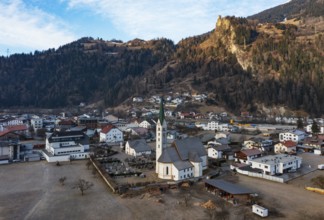
Drone image, view of village with parish church, B...
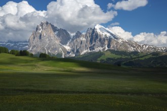
BRK26C70_240
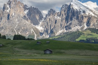
Alpe di Siusi in the Dolomites mountains of Italy ...
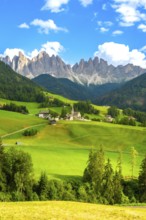
BRK26C86_368
Green meadows and santa maddalena church under the...
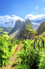
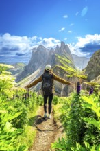
BRK26C58_197
Scenic hiking path winds through lush vegetation, ...
BRK26C77_052
Far reaching view from a vantage point over a rive...

BRK26C87_384
Tourist standing on a tree stump, admiring the stu...
BRK26C90_497
View of a part of the Geisler group from the Gampe...
- Page
-
- sur
- 130