412 résultats pour : flood dams
- Page
-
- sur
- 5
Connectez-vous pour plus de résultats
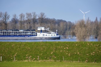
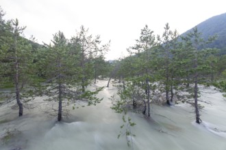
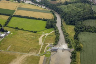
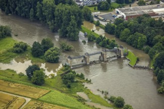
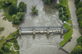
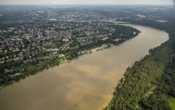
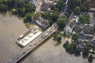
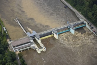
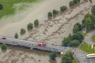
BRK26C09_166
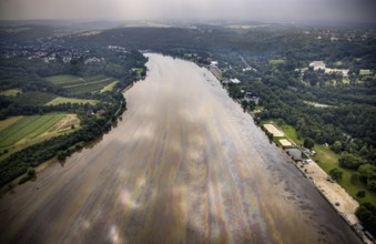
Floods on the Rhine, Lower Rhine near Xanten, Bisl...
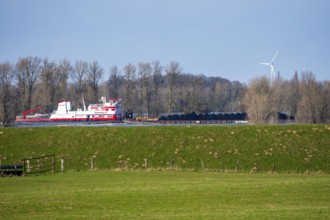
BRK26C09_171
Schubverband HGK Herkules II, coal for the steel i...
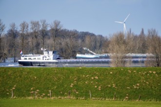
BRK26C09_187
Floods on the Rhine, Lower Rhine near Xanten, heig...
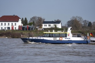
BRK26C09_188
Boat of the North Rhine-Westphalia Water Protectio...
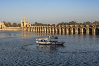
BRK26B54_495
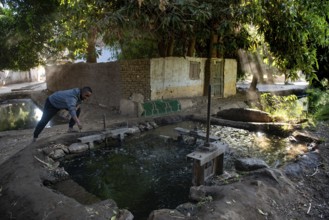
Qanater, Nile Delta. Egypt. December 18th 2022 An ...
BRK26B54_498
Qanater, Nile Delta. Egypt. December 18th 2022 Egy...
BRK26B54_489
Qanater, Nile Delta. Egypt. December 18th 2022 Egy...
BRK26B54_497
Qanater, Nile Delta. Egypt. December 18th 2022 An ...
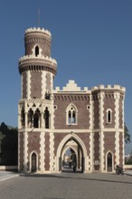
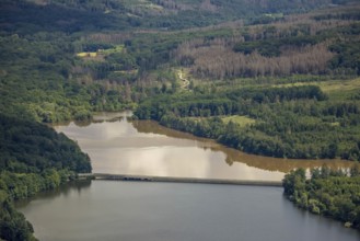
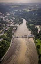
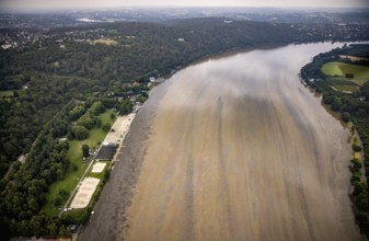
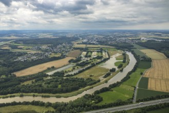
BRK26C47_054
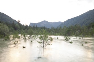
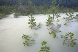
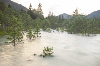
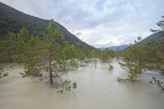
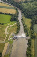
The Isar carries floods between Lake Sylvenstein a...
BRK26B55_005
Qanater, Nile Delta. Egypt. December 18th 2022 The...
BRK26B54_494
Qanater, Nile Delta. Egypt. December 18th 2022 El ...
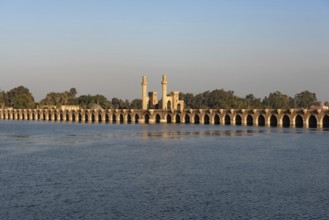
BRK26B55_001
Qanater, Nile Delta. Egypt. December 18th 2022 Arc...
BRK26B54_493
Qanater, Nile Delta. Egypt. December 18th 2022 Day...
BRK26B54_499
Qanater, Nile Delta. Egypt. December 18th 2022 A t...
BRK26B55_003
Qanater, Nile Delta. Egypt. December 18th 2022 Arc...
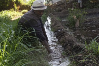
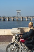
BRK26B66_406
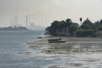
Aswan, Egypt. 9th December 2020 A Nubian farmer cl...
BRK26B66_409
Aswan, Egypt. 9th December 2020 A Nubian man contr...
BRK26B54_500
Qanater, Nile Delta. Egypt. December 18th 2022 The...
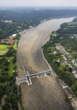
BRK26C00_236
The Isar carries floods between Lake Sylvenstein a...
BRK26B55_002
Qanater, Nile Delta. Egypt. December 18th 2022 A h...
BRK26A85_495
The Isar carries floods between Lake Sylvenstein a...
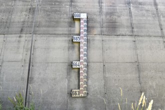
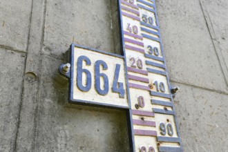
BRK26A33_341
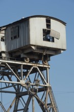
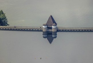
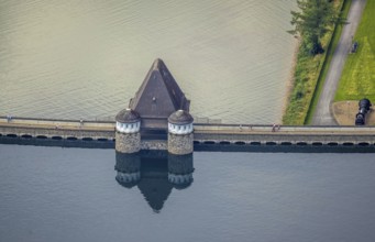
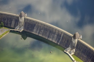
Water level gauge on dam wall at Schwarzenbachtals...
BRK26A25_498
The Isar carries floods between Lake Sylvenstein a...
BRK25M72_431
The Isar carries floods between Lake Sylvenstein a...
BRK25M39_144
The Isar carries floods between Lake Sylvenstein a...
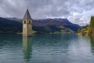
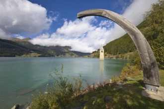
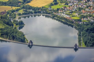
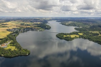
BRK25M17_462
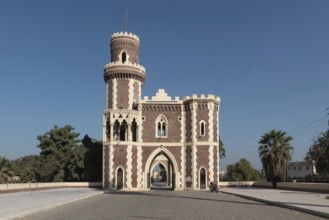
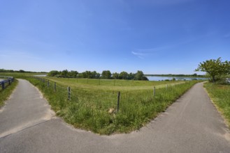
Church tower in Lake Reschen, Graun, Reschen, Vins...
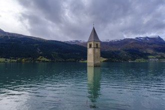
BRK25L92_218
Church tower in Lake Reschen, Graun, Reschen, Vins...
BRK25K70_041
Overflows are used to drain water from Lake Resia ...

BRK25K70_062
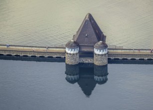
The church tower standing in Lake Reschen is the b...
BRK25K70_063
Old Grauner church tower in Lake Resia under a woo...
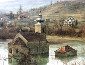
BRK25K17_337
BIH, Tuzla, 01.01.1996 -- A flooded church in the ...
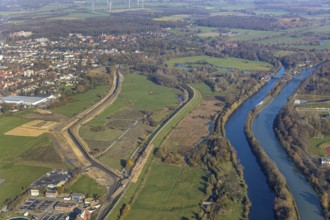
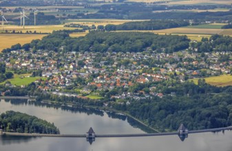
BRK25K48_488
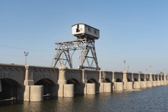
Aerial view, dam course, new Lippe dam, Lippe reco...
BRK25K48_489
Aerial view, dam course, new Lippe dam, Lippe reco...
BRK25J80_343
Close up of water level gauge on dam wall at Schwa...
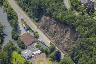
BRK25J61_268
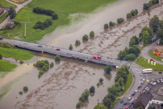
Dortmund, Castrop-Rauxel, North Rhine-Westphalia, ...
BRK25J61_267
Dortmund, Castrop-Rauxel, North Rhine-Westphalia, ...
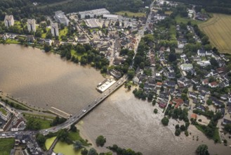
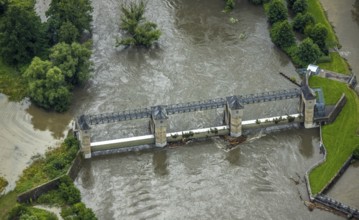
BRK25J22_031
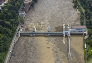
Aerial view, flood after heavy rainfall, Möhne dam...
BRK25J09_293
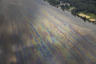
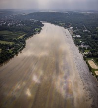
Aerial photo, Ruhr flood, flood after heavy rainfa...
BRK25J09_441
Aerial photo, Ruhr flood, flooding, Lake Baldeney ...
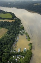
BRK25J09_450
Aerial photo, Ruhr flood, flooding, Lake Baldeney ...
BRK25J34_453
Aerial photo, Ruhr flood, flooding, Lake Baldeney ...
BRK25J22_030
Aerial view, flood after heavy rainfall, Möhne dam...

BRK25J09_440
Aerial photo, Ruhr flood, flooding, Lake Baldeney ...

BRK25J09_448
Aerial photo, Ruhr flood, flooding, Lake Baldeney ...
BRK25J10_064
Aerial photo, Ruhr flood, flood after heavy rainfa...
BRK25J34_413
Aerial photo, Ruhr flood, flooding, Lake Baldeney ...
BRK25J22_029
Aerial view, flood after heavy rainfall, Möhne dam...

BRK25J10_060
Aerial photo, Ruhr flood, flood after heavy rainfa...
BRK25J10_070
Aerial photo, Ruhr flood, barrage Ense Wickede, fl...
BRK25J10_087
Aerial view, flood after heavy rainfall, Möhne dam...
BRK25J34_412
Aerial photo, Ruhr flood, flooding, Lake Baldeney ...
BRK25J38_204
Aerial view, flood after heavy rainfall, Niederens...
BRK25J22_032
Aerial view, flood after heavy rainfall, Möhne dam...

BRK25J10_063
Aerial photo, Ruhr flood, flood after heavy rainfa...

BRK25J10_069
Aerial photo, Ruhr flood, barrage Ense Wickede, fl...
BRK25J10_086
Aerial view, flood after heavy rainfall, Möhne dam...

BRK25J10_401
Aerial photo, Ruhr flood, flood after heavy rainfa...
BRK25J34_454
Aerial photo, Ruhr flood, flooding, Lake Baldeney ...
BRK25J22_025
Aerial view, flood after heavy rainfall, Möhne dam...
BRK25J10_067
Aerial view, Ruhr flood, flood after heavy rainfal...
BRK25J21_491
Aerial view, flood after heavy rainfall, Möhne dam...
BRK25J34_452
Aerial photo, Ruhr flood, flooding, Lake Baldeney ...
BRK25J10_068
Aerial photo, Ruhr flood, barrage Ense Wickede, fl...
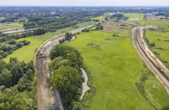
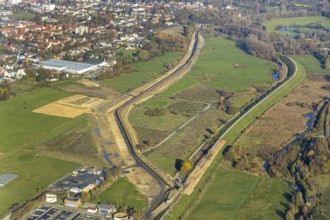
BRK25J34_151
Aerial view, New course of the flood dyke between ...
BRK25J34_451
Aerial photo, Ruhr flood, flooding, Lake Baldeney ...
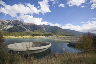
BRK25J42_401
Reservoir Alfsee, flood protection, flood retentio...
BRK25J22_027
Aerial view, flood after heavy rainfall, Möhne dam...
BRK25J10_065
Aerial photo, Ruhr flood, flood after heavy rainfa...
BRK25J21_490
Aerial view, flood after heavy rainfall, Möhne dam...
BRK25J34_420
Aerial photo, Ruhr flood, flooding, Lake Baldeney ...
BRK25J34_445
Aerial photograph, Ruhr flood, flooding, Kettwig d...
BRK25J34_458
Aerial photo, Ruhr flood, flooding, Lake Baldeney ...
BRK25J42_388
Alfsee reservoir, flood protection, flood retentio...

BRK25J22_026
Aerial view, flood after heavy rainfall, Möhne dam...
BRK25J22_033
Aerial view, flood after heavy rainfall, Möhne dam...
BRK25J10_066
Aerial photo, Ruhr flood, flood after heavy rainfa...
BRK25J34_414
Aerial photograph, Ruhr flood, flooding, Kettwig d...
BRK25J34_421
Aerial photo, Ruhr flood, flooding, Lake Baldeney ...

BRK25J34_457
Aerial photo, Ruhr flood, flooding, Lake Baldeney ...
BRK25J09_453
Aerial photo, Ruhr flood, flooding, Lake Baldeney ...

BRK25J09_456
Aerial photo, Ruhr flood, flooding, Lake Baldeney ...
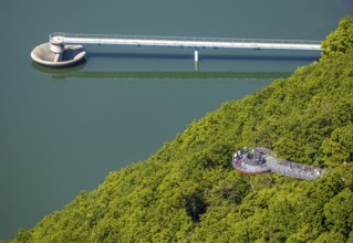
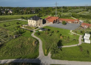
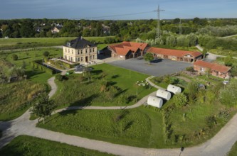
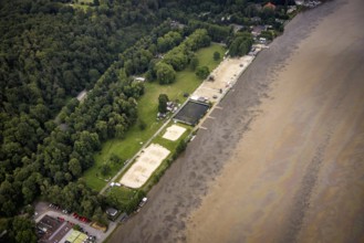
BRK25J05_422
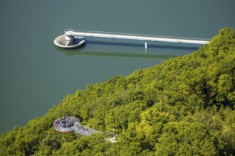
Aerial view, forest area, Biggeblick viewing platf...

BRK25J10_036
Aerial view, flood after heavy rainfall, Möhne dam...

BRK25J10_085
Aerial view, flood after heavy rainfall, Möhne dam...

BRK25J10_435
Aerial photo, Ruhr flood, flood after heavy rainfa...
BRK25J34_450
Aerial photo, Ruhr flood, flooding, Lake Baldeney ...
BRK25J34_456
Aerial photo, Ruhr flood, flooding, Lake Baldeney ...
BRK25J38_203
Aerial view, Ruhr flood, flood after heavy rainfal...

BRK25J09_449
Aerial photo, Ruhr flood, flooding, Lake Baldeney ...
BRK25J09_452
Aerial photo, Ruhr flood, flooding, Lake Baldeney ...

BRK25J10_082
Aerial view, flood after heavy rainfall, Niederens...

BRK25J10_092
Aerial view, flood after heavy rainfall, Möhne dam...
BRK25J10_434
Aerial photo, Ruhr flood, flood after heavy rainfa...
BRK25J34_426
Aerial photo, Ruhr flood, flooding, Lake Baldeney ...
BRK25J34_455
Aerial photo, Ruhr flood, flooding, Lake Baldeney ...
BRK25J38_202
Aerial photo, Ruhr flood, barrage Ense Wickede, fl...

BRK25J09_294
Aerial view, flood after heavy rainfall, Möhne dam...

BRK25J09_443
Aerial photo, Ruhr flood, flooding, Lake Baldeney ...

BRK25J09_447
Aerial photo, Ruhr flood, flooding, Lake Baldeney ...
BRK25J05_420
Aerial view, forest area, Biggeblick viewing platf...
- Page
-
- sur
- 5