1958 résultats pour : border region
- Page
-
- sur
- 20
Connectez-vous pour plus de résultats
BRK26C60_220
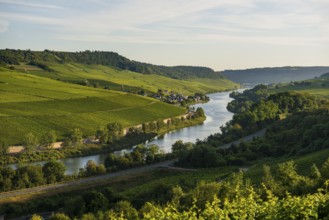
River and vineyards, border to Lichtenstein, Winch...
BRK26C65_031
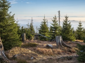
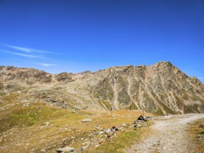
View from the Hochkammweg on the border to the Cze...

BRK26C60_002
Polish Foreign Minister Radoslaw Sikorski at a joi...
BRK26C67_317
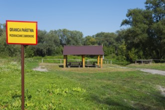
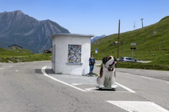
Border sign and wooden shelter in a green park wit...
BRK26C61_463
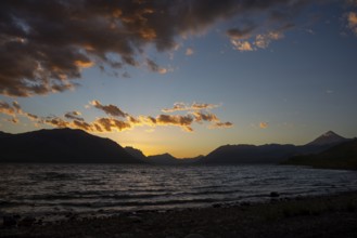
Sunset at Lago Huechulafquen with the Lanin volcan...
BRK26C90_349
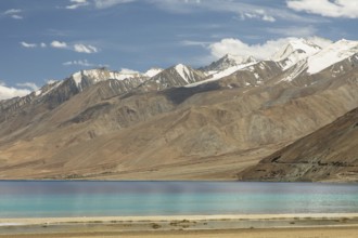
Beautiful view of Pangong Tso lake in Ladakh, Indi...
BRK26C82_382
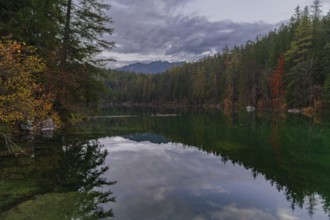
A tranquil lake in the Bavarian Alps, Eibsee, refl...
BRK26C85_153
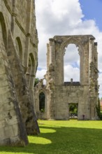
Walkenried Abbey is a former Cistercian abbey in W...
BRK26C79_391
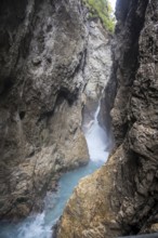
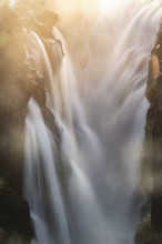
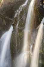
Waterfall trail at the Leutaschklamm gorge in the ...
BRK26C60_305
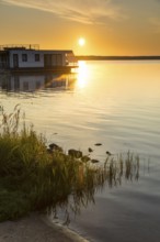
Sunrise at the floating houses on Gräbendorfer See...
BRK26C64_437
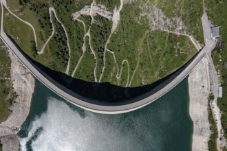
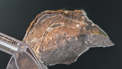
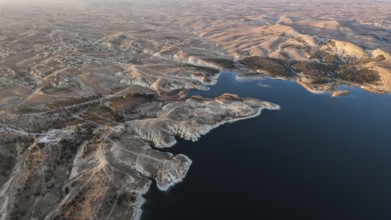
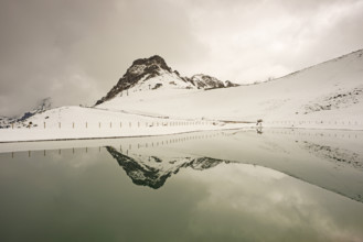
Aerial view of the dam wall at Lago di Lei in the ...
BRK26C77_457
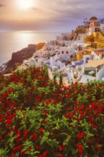
Scenic sunset over sea and picturesque Oia town on...
BRK26C04_002
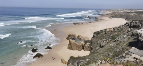
Rocky cliffs border an extensive sandy beach by th...
BRK26C37_425
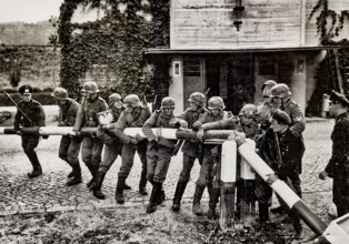
German troops storm the Polish border, propaganda ...
BRK26C41_028
In northeast Syria on January 19, 2026, the Syrian...
BRK26C16_392
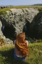
Back view of an unrecognizable redhead woman sitti...
BRK26C29_494
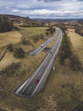
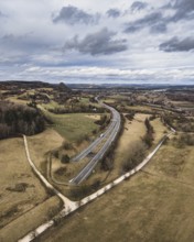
The A81 motorway passes through the 782 meter long...
BRK26C21_371
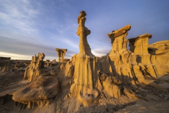
Stunning sandstone formations in Bisti De-Na-Zin W...
BRK26C06_385
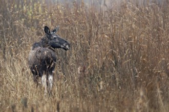
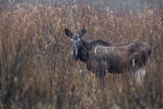
Moose cow (Alces alces) in a reed belt, rutting se...
BRK26C06_386
A cow moose (Alces alces) foraging in a reed belt,...

BRK26C06_406
After three days of intensive searching, I discove...

BRK26C06_387
Slowly the cow moose (Alces alces) retreats into t...
BRK26B78_334
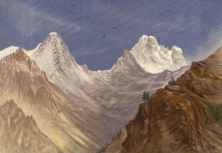
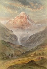
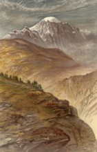
Monte Viso, seen from Col de la Croix, around 1860...
BRK26B78_314
Monte Viso, seen from the south, around 1860, the ...
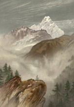
BRK26B78_324
Pointe de Tenneverge, Pic de Tenneverge, around 18...
BRK26B56_136
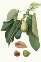
Fico della Lunigiana, a specific type of fig that ...
BRK26B65_482
The A81 motorway passes through the 782 meter long...
BRK26B76_326
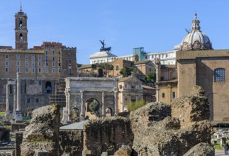
View of Roman Forum, in front ruin of temple of th...
BRK26B81_480
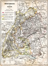
Colored topographic map of the Kingdom of Würtembe...
BRK26B55_243
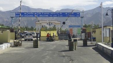
Entrance to Leh with a welcome sign and views of t...
BRK26B78_236
Mont Vélan rises on the border between the Aosta V...
BRK26B89_119
In northeast Syria on January 19, 2026, the Syrian...
BRK26B79_355
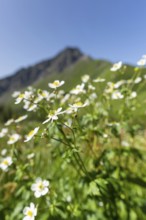
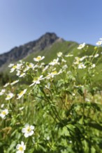
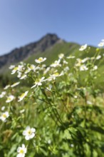
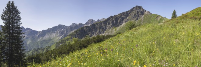
Mountain panorama with white alpine anemones (Puls...
BRK26B51_473
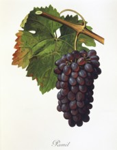
Ampelography, grape variety, oenology, viticulture...
BRK26B21_249
In northeast Syria on January 19, 2026, the Syrian...
BRK26B06_141
Mountain panorama with white alpine anemones (Puls...
BRK26B38_351
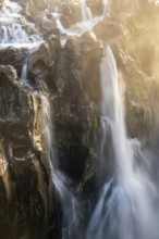
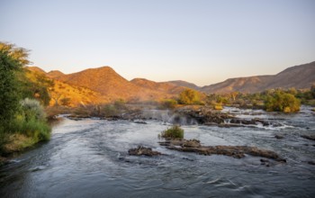
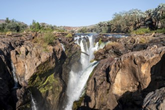
Epupa Falls, sunset at Epupa Waterfalls, Kaokoveld...
BRK26B06_139
Alpine rose blossom, panorama from the Fellhorn, b...
BRK26B08_218
Alpine rose blossom, panorama from the Fellhorn, b...
BRK26B32_176
A blooming garden with palm trees and colorful flo...
BRK26B08_213
Mountain panorama with white alpine anemones (Puls...
BRK26B38_352
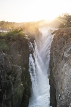
Detail, Epupa Falls, Water at Epupa Waterfalls, Ka...
BRK26A97_387
Former anti-tank ditch from the 2nd World War, Wes...
BRK26A57_146
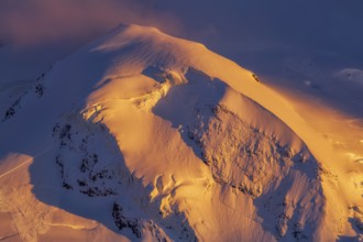
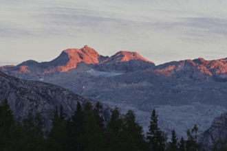
Pollux (4, 092?m -13, 425?ft) at sunset in winter,...
BRK26A57_258
Winter morning at Monte Rosa Hut (2, 883?m), alpin...
BRK26A54_139
In northeast Syria on January 19, 2026, the Syrian...
BRK26A87_309
Detail, Epupa Falls, Water at Epupa Waterfalls, Ka...
BRK26A87_307
Epupa Falls, sunset at Epupa Waterfalls, Kaokoveld...
BRK26A87_308
Epupa Falls, sunset at Epupa Waterfalls, Kaokoveld...
BRK26A83_005
Another onset of winter in May, Kanzelwand, 2058m,...
BRK26A57_254
Sunset at Monte Rosa Hut (2, 883?m), alpine refuge...

BRK26B00_037
Former Foreign Minister Joschka fisherman during a...

BRK26B00_036
Polish Foreign Minister Radoslaw Sikorski at a joi...
BRK26A41_276
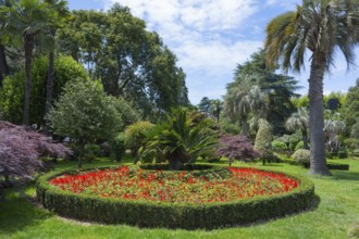
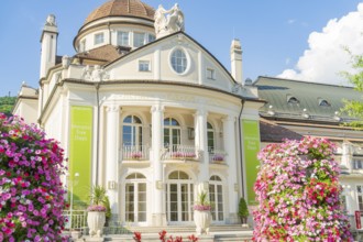
A magnificent baroque building with flowerbeds and...
BRK26A09_434
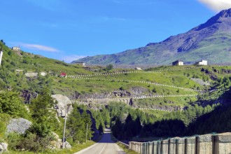
Road from in Italy just in front of the border wit...
BRK26A41_293
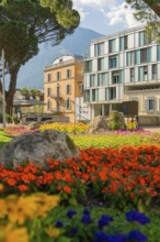
Colourful flower beds in front of a modern buildin...
BRK26A32_083
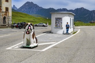
Disused former border hut for passport control at ...
BRK26A39_426
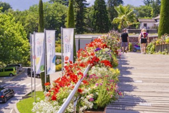
Flowerbeds along a wooden path with flags and walk...
BRK26A43_132
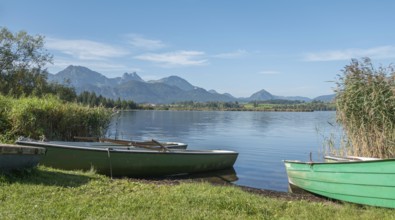
Rowing boats on Lake Hopfensee, Hopfen am See, nea...
BRK26A11_408
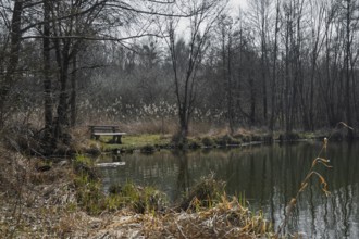
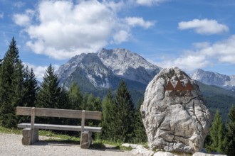
Bench and symbol of the Berchtesgaden National Par...
BRK26A27_349
Detail, Epupa Falls, Water at Epupa Waterfalls, Ka...

BRK26A27_350
Epupa Falls, sunset at Epupa Waterfalls, Kaokoveld...
BRK26A37_461
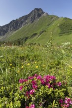
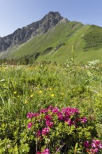
Panorama over a mountain flower meadow in front of...
BRK26A10_126
Residential and commercial buildings, houses, gene...
BRK26A11_411
The summit of the Hochkönig with the Matrashaus in...
BRK26A51_365
In the High Fens... impressive, wide, strictly pro...
BRK26A06_420
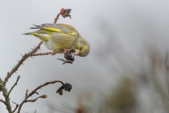
A male greenfinch (Chloris chloris) has opened the...
BRK26A31_121
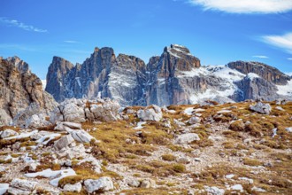
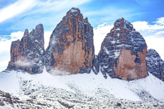
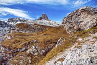
The Three Peaks in the Sesto Dolomites on the bord...
BRK26A27_351
Epupa Falls, sunset at Epupa Waterfalls, Kaokoveld...

BRK26A51_214
Polish Foreign Minister Radoslaw Sikorski at a joi...

BRK26A51_215
Former Foreign Minister Joschka fisherman during a...
BRK25M04_027
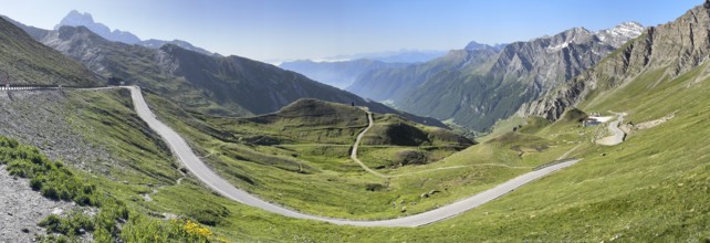
Steinerne Hütte at the Timmelsjoch rest house on t...
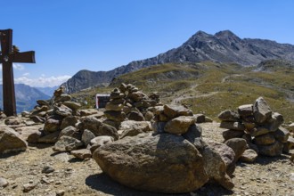
BRK25M04_029
Stone men in front of an alpine landscape at the T...
BRK25M87_236
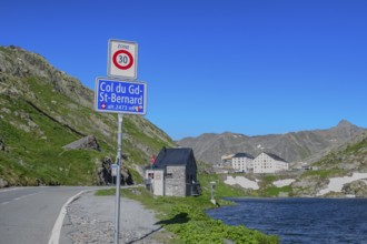
Traffic sign Speed limit sign 30 km/h below inform...
BRK25M04_024
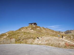
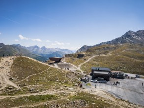
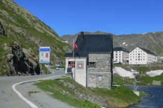
Timmelsjoch rest house on the border between Austr...
BRK25M04_022
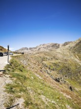
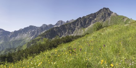
View of the high-alpine mountain landscape at the ...
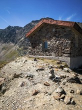
BRK25M04_026
Steinerne Hütte at the Timmelsjoch rest house on t...
BRK25M96_073
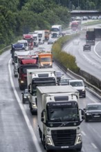
Heavy traffic, mainly lorries, on the A40 motorway...
BRK25M18_413
The Three Peaks in the Sesto Dolomites on the bord...
BRK25M52_091
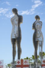
Metal figures of a woman and a man against a blue ...
BRK25M41_399
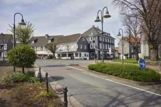
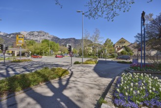
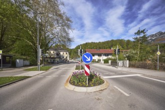
Streets, traffic lights, lantern, trees, flower be...
BRK25M41_403
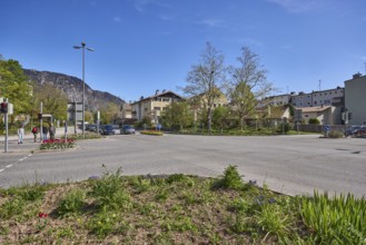
Streets, lantern, trees, general architecture, mou...

BRK25M29_482
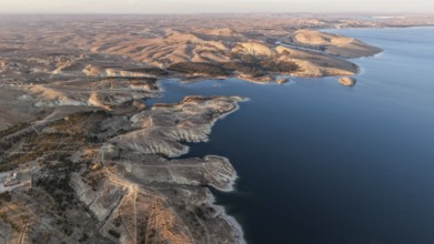
Elbow sand dunes on the coast of the German island...
BRK25M41_243
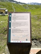
Information board on prehistoric and ancient pass ...
BRK25M41_369
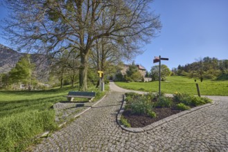
Footpath, cobblestones, bench, flowerbed, trees, l...
BRK25M41_446
Traffic island, traffic lights, pedestrian crossin...
BRK25M84_283
The Three Peaks in the Sesto Dolomites on the bord...
BRK25M87_229
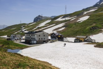
View of buildings Italian inns at the top of the L...
BRK25M87_233
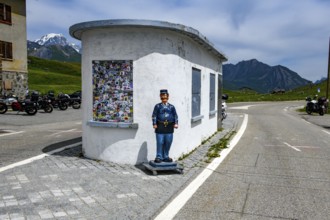
Disused former border house for passport control a...
BRK25M87_232
Disused former border hut for passport control at ...
BRK25M87_235
View of former border building on Colle del Gran S...
BRK25M65_095
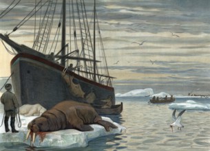
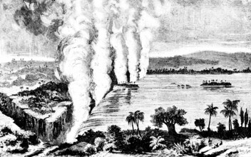
Hunting for walrus near Novaya Zemlya, a Russian t...
BRK25M91_455
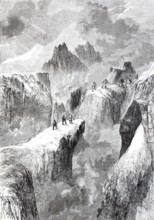
Mountaineer on Mont Blanc, 1880, on the border bet...
BRK25M54_362
The Victoria Falls of the Zambezi in the border ar...
BRK25M92_124
Panoramic view of southern ramp southern ascent mo...
BRK25M69_160
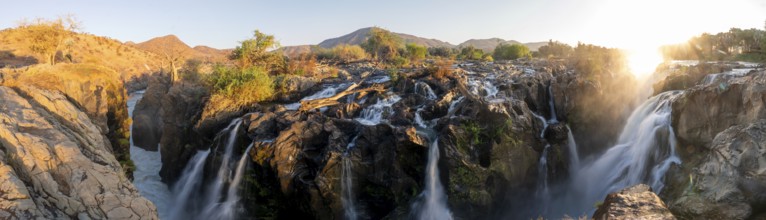
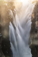
Epupa Falls waterfall on the Kunene River, Kunene,...
BRK25M72_215
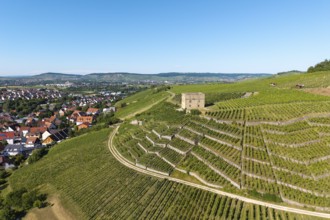
Vineyard landscape with a stone house, bordering a...
BRK25M75_181
View of the high alpine mountain landscape at the ...
BRK25M99_477
Panorama over a mountain flower meadow in front of...
BRK25M77_174
Detail, Epupa Falls, Water at Epupa Waterfalls, Ka...
- Page
-
- sur
- 20