4003 résultats pour : border area
- Page
-
- sur
- 41
Connectez-vous pour plus de résultats
BRK26C57_231
On the shore of the Scheibe-See, open-cast mining ...
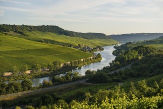
BRK26C60_220
River and vineyards, border to Lichtenstein, Winch...
BRK26C64_270
Rowing boat lying in the reeds at the old lido of ...
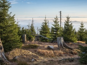
BRK26C65_031
View from the Hochkammweg on the border to the Cze...

BRK26C61_463
Sunset at Lago Huechulafquen with the Lanin volcan...
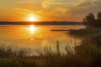
BRK26C61_037
Sunrise over the Quitzdorf dam near Kollm, Upper L...
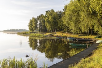
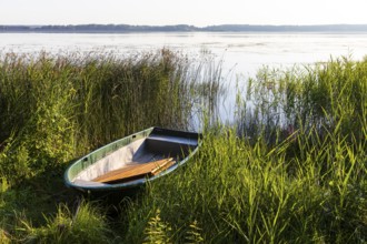
BRK26C62_419
Rowing boats moored at the old lido of the Quitzdo...

BRK26C75_341
Grey heron (Ardea cinerea), also heron, hunting, f...

BRK26C99_389
Detroit, Michigan USA -8 February 2026 - President...

BRK26C90_349
Beautiful view of Pangong Tso lake in Ladakh, Indi...
BRK26C82_382
A tranquil lake in the Bavarian Alps, Eibsee, refl...
BRK26C86_079
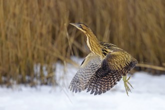
Eurasian bittern, great bittern (Botaurus stellari...
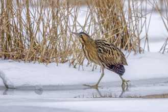
BRK26C87_283
Eurasian bittern, great bittern (Botaurus stellari...
BRK26C85_153
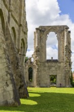
Walkenried Abbey is a former Cistercian abbey in W...
BRK26C79_391
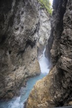
Waterfall trail at the Leutaschklamm gorge in the ...

BRK26C68_419
Sunset, morning light with big brown bear walking ...

BRK26C74_010
Little Japanese garden after rain, Park Clingendae...

BRK26C89_129
Colourful blooming tulips (tulpia) in a field for ...

BRK26C60_305
Sunrise at the floating houses on Gräbendorfer See...

BRK26C97_321
In Southern Yemen on February 5, 2026, the Saudi-b...

BRK26C57_151
Brown Bear (Ursus arctos), border area to Russia, ...
BRK26C87_058
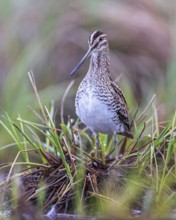
Common snipe (Gallinago gallinago) or marsh snipe....
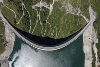
BRK26C64_437
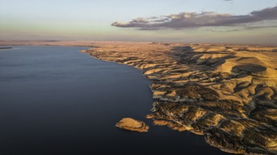
Aerial view of the dam wall at Lago di Lei in the ...

BRK26C77_457
Scenic sunset over sea and picturesque Oia town on...
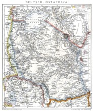
BRK26C85_186
Map of the former German colony of East Africa, 18...
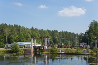
BRK26C64_241
Lock with bridge and neighbouring building in fore...
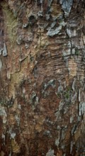
BRK26C18_003
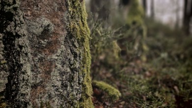
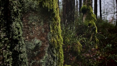
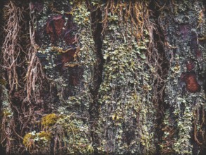
Close-up of tree bark with complex patterns and ea...

BRK26C28_285
Detroit, Michigan USA -8 February 2026 - President...
BRK26C41_264
Waterloo Monument over Scottish fields and farms, ...
BRK26C18_019
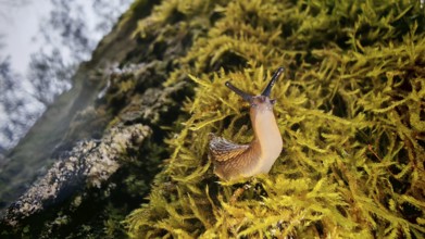
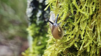
A snail (cochlea) crawls over moss-covered ground ...
BRK26C18_008
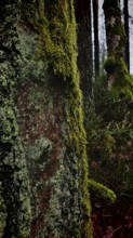
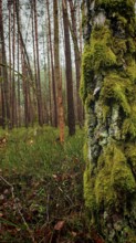
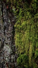
Detailed photo of moss (Bryophyta) on a tree bark ...
BRK26C18_001
A snail (cochlea) crawls over a mossy (bryophyta) ...
BRK26C17_500
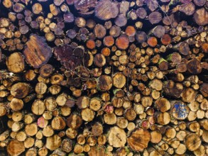
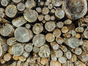
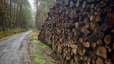
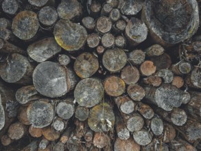
Close-up of a pile of wood in the forest, differen...
BRK26C18_011
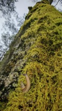
A close-up of a tree trunk covered with moss (bryo...
BRK26C18_018
Close-up of a snail (cochlea) crawling over moss (...
BRK26C04_002
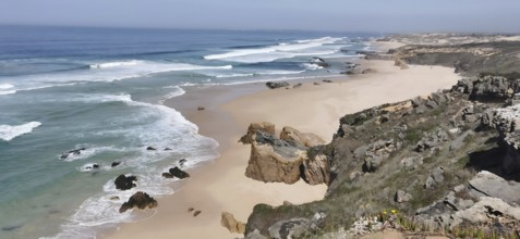
Rocky cliffs border an extensive sandy beach by th...

BRK26C18_002
A snail (cochlea) in close-up crawls up a moss-cov...
BRK26C18_012
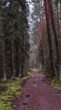
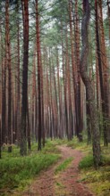
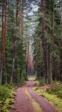
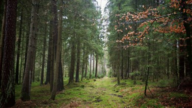
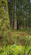
A winding path meanders through a pine forest (pin...

BRK26C18_017
A snail (cochlea) on a moss-covered tree trunk, na...
BRK26C18_009
Close-up of a tree trunk with green moss (Bryophyt...
BRK26C18_010
A moss-covered (Bryophyta) tree trunk in front of ...
BRK26C18_005
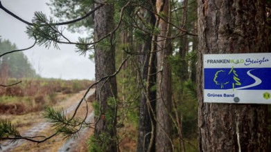
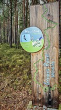
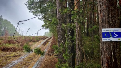
A sign on the Frankenwaldsteigla on a tree marks a...

BRK26C18_015
View through a pine forest (pinus) with grassy gro...
BRK26C18_004
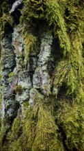
Close-up of tree bark richly covered with moss (Br...
BRK26C44_096
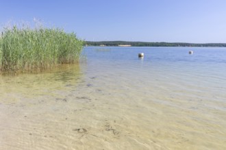
Autumn morning fog on the reed belt on the shores ...
BRK26C18_007
A moss-covered (Bryophyta) tree in the foreground ...
BRK26C18_013
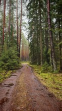
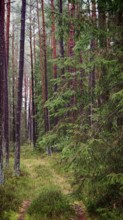
A forest path leading through a pine forest (pinus...
BRK26C18_006
A narrow path winds through a dense pine forest (p...
BRK26C37_425
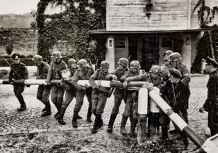
German troops storm the Polish border, propaganda ...
BRK26C18_059
Narrow path through the forest, flanked by tall pi...

BRK26C19_255
Vienna, Austria. October 5th 2023 Palais Pallavici...
BRK26C18_310
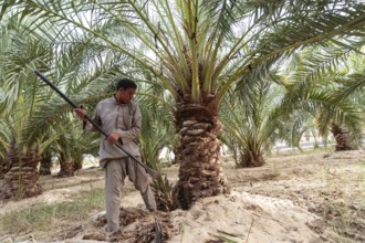
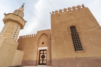
Siwa Oasis, Egypt. March 14th 2018 A Local Siwian ...
BRK26C26_354
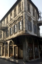
Antakya, Turkey. December 23rd 2013 Faded Architec...
BRK26C41_028
In northeast Syria on January 19, 2026, the Syrian...
BRK26C18_024
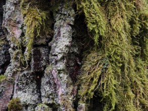
Dense moss structures (bryophyta) in detailed clos...
BRK26C18_045
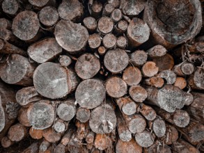
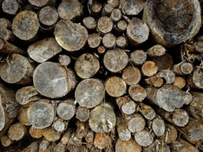
Stacked wood with visible tree rings, natural wood...
BRK26C18_050
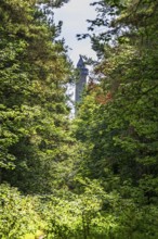
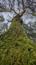
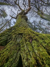
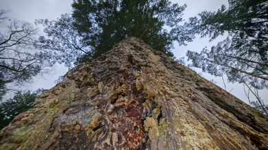
Photographic shot of a tall moss-covered tree from...
BRK26C18_025
Close-up of moss (bryophyta) on a rough tree bark ...
BRK26C18_049
Wooden sign with information about the Green Belt ...
BRK26C18_029
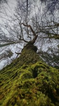
Looking up to the sky along an old, moss-covered t...

BRK26C18_065
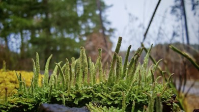
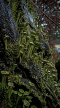
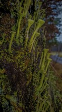
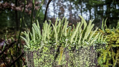
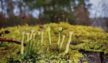
Close-up of trumpet lichens (cladonia fimbriata) g...
BRK26C18_068
Former border strip in the forest with inscribed F...

BRK26C36_113
In kobani, Syria on February 2, 2026, Syrian Gover...
BRK26C18_051
Looking from below at a moss-covered tree with wid...
BRK26C18_052
Close-up of green moss structures (bryophyta) and ...

BRK26C33_234
In Southern Yemen on February 5, 2026, the Saudi-b...
BRK26C18_034
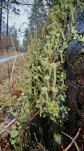
Moist trumpet lichen (cladonia fimbriata) on a tre...
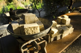
BRK26C26_337
Antakya, Turkey. December 22rd 2013 Olive Oil Soap...

BRK26C33_235
In Southern Yemen on February 5, 2026, the Saudi-b...

BRK26B74_066
Queen statue with scepter and orb surrounded by de...
BRK26C18_030
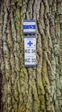
Two signs attached to rough tree bark, reference t...
BRK26C18_042
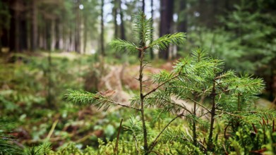
Large pine tree (pinus) from a frog's perspective ...
BRK26C18_046
Close-up of cut tree trunks showing a rustic woode...

BRK26C18_066
Portrait of trumpet lichens (cladonia fimbriata) p...
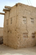
BRK26C18_302
Siwa Oasis, Egypt. March 11th 2018 Traditional Mud...
BRK26C18_044
Stacked tree trunks with clearly visible annual ri...
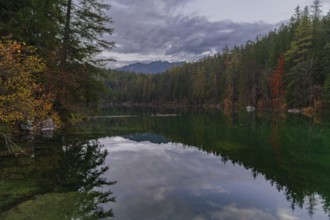
BRK26C33_163
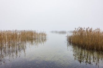
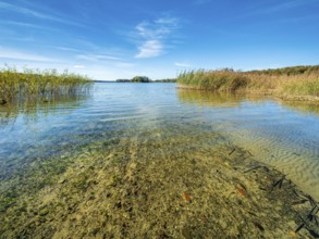
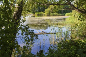
Clear lake with reed belt surrounded by forest, Pr...
BRK26C41_038
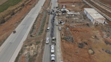
In Raqqa, Syria on January 17, 2026, the Syrian Ar...
BRK26C18_058
Close-up of mosses and trumpet lichens (cladonia f...
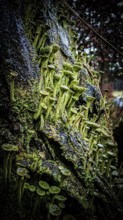
BRK26C18_061
Dense structures of moss and trumpet lichen (clado...
BRK26C33_024
Parish pond with trees and reed belt, Guttau ponds...

BRK26B89_163
In Raqqa, Syria on January 17, 2026, the Syrian Ar...
BRK26C18_053
Large pile of cut tree trunks along a muddy forest...
BRK26C18_313
Siwa Oasis, Egypt. March 11th 2018 Attractive Egyp...
BRK26C26_342
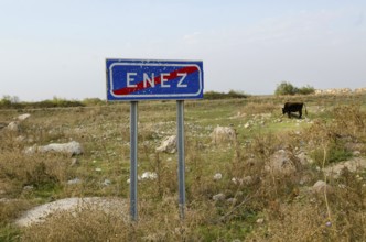
Enez, Turkey. October 15th 2013 Sign post for the ...

BRK26C54_018
Different coloured tulips (Tulipa), colourful tuli...
BRK26C18_040
A narrow forest path, flanked by tall pines (pinus...
BRK26C18_064
Green trumpet lichens (cladonia fimbriata) and mos...
BRK26C18_069
Stacks of tree trunks in various shades of gray th...

BRK26C54_038
Different coloured tulips (Tulipa), colourful tuli...
BRK26C18_054
Close-up of a small conifer tree in the middle of ...
BRK26C18_063
Close-up of luminous living tips of mosses and lic...

BRK26C18_067
Portrait of trumpet lichens (cladonia fimbriata) p...

BRK26C36_114
In Kobani, Syria, on February 1, 2026, a Syrian Go...
BRK26C18_031
Green forest trail framed by tall trees, covered b...
BRK26C18_057
Small, detailed mosses (bryophyta) and bright trum...
BRK26C54_253
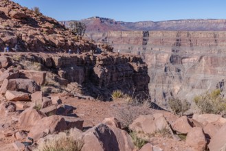
Visitors walk along the canyon rim to the location...

BRK26C18_047
Close-up of stacked tree trunks with visible annua...
BRK26C18_027
Moss-covered (bryophyta) plants on the forest floo...
BRK26C13_242
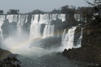
Breathtaking image capturing the powerful cascades...
- Page
-
- sur
- 41