697 résultats pour : 360 panoramic view
- Page
-
- sur
- 7
Connectez-vous pour plus de résultats
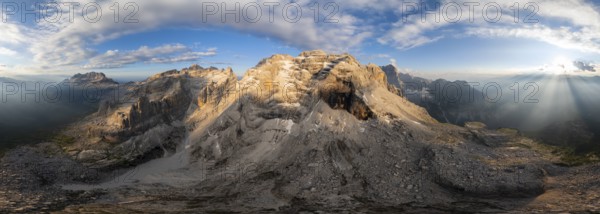
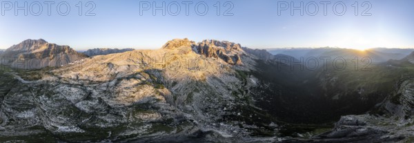
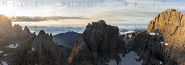
BRK26C96_050
360 degree alpine panorama, aerial view, impressiv...
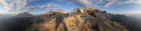
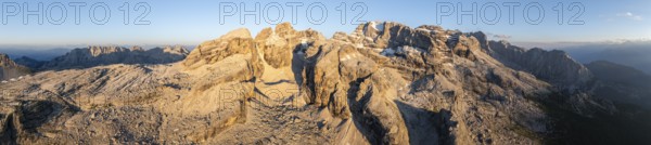
BRK26C35_199
360 degree alpine panorama, aerial view, impressiv...
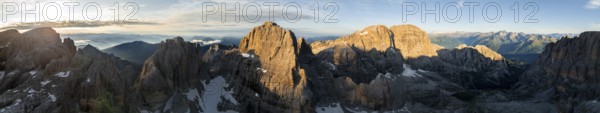
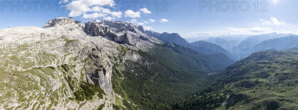
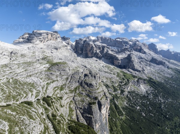
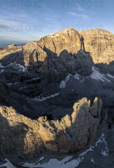
BRK26C34_085
Impressive mountain peaks of the Brenta Mountains,...
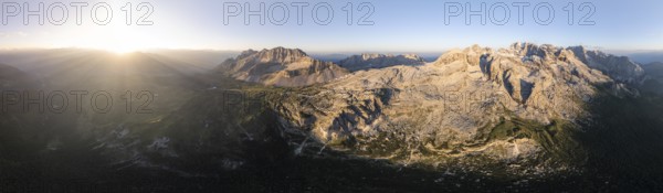
BRK26C35_215
Impressive mountain peaks of the Brenta Mountains,...
BRK26C35_202
Impressive mountain peaks of the Brenta Mountains,...
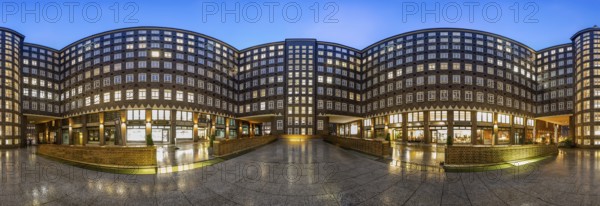
BRK26B70_357
360 degree panoramic view of the Sprinkenhof court...
BRK26B75_378
Impressive mountain peaks of the Brenta Mountains,...
BRK26B75_414
Impressive mountain peaks of the Brenta Mountains,...
BRK26B75_418
Impressive mountain peaks of the Brenta Mountains,...
BRK26B74_327
Impressive mountain peaks of the Brenta Mountains,...
BRK26B74_328
Impressive mountain peaks of the Brenta Mountains,...
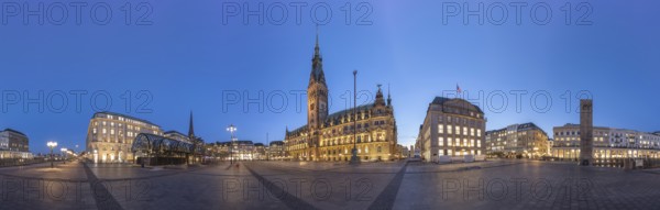
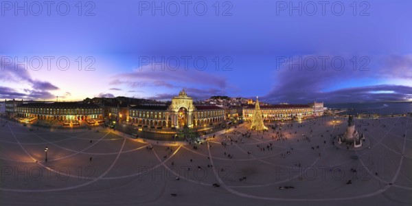
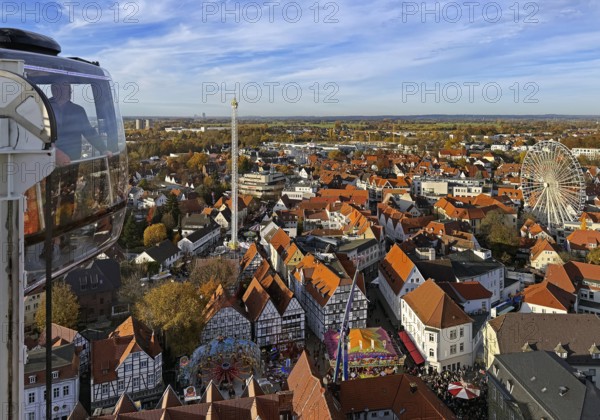
BRK26A55_107
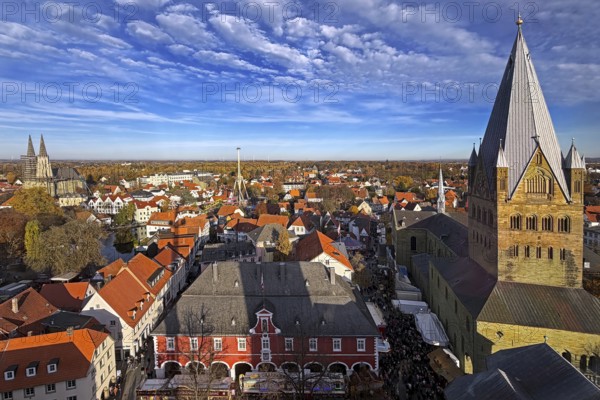
360 degree view of Rathausplatz at Blue Hour with ...
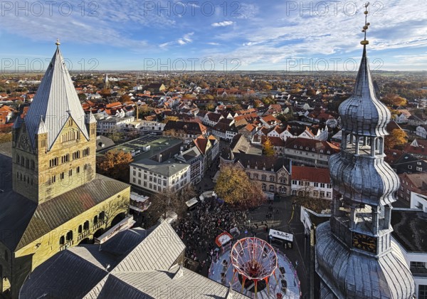
BRK26A11_007
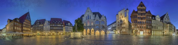
Marketplace illuminates 360 degrees of Hildesheim ...
BRK26A06_468
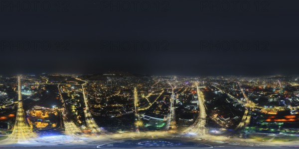
In Damascus, Syria, on December 29, 2025, a 360-de...
BRK25M93_210
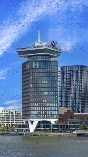
Amsterdam lookout with 360-degree views of Amsterd...
BRK25M36_211
View from above from the Look mobile Skylift 360 d...
BRK25M58_034
360 degrees aerial panorama of winter twilight at ...
BRK25L55_032
View from above from the mobile Skylift Look 360 d...
BRK25L55_022
View from above from the Look mobile Skylift 360 d...
BRK25L55_027
View from bottom to top of the Look 360 degree mob...
BRK25L55_038
View from the mobile Skylift Look 360 degree panor...
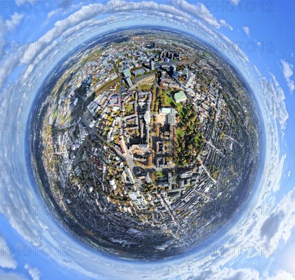
BRK25K62_480
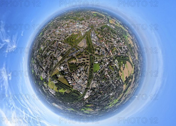
Aerial view, central station station, redesign of ...
BRK25K87_298
Aerial view, villa hill and hill park with autumna...
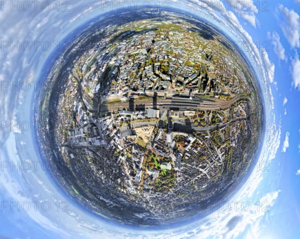
BRK25K62_485
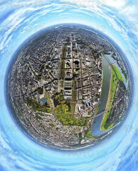
Aerial view, central station and city city center,...
BRK25K52_480
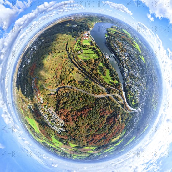
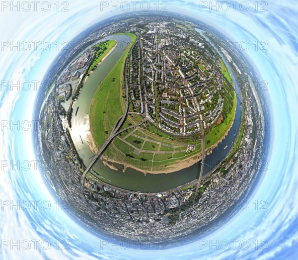
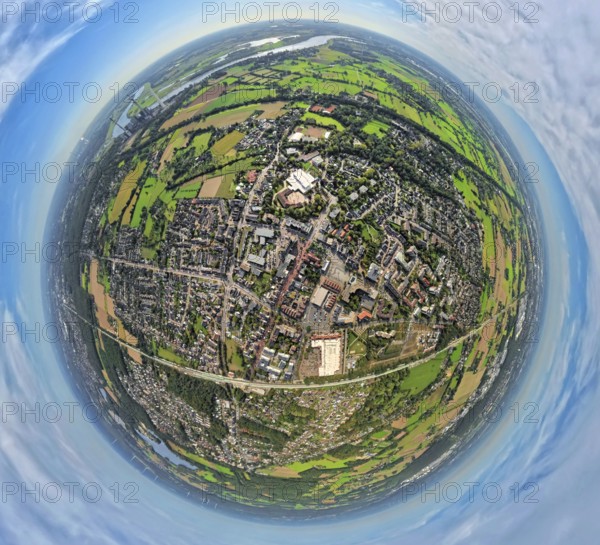
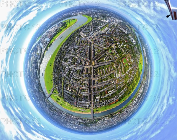
Aerial view, town view of Wesel, Rhine river and W...
BRK25K52_477
Aerial view, town view of Wesel, Rhine river and W...
BRK25K62_481
Aerial view, central station station, redesign of ...
BRK25K87_307
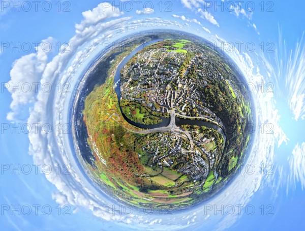
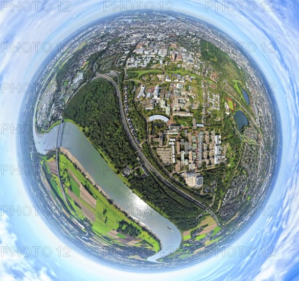
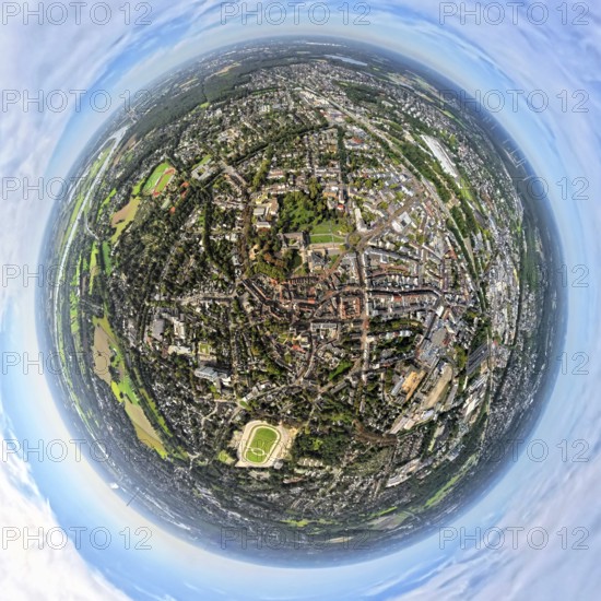
Aerial view, residential area town view Werden dis...
BRK25K87_318
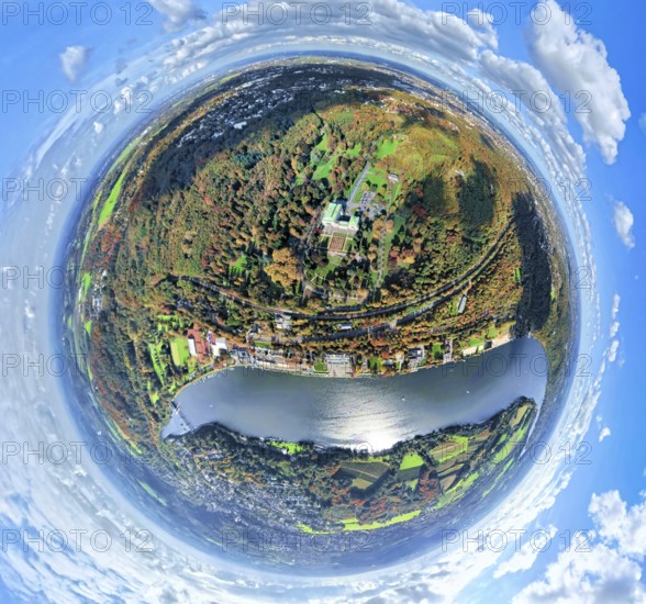
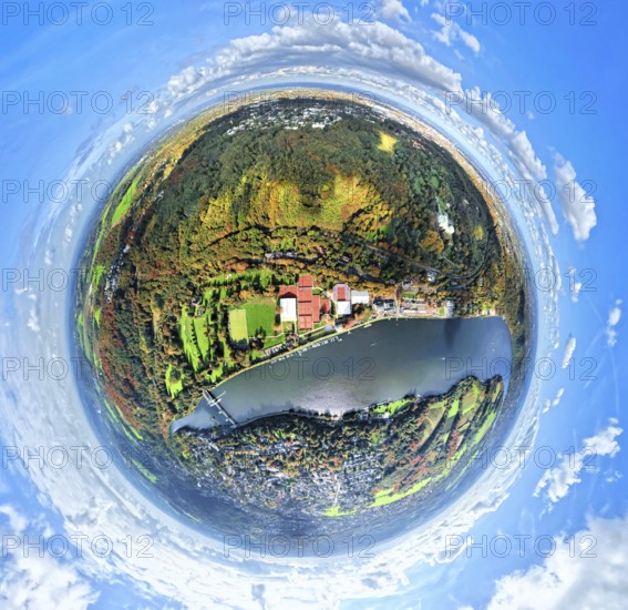
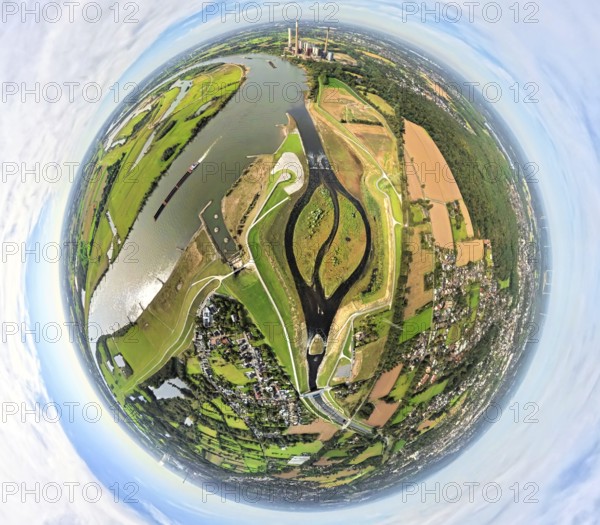
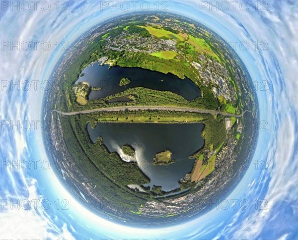
Aerial view, Lake Baldeney with dam RWE hydroelect...
BRK25K87_270
Aerial view, Lake Baldeney with dam RWE hydroelect...
BRK25K87_313
Aerial view, residential area town view Werden dis...
BRK25J73_122
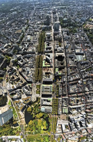
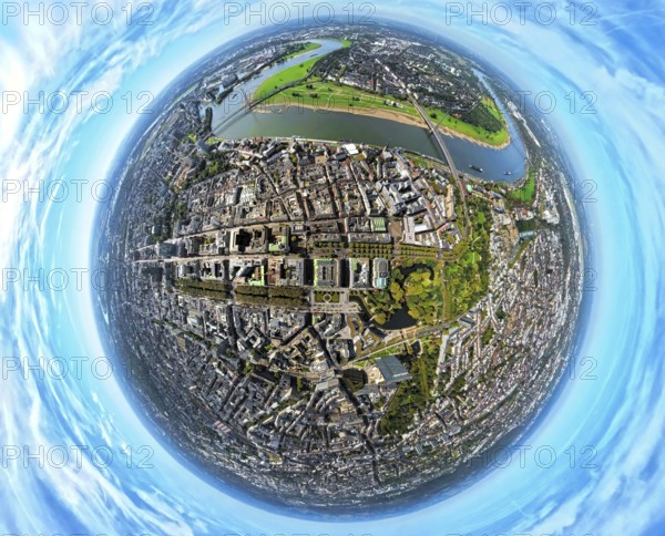
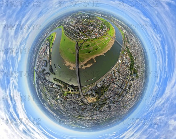
Aerial view, Königsallee with tree avenue, city ce...
BRK25J81_394
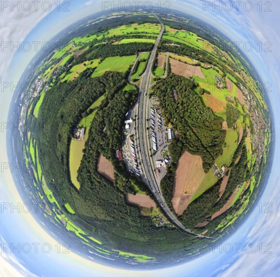
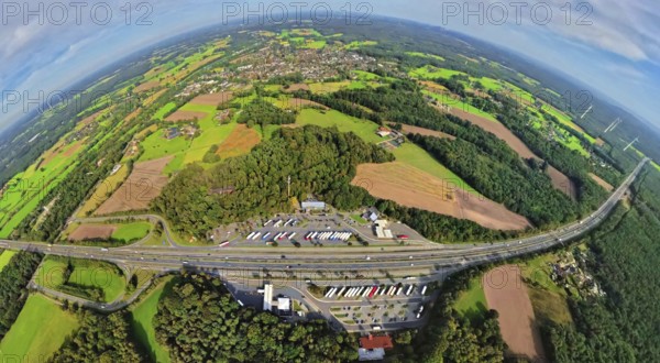
Aerial view, service area Hünxe-Ost and Hünxe-West...
BRK25J81_405
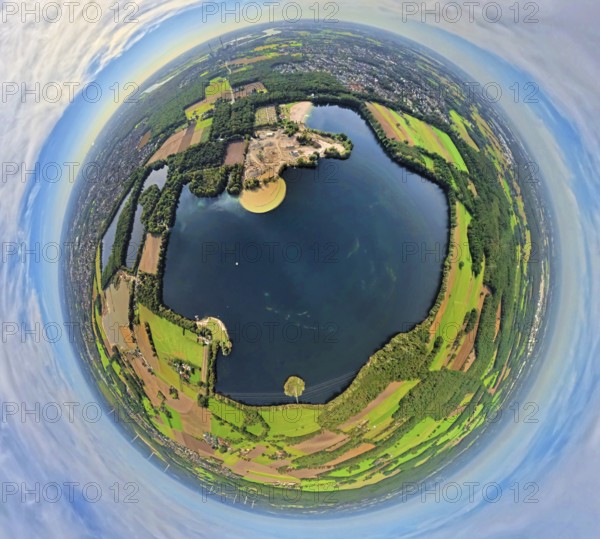
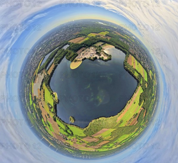
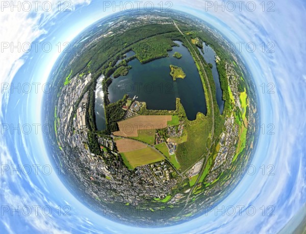
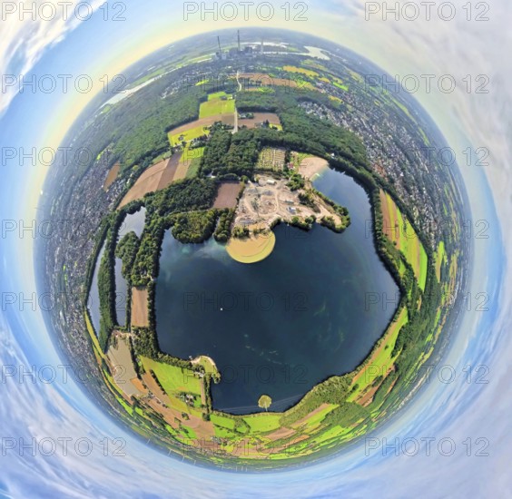
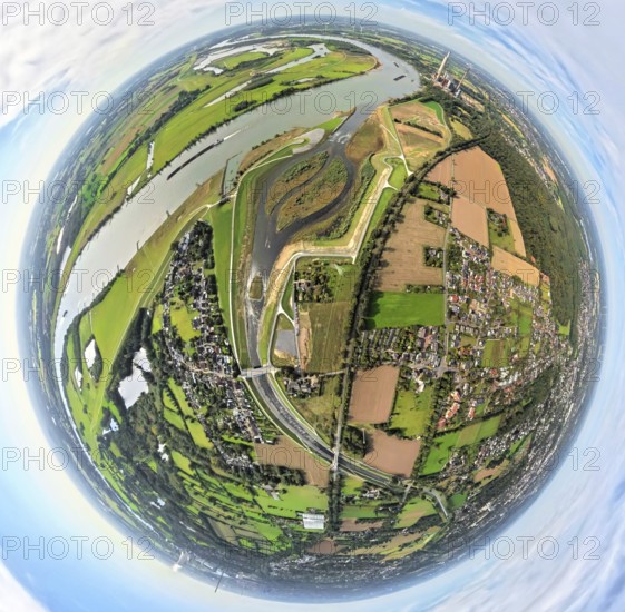
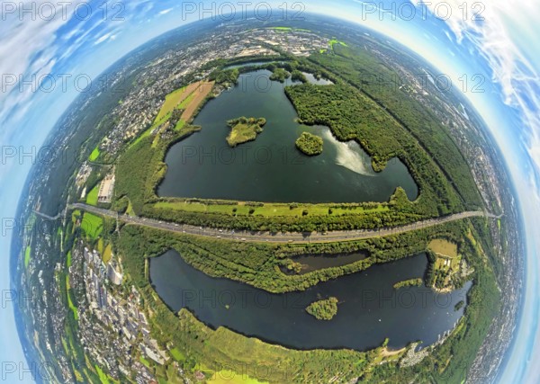
Aerial view, Tenderingssee and lido, globe, fishey...
BRK25J81_486
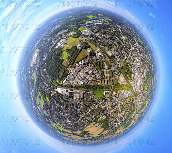
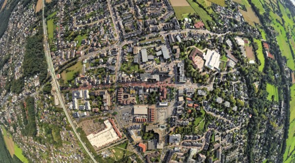
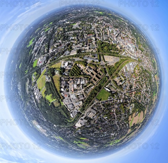
Aerial view, town hall district administration Rec...
BRK25J86_249
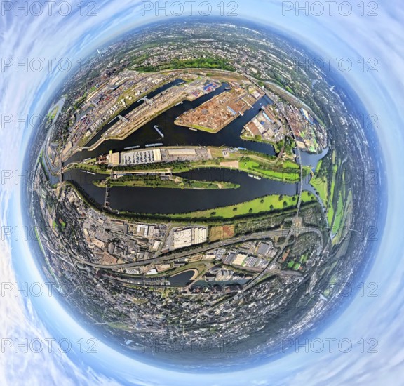
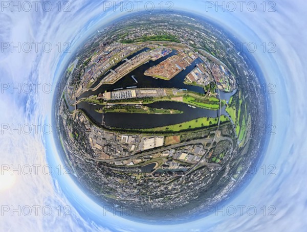
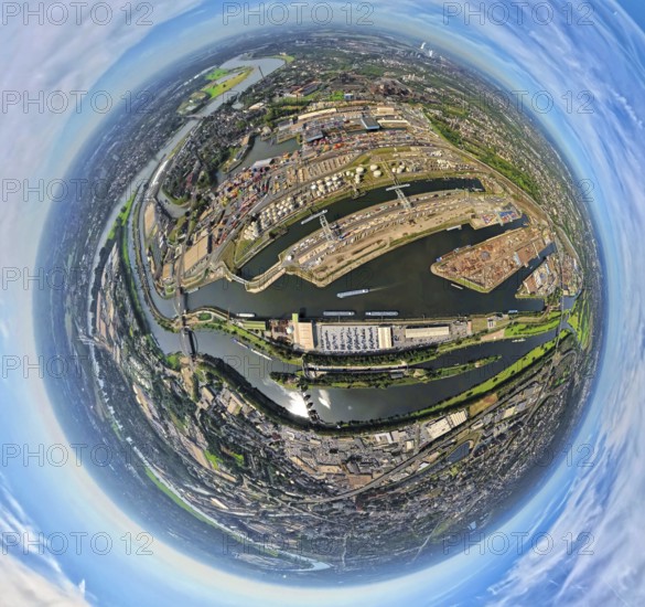
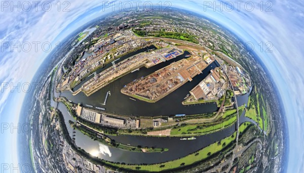
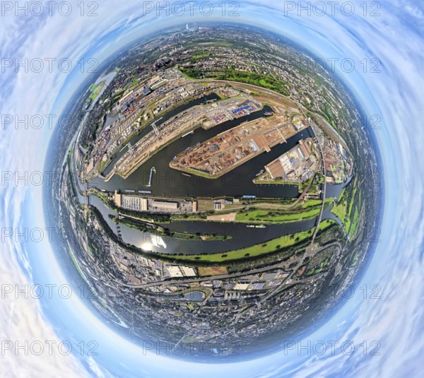
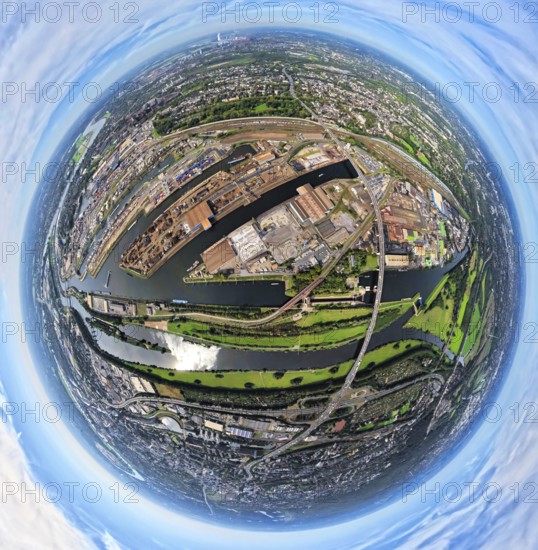
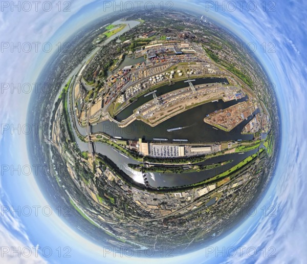
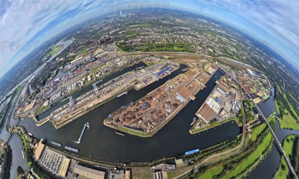
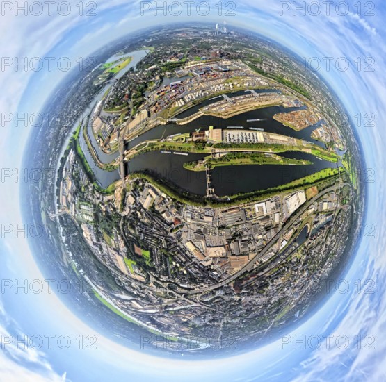
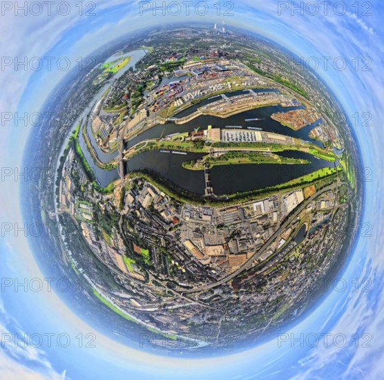
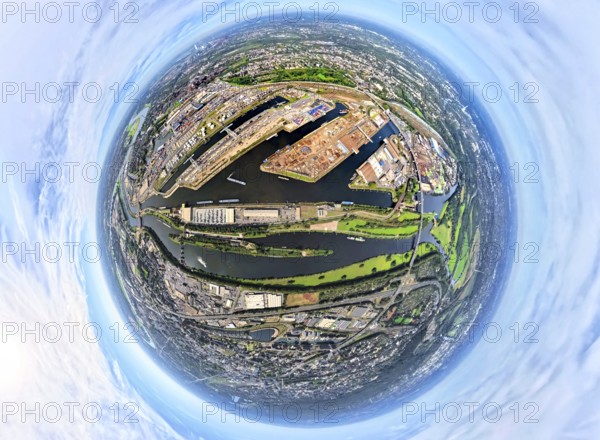
Aerial view, Duisburg-Ruhrort harbour with oil isl...
BRK25J72_007
Aerial photo, Heinrich-Heine-University at the riv...
BRK25J73_119
Aerial view, old town and Königsallee with tree av...
BRK25J81_396
Aerial view, service area Hünxe-Ost and Hünxe-West...
BRK25J81_404
Aerial view, Tenderingssee and lido, globe, fishey...
BRK25J81_488
Aerial view, town hall district administration Rec...
BRK25J86_250
Aerial view, Duisburg-Ruhrort harbour with oil isl...
BRK25J71_364
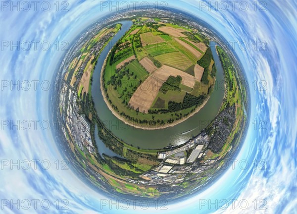
Aerial view, Himmelgeister Rheinbogen nature reser...
BRK25J71_400
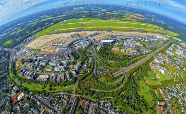
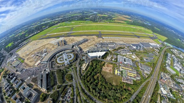
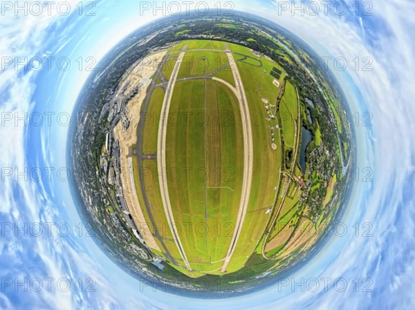
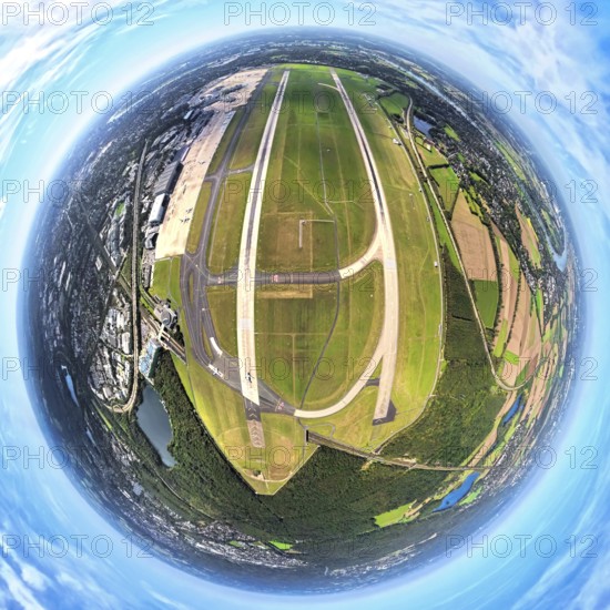
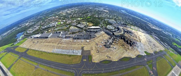
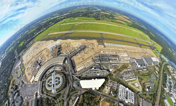
Aerial view, DUS Airport Düsseldorf with reception...
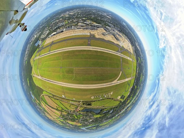
BRK25J72_040
Aerial photo, DUS Airport Düsseldorf with runway a...
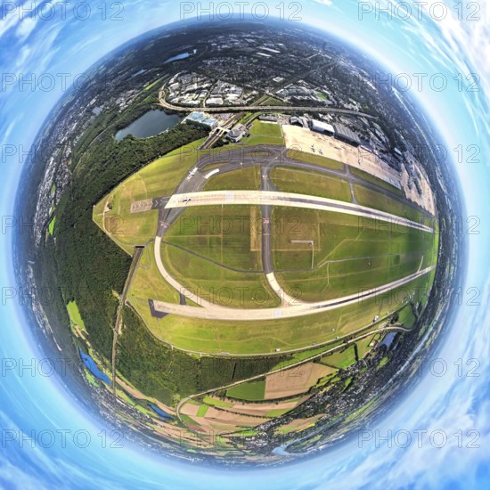
BRK25J73_187
Aerial photo, DUS Airport Düsseldorf Airport with ...
BRK25J81_299
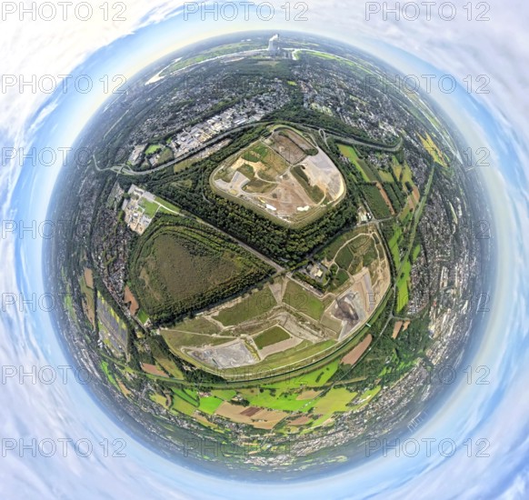
Aerial view, Emscher Hangpark and tailings pile wi...
BRK25J81_380
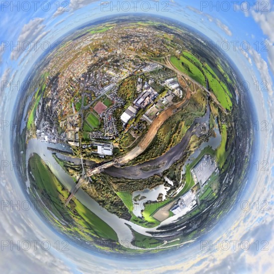
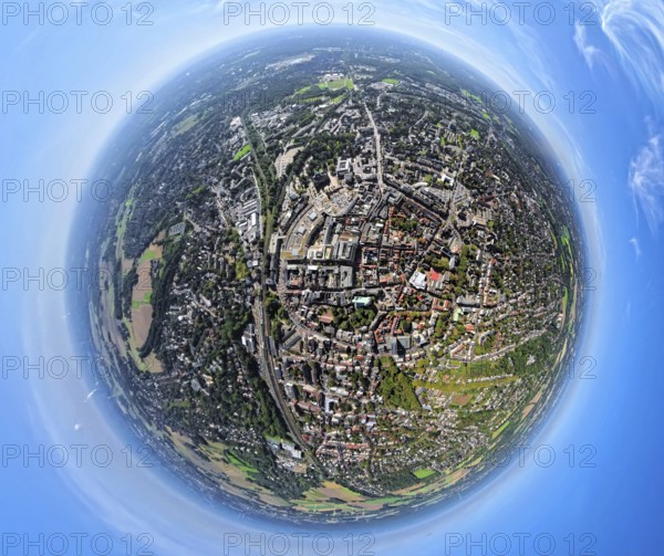
Aerial view, city centre view with comprehensive s...
BRK25J86_257
Aerial view, Duisburg-Ruhrort harbour with oil isl...
BRK25J86_259
Aerial view, Duisburg-Ruhrort harbour with oil isl...
BRK25J71_344
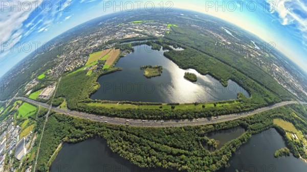
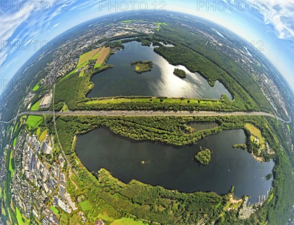
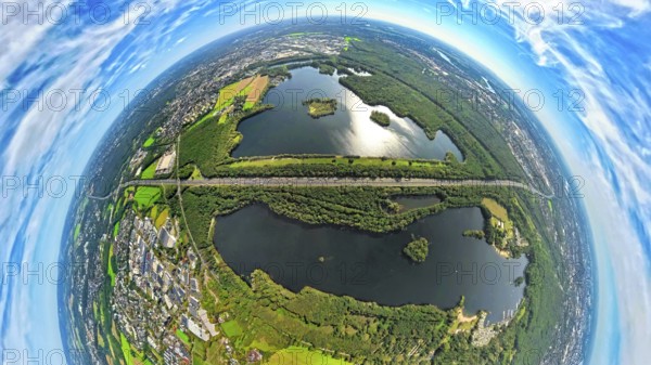
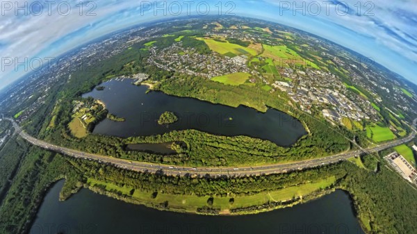
Aerial photo, Elbsee and Unterbacher See with fore...
BRK25J71_393
Aerial view, DUS Airport Düsseldorf with reception...
BRK25J72_037
Aerial photo, DUS Airport Düsseldorf Airport with ...
BRK25J73_112
Aerial view, old town and Königsallee with tree av...
BRK25J73_151
Aerial photo, DUS Airport Düsseldorf Airport with ...
BRK25J81_358
Aerial view, meadows and fields Tenderingsweg at B...
BRK25J81_406
Aerial view, Tenderingssee and lido, globe, fishey...
BRK25J86_277
Aerial view, Duisburg-Ruhrort harbour with oil isl...
BRK25J71_341
Aerial photo, Elbsee and Unterbacher See with fore...
BRK25J71_365
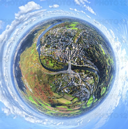
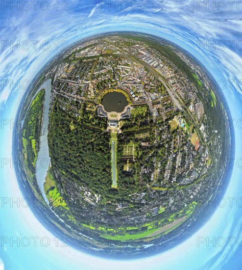
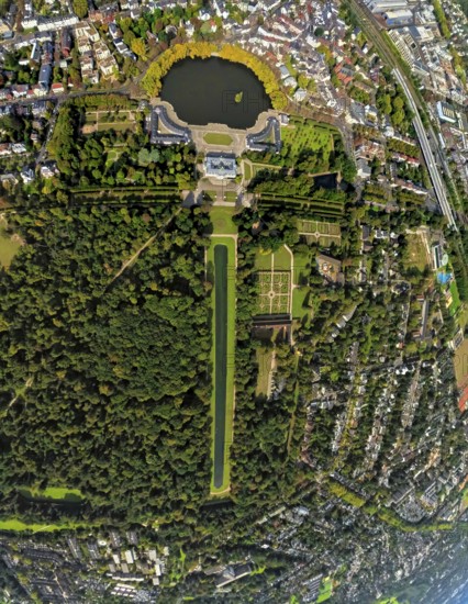
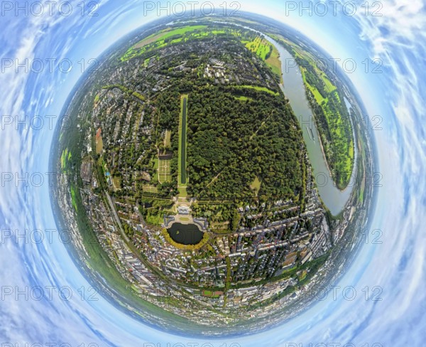
Aerial view, Benrath Castle with castle park and c...
BRK25J73_067
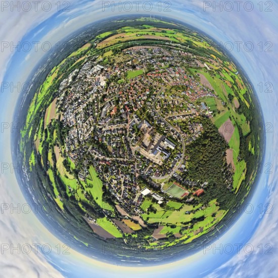
Aerial view, district Oberkassel with Festwiese Ob...
BRK25J81_303
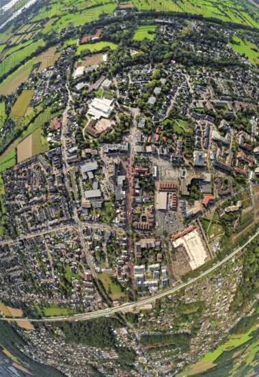
Aerial view, municipal park and castle Dinslaken w...
BRK25J81_331
Aerial view, Emscher renaturalisation river Emsche...
BRK25J81_342
Aerial view, residential area Lohberg district, be...
BRK25J81_416
Aerial view, city centre view with town hall and t...
BRK25J86_253
Aerial view, Duisburg-Ruhrort harbour with oil isl...
BRK25J86_266
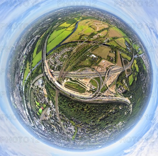
Aerial photo, Kaiserberg motorway junction with co...
BRK25J86_275
Aerial view, harbour Duisburg-Ruhrort with oil isl...
BRK25J71_342
Aerial photo, Elbsee and Unterbacher See with fore...
BRK25J71_367
Aerial view, Benrath Castle with castle park and c...
BRK25J73_029
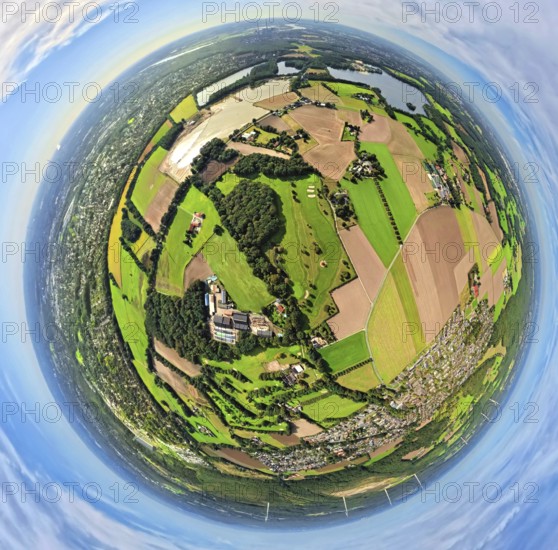
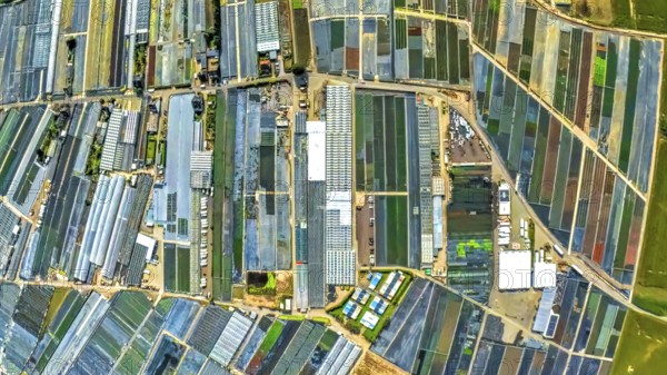
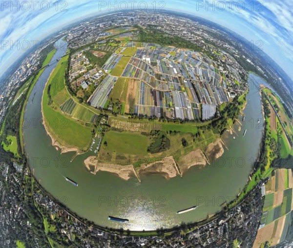
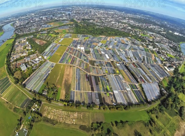
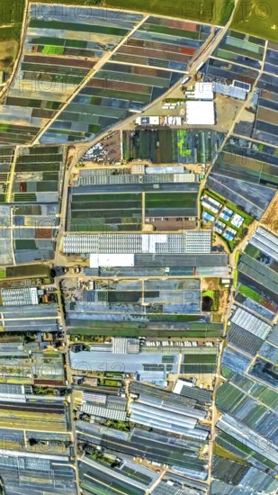
Aerial view, horticulture and agricultural use in ...
BRK25J73_068
Aerial view, district Oberkassel with Festwiese Ob...
BRK25J73_088
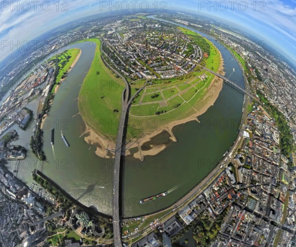
Aerial view, district Oberkassel and river Rhine, ...
BRK25J81_290
Aerial view, municipal park and castle Dinslaken w...
BRK25J81_365
Aerial view, Emscher renaturalisation river Emsche...
BRK25J81_417
Aerial view, city centre view with town hall and t...
BRK25J86_251
Aerial view, Duisburg-Ruhrort harbour with oil isl...
BRK25J86_258
Aerial view, harbour Duisburg-Ruhrort with oil isl...
BRK25J71_419
Aerial photo, Elbsee and Unterbacher See with fore...
BRK25J73_014
Aerial view, horticulture and agricultural use in ...
BRK25J73_069
Aerial view, district Oberkassel with Festwiese Ob...

BRK25J73_120
Aerial view, Königsallee with tree avenue, city ce...
BRK25J81_418
Aerial view, city centre view with town hall and t...
BRK25J86_276
Aerial view, harbour Duisburg-Ruhrort with oil isl...
BRK25J71_371
Aerial photo, Elbsee and Unterbacher See with fore...
BRK25J72_032
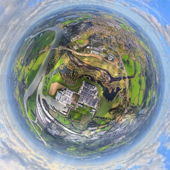
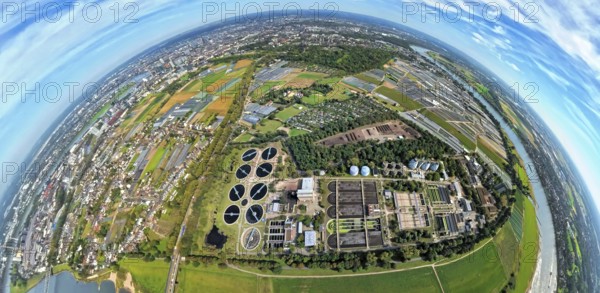
Aerial view, sewage treatment plant Düsseldorf-Süd...
BRK25J73_015
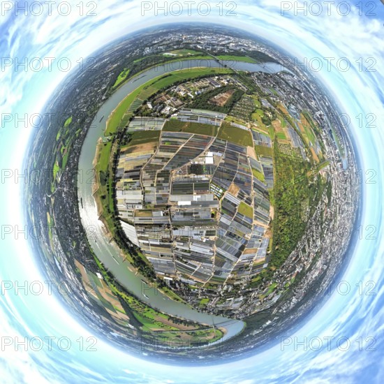
Aerial view, horticulture and agricultural use in ...
BRK25J73_038
Aerial view, horticulture and agricultural use in ...
BRK25J73_113
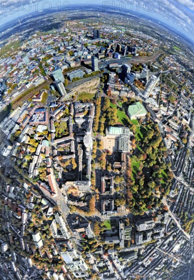
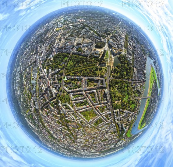
Aerial view, Hofgarten, residential area Kaiserstr...
BRK25J81_291
Aerial view, municipal park and castle Dinslaken w...
BRK25J86_248
Aerial view, Duisburg-Ruhrort harbour with oil isl...
BRK25J71_399
Aerial view, DUS Airport Düsseldorf with reception...
BRK25J71_418
Aerial photo, Elbsee and Unterbacher See with fore...
BRK25J73_037
Aerial view, horticulture and agricultural use in ...
BRK25J81_485
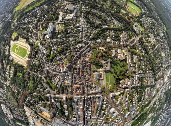
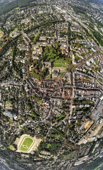
Aerial view, old town and old town ring Herzogswal...
BRK25J71_380
Aerial photo, Elbsee and Unterbacher See with fore...
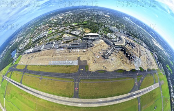
BRK25J71_382
Aerial view, DUS Airport Düsseldorf with reception...
BRK25J81_484
Aerial view, town hall district administration Rec...
BRK25J71_368
Aerial view, Benrath Castle with castle park and c...
BRK25J71_384
Aerial photo, DUS Airport Düsseldorf with receptio...
- Page
-
- sur
- 7