462 résultats pour : Ötztal alps
- Page
-
- sur
- 5
Connectez-vous pour plus de résultats
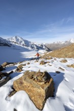
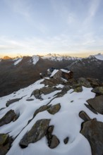
BRK26C70_446
Mountaineer on a hiking trail with snow, descent f...
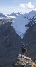
BRK26C64_458
Mountaineer standing on a rock, surrounded by an i...
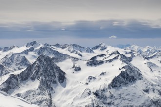
BRK26C55_416
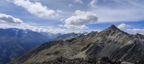
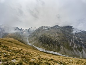
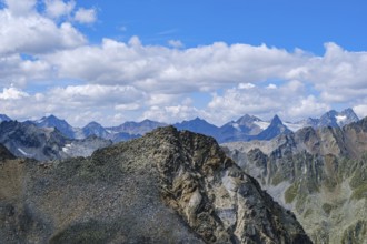
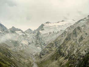
Views of snowy summits of the Ötztal Alps in winte...
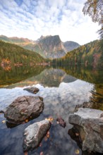
BRK26C89_115
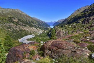
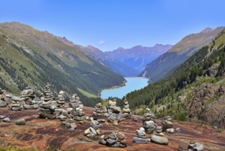
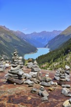
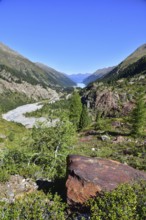
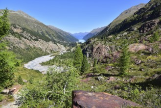
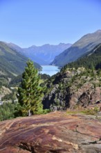
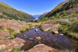
Mountain peaks of the Ötztal Alps reflected in Lak...
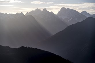
BRK26C64_087
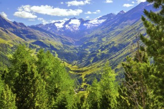
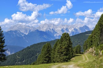
Ötztal Alps, mountain panorama in the morning ligh...
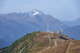
BRK26C59_356
Venet mountain station and summit, Venet mountain ...
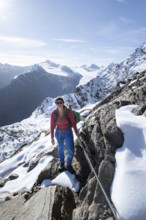
BRK26C76_322
Mountaineer on a secured path with snow, climbing ...
BRK26C58_491
Snow-covered mountain landscape, mountain hut Ramo...
BRK26C98_186
View from the ridge of the Venet to the mountain p...
BRK26C58_034
Venet ridge with Kreuzjoch summit, view from the V...
BRK26C03_095
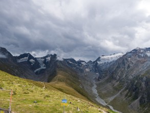
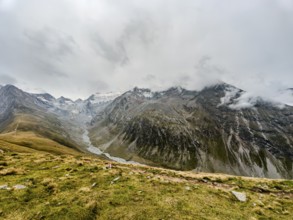
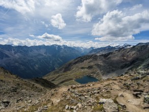
Panoramic view from the Hohe Mut over the Mutsatte...
BRK26B39_372
Panoramic view from the Hohe Mut over the Mutsatte...
BRK26B43_117
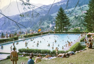
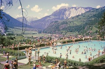
Crowded swimming pool on sunny summer day Oetz, Im...
BRK26B43_118
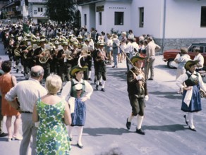
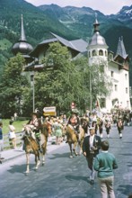
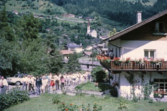
People in street procession through village of Oet...
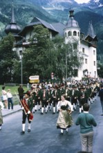
BRK26B43_119
People in street procession through village of Oet...
BRK26A92_256
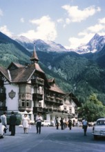
Hotel Kassl Posthotel, Oetz, Imst district, Tyrol,...
BRK26A92_260
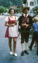
Man and woman wearing traditional clothing, Oetz, ...
BRK26A92_273
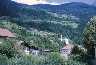
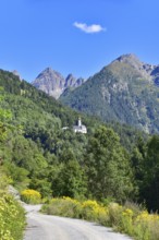
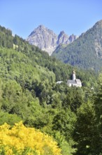
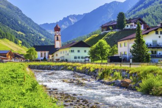
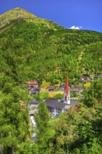
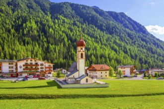
Historic village buildings and church of Maria Hil...
BRK26A88_335
Panoramic view from the Hohe Mut over the Mutsatte...
BRK26A92_258
People in street procession through village of Oet...
BRK26A92_257
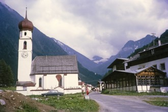
Church and buildings, Oetz, Imst district, Tyrol, ...
BRK26A92_259
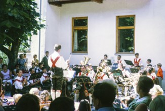
Male musical band performance wearing traditional ...
BRK26A92_255
Crowded swimming pool on sunny summer day Oetz, Im...
BRK26A92_262
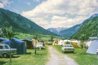
Tents in campsite at Oetz, Imst district, Tyrol, A...
BRK26A92_268
People in street procession through village of Oet...
BRK26A89_487
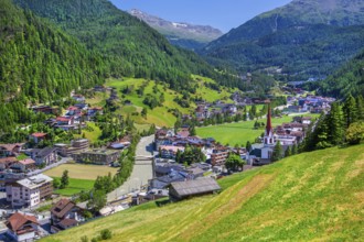
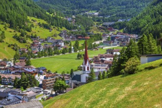
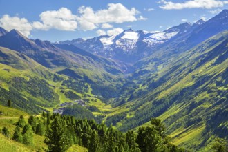
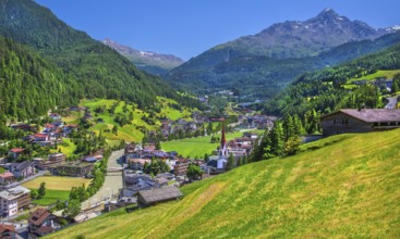
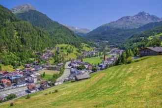
View of the village and the valley, Sölden, Ötztal...
BRK26A29_191
Panoramic view from the Hohe Mut over the Mutsatte...
BRK26A26_015
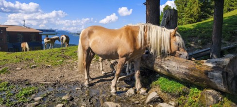
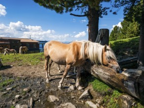
Free-grazing horses on an alpine pasture near the ...
BRK26A26_033
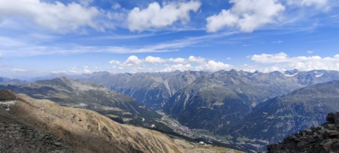
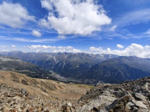
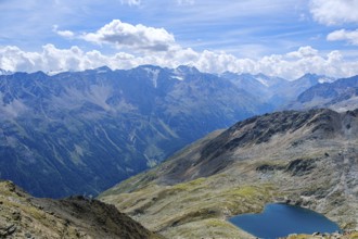
Scenic view from Gaislachkogel over the Ötztal Alp...
BRK26A31_337
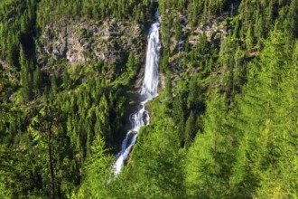
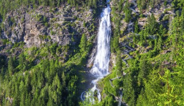
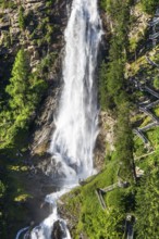
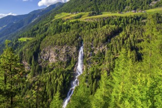
Stuiben Waterfall, Umhausen, Ötztal, Ötztal Alps, ...
BRK26A31_336
View of the village and the valley, Sölden, Ötztal...
BRK25M79_338
Panoramic view from the Hohe Mut over the Mutsatte...
BRK25M73_433
Free-grazing horses on an alpine pasture near the ...
BRK25M12_165
Panoramic view from the Hohe Mut over the Mutsatte...
BRK25M85_255
Stuiben Waterfall, Umhausen, Ötztal, Ötztal Alps, ...
BRK25M85_256
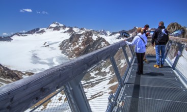
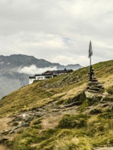
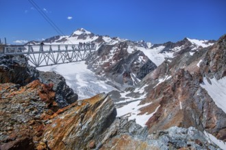
Viewing terrace on the Tiefenbachkogl with the Wil...
BRK25M85_257
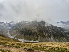
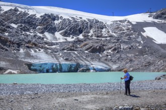
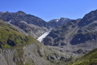
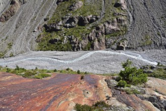
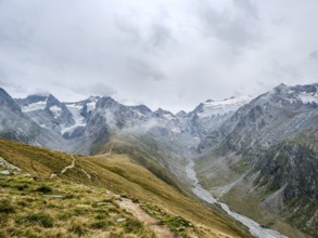
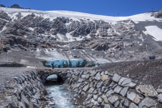
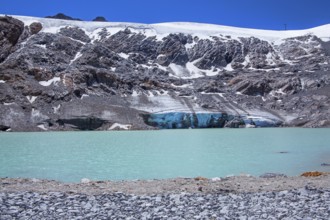
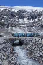
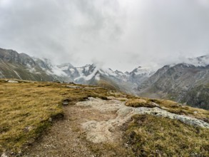
Rettenbachferner with glacial lake on the Ötztal G...
BRK25M85_258
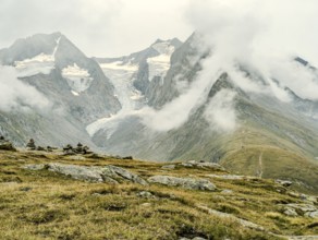
Valley head with the Gurgler Ferner, Hochgurgl, Öt...
BRK25M85_254
View of the village and the valley, Sölden, Ötztal...
BRK25M79_397
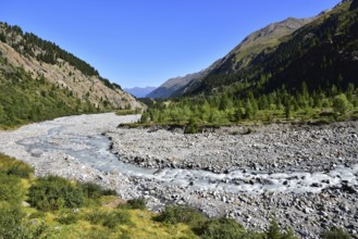
The Faggenbach (also known locally as the Fagge) r...
BRK25M79_398
Hiking area above the Faggenbach in the Kaunertal,...
BRK25M79_396
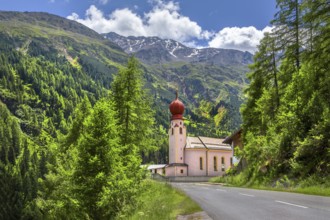
Kaltenbrunn pilgrimage church in Kaunertal, in the...
BRK25M73_463
Scenic view from Gaislachkogel over the Ötztal Alp...
BRK25M13_092
The Faggenbach (also known locally as the Fagge) r...
BRK25M13_095
Hiking area below the Gepatsch Glacier in the Kaun...
BRK25M13_094
Hiking area below the Gepatsch Glacier in the Kaun...
BRK25M13_100
Hiking area above the Faggenbach in the Kaunertal,...
BRK25M13_097
Hiking area above the Faggenbach in the Kaunertal,...
BRK25M13_101
Hiking area above the Faggenbach in the Kaunertal,...
BRK25M13_105
The Gepatschferner in the Kaunertal in the Ötztal ...
BRK25M13_090
Kaltenbrunn pilgrimage church in Kaunertal, in the...
BRK25M13_102
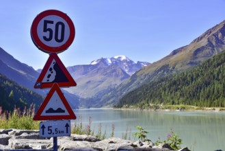
Reservoir in the Kaunertal in the Ötztal Alps, in ...
BRK25M13_091
Hiking area above the Faggenbach in the Kaunertal,...
BRK25M13_099
Hiking area below the Gepatsch Glacier in the Kaun...
BRK25M13_108
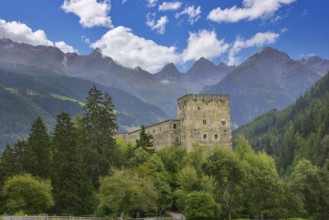
Berneck Castle in the Kaunertal, in the background...
BRK25M13_098
Hiking area below the Gepatsch Glacier in the Kaun...
BRK25M00_219
Scenic view from Gaislachkogel over the Ötztal Alp...
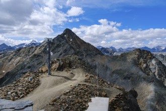
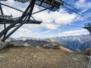
BRK25L63_322
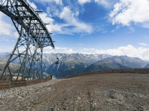
Scenic view from the mountain station of the Gaisl...
BRK25L79_423
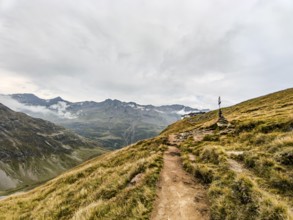
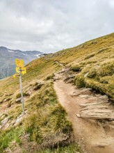
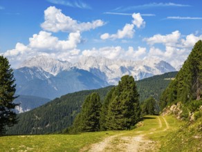
Mountain hiking trail on the Hohe Mut in the Ötzta...
BRK25L79_422
Panoramic view from the Hohe Mut over the Mutsatte...
BRK25L63_323
Free-grazing horses on an alpine pasture near the ...
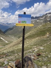
BRK25L89_089
Information board at the top of the Timmelsjoch Pa...
BRK25L63_324
View from the summit of the Gaislachkogel of the Ä...
BRK25L63_325
Scenic view from Gaislachkogel over the Ötztal Alp...
BRK25L99_075
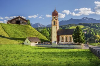
Chaplaincy church, Niederthai in the Horlachtal, s...
BRK25L99_079
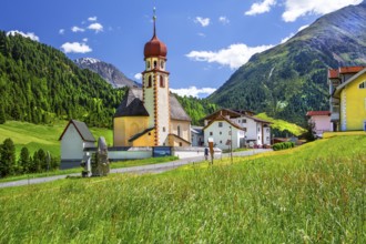
Village centre with parish church, Vent im Ventert...
BRK25L99_072
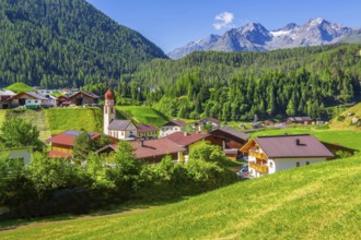
Overview of the village with the chaplaincy church...
BRK25L99_074
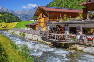
Old forge with water wheel on the Horlachbach, Nie...
BRK25L99_076
Stuiben Waterfall, Umhausen, Ötztal, Ötztal Alps, ...
BRK25L99_083
Chaplaincy church in the village on Horlachbach, N...
BRK25L99_065
Stuiben Waterfall, Umhausen, Ötztal, Ötztal Alps, ...
BRK25L99_073
Viewing terrace on the Tiefenbachkogl with the Wil...
BRK25L99_081
Church of the Holy Cross, Holy Cross, Venter Tal, ...
BRK25L99_082
Rettenbachferner on the Ötztal Glacier Road, Sölde...
BRK25L99_064
View of the village and the valley, Sölden, Ötztal...
BRK25L99_069
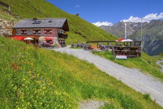
Rettenbachalm on the Ötztal Glacier Road, Sölden, ...
BRK25L99_068
View of the village and the valley, Sölden, Ötztal...
BRK25L99_070
Rettenbachferner with glacial lake on the Ötztal G...
BRK25L99_080
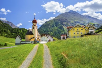
Village centre with parish church and Talleitspitz...
BRK25L99_078
Valley head with the Gurgler Ferner, Hochgurgl, Öt...
BRK25L63_334
Scenic view from Gaislachkogel over the Ötztal Alp...
BRK25L99_071
Rettenbachferner on the Ötztal Glacier Road, Sölde...
BRK25L99_077
Village view with Maria Hilf chaplaincy church, Gr...
BRK25L36_361
Mountain hiking trail on the Hohe Mut in the Ötzta...
BRK25L01_102
View from the summit of the Gaislachkogel of the Ä...
BRK25L01_112
View from an alpine pasture near the Acherkogel in...
BRK25L36_359
Panoramic view from the Hohe Mut over the Mutsatte...
BRK25L36_360
View from the Hohe Mut over to the Gaisbergferner ...
BRK25L36_362
Mountain hiking trail on the Hohe Mut in the Ötzta...
BRK25L01_111
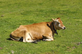
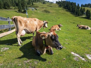
Free-grazing cows on an alpine pasture near the Ac...
BRK25L01_113
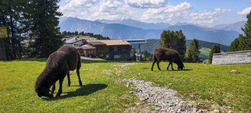
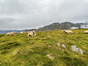
Free-grazing sheep on an alpine pasture near the A...
BRK25L01_105
Free-grazing cows on an alpine pasture near the Ac...
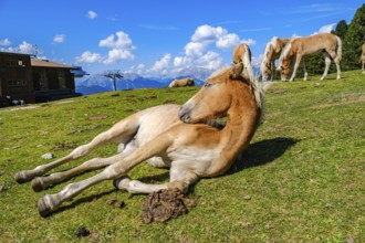
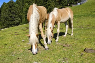
BRK25L01_101
Free-grazing horses on an alpine pasture near the ...
BRK25L01_116
Picturesque mountain landscape with a view of the ...
BRK25L01_104
Scenic view from the mountain station of the Gaisl...
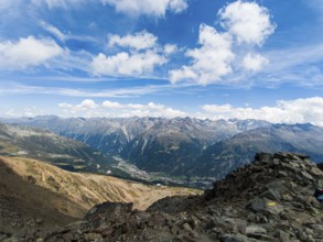
BRK25L01_103
Scenic view from Gaislachkogel over the Ötztal Alp...
BRK25L36_356
View from the Hohe Mut over the Rotmoostal to the ...
BRK25L36_357
Flock of sheep in the high mountains on Hohe Mut A...
BRK25L01_215
View from an alpine pasture near the Acherkogel in...
BRK25L01_212
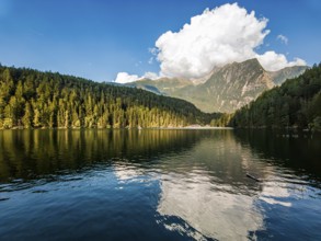
Piburger See with picturesque view of the Acherkog...
- Page
-
- sur
- 5