Sujet
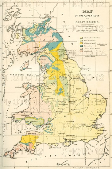
Map showing the coalfields of Great Britain in the 19th century.
Légende
Map showing the coalfields of Great Britain in the 19th century. From The National Encyclopaedia, published c.1890.
Date
1890
Crédit
Photo12/UIG/Universal History Archive
Notre référence
UMG23A65_205
Model release
Non
Property release
Non
Licence
Droits gérés
Format disponible
49.5Mo (3.3Mo) / 28.7cm x 43.2cm / 3390 x 5100 (300dpi)