Sujet
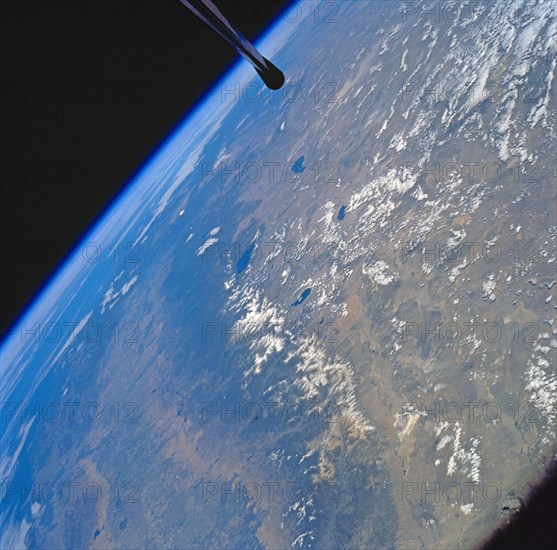
1994 - Sierra Nevada Mountain Range as seen from STS-58
Légende
Visible in the view to the west of the Sierra Nevada are the San Joaquin and Sacramento Valleys of central California. The San Francisco/Oakland Bay Area can be seen to the west of the valley at the extreme left of the photograph. To the east or right of the Sierra Nevada, the basin and Range Region of central and northern Nevada is visible. Mono Lake, Lake Tahoe and Pyramid Lake are also visible in this scene. The long northwest/southeast trending Walker Lane Shear Zone, which lies just to the east (right) of the Sierra Nevada is also visible. Near the top of the view (near the horizon), the snow covered volcanic peak Mount Shasta can be seen. Over 645 kilometers (400 miles) long and from 65 to 130 kilometers (40 to 80 miles) wide, the Sierra Nevada have many peaks in excess of 3,300 meters (11,000 feet) above sea level.
Info+
.
Crédit
Photo12/Universal Images Group
Notre référence
UMG22A40_397
Licence
Droits gérés
Format disponible
61.0Mo (3.2Mo) / 39.4cm x 38.8cm / 4651 x 4585 (300dpi)