Sujet
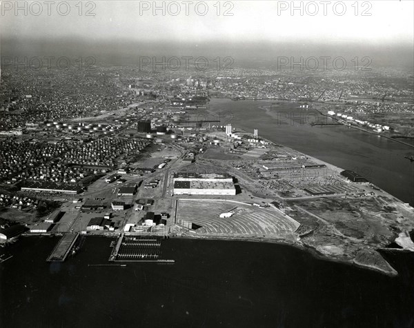
an aerial view of the industrial area at Fields Point
Légende
This photograph depicts an aerial view of the industrial area at Fields Point, on the west side of Providence River in Narragansett Bay. 1937-1959.
Date
01 févr. 1959
Crédit
Photo12/Universal Images Group/HUM Images
Notre référence
UMG22A03_262
Model release
Non
Property release
Non
Licence
Droits gérés
Format disponible
32.4Mo (1.9Mo) / 32.0cm x 25.4cm / 3775 x 2997 (300dpi)