Sujet
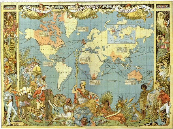
Map of the British Empire in 1886
Légende
Map of the British Empire in 1886.
Date
01 févr. 1886
Crédit
Photo12/Universal Images Group/Picturenow
Notre référence
UMG21A17_392
Model release
Non
Property release
Non
Licence
Droits gérés
Format disponible
20.1Mo (2.9Mo) / 26.0cm x 19.4cm / 3071 x 2288 (300dpi)