Sujet
Napoleonic map of Boulogne-sur-Mer.
Légende
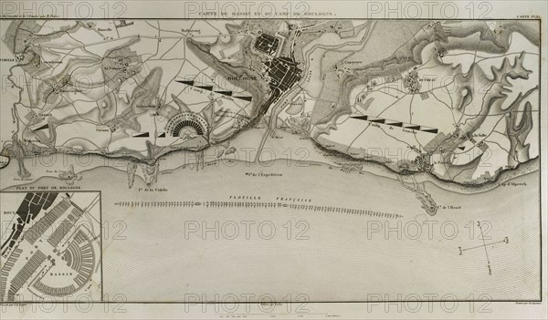
Map of Boulogne-sur-Mer. In French coast on the English Channel. it was a staging area for Napoleon's troops for several months in 1805, during his planned invasion of the United Kingdom. Atlas de l'Histoire du Consulat et de l'Empire. History of the Consulate and the Empire of France under Napoleon by Marie Joseph Louis Adolphe Thiers (1797-1877). Drawings by Dufour, engravings by Dyonnet. Edited in Paris, 1864.
Date
1864
Crédit
Photo12/UIG/PHAS
Notre référence
UMG21A15_007
Licence
Droits gérés
Format disponible
43.3Mo (2.6Mo) / 43.0cm x 25.2cm / 5079 x 2977 (300dpi)