Sujet
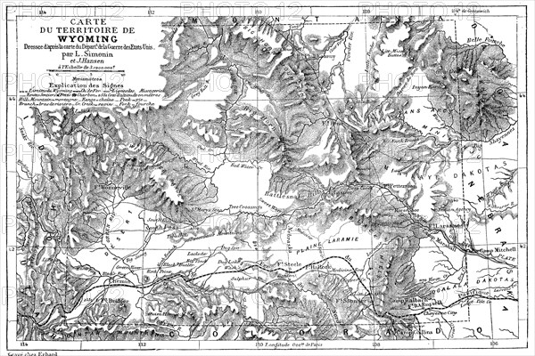
Landkarte des Bundesstaat Wyoming im Jahre 1882
Légende
Landkarte des Bundesstaat Wyoming im Jahre 1882, USA / Historical map of Wyoming, Digitale Reproduktion von einer Originalvorlage aus dem 19. Jahrhundert / digital improved reproduction of an original print from the 19th century.
Crédit
Photo12/UIG/Bildagentur-online
Notre référence
UMG20B50_458
Licence
Droits gérés
Format disponible
28.1Mo (4.3Mo) / 32.4cm x 21.7cm / 3832 x 2560 (300dpi)