Sujet
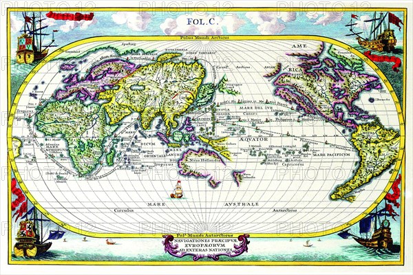
Navigationes Precipae Europorum ad Exteras Nationes; Navigational Map of the World 1700
Légende
Heinrich Scherer (1628-1704) taught as Professor of Hebrew, Mathematics and Ethics at the University of Dillingen until about 1680. Thereafter he obtained important positions as Official Tutor to the Royal Princes of Mantua and Bavaria. It was during his time in Munich as Tutor to the Princely house of Bavaria that his lifetime's work as a cartographer received acclaim and recognition. What makes Scherer's maps so singular and unusual is their highly decorative Catholic iconography and imagery and the revolutionary thematic nature of many of the maps. Scherer himself was a Jesuit and many of the maps draw heavily from the history and development of the Jesuit order since its establishment by St.Ignatius Loyola in the early 16th Century when it was the driving force behind the European Catholic Counter Reformation.
Scherer's maps vividly chart the revival and spread of the Catholic faith in the late 16th and 17th Centuries principally through the efforts of Jesuit missionaries around the globe and most notably in North and South America, South East Asia and the Far East.
Date
1700
Crédit
Photo12/Universal Images Group
Notre référence
UMG20A04_104
Model release
NA
Property release
NA
Licence
Droits gérés
Format disponible
24.9Mo (3.9Mo) / 30.6cm x 20.4cm / 3616 x 2411 (300dpi)