Sujet
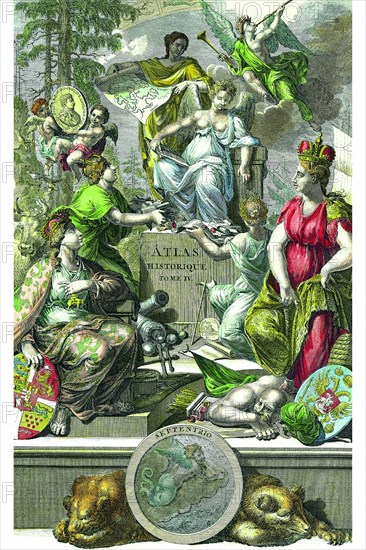
Historical Atlas Title Page 1719
Légende
The maps in the Atlas Historique were mainly based on those of the French cartographer, Guillaume De L’Isle, but were presented by the Chatelains in an encyclopedic form. The accompanying text is in French and often is printed in two columns on the page with maps and other illustrations interspersed. Each map and table is numbered consecutively within its volume and all maps bear the privileges of the States of Holland and West-Friesland. Zacharie Chatelain (d.1723) was the father of Henri Abraham (1684-1743) and Zacharie Junior (1690-1754). They worked as a partnership publishing the Atlas Historique, Ou Nouvelle Introduction A L’Histoire … under several different Chatelain imprints, depending on the Chatelain family partnerships at the time of publication. The atlas was published in seven volumes between 1705 and 1720, with a second edition appearing in 1732. The maps were accompanied by information pertaining to cosmography, geography, history, chronology, genealogy, topography, heraldry, and costume of the world.
Crédit
Photo12/Universal Images Group
Notre référence
UMG20A04_082
Model release
NA
Property release
NA
Licence
Droits gérés
Format disponible
29.0Mo (6.4Mo) / 22.0cm x 33.0cm / 2600 x 3900 (300dpi)