Sujet
Hessians control Fort Washington & Manhattan Island - 1776
Légende
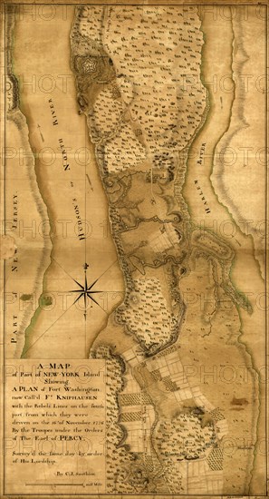
A map of part of New-York Island showing a plan of Fort Washington, now called Ft. Knypehausen with the rebels lines on the south part, from which they were driven on the 16th of November 1776 by the troupes under the orders of the Earl of Percy. Surveyed the same day by order of His Lordship by C. J. Sauthier.
Date
1776
Crédit
Photo12/Universal Images Group
Notre référence
UMG20A03_410
Model release
NA
Property release
NA
Licence
Droits gérés
Format disponible
86.6Mo (4.6Mo) / 34.3cm x 63.3cm / 4048 x 7474 (300dpi)