Sujet
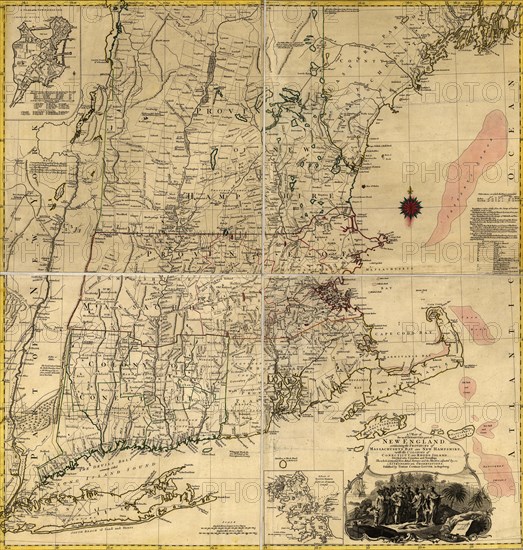
New England during the War of Independence 1776
Légende
A map of the most inhabited part of New England, containing the colonies of Connecticut and Rhode Island, divided into counties and townships: The whole composed from actual surveys and its situation adjusted by astronomical observations. Lotter, culprit, 1776.
Date
1776
Crédit
Photo12/Universal Images Group
Notre référence
UMG20A03_406
Model release
NA
Property release
NA
Licence
Droits gérés
Format disponible
307.8Mo (14.6Mo) / 85.7cm x 90.0cm / 10120 x 10630 (300dpi)