Sujet
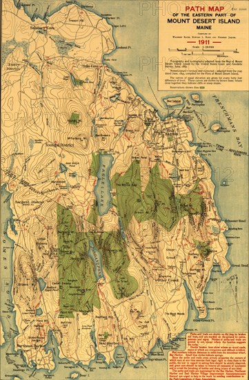
Path map of the Eastern part of Mount Desert Island Maine 1911 1911
Légende
Path map of the Eastern part of Mount Desert Island Maine 1911
Crédit
Photo12/Universal Images Group
Notre référence
UMG20A03_176
Model release
NA
Property release
NA
Licence
Droits gérés
Format disponible
101.1Mo (5.2Mo) / 40.8cm x 62.0cm / 4821 x 7327 (300dpi)