Sujet
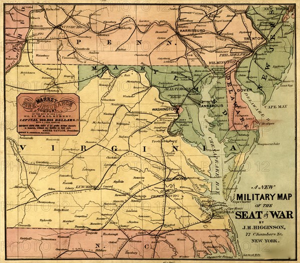
Military Map - 1861 1861
Légende
eastern and central Virginia, Maryland, Delaware, southern Pennsylvania, and northern North Carolina showing cities and towns, state boundaries, and railroads.
Crédit
Photo12/Universal Images Group
Notre référence
UMG20A03_104
Model release
NA
Property release
NA
Licence
Droits gérés
Format disponible
53.7Mo (4.2Mo) / 39.1cm x 34.3cm / 4624 x 4056 (300dpi)