Sujet
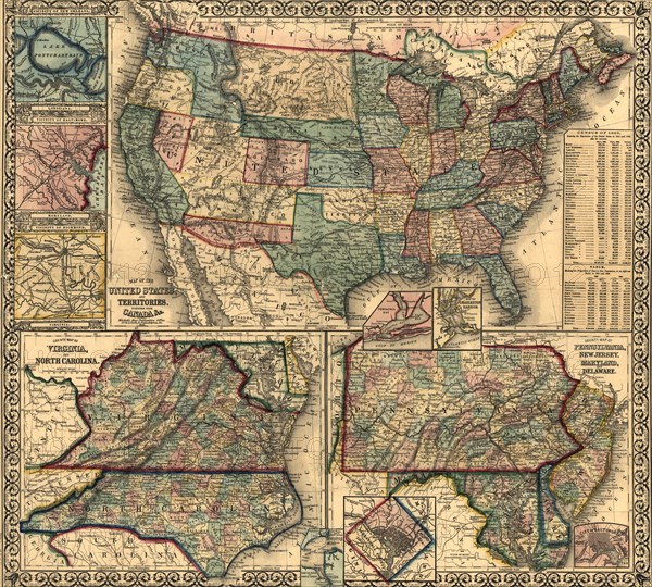
Map of the United States & Its Territories - 1861 1861
Légende
Insets: County map of Virginia, and North Carolina - County map of Pennsylvania, New Jersey, Maryland, and Delaware. Hampton Roads -Washington, D.C. - Pensacola Bay- Map of Charleston Harbor. - Vicinity of New Orleans, Louisiana. - Vicinity of Baltimore, Maryland - Vicinity of Richmond, Virginia.
Crédit
Photo12/Universal Images Group
Notre référence
UMG20A03_069
Model release
NA
Property release
NA
Licence
Droits gérés
Format disponible
67.0Mo (8.6Mo) / 43.2cm x 38.9cm / 5100 x 4592 (300dpi)