Sujet
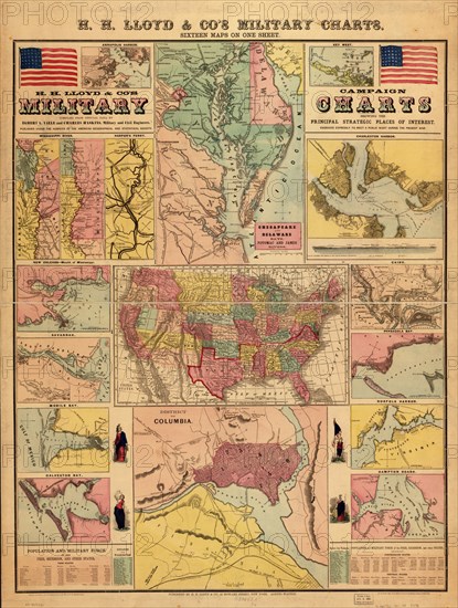
Campaign military charts showing the principal strategic places - 1861 1861
Légende
Maps of Annapolis, Key West, the Mississippi River, Chesapeake Bay and vicinity, Charleston, New Orleans, Savannah, Mobile Bay, the United States, Cairo, Pensacola Bay, Galveston Bay, Norfolk, Hampton Roads, Washington, D.C., and Harpers Ferry.
Crédit
Photo12/Universal Images Group
Notre référence
UMG20A03_059
Model release
NA
Property release
NA
Licence
Droits gérés
Format disponible
56.3Mo (5.6Mo) / 32.7cm x 43.2cm / 3857 x 5100 (300dpi)