Sujet
Historical War Map - 1862
Légende
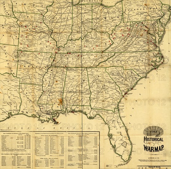
Map of southeastern United States showing forts and battlefields, railroads, state boundaries, rivers, and town; Population statistics and "Date's] of admission and secession of the Southern States" are given in lower left corner.
Date
1862
Crédit
Photo12/Universal Images Group
Notre référence
UMG20A03_037
Model release
NA
Property release
NA
Licence
Droits gérés
Format disponible
73.5Mo (7.3Mo) / 43.2cm x 42.6cm / 5100 x 5036 (300dpi)