Sujet
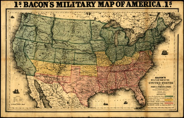
Bacon's military map of the United States showing the forts & fortifications - 1862
Légende
Forts are named and marked by small flags. Map also includes towns, railroads, names and boundaries of states and territories, and relief by hachure's. "Free or non-slaveholding states" are colored green, "border slave states" are yellow, and "seceded or Confederate States" are pink.
Date
1862
Crédit
Photo12/Universal Images Group
Notre référence
UMG20A03_022
Model release
NA
Property release
NA
Licence
Droits gérés
Format disponible
47.7Mo (5.7Mo) / 43.2cm x 27.7cm / 5100 x 3268 (300dpi)