Sujet
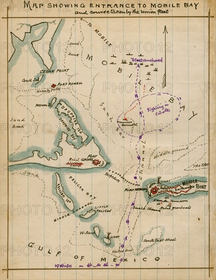
Map showing entrance to Mobile Bay and course taken by Union fleet. 1864
Légende
Map showing entrance to Mobile Bay and course taken by Union fleet; Confederate fortifications (Forts Powell, Gaines, Morgan) and the location of Union fleet in Mobile Bay and the Gulf of Mexico. On August 5, Union Admiral Farragut attempted to lead several ships into Mobile Bay, past formidable Confederate forts and the ironclad C.S.S. Tennessee. Despite the sinking by a mine of the U.S.S. Tecumseh, the Union fleet passed through the channel and engaged the Tennessee, paving the way for Union land operations against the city of Mobile, Ala. Undermanned and damaged by Union rams, the Tennessee surrendered.
Crédit
Photo12/Universal Images Group
Notre référence
UMG20A02_391
Model release
NA
Property release
NA
Licence
Droits gérés
Format disponible
9.1Mo (595.6Ko) / 13.3cm x 17.2cm / 1566 x 2029 (300dpi)