Sujet
Topographic Map of Central America - 1850 1850
Légende
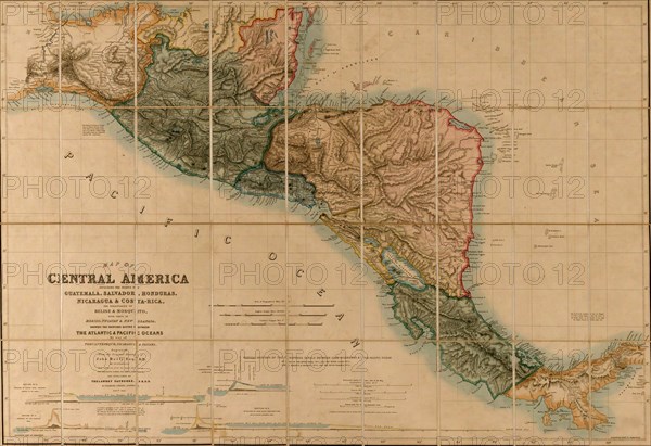
Map of Central America including the states of Guatemala, Salvador, Honduras, Nicaragua & Costa Rica, the territories of Belise & Mosquito, with parts of Mexico, Yucatan & New Granada : shewing the proposed routes between the Atlantic & Pacific Oceans by way of Tehuantepeque, Nicaragua & Panama; Includes four "vertical sections of the proposed canals between Lake Nicaragua & the Pacific Ocean"
Date
1850
Crédit
Photo12/Universal Images Group
Notre référence
UMG20A01_390
Model release
NA
Property release
NA
Licence
Droits gérés
Format disponible
51.0Mo (4.0Mo) / 43.2cm x 29.6cm / 5100 x 3495 (300dpi)