Sujet
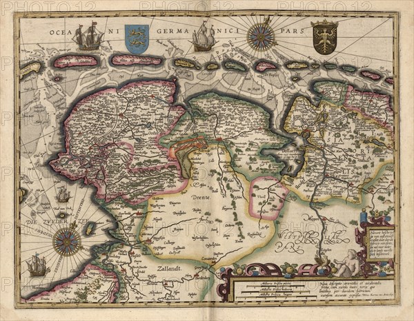
Map of the Area East of the Zuiderzee in the Netherlands 1622
Légende
The Zuiderzee was a shallow bay of the North Sea in the northwest of the Netherlands, extending about 100 km (60 miles) inland and at most 50 km (30 miles) wide, with an overall depth of about 4 to 5 metres (13-16 feet) and a coastline of about 300 km (200 miles). It covered 5,000 km² (2,000 square miles). Its name means "southern sea" in Dutch, indicating that the origin of the name can be found in Friesland to the north of the Zuiderzee (also see North Sea). In the 20th century the majority of the Zuiderzee was closed off from the North Sea (leaving the mouth of the inlet to become part of the Wadden Sea) and the salt water inlet changed into a fresh water lake called the IJsselmeer (IJssel-lake) after the river that drains into it. The river IJssel is an estuary branch of the river Rhine .
Crédit
Photo12/Universal Images Group
Notre référence
UMG20A01_057
Model release
NA
Property release
NA
Licence
Droits gérés
Format disponible
57.9Mo (5.2Mo) / 43.2cm x 33.6cm / 5100 x 3966 (300dpi)