Sujet
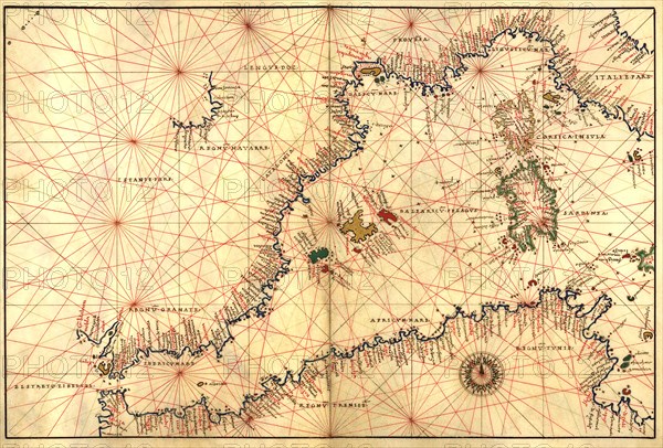
Portolan or Navigational Map of the Western Mediterranean from Gibraltar to Piedmont & Sardinia 1544
Légende
Portolan or Navigational Map of the Western Mediterranean from Gibraltar to Piedmont & Sardinia. Done in 1544 by the Italian cartographer Battista Agnese.
Crédit
Photo12/Universal Images Group
Notre référence
UMG20A00_290
Model release
NA
Property release
NA
Licence
Droits gérés
Format disponible
50.3Mo (4.2Mo) / 43.1cm x 29.2cm / 5091 x 3450 (300dpi)