Légende
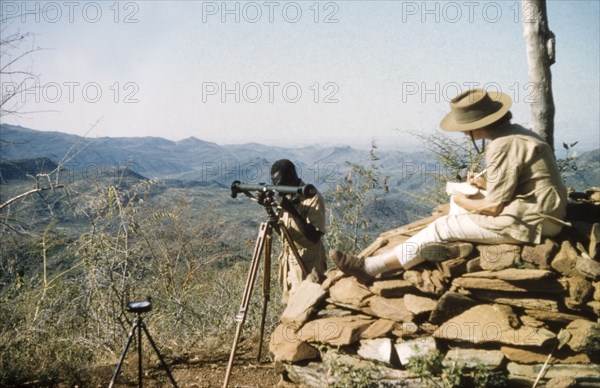
Elisabeth Lang Brown records survey data. Elisabeth, the wife of District Forest Officer James Lang Brown, sits on a 'kituti' (cairn) as she records data during a survey safari to the Karasuk hills on the Kenya-Uganda border. In front of her, a Forest Ranger uses a range finder to measure the distance to the next 'kituti'. A related caption comments: "When plotted on the map, the line of bituti cairns will form the legal boundary of a new forest reserve from which marauding goats will be excluded". Kenya, 1959., East (Uganda), Uganda, Eastern Africa, Africa.
Crédit
Photo12/Universal Images Group
Notre référence
UMG12A14_292
Licence
Droits gérés
Format disponible
57.7Mo (1.9Mo) / 47.3cm x 30.6cm / 5581 x 3612 (300dpi)