Légende
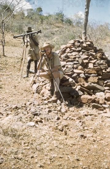
Surveying with 'kituti' markers. District Forest Officer James Lang Brown (right) is accompanied by Forest Ranger Langoya on a survey safari in the Karasuk hills on the Kenya-Uganda border. The men use a range finder and compass to measure the distance between one 'kituti' (cairn) marker and the next. A related caption comments: "When plotted on the map, the line of bituti... will form the legal boundary of a new forest reserve from which marauding goats will be excluded". Kenya, 1959., East (Uganda), Uganda, Eastern Africa, Africa.
Crédit
Photo12/Universal Images Group
Notre référence
UMG12A14_291
Licence
Droits gérés
Format disponible
59.0Mo (2.4Mo) / 31.0cm x 47.6cm / 3667 x 5623 (300dpi)