Légende
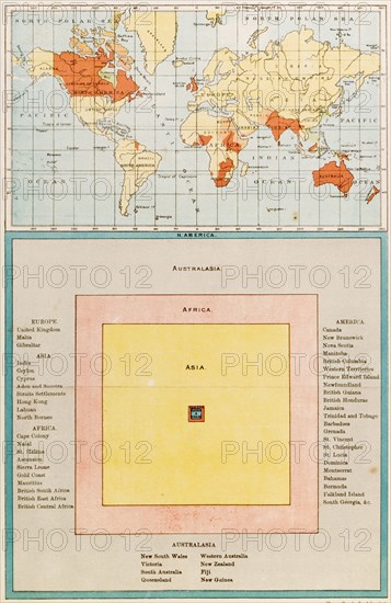
Map and diagram of the British Empire. A map highlighting the countries of the British Empire, accompanied by a diagram representing the proportions of each continent under British rule. England, circa 1899. England (United Kingdom), Western Europe, Europe .
Crédit
Photo12/Universal Images Group
Notre référence
UMG12A10_468
Licence
Droits gérés
Format disponible
48.4Mo (2.8Mo) / 28.1cm x 43.2cm / 3317 x 5097 (300dpi)