Légende
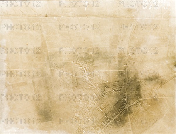
Aerial view of a bomb-damaged landscape. One of a series of British aerial reconnaissance photographs recording the positions of trenches on the Western Front during the First World War. A line of poplar trees flank a prominently straight road, possibly one of several Roman roads in the region, casting long shadows across the surrounding fields. A nearby village lies in ruins after suffering a continuous barrage of artillery fire. Nord-Pas de Calais or Picardie, France, 26 February 1918., Nord-Pas de Calais, France, Western Europe, Europe .
Crédit
Photo12/Universal Images Group
Notre référence
UMG12A10_099
Licence
Droits gérés
Format disponible
75.2Mo (3.0Mo) / 49.7cm x 37.9cm / 5869 x 4478 (300dpi)