Légende
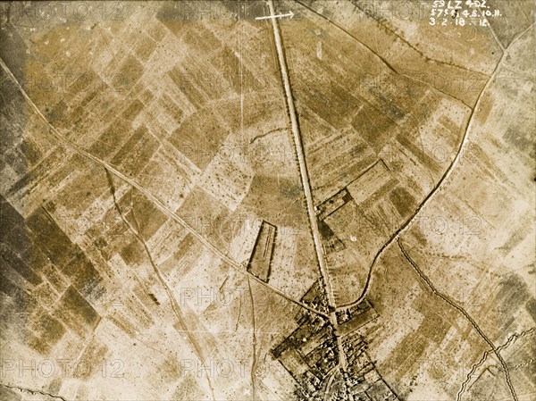
Aerial view of a bomb-damaged village. One of a series of British aerial reconnaissance photographs recording the positions of trenches on the Western Front during the First World War. A prominently straight road, possibly one of several Roman roads in the region, runs east to west through a bomb-damaged village, surrounded by fields pockmarked with bomb craters. Nord-Pas de Calais or Picardie, France, 3 February 1918., Nord-Pas de Calais, France, Western Europe, Europe .
Crédit
Photo12/Universal Images Group
Notre référence
UMG12A10_083
Licence
Droits gérés
Format disponible
74.4Mo (4.3Mo) / 49.9cm x 37.4cm / 5893 x 4414 (300dpi)